|
|
Mountain/Rock |
|---|---|
|
|
42.06226°N / 14.11870°E |
|
|
Hiking, Skiing |
|
|
Spring, Fall, Winter |
|
|
7917 ft / 2413 m |
|
|
Altare dello Sticone and the Taranta Valley
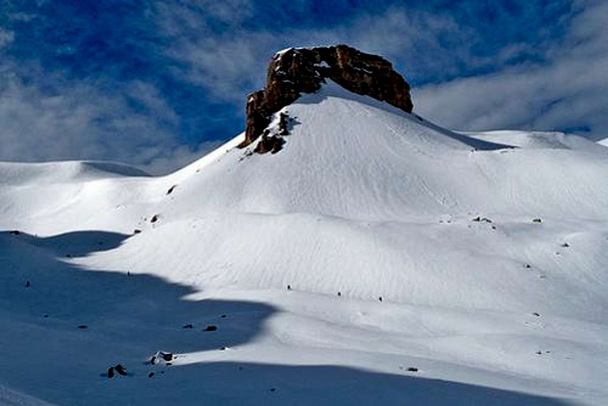
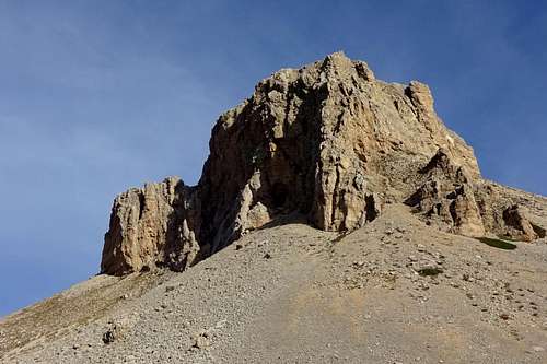
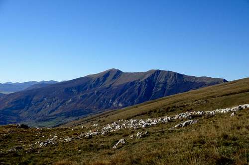
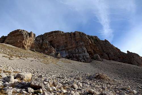
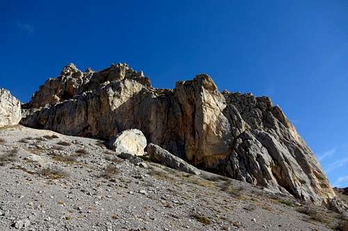
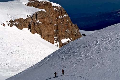
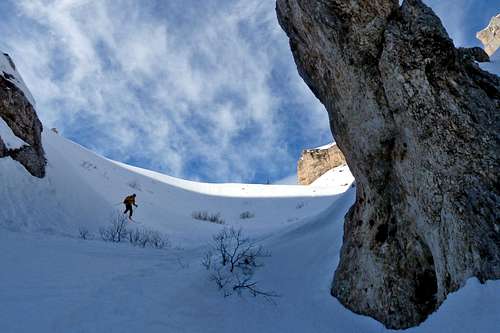
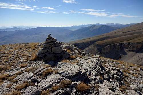
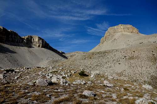
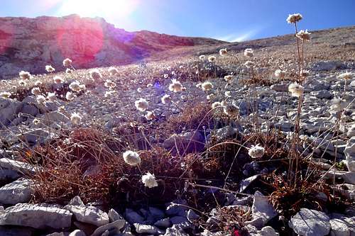
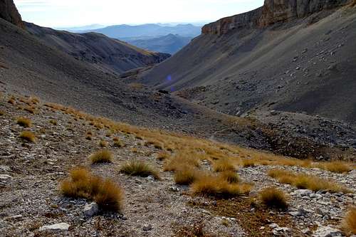
Altare dello Stincone (2,413m) is a very characteristic rock formation which closes the upper entrance of the canyon-like valley Valone di Taranta. Because of its minor prominence this rock is generally not considered an independent peak but rather a protrusion of the east ridge of Monte Macellaro (2,646m). Both because of its aspects and its location, embedded in the extensive lunar landscapes of Piano Amaro, the stark east slopes of Monte Macellaro and the steep cliffs of the Taranta valley, this rock is still a very rewarding destination for hikers, alpine skiers and trail runners.From its base the impressive tower of Altare dello Stincone seems to be inviting rock climbers as well, but upon closer examination it becomes clear that the rock quality is rather bad, all craggy and crumbly, and should be treated with utmost caution.
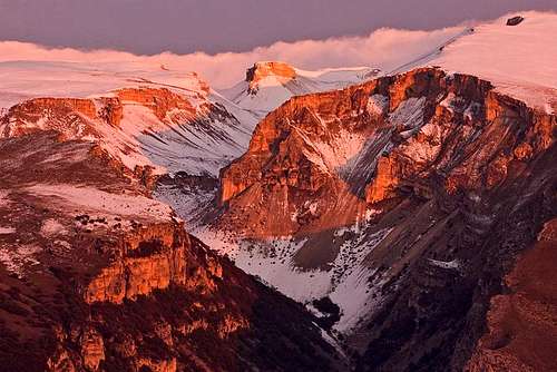
Like Vallone di Palombaro and Valle Santo Spirito, the Taranto valley is a deep incision on the eastern flank of the Majella massif. First and foremost it is know for the "Grotta del Cavallone", an impressive limestone cave situated at about 1,450m, penetrating the walls of the canyon for a total length of more than one kilometer.
With steep cliffs and desert-like high plains enclosing it, the Taranta valley is a worthwhile hiking destination in its own right and, in winter, an attractive route for alpine skiing as well. Furthermore, it is a very interesting alternative to the normal routes to Monte Amaro (2,793m) and Monte Macellaro (2,646m).
Foto credits: (**) Antonio Palermi
Panorama
Routes
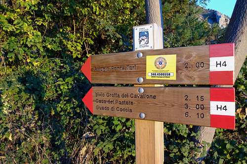
There are several interesting routes to the summit of Altare dello Sticone. Depending on the season, and the amount of snow on the slopes of the Majella massif, an ascent can be highly rewarding on either one of the hiking paths, or on ski. Signposting is quite comprehensible, better than on some other ranges of the Apennines and much better than around other parts of the Majella massif itself.1. Lama dei Peligni - Fonte Tarì - Colle d'Acquaviva - Piano Amaro - Altare dello Stincone (on hiking path H4, cross-country)
In order to reach the trailhead, on the SS84, shortly after the village's exit in direction Palena, take an asphalt road (right) that soon enters the forest. After about 1-2 kilometers the road terminates at a spacious parking area.
time: about 1'45 (2 hours with a heavy bag)
From the hut, keep following the hiking path for a few hundred meters until it reaches the edge of the Taranta valley. From here it is possible to take the steep path that crosses an enormous scree field while descending towards the valley floor.
Alternatively, keep ascending in a northern direction. Where the path starts flattening out leave it altogether and find your way up the broad east ridge of Colle d'Acquaviva.
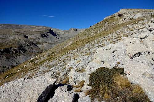
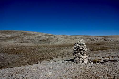
Once on the ridge, simply keep following the cliffs. Around the 2,000m mark the view on the valley opens and the recognizable shape of Altare dello Stincone will appear. Another 200m of elevation gain and you should come upon a small heap of rocks marking the summit of Colle d'Acquaviva.
time: about 2 hours
At this point you may come upon signposting for the hiking trail H6 which traverses the desert-like moraine landscape of the high plain Piano Amaro. Followed in a north-western direction this trail passes a location called Grotta Canosa and eventually leads to the summit of Monte Amaro.
Instead of taking the trail simply keep following the edge of the valley, without gaining or losing too much altitude. However, with clear weather the distinctive cliffs of Altare dello Stincone are almost all the time in sight. Also here a heap of rocks marks the summit.
time: not more than 2 hours
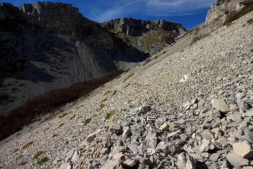
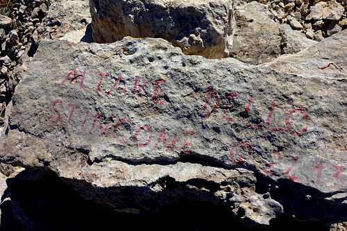
For the descent there are several options. In order to take the trail that runs along the valley floor descend the scree ramp to the right of the summit (facing the valley), along the south wall. Later a foot path meanders between large erratic blocks and talus. (Red and white signposting on boulders along the way.)
After losing about 500 meters in altitude the valley is narrowing significantly. A deep incision with almost vertical rock can be bypassed on either side. To the left there is a short passage with some fixed ropes in place. Take the right if you are descending on skis. At the bottom of this escarpment water is collected for the aqueduct. Another hundred meters and the trail is parting: right for Casa del Pastore, ahead for Grotta del Cavalone and Taranta Peligna, left for Fonte Tarì and Lama dei Peligni.
2. Taranta Peligna - Casa del Pastore - Monte Macellaro - Altare dello Stincone (on hiking path H6, cross-country)
This route basically offers an alternative to the one above. Indeed, both routes are more or less comparable in terms of total distance and elevation gain. They offer equally beautiful views on the Taranta valley, on Monte Porrara and, further to the south-west, the peaks of the Mainarde range.
Unlike the trail above, this one does not offer any possibility to refresh water supplies, though. A crucial factor to be considered especially in the summer months.
Both trails are interconnected by a steep foot path that traverses the Taranta valley in vicinity of the limestone cave "Grotta del Cavalone". From the hut Casa del Pastore it is only about 1½ hours on the hiking path H4 (in a south-western direction) to the mountain pass 'Guado di Coccia' (see IGMI map).
3. Guado di Coccia - Femmina Morta - Monte Mecellaro - Altare dello Stincone (on hiking path I1, cross-country)
Of course it it is also possible to ascend Altare dello Stincone with ski via one of the routes already mentioned above. The most interesting route, however, goes via the mountain pass Guado di Coccia (1,674m). The pass itself can be reached either from the village of Palena (east) or from Campo di Giove (west). Both locations are connected by the hiking trail I1, also know as the "Freedom Trail" (ital. Sentiero della Libertà), and both trailheads are situated at about 1.100m. There are also ski-lifts which, if not inoperative, may be used for reaching the pass.
From the pass it is still a long ascent, first in a northern later in a north-eastern direction. In order to avoid exhausting extra meters you might avoid ascending Tavola Rotanda (2.403m) but, by keeping direction NNW traverse an undulated high plain and take the broad south ridge of Monte Macellaro. From its summit Altare dello Stincone and the Taranta Valley can be spotted already (direction E/ENE).
(For more details about skiing on this route: www.auaa.it)
Some landmarks & Impressions
Getting there
The closest international airport is Pescara (about 65 km). From Rome and its big international airports it is a considerably longer journey of 180-220 km (depending on the trailhead). Public transport (both bus and train) is limited and should be checked well before embarking on a journey to the Majella massif.- from Pescara (airport): take the highway A14 and exit at Val di Sangro; follow indications for Casoli, later for Fara San Martino and Palena (SS84)
- from Ancona (highway E80/A14): simply follow the road indicated above
- from Bari/Taranto (highway E80/A14): take the Exit 'Val del Sangro' in direction Casoli (state road SS652), at Piane d'Archi-Casoli take the state road SS154 and then SS84 in direction Casoli; from Casoli follow the indications for your trailhead of choice (Fara San Martino, Palena etc.)
- from Rome: take the highway E80/A24 and later E80/A25, at Pratola Peligna-Sulmona you may exit the highway for Sulmona and follow indications for Cansano and Campo di Giove or take the SS17 in direction of Roccaraso and later the SS84 for Palena, Fara San Martino etc.
Red Tape
The entire Majella mountain range (or Maiella massif) is an integral part of the Maiella National Park, one of the three national parks of the Abruzzo region. The park was constituted in 1991. The same rules apply as for any other national park in Italy. Free camping is not allowed. There are no fees or permits required.
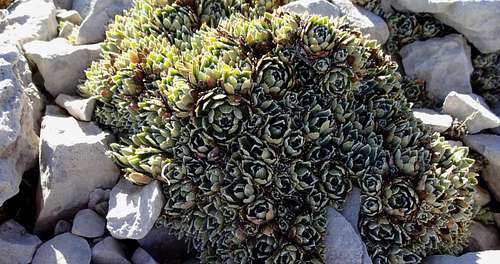
The Majella National Park is home to an exceptional species-rich flora and a very varied wild life. For instance, you will almost certainly spot several specimen of the generally shy Chamois (Rupicapra rupicapra), prying human intruders from a save distance or from behind a rock.
When to Climb
Altare dello Stincone can be reached all year round. Best season for hiking is late spring/early summer. Late autumn is also a very recommendable period.During the winter months an ascent should be planned with caution and foresight. As violent slab avalanches are rather frequent around the entire Majella massif, checking the meteorological situation (wind direction, precipitation, sudden changes in temperature) is mandatory. The slope angle on the east face of Monte Macellaro and on both sides of the Taranta valley is widely critical, i.e. between 30° and 45°. However, with the right snow conditions both ascent and descent will surely become an unforgettable experience, especially for alpine ski enthusiasts.
In any case it is important not to underestimate the overall distance and the difference in altitude that will have to be negotiated. Outside the canyon, on the vast and often windswept high plains, with the weather deteriorating, fog or suddenly incoming clouds, orientation can become a serious issue, especially around Piano Amaro. Here signposting is scarce, sometimes discontinued, and it can become quite difficult to tell the actual hiking trail from natural features of the gravelly surface. Only a few inches of snow can cover all signposting, anyway.
There are two mountain huts and a bivouac to be taken into consideration for an overnight stay in this area: (1) Rifugio Fonte Tarì, (2) Rifugio Casa del Pastore and (3) Bivacco Pelino.
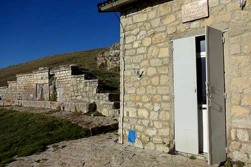
(1) Rifugio Fonte Tarì is a small and only recently renovated mountain hut. Situated at 1,540m, it can be reached on the easy and well signposted hiking trail H4. Trailhead is a parking area at about 760m in vicinity of the village Lama dei Peligni (2 hours - without snow). The mountain hut is quite popular with the locals and, especially on weekends, frequented by hikers and trail runners. The hut has room for a total of 18 guests and is equipped with a kitchen (gas oven and electricity), a bathroom and a wood stove. Water can be found just outside the hut, at the eponymous Fonte Tarì, a perennial well-spring. The mountain hut is usually unguarded, i.e. closed. But the keys can be picked up at Lama dei Peligni (see link section below). - A small winter room, always open for an emergency bivouac, is also available. It has room for 2-4 guests but no heating.
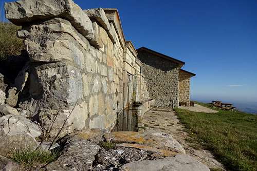
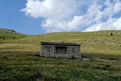
(2) Rifugio Casa del Pastore is another unguarded mountain hut in vicinity of the Taranta valley. The hut is situated at 1,696m and can be reached on the hiking trail H6. Trailhead for this hut is at about 700m and somewhat hidden. It can be found along the country road that connects Lama dei Peligni with Palena, shortly after the road with indications for Grotta del Cavallone. This hut is much smaller and should be considered rather for emergencies only. No water can be found nearby.
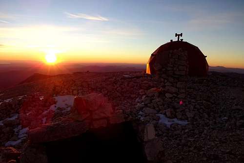
(3) Bivacco Pelino is another option but only for those bound for the higher and remoter regions of the Majella massif. The bivouac is situated right on top of the highest peak, Monte Amaro (2,793m). It has room for about max. 10 guests. No water, no heating, no comfort but without any doubt the best view for miles!
Maps
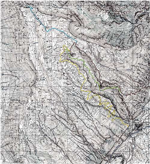
- Itinerary 1 (red): Lama dei Peligni - Fonte Tarì - Colle d'Acquaviva - Piano Amaro - Altare dello Stincone
- Itinerary 2 (yellow) Taranta Peligna - Casa del Pastore - Altare dello Stincone
- Itinerary (light green): Altare dello Stincone - Vallone di Taranta - Fonte Tarì
- Itinerary (light blue): Altare dello Stincone - Monte Amaro / Bivouac M. Pelino
*Note: The maps from the IGMI (Istituto Geografico Militare Italiano), after more than 50 years, are still the most accurate and reliable resource when it comes to the geographical features of mountainous terrain in central and southern Italy. These maps may sometimes show differing names of locations but they also give a number of alternative foot paths, usually uncharted on most newer maps.
Useful maps and guide books:
- Parco Nazionale della Majella, Società Editrice Richerche 2008, map scale 1:25.000 (hiking atlas)
- Majella. Carta escursionistica, Edizioni Il Lupo, 2nd edition 1990, map scale 1:25.000 (hiking map)
- Guida all'alta via della Majella, CARSA 2002 (guidebook)
- Parco nazionale della Majella. 30 itinerari scelti nel cuore della Montagna madre, Edizioni Mediterranee 2007, map scale 1:50.000 (comprehensive guidebook with a selection of various itineraries, b/w images)
External Links
|


