
-
 24348 Hits
-
 90.39% Score
-
 32 Votes
|
|
Mountain/Rock |
|---|---|
|
|
38.58638°N / 106.32048°W |
|
|
Chaffee |
|
|
Hiking, Mountaineering, Scrambling |
|
|
Spring, Summer, Fall, Winter |
|
|
13745 ft / 4189 m |
|
|
Overview
Mount Aetna is a prominent looking peak especially when viewed from Monarch Pass. As you are descending this pass eastward (towards Salida) Mount Aetna and its neighbor Mount Taylor demand your view - see photo below. Mount Aetna appears more grandiose of both, and is easy to recognize since it has a spectacular rockslide gully that extends down the entire south side of the peak. This gully is known as the Grand Couloir, and is popular in the late winter/spring for ski descent. Both peaks, Mount Aetna and Mount Taylor are nicely combined together as a nice hiking/scrambling loop.
Mount Aetna used to have a SP site, but it was erased. I hope that there would be a better system and people who are leaving SP would rather transfer their pages then to erase them.
Colorado rank: 127 (it is a bicentennial peak = among the top 200 in Colorado).
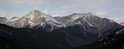
Mount Aetna (on the left) and Taylor Mountain (on the right) as seen from Monarch Pass.
Hiking distance: 9 miles Difficulty: class 2
Starting Elevation 9,660 feet Elevation Gain: 4,800 feet
Getting There
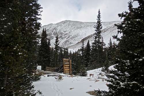
Drive to Garfield on US 50 between Poncha Springs and Monarch Pass. On the west edge of town is a jeep trail leaving the north side of the highway to ascend the Middle Fork South Arkansas River drainage. Park passenger cars at Garfield at the start of this jeep trail (in front of Snowmobile Tours & Rentals, 22763 Highway 50, Garfield/Monarch). The 4 WD road is well marked and easy to spot - Boss Lake TR and Middle Fork TRHD. You can drive on this road in the summer months for at least 1.3 miles to Boss Lake Trailhead (there is a nice parking lot). I found snow on the road, and was not sure about conditions higher up, so decided to hike up from the town. The hike does not add up much to your trip, only 1.3 miles one way. This short approach from the main road can make Mount Aetna a desirable winter climb.
Garfield (marked as Monarch) is located 12 miles west from Poncha Springs, or 5.5 miles east from the summit of Monarch Pass.
Route
Southern approach from Garfield (Monarch): Start by Snowmobile tours & Rentals, go up the 4WD road 230, marked for Boss Lake TR and Middle Fork TRHD. Continue on the 230 road, there will be several spurs branching off, ignore those and continue higher up on 230. See photos below.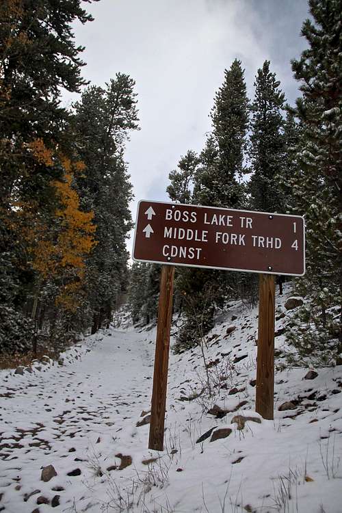 Start of the 4WD road, close to Snowmobile shop in Garfield (Monarch). | 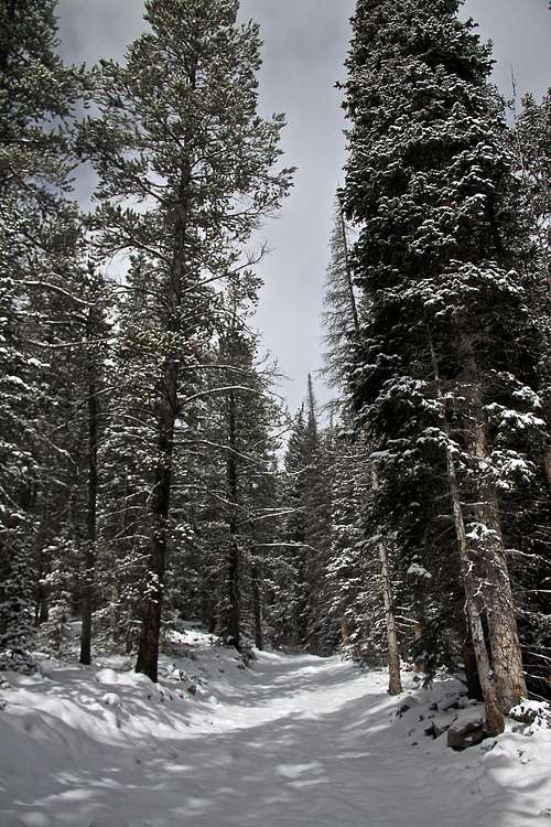 Winter conditions on Road 230 | 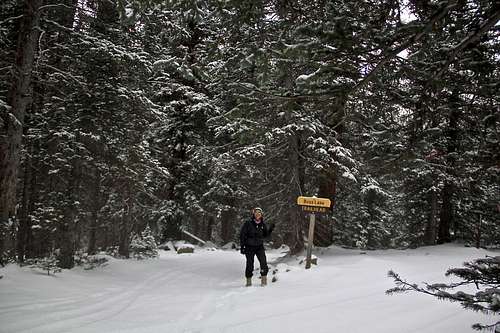 This TH is easily accessible in the summer, but off season it adds about 1.3 miles to your hiking and 800 feet of elevation gain. I am pointing to the right - the way to go to Mount Aetna. To the left takes you to Boss Lake reservoir . | 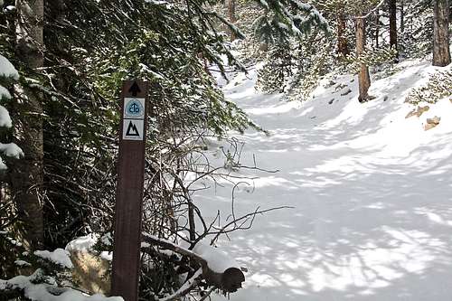 For a short while you will be connecting and intersecting with Continental Divide trail and Colorado trail. | 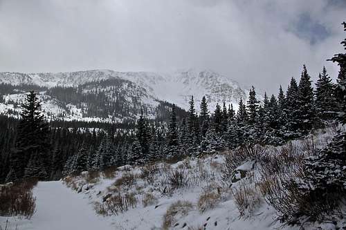 Clover Mountain as seen from the approach to Mount Aetna. Clover was coming in and out of clouds. |
I believe that there are many routes up each mountain, I tend to choose a different way up and different way down to get more acquainted with the area. I went up the South Ridge of Mount Aetna (see photo below), and while ascending and crossing the rocky Grand Couloir, I was deciding whether to go up its south or its west ridge. Both appeared about the same in the difficulty - class 2. South Ridge won since it appeared to have less snow and I wanted to check out my next destination - Mount Taylor, which was visible from the south ridge, but not from the west.
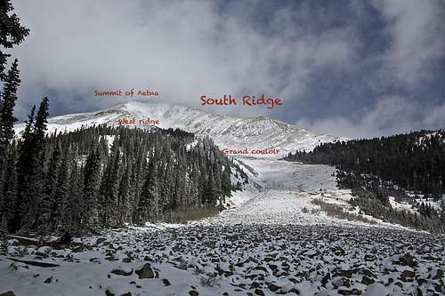 Mt. Aetna as seen from southwest - I left the 4WD = 230 road here. | 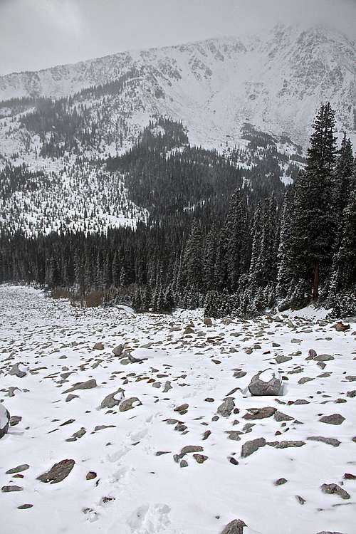 Crossing rocky Grand Couloir on Mount Aetna - looking back at Clover Mountain. |
The South Ridge - the hike/scramble is class 2. Trekking poles would be helpful here to help you to balance on unstable rocks. It would be easier under frozen snow conditions- less postholing into spaces between rocks filled with the snow. Not much exposure on this route. I am assuming typically nice views, but I had clouds, snow drifts and wind obscuring views to the south and west, and greatly limiting my views to the north and east. The scramble was dragging, I was hoping to be on the summit a couple of times, and finding out that there is something higher ahead of me. See photos below.
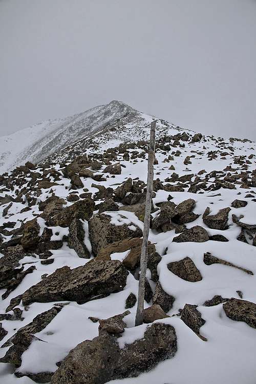 South Ridge of Mount Aetna. | 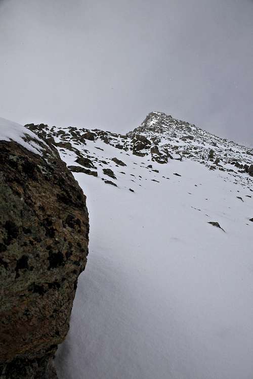 The south ridge was long over a few false summits | 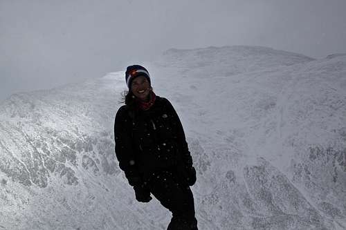 Taylor Mountain as seen from the south ridge on Mount Aetna. Cold and windy day, mountain coming in and out of view due to fast moving clouds. | 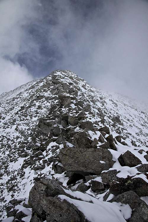 Higher up on South ridge | 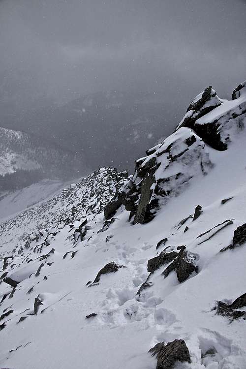 South Ridge - looking down. |
The summit of Mount Aetna is not very big - it looks like a continuation of the ridge. There is a small cairn. I did not find any summit registry. It was a cold day and I had poor visibility that day.
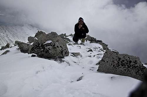 Summit of Mount Aetna. Mount Taylor visible in the background. Photo with camera timer. | 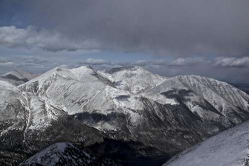 I had only clear view for moments in the east to northeast directions, western and southern views were completely covered in clouds. |
The East ridge of Mount Aetna - I descended the east ridge towards the Aetna - Taylor saddle. The difficulty does not exceed class 2+, mostly class 2, with a short section of class 2+. It is slightly steeper when compared to the South Ridge of Mount Aetna. There was some loose rock, but the ridge was mostly covered with snow. Easy and obvious route finding. From the saddle you have an option to ascend up Mt. Taylor, or drop down to Hoffman park - nice alpine valley, with rough 4WD roads and some old cabins. The road will connect with 230, and will bring you down to Boss Lake Trailhead.
Return: you can either continue up Mount Taylor, easy west ridge and descend from Mount Taylor via southwest ridge to drop into Hoffman Park, or you can descend from the Aetna - Taylor saddle to Hoffman park and find the dirt road, which will bring you down to Boss Trailhead and Garfield.
 Taylor Mountain as seen from Hoffman Park area - some old cabin with a stove | 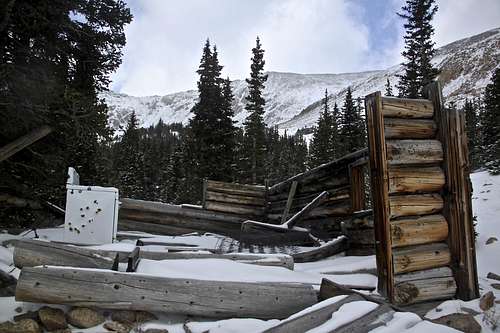 Old stove serving as target practice. Hoffman ghost town below Mount Aetna and Mount Taylor. |  Road 230 C leads to Hoffman Park area and brings you to a nice alpine valley between Mount Aetna and Mount Taylor. |
Boss Reservoir
If you have time consider checking out the reservoir. It is a detour from Mount Aetna, but the hike is very pleasant, and provides nice views. The trail was covered with the snow, but there was a nice marked trailhead, bridge across the stream, and short hike (about 0.5 miles from the trailhead), brought you to a nice reservoir. Per reports it is a popular destination for Greenback cutthroat trout fishing. The fishing is only Catch & Release.Fishing information: click here
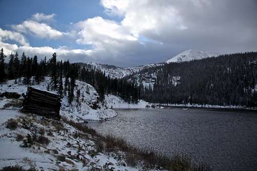 Boss Lake has elevation 10,872 feet. | 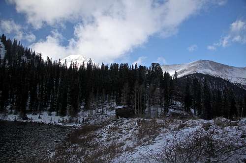 Mount Aetna (the white higher pear on the left) and Taylor Mountain (wind blown smaller peak on the right) as seen from the dam of Boss Lake Reservoir. |
Red Tape
There are no fees. Parking is for free.If you decide to go fishing at Boss Lake reservoir, then you need a fishing permit.
When to Climb
Summer is the easiest time, but since the mountain is easily approachable from US Hwy 50, any time of the year. Late winter and spring would be good for ski descent of Grand Couloir. Always check avalanche conditions prior venturing out.Camping
The mountain can be done as an easy day trip. If you decide to camp in the developed area - here is a link to the closest campgrounds. Backcountry camping is for free.
External Links
- Mount Aetna on 13ers.com
- Trip Report of skiing Grand Couloir
- Monarch cabins
- Monarch lodge
- Monarch Ski Area
- Monarch Snowmobile Tours - I am not into snowmobiling, but I added the link since I parked in front of this building to start my hike.