
-
 2725 Hits
-
 80.49% Score
-
 12 Votes
|
|
Mountain/Rock |
|---|---|
|
|
37.95397°N / 107.53995°W |
|
|
Hinsdale |
|
|
13688 ft / 4172 m |
|
|
Overview
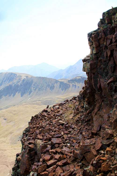
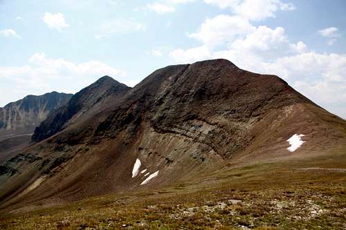 Gravel Mountain (close, center) and UN 13688 (far left) as seen from the south
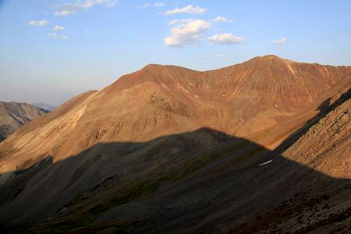 Sunset over Hurricane Basin, Gravel Mountain left and UN 13688 right. The shadow is cast by Seigal Mountain. View from the north.
 As mentioned above, the peak is bicentennial, among the 200 highest in Colorado, making it a more popular destination for those completing lists).
![Old miner's cabin]() Old miner's cabin
Old miner's cabin![Raspberries]() RaspberriesUnnamed 13688 has relatively easy to access from Colorado Scenic Byway: Alpine Loop. The entire route is a rough four wheel drive and you do need a high clearance 4WD vehicle. The road closes late in the fall and opens in June.
RaspberriesUnnamed 13688 has relatively easy to access from Colorado Scenic Byway: Alpine Loop. The entire route is a rough four wheel drive and you do need a high clearance 4WD vehicle. The road closes late in the fall and opens in June.
![Nice path]() Nice path
Nice path![UN 13688]() UN 13688 from Gravel Mountain
As any mountain there are many different route up it. I chose to combine it with unranked Gravel Mountain since I have done all the nearby peaks on its southern side. The advantage of coming from Gravel Mountain side is an easier terrain, but a longer approach. The advantage coming from Wood Mountain side is a combination with other high 13ers in the area (you can get 3 ranked bicentennial peaks: Wood, "Animas Forks, and Unnamed 13688), but the initial section of traverse between Wood and UN 13688 is tricky, loose and at least class 3.
UN 13688 from Gravel Mountain
As any mountain there are many different route up it. I chose to combine it with unranked Gravel Mountain since I have done all the nearby peaks on its southern side. The advantage of coming from Gravel Mountain side is an easier terrain, but a longer approach. The advantage coming from Wood Mountain side is a combination with other high 13ers in the area (you can get 3 ranked bicentennial peaks: Wood, "Animas Forks, and Unnamed 13688), but the initial section of traverse between Wood and UN 13688 is tricky, loose and at least class 3.
Guide to the Colorado Mountains with Robert Ormes (sort of a bible of Colorado mountains) offers again only a very brief description: "Peak 13,688', also usually combined with Wood, is one of the more interesting peaks in the area, and involves some careful route finding. Climb west from Wood, past the beginning of spired south ridge of 13,688'. Descend about 250 feet into Hurricane Basin from the 13,300' saddle just past this ridge, and traverse underneath the spires of the ridge towards the low point. The best gully to take appears to be the second one past the last major pinnacle. Ascend this on third or forth class rock to gain the south ridge, and an easy third class scramble to the top. Ice has been reported up to July in the shady recesses of the traverse, so take an axe."
Colorado Rank: 154 (bicentennial peak)
Parent Lineage: "Animas Forks Mountain"
Class: 2-3 (depending on your route)
Nearby Mountains:
- Gravel Mountain A 0.41 miles
- Wood Mountain A 0.46 miles
- Unnamed 13708 0.70 miles
- "Animas Forks Mountain" 1.10 miles
- Seigal Mountain 1.32 miles
- Cinnamon Mountain A 1.71 miles
- Unnamed 13540 A 2.48 miles
- Houghton Mountain 2.70 miles
- Engineer Mountain A 2.86 miles
Getting There
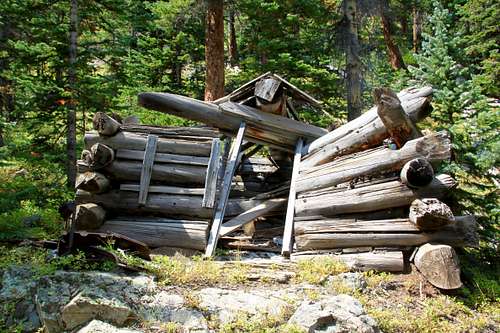 Old miner's cabin
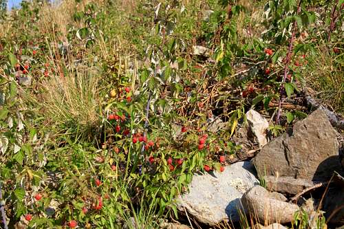 Raspberries
Alpine Loop connects San Juan Mountains town of Ouray, Silverton and Lake City, and navigates between two mountain passes: Engineer Pass to the north and on the southern route Cinnamon Pass.
The road is well marked.
You can access Unnamed 13688 from the summit of Cinnamon Pass if planning combination with Wood Mountain, Unnamed 13708 and "Animas Forks Mountain". Expect a more difficult terrain, loose class 3 to summit Unnamed 13688 from this side.
If planning to climb Unnamed 13688 with Gravel Mountain, you have to drive on Engineer Pass Road and either turn into Hurricane Basin or park below it.
Route
 Nice path
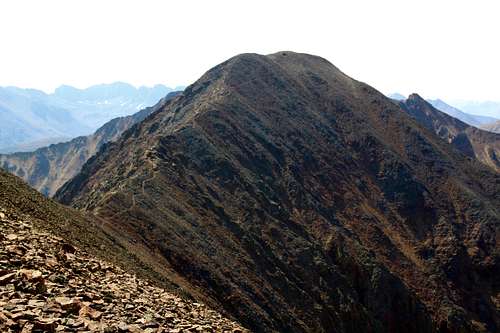 UN 13688 from Gravel Mountain
North Ridge = traverse from Gravel Mountain: there is a small path following the ridge between those 2. The walking is enjoyable at class 2 with some mild exposure. Views are spectacular. The distance between Gravel Mountain and UN13688 is 0.41 miles and the escape from the traverse is not easy, make sure that the weather holds up. You do not want to be up there is a thunderstorm. I will describe how to reach Gravel Mountain in a separate page, but briefly either follow east ridge after crossing Henson Creek, or drive into Hurricane Basin and ascent north facing slopes leading to a saddle between sub peak of Gravel and main Gravel summit. The both routes (east ridge and short cut from Hurricane Basin connect here), follow the ridge, which turns south here to the summit of Gravel Mountain.
South Ridge - traverse from Wood Mountain: descent slightly on the west ridge of Wood Mountain, bypass steep towers and pinnacles on a very technical and loose ridge leading to UN 13688. Descent into Hurricane Basin about 100 meters and look for the easiest gully leading back up the south ridge of UN 13688 while bypassing the technical towers, pinnacles above. Expect loose scree, loose rocks and lots of steepness, class 3 sections. Once back on the south ridge, the terrain becomes easy.
Red Tape
Driving scenic Alpine Loop is free. There are enough parking places along Engineer Pass and Cinnamon Pass Road. Expect a lot of alternative off road vehicles during the peak summer months. Hiking is free.When to Climb
Summer and early autumn is the easiest since you can drive to high up on Engineer Pass or Cinnamon Pass roads. Winter and spring provide a more difficult access, and you have to travel through avalanche prone terrain. Check avalanche conditions prior venturing out there in the winter - Northern San Juan Avalanche Information Center. The alpine scenic loop is usually open to motorized vehicles in June and closes with the first big snowfall - late October, early November.Camping
Primitive camping is available along the Engineer Road or Cinnamon Pass roads at various turn offs. I have slept in the car at the top of both passes.
Developed campgrounds are closer to towns - Eureka Campground on Silverton site, or here is a list of campground in Lake City area.