
|
|
Mountain/Rock |
|---|---|
|
|
44.63146°N / 107.57353°W |
|
|
Bighorn |
|
|
Hiking |
|
|
Spring, Summer, Fall |
|
|
9813 ft / 2991 m |
|
|
Overview
Cedar Mountain is fringed by a dolomite cliffs giving way to aspen groves and high mountain sage. The approach is via a long a rough 4WD road. There is rocking climbing and ATV trails in the area. Cedar Mountain sits across the highway from Antelope Butte and its southeast basin (Dry Fork Granite Creek) is visited by snowmobiles and backcountry skiers.
Getting There
From Highway 14 turn west on Forrest Road 10. Zero your odometer here and continue for 1.5 miles and then turn left (south) on FSR 216. This road is steep and rough at times and slow going. A high clearance vehicle is needed. If you have an ATV the travel would go faster. Follow FSR 216 for 3.4 miles and park where the road ends. Continue north to summit of the peak.
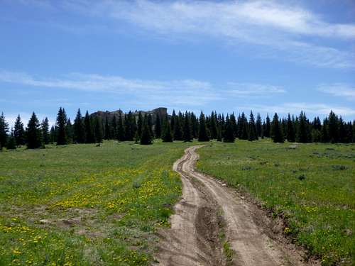
Forest Service Road 216
Route
The route starts from the end FSR 216. From the parking spot a small trail ascends north toward the summit. There is minimal elevation gain and the summit is only a short 10 minute walk. The actual summit views are somewhat obscured by trees.
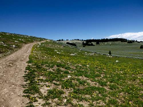
Last strech of FSR 216 with the summit of Cedar Mountain visible in the distance.
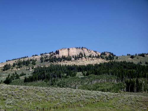
Cliffs flanking the southern aspect of the Cedar Mountain complex.
Red Tape
No red tape. No permit is required.
When to Climb
The main factor limiting access is snow blocking the access road. Generally FSR 216 should be passable from June thru October.
Camping
Primitive dispersed camping is widely available in the area.
External Links
Add External Links text here.