
-
 4409 Hits
-
 79.04% Score
-
 10 Votes
|
|
Mountain/Rock |
|---|---|
|
|
37.63750°N / 107.625°W |
|
|
La Plata |
|
|
Hiking, Mountaineering, Scrambling |
|
|
13696 ft / 4175 m |
|
|
Overview
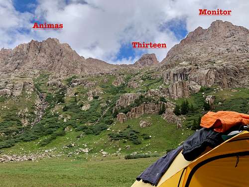
 Monitor Peak
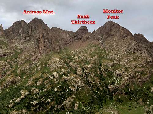 Monitor Peak and Animas Mnt.
Monitor Peak is typically accessed via historic narrow gauge Durango Silverton Train, and then hiking into Ruby Basin. An alternative approach is from Durango Mountain ski area and it is about 17 miles long. I have been to Ruby Basin on two different occasions and the train did not operate: 2018 closed due to extreme drought and fire hazard, and 2020 closed due to Covid pandemic.
Ruby Basin is a beautiful area to camp and provides access to multiple peaks. There is a small stream, waterfall and mountain goats (less mountain goats here than in Chicago Basin).
Colorado Rank: 148
Parent Lineage: Animas Mountain
Class: 4
Nearby Peaks: (in bold are 14ers)
- Peak Thirteen 0.2 miles
- Peak Twelve 0.46 miles
- Animas Mountain 0.47 miles
- The Index 0.65 miles
- Peak Sixteen 0.77 miles
- North Eolus 0.85 miles
- Peak Fifteen 0.86 miles
- Mt. Eolus 1.07 miles
- Turret Peak 1.08 miles
- Peak Eleven 1.19 miles
- Pigeon Peak 1.25 miles
- Sunlight Peak 1.73 miles
- Peak Four 1.81 miles
- The Hiesspitz 1.88 miles
- Windom Peak 2.11 miles
Getting There
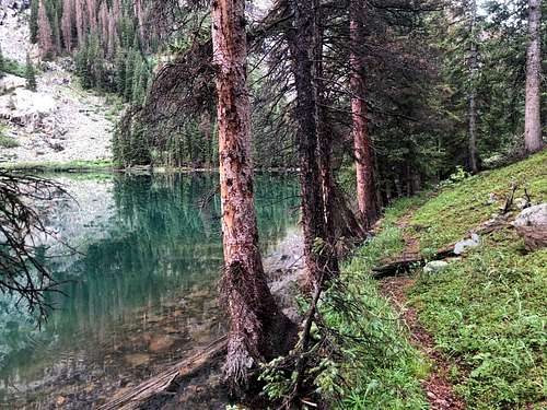 Ruby Lake
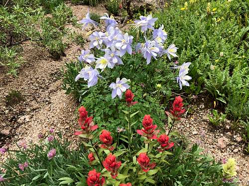 Wildflowers
Once you reach the turn off for Chicago Basin (access to three 14ers and a much more popular basin than Ruby), continue towards the Needleton train station, but do not cross the bridge. Instead continue on a small trail past some private cabins while staying on the east side of the Animas River. The trail weans away from the river and you enter into a large meadow. Continue on small trail to the second meadow and look to your right - there should be a small trail leading into the forest. There is a small cairn marking the turn off and an old campsite. This is your access trail into the Ruby Basin, and can be easily missed if you are not looking for it. The trail is steep and not in a great shape - fallen trees higher up etc. It is relatively easy to follow all the way to Ruby Lake - another great place to camp.
The trail gets really confusing above the Ruby Lake. There are cliffs and lots of vegetation. I was never able to follow it completely. The section from Ruby Lake to the Ruby Basin drags and expect loosing and finding the trail and battling willows. See below my Gaia GPS for some guidance.
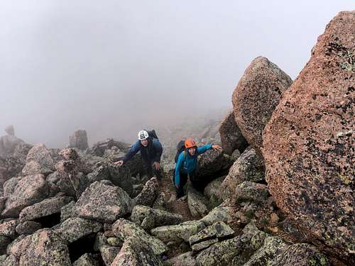
Route
 Monitor Peak
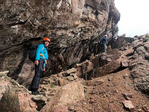 Ramp up Monitor Peak
My Gaia GPS also includes Turret Peak and Peak Twelve. The mileage is not entirely accurate, Gaia was off for some sections of the trail.
Red Tape
Monitor Peak is located in the Weminuche Wilderness, so wilderness rules apply. Leave no trace.
ALL VISITORS
-- Group size is limited to no more than 15 people per party. -- Camping is prohibited within 100 feet of any water source. -- Camping and all campfires are prohibited at the following locations: 1. within 200 feet of Archuleta Lake, Fourmile Lake, and West Ute Lake 2. within 1/2 mile of the north shore and 1/4 mile of other shores of Emerald Lake 3. within 1/4 mile of Little Emerald Lake 4. between the shore and Flint and La Osa Trails at Flint Lake; and within 200 feet of the west and north shores 5. in Needle Creek drainage at Twin Lakes 6. in the hot springs area at West Fork (Rainbow) -- Campfires are also prohibited in all of Needle Creek Drainage (including Chicago Basin) and Vestal Basin. -- Do not shortcut switchbacks. -- Pets must be under verbal control or leashed at all times. -- Disposal of human waste and wash water is prohibited within 100 feet of any water source. -- As with all designated Wilderness areas, mechanical transportation (including wagons, game carts, wheelbarrows, bicycles, or other vehicles) is prohibited.
When to Climb
The approach is hard and obviously the easiest time to climb Monitor Peak is in the summer or early fall. Other seasons provide difficult and long approach and winter there is a high avalanche danger.
The train between Durango and Silverton operates only seasonally during the summer and early fall, winter means at least 16 miles of backpacking in.
Camping
There are wonderful campsites in Ruby Basin, nice green meadow, close by boulders/granite wall helps with hanging up your food. There are not trees up there.