
|
|
Mountain/Rock |
|---|---|
|
|
56.82793°N / 3.73398°W |
|
|
Hiking, Mountaineering, Skiing |
|
|
Spring, Summer, Fall, Winter |
|
|
3678 ft / 1121 m |
|
|
Overview
Beinn a'Ghlo (Pronounced: Byn a Ghlaw) is a beautiful, mysterious and striking mountain mass of many complex summits, ridges and corries that is visible for many miles around. It's name derives from the old Gaelic word 'glo', meaning veil or mist, and this naming was undoubtedly due to the fact that the mountain mass has a tendency to catch and retain the passing clouds.
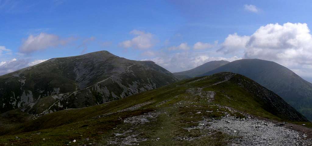
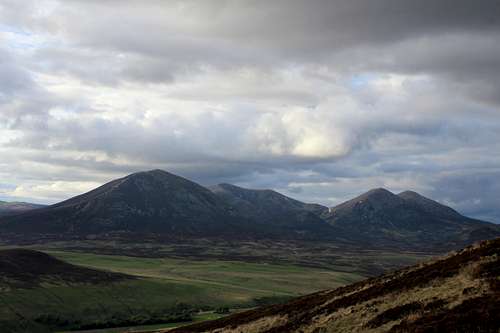
Beinn a'Ghlo panorama from Carn Liath. (Photo by Boydie)
Beinn a'Ghlo has three main peaks, all of which hold Munro status. The peaks that make up Beinn a'Ghlo are as follows;
Carn Liath - 975m/3199ft - Munro No.181
Translation: Grey Hill
Pronounced: Karn Lyee-a
Braigh Coire Chruinn-bhalgain - 1070m/3510ft - Munro No.66
Translation: Height of the Corrie of Round Blisters
Pronounced: Bray Kora Kryn-valageen
Carn nan Gabhar - 1121m/3678ft - Munro No.32
Translation: Hill of Goats
Pronounced: Karn nan Gawar


As mentioned there are numerous corries emanating from Beinn a'Ghlo due to its comlplex nature. An old stalkers legend was that it held 19 corries, in any of which a rifle could be fired without being heard in another.
The most popular route of ascent for Beinn a'Ghlo is from Glen Fender on the road to Monzie, however an aproach from Glen Tilt can be easily done also. Either way, a traverse of the three peaks is made in a southwest to northeast fashion.
Approx time taken: 7-9 hours.
History
A little piece of local history that was to good to omit.
In the late 1840's the Duke of Atholl tried to close Glen Tilt, but eventually lost his right of way case. In 1847 Proffessor Balfour and a group of botanists were stopped at Glen Tilt on the old glen road from Braemar to Blair Atholl by the angry Duke, which eventually led to the afore mentioned law plea.
Below is an extract from 'The Ballad of Glen Tilt' by Sir Douglas MacLagan that details the event.
The Duke at this put up his birse,
He vowed in English and in Erse,
That Saxon fit
Su'd never get
Ae single bit
Throughout his yet,
Among the Heilan hills, man.
Balfour he had a mind as weel
As ony duke could hae, man,
Quo' he, 'There's ne'er a kilted chiel
Shall drive us back this day, man.
It's justice and it's public richt,
We'll pass Glen Tilt afore the nicht,
For dukes shall we
Care ae bawbee?
The roads as free
To you and me
As to his grace himself, man.
Getting There
If arriving in Scotland and making your way to Beinn a'Ghlo then the best airports to arrive in are;
Airports
Glasgow Airport
Edinburgh Airport
Inverness Airport
Car
Car directions to Beinn a'Ghlo from Glasgow, Inverness and Edinburgh can be seen on the embedded map below. Click on the view larger map link for more detailed directions. Once at Blair Atholl you must then travel to the starting point at Loch Moraig on the single track road to Monzie. A small amount of car parking is available.
View Larger Map
Train
The nearest train station to Beinn a'Ghlo is Blair Atholl. Scotrail info link.
Bus
The nearest bus drop off from Glasgow/Edinburgh/Inverness is Blair Atholl. Details can be found on this Scottish City Link info link.
Red Tape
There is no red tape in Scotland due to the Land Reform (Scotland) Act 2003 which incorporated the Scottish Outdoor Access Code. This code, which commenced on the 9th of February 2005, has established statutory rights of access to land and inland water for outdoor recreation.
The Land Reform(Scotland) Act 2003
Scottish Outdoor Access Code
The following aspects should be taken into consideration when you are in the Scottish countryside;
- Seek local advice in regard to deer stalking or grouse shooting activities
- Ensure that all gates are closed behind you
- During the lambing season (March to May) ensure that all dogs are kept on a lead
- Please refrain from feeding or annoying any animals
- Limited parking space is available at the start of many routes, please ensure that you are not blocking a road and/or entrance
- Parking is provided at the start of some routes by the local farmers, it is polite to ask if you can use this facility
- Try to refrain from crossing fields with animals and/or crops if an alternative route is available
- Ensure that you treat the local environment with care by leaving it as you found it and by taking any litter home with you
- Any camp fires should be carefully watched and only used away from dense forest areas
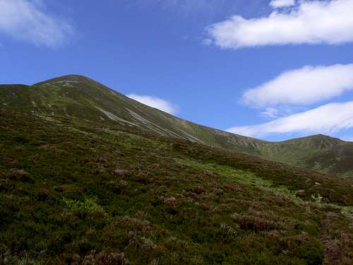
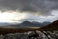
Carn Liath from the ridge between it and Braigh Coire Chruinn-bhalgain. (Photo by Boydie)
Accommodation
The best place to base yourself for climbing Beinn a'Ghlo is in the picturesque town of Blair Atholl. There is also various accommodation to be found in abundance within the Cairngorms National Park.
Hotels/B&B‘s
Atholl Arms Hotel
Ptarmigan House
River Tilt Park
The Firs
The Struan
The Dalgreine Guest House
Killiecrankie Hotel
Lodges & Campsites
Blair Castle Caravan Park
Blair Castle Woodland Lodges
Hostels & Bunkhouses
Hostels & Bunkhouse in Aviemore & Cairngorms National Park
Wild Camping
Wild camping is totally legal in Scotland and can be done in various locations close to Beinn a'Ghlo. This is due to the Land Reform (Scotland) Act 2003 that was mentioned earlier.
Here are some of the basic rules that should be adopted when wild camping;
- The larger the group, the harder it is to keep impacts to a minimum. Keep groups small.
- Camp as unobtrusively as possible.
- Remember that noise travels from tents disturbing wildlife as well as humans.
- Enjoy the freedom of wild camping without leaving a trace of your passage. Protect our country's outstanding scenery and wildlife as well as the wilderness experience.
- Camping on the same spot harms vegetation. Aim to move frequently and do not stay for any longer than 3 nights in the same place.
- Lighting fires poses a high fire risk on peaty soils and close to tinder dry grass. A high risk of fire can exist at any time of year, and not just in times of drought.
- Watercourses and loch sides are important sites for birds and animals. Take extra care when camping near burns and lochs, and try to avoid camping immediately beside them.
- Always find a spot at least 30 metres from fresh/running water when going to the toilet.
- Bury excrement in a small hole (not under boulders). A trowel or ice axe can be used to lift a flap of turf.
- Remove all litter (even other peoples!) Think ahead and only carry in what you are prepared to carry out.
The Mountaineering Council of Scotland provides an invaluable leaflet providing a full breakdown of the do's and don'ts of wild camping in Scotland. Wild Camping, A guide to good practice.
Mountain/Weather conditions
The weather conditions in Perthshire can alter rapidly and you should ensure you are fully prepared for all weather eventualities. The following websites will provide invaluable information on the expected conditions for your planned trip.
Southeastern Highlands Forecast
Mountain forecast
Avalanche forecast


Books & Maps
Books
The Cairngorms by Adam Watson
Scottish Hill and Mountain Names by Peter Drummond
The Munros (SMC Hillwalkers guide) edited by Donald Bennet & Rab Anderson
Walking the Munros Vol 2 - Northern Highlands and the Cairngorms by Steve Kew
The Munros by Cameron McNeish
Walking Highland Perthshire by Ronal Turnbull
Hostile Habitats by Mark Wrightham & Nick Kempe
Please click on the view larger map link to see an ordanance survey view of Beinn a'Ghlo
Maps
OS Landranger Map 43 - Braemar & Blair Atholl
OS Explorer Map 394 - Atholl
External Links
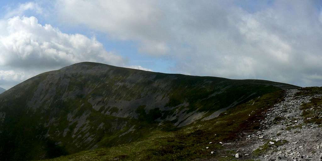
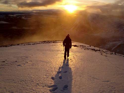 Descending Beinn a'Ghlo.(Photo by: markthejock)
Visit Scotland
Discover Scotland
Undiscovered Scotland
Walk Highlands
Munro Magic
Deer Stalking Scotland
Visit Perthshire
Mountain Rescue Committee of Scotland
Buachaille.com