
|
|
Mountain/Rock |
|---|---|
|
|
57.06320°N / 3.62245°W |
|
|
Hiking, Mountaineering |
|
|
Spring, Summer, Fall, Winter |
|
|
3789 ft / 1155 m |
|
|
Overview
Summit height - 1,155 m (3,788 ft)
Meaning - Blue Cairn of Derry
Scottish Gaelic - Càrn Gorm an Doire
According to Wikipedia, it was originally named An Carn Gorm but was renamed to Carn Gorm an Doire to avoid confusion with the nearby Cairn Gorm.
Its name has now been anglicised to Derry Cairngorm.
The original Gaelic (Carn Gorm an Doire) means “Blue cairn of Derry”. Derry is the anglicisation of doire, or doireach, meaning wooded, a reference to the Scots pines that adorn the southern slope of the mountain near Derry Lodge. This valley is now known as Glen Derry.
The hill can be seen from the hamlet of Inverey and often appears as dark blue in colour, however from other angles it takes on a pink tinge as result of its granite rocks.
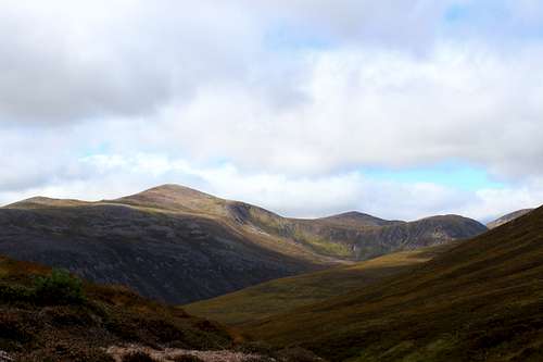
The Cairngorm National Park was formed in 2003 to protect this unique area. It is the UK's largest national park with a large mountain range at its heart and with many diverse communities around it. The habitat offers a secure haven for many rare species and the forests include remnants of the original, ancient Caledonian pine forest. These contrast with large areas of heather moorland.
The southern aspect of the Cairngorms has a different feel to that of the northern corries. The area has a more wide-open feel to the landscape and human development seems to be further away from the mountains themselves.
The village of Braemar lies within the southern part of the Cairngorms National Park, close to the Mar lodge estate. It is the way into this area, lying at the convergence of hill passes from the north, south, east and west.
Braemar and the surrounding area had been a haunt of the old Scottish Kings for centuries for hunting and The Earl of Mar raised the standard here to signal the start of the Jacobite uprising in 1715.
However, in 1852 the nearby Balmoral estate was purchased by Queen Victoria and this has remained in the Royal family ever since, giving the area a focus for tourist activity.
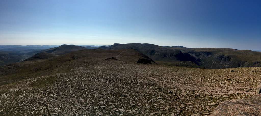
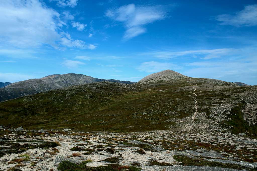
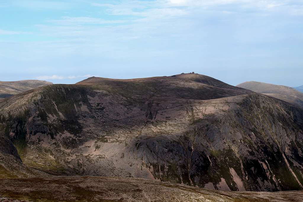
Derry Cairngorm is a mountain characterised as a long ridge running roughly north to south, lying in the area known as the Central Cairngorms.
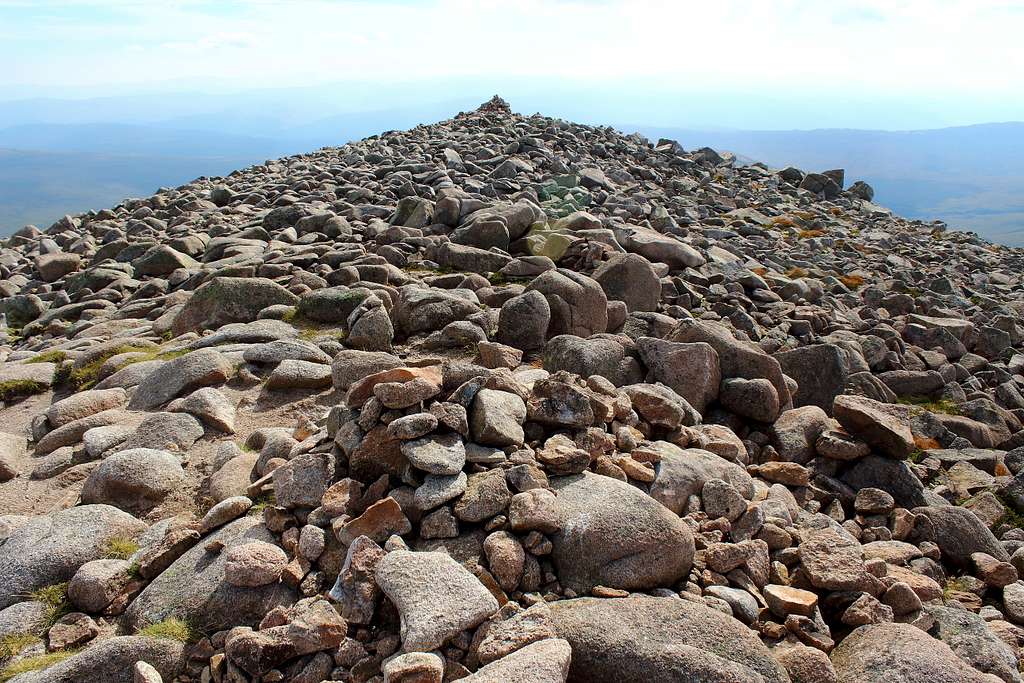
It has a generous covering of loose rocks including fields of large boulders. In fact, just south of the summit lies an unnamed, (on the map) rocky point with a height of 1040m, this was formerly called “Little Cairngorm” and presents itself as a “false summit” on the ascent of this ridge.
Getting There
Driving from the south (Glasgow), take the M9/A9 roads to Perth, then the A93 north through Glenshee to Braemar.
Driving from the north (Inverness), take the A9 south towards Aviemore. At Carrbridge turn left onto the A938 and head into Grantown on Spey. At Grantown turn right onto the A939 and follow this road through Tomintoul and Cock Bridge towards Ballater but turn right onto the A93 signposted for Braemar before reaching the town.
Driving from the east (Aberdeen), take the A93 through Banchory, Aboyne, and Ballater until you reach Braemar.
The only Bus service is the Stagecoach service no 201, Aberdeen to Braemar.
There is no nearby train service and at time of writing, no Taxi service in Braemar.
Route
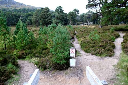
Derry Cairngorm is usually climbed from the south, the starting point being the National Trust car park at Linn of Dee. This is a pay and display car park (free for NT members).
Head north, through the forest to the rough track which runs into Glen Lui. This track is used by authorised motor vehicles and cyclists nowadays so you will need to be aware of occasional traffic. This track lasts for approximately 3 miles until it reaches the remains of Derry Lodge. (You may want to consider renting a bicycle for this part of your day!).
Derry Lodge is now boarded up and disused but was originally used as a hunting and shooting lodge for the Mar estate. Queen Victoria is reputed to have stopped here for refreshments on her way back from climbing Ben Macdui and a family lived there during the early 20th century. It was used by the army during the war and leased by the Cairngorms club between 1955 – 1967. Since then, it has deteriorated into its present state although, there have been plans to renovate it in recent times.
Pass Derry Lodge and cross the bridge over the river issuing from Glen Derry on the right.
Here, there are three paths to choose from. The left-hand path heads west towards the Lairig Ghru whilst the right-hand path heads north up Glen Derry. Therefore, take the middle path towards the rocky outcrop of Creag Bad an t-Seabhaig.
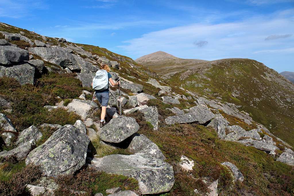
At this point, the summit ridge of Derry Cairngorm is unseen but the path is quite distinct and heads up through thick heather and trees at first before emerging on the open hillside a little farther up.
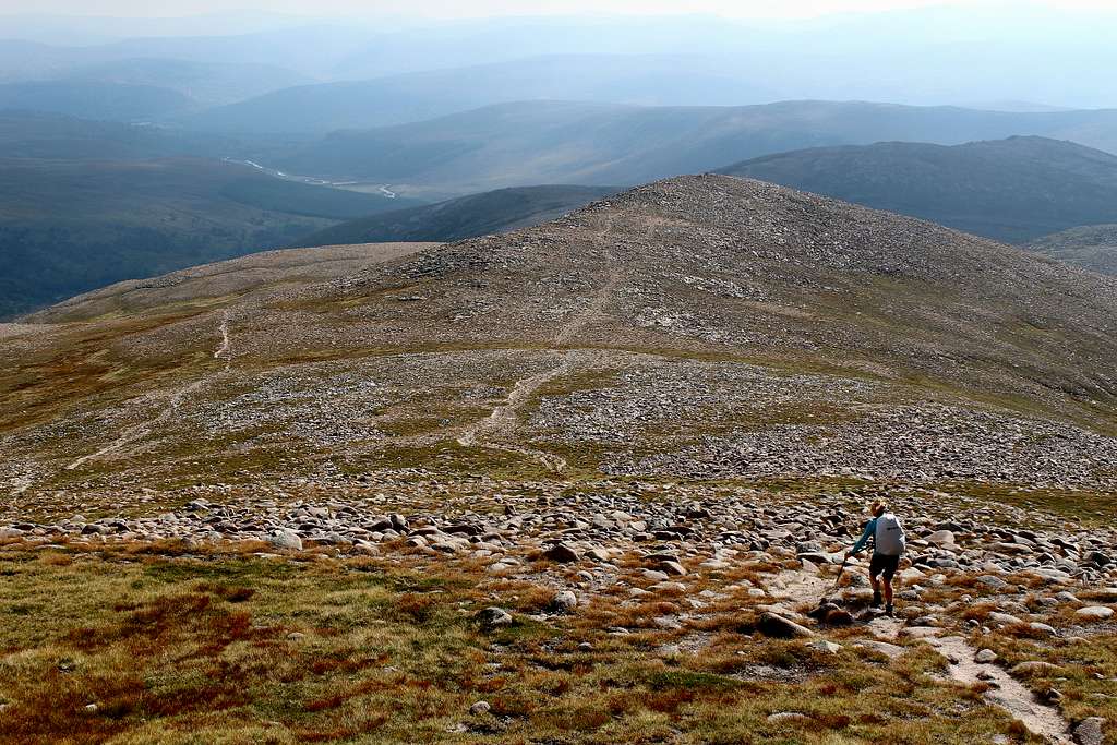
Follow the path up the broad ridge in a northerly direction towards the top of Carn Crom. What appears to be the summit, a huge pile of rocks, can be seen ahead but this is only the top of “Little Cairngorm” (marked on the map as 1040m) and not the true summit.
The path descends over a rocky landscape to the “bealach” at 833m, then ascends again towards the pile of rocks ahead (Little Cairngorm). The path, by passes this on its right side (east) but could be climbed by scrambling up to the top.
Continue upwards towards the next rocky top, the path takes this full on but then vanishes in the jumble of rocks. Scramble upwards but take care as some rocks are loose.
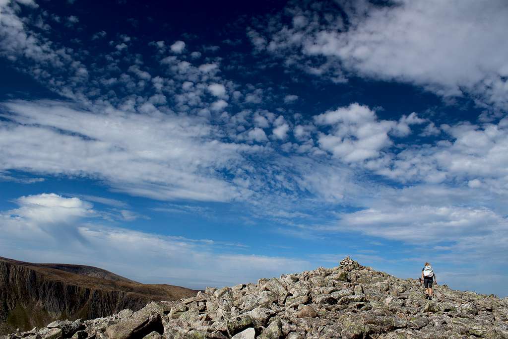
Crest the ridge and head towards the large cairn. From there, another cairn appears further on and looks to be higher. Scramble across the rocks to the second (smaller) cairn and look back. The first cairn now appears to be the higher one! The OS map seems to indicate the second cairn is the higher one but probably best to visit both!
The views here are fabulous in clear weather. To the west it will be possible to identify Cairn Toul and a little closer, the ridged mountain of Càrn a' Mhàim and Ben Macdui with the cliffs above Lochain Uaine being prominent. To the north, the mountain’s more famous namesake, Cairngorm and Beinn Mheadhoin are visible whilst to the west, the rounded Munros of Beinn a ‘ Chaorainn and Beinn Bhreac nestle either side of the Moine Bhealaidh (Yellow Moss). The tors of Ben Avon may be visible behind this view.
To return, retrace your footsteps back to Linn of Dee or continue your day to include one or more of the mountains mentioned above in an extended tour.
When to Climb
Spring, Summer or Autumn (Fall) depending on conditions.
Warning: The above description is for use in reasonable summer conditions. Winter conditions can occur at almost any time of the year. In winter condition, this mountain is a much more serious proposition. Any paths may be covered by snow and ice and gale force winds are common. Ice axe, Crampons, the knowledge of how to use them allied with excellent map reading and compass skills are essential.
Red Tape
No red tape.
However, Scotland has an Outdoor Access code, see link:
https://www.outdooraccess-scotland.scot/practical-guide-all
Accomodation
There are a limited number of Hotels, guesthouses and B&B premises in Braemar and there are many self-catering cottages in the area.
There is a caravan and campsite in Braemar, see the Braemar information page for details of all of these.
It is possible to wild camp in Scotland, see the Outdoor access code details via the link in the “Red tape” section.
Map
OS Explorer Cairn Gorm and Aviemore No. OL57 – 1: 25,000
External Links
Walk highlands - https://www.walkhighlands.co.uk/
SMC - https://www.smc.org.uk/
Cairngorms club - https://www.cairngormclub.org.uk/
Cairngorms National Park - https://cairngorms.co.uk/
Braemar information - http://braemarscotland.co.uk/
Wikipedia - https://en.wikipedia.org/wiki/Derry_Cairngorm