|
|
Mountain/Rock |
|---|---|
|
|
57.17735°N / 5.09675°W |
|
|
Hiking, Mountaineering |
|
|
Spring, Summer, Fall |
|
|
3638 ft / 1109 m |
|
|
Overview
Pronounced – Sgurr nan Con – vair - an
Summit height - 1109 m (3,635 ft)
Meaning – Peak of the hound keepers
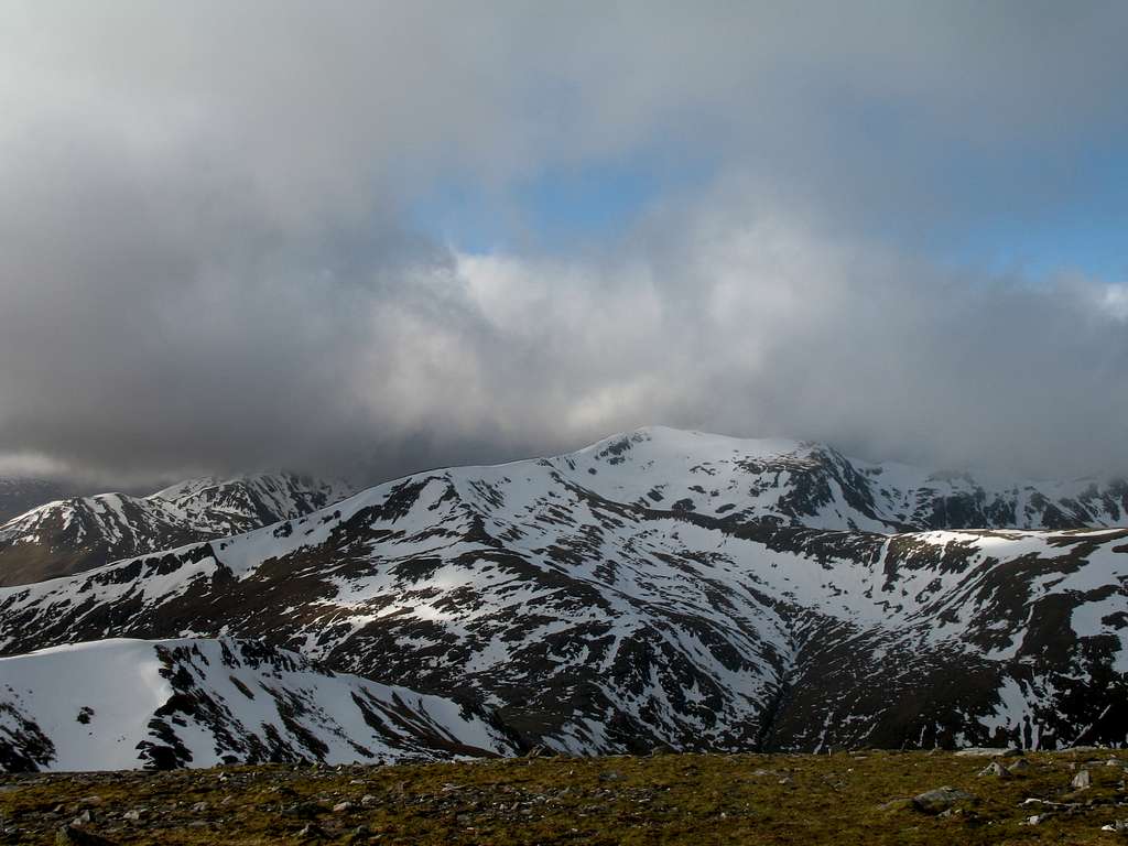
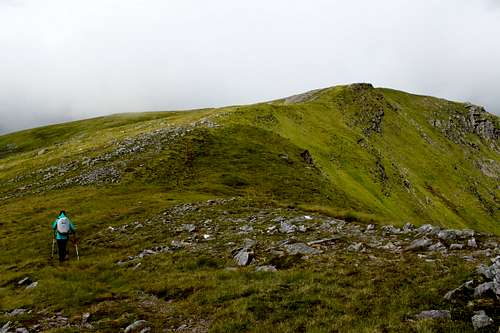
Sgurr nan Conbhairean, like Carn Ghluasaid, is a mountain whose summit is hidden from the majority of travelers using the A87 road along the north shore of Loch Cluanie. From here, all that is seen, is its southern slopes of grass, rock and heather.
From the summit, its eastern facing corries are steep, broken and remote but lack much interest except for their views.
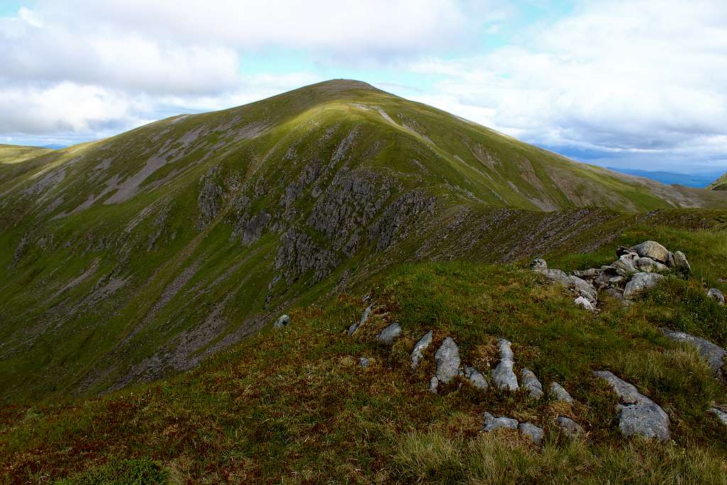
Sgurr nan Conbhairean is the highest and central peak of the three Munros linked by a northward heading, grassy ridge and it is often climbed as part of a traverse along with Carn Ghluasaid and Sail Chaorainn.
Getting There
By Road:
From Fort William, the A82 and A87 roads head northwards towards Kyle of Lochalsh on the northwest coast.
From Inverness, the A82 road heads south along the shores of Loch Ness. Take the A887 westwards towards Kyle of Lochalsh, where it becomes the A87 at Bunloyne junction.
Sgurr nan Conbhairean lies on the north side of Loch Cluanie, where the A87 road follows the shoreline. Soon after Loch Cluanie is reached travelling west, there is an “S” bend in the road and the shoreline. This is marked as “Lundie” on the map and is now an area for parking (or camping!). If there is no room when you arrive, there is another large layby about 100m further west down the road.
Travelling from the west, pass through Glen Shiel and up the valley on the A87 road, passing The Cluanie Inn.
Look out for the parking area at Lundie as described above.
By Bus
Buses are run from Kyle of Lochalsh to Fort William by City Link services.
The nearest bus stop is at Bunloyne junction where the A87 and A887 meet. This would entail a roadside walk westwards of over 7km (4.5 miles) to reach Lundie along the A87.
By Rail:
Kyle of Lochalsh is the nearest railway station. Scotrail’s Highland line which runs between Dingwall (north of Inverness) on the east coast and Kyle of Lochalsh on the west coast is the only railway line.
See the Scotrail website for service information:
https://www.scotrail.co.uk/plan-your-journey/stations-and-facilities/ach
Route
Starting point:
Lundie - There is limited parking in a layby on the A87. Grid reference: 145103
From Lundie, leave the A87 road on the old military road – now a track – which heads west, parallel to the A87. This is the same route used to climb Carn Ghluasaid.
This track soon passes through a gate and onwards towards a communications aerial. Just after this, a path heads off to the right, uphill (north), take this.
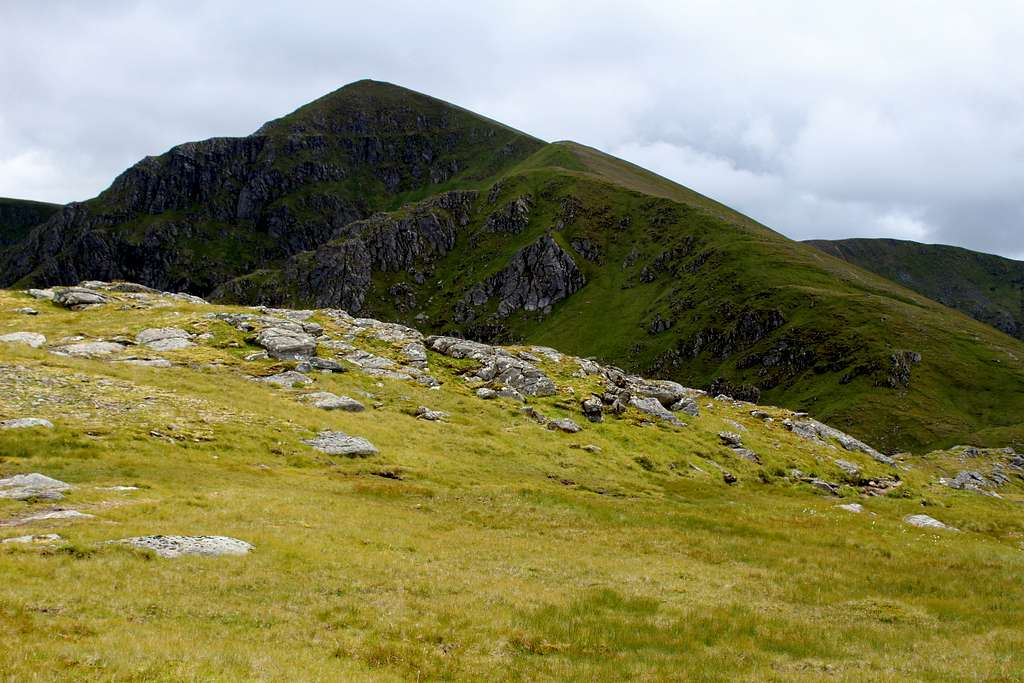
The path is well made and easy to follow, it finds a way up onto An Cruachan, a small hill south of Carn Ghluasaid’s summit.
|
|
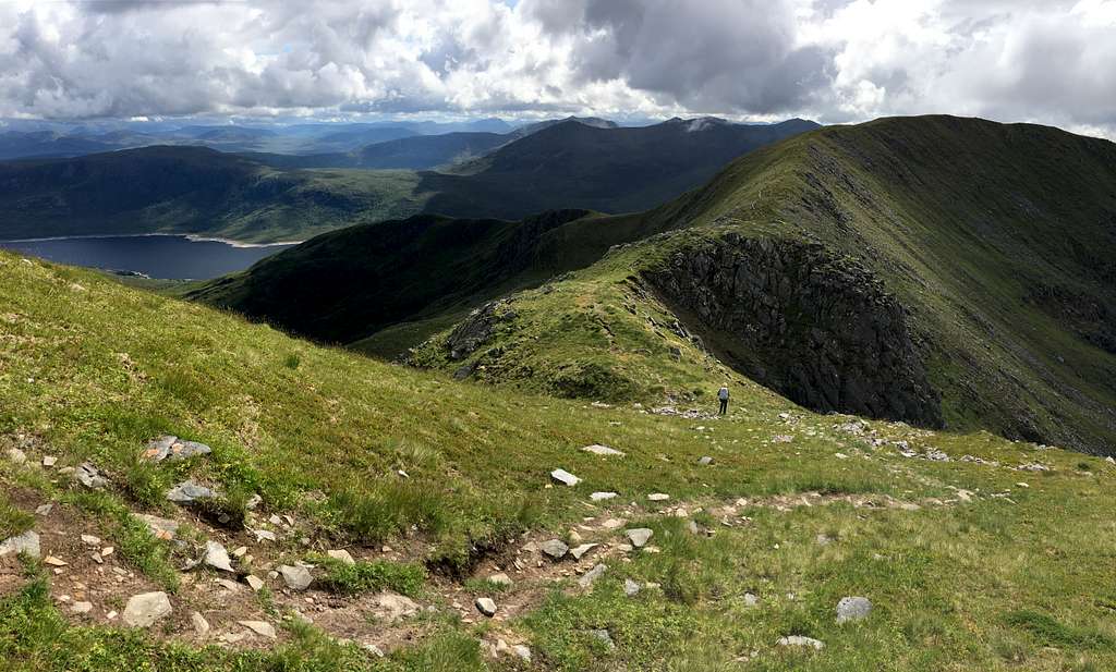
From here, Carn Ghluasaid’s summit can be reached or this can be avoided by heading northwest following the rim of the large corrie towards Creag a’ Chaorainn and onwards towards the summit of Sgurr nan Conbhairean.
Then, it would be easy to retrace your steps back to Lundie, continue the traverse on towards Sail Chaorainn or descend southwest on the grassy ridge to Drochaid an Tuill Easaich. This is an outlying Munro “top” of Sgurr nan Conbhairean and has a pleasant, grassy south ridge as a descent route.
Follow this down towards Loch Cluanie on a path parallel to the Allt Coire nan Clach which is on the left (east) side. This river can be crossed to a feint path on its east side, then descended to the old military road.
Alternatively, stay on the west side and descend to cross the river on rocks just beneath a waterfall. Head east to join the military road. At this point it is little more than a path.
Head east, until the path becomes a track and returns you to the start point.
Of course, it’s possible to do this route in reverse by ascending the grassy ridge to Drochaid an Tuill Easaich and on, eastwards to Sgurr nan Conbhairean.
Red Tape
Scotland has an Outdoor Access code, see link:
https://www.outdooraccess-scotland.scot/practical-guide-all
The area is popular for Deer stalking and Grouse shooting. These activities may impact on any plans for hiking. However, it is still possible to hike during these events with a little extra effort at the planning stage.
This is a useful page on the Outdoor access – Scotland website
https://www.outdooraccess-scotland.scot/practical-guide-all/heading-scottish-hills
When to Climb
Spring, Summer or Autumn (Fall) depending on conditions.
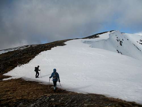
Warning: The above descriptions are for use in reasonable summer conditions. Winter conditions can occur at almost any time of the year. In winter condition, this mountain is a much more serious proposition. Any paths may be covered by snow and ice and gale force winds are common.
Ice axe, Crampons, the knowledge of how to use them allied with excellent map reading and compass skills are essential.
The proximity of the west coast and the sea means that mist often forms and can cover the mountain.
Accomodation
There is limited hotel accommodation at the Cluanie Inn and in the town of Kyle of Lochalsh. There are also campsites around this town and in Glen Shiel.
It is possible to wild camp in Scotland. See the Outdoor access code (above) for more details.
There are many types of self-catering accommodation in these areas but it is best to book these in advance.
External Links
SMC - https://www.smc.org.uk/
The Munros – (SMC Hillwalkers guidebook)
The High Mountains of Britain and Ireland – I. Butterfield
Ordnance survey map OS 414 Glen Shiel and Kintail Forest. 1: 25 000