|
|
Mountain/Rock |
|---|---|
|
|
57.13728°N / 3.58416°W |
|
|
Hiking, Mountaineering |
|
|
Spring, Summer, Fall |
|
|
3576 ft / 1090 m |
|
|
Overview
Pronounced – Bei-nack More
Scottish gaelic - A' Bheithneag Mhòr
Meaning – The meaning is unclear. Some sources say it comes from the word “beannag” which means cap, band or kerchief. Other sources say it comes from the word “beinneag” which means big little hill or even the word “binneag” meaning chimney pot.
Summit height - 1,090 m (3,574 ft)
The Cairngorm National Park was formed in 2003 to protect this unique area. It is the UK's largest national park with a large mountain range at its heart and with many diverse communities around it. The habitat offers a secure haven for many rare species and the forests include remnants of the original, ancient Caledonian pine forest. These contrast with large areas of heather moorland.
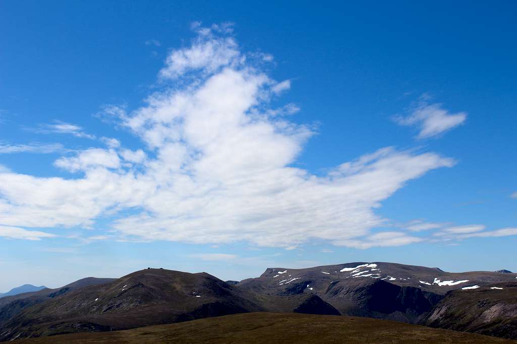
Seen from the roadside to the north, Bynack More appears as a classic conical shaped mountain. It is separated from the central Cairngorms (and Caingorm itself) by the deep cut of Strath Nethy and rises above the high plateau which emerges out of the Abernethy forest.
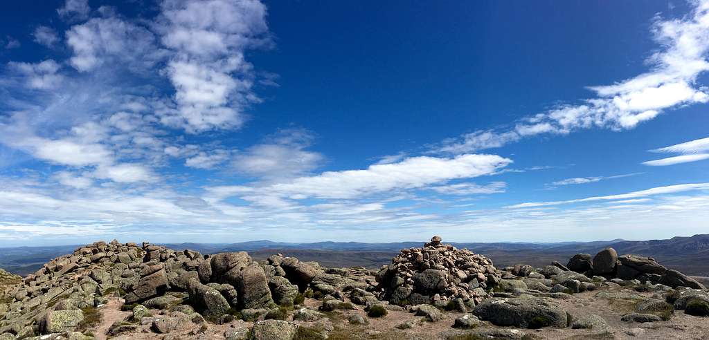
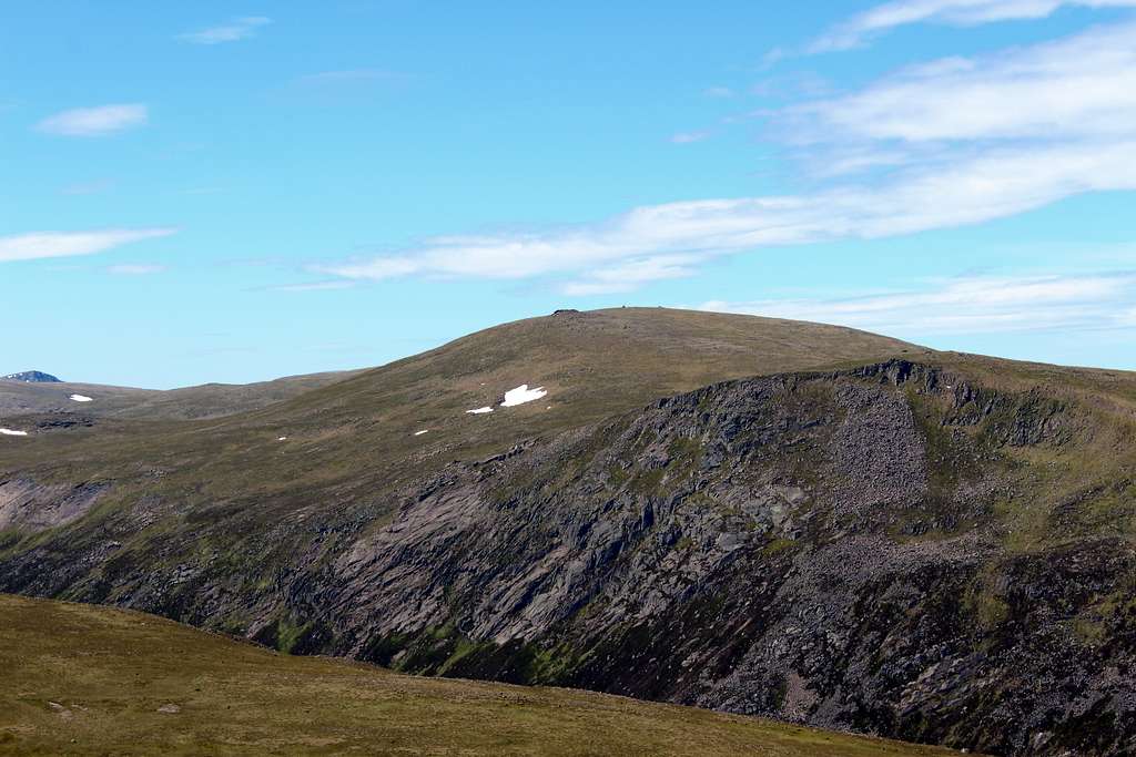
Like its southerly neighbour Beinn Mheadhoin, Bynack More’s slopes are populated with a series of granite tors or “barns” and a proliferation of broken granite boulders. At this altitude, the gravelly soil only supports a thin covering of grass and heathers. The lower gullies and riversides around the mountain manage to support these along with low growing bushes and trees.
The Cairngorms are a stronghold for high mountain and some Arctic species, Ptarmigan being the most common bird. It’s also possible to see Dotterel and Snow Bunting. The barren ground does provide a home for various mosses and rushes where streams feed them water.
Getting There
Aviemore is the main town to use as a base for the northern Cairngorms. It has many hotels and shops and provides a good bus service to the area as well as a good train service to the wider country.
By road, Aviemore is easily accessed from the main A9 road which links Glasgow with Inverness. From Aviemore a minor road runs to Loch Morlich, and from there onwards to the Cairngorm ski development at Coire Cas.
Two main routes can be started from car parks along this road at the Allt Mor car park (pay and display) or the Coire na Ciste car park (pay on exit).
Routes
For an ascent of Bynack More, there are two main starting points and whichever route you choose, this will be a long day out in a remote area so make sure you are fully prepared.
Starting points:
Allt Mor car park – Map reference 984087
Coire na Ciste car park – Map reference 998074
Blue route
From the Allt Mor car park, head to its southerly end and take a path heading east to quickly cross a river on a footbridge. This path continues, on an easterly direction before swinging to the north, all the time in the forest. After two more river crossings, the path meets a track heading west towards the Glenmore Lodge outdoor centre. Do not take this, rather head northeast towards a signposted An Lochan Uaine (The green lochain).
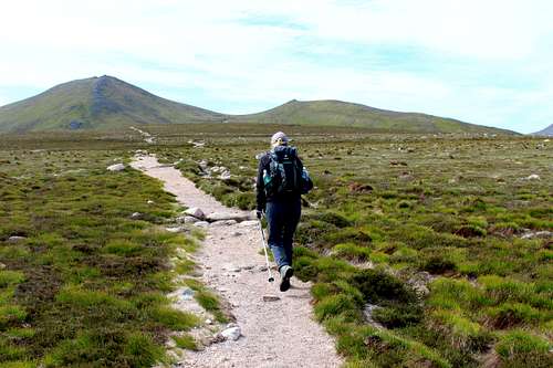
Follow the track as it opens up a little and passes the Lochain on its left side. After this, the trees start to become fewer as the path rises up towards the open moors of the Ryvoan pass.
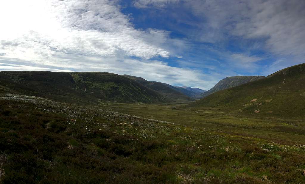
The path forks, left would take you north towards Ryvoan Bothy and distant Nethy Bridge. Take the right fork that heads east at first, then swings to the southeast as it crosses the River Nethy and finally south as it rises higher onto the moorland plateau.
Bynack More can be seen ahead on a clear day seemingly far away but the well-made path quickly eats up the ground. Cairngorm becomes visible on the right (southwest) and at the head of the River Nethy valley, it’s possible to see Beinn Mheadhoin, its summit tors will give it away!
As the path rises more steeply onto the moor, it forks again. This time the left fork will take you to Braemar through the Larig an Laoigh. Take the right fork to head south towards the obvious summit ridge of Bynack More which lies ahead. The “Top” of Bynack Beg is the lower summit to the right.
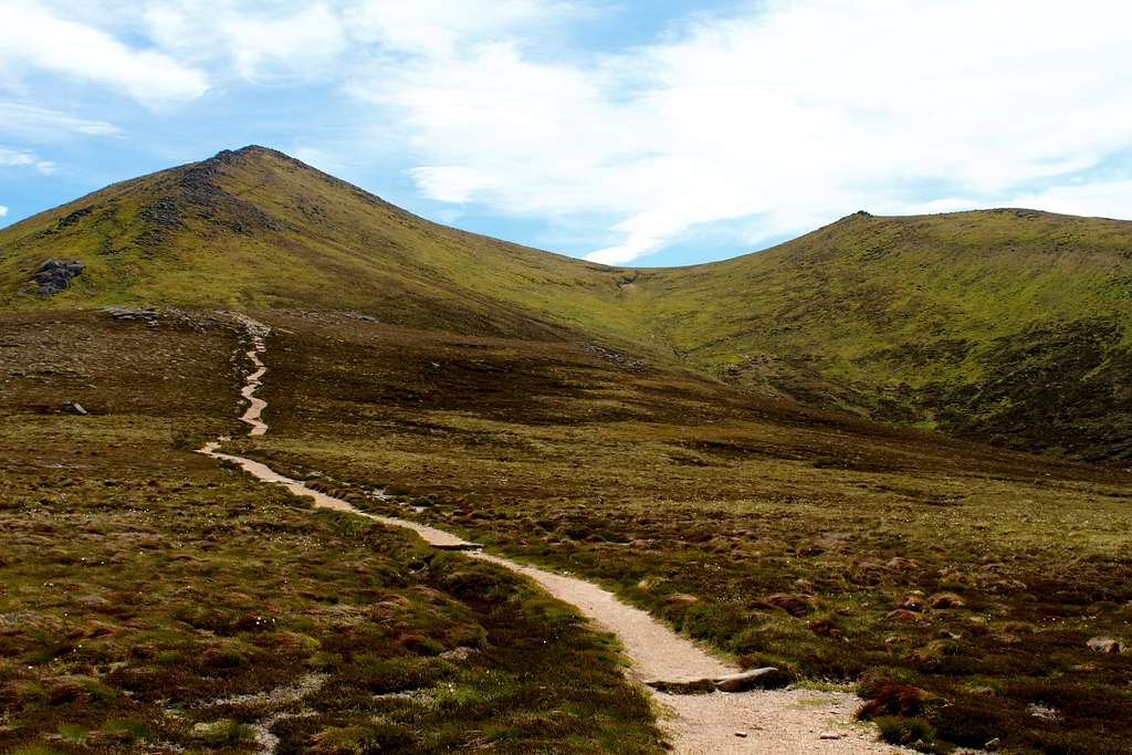
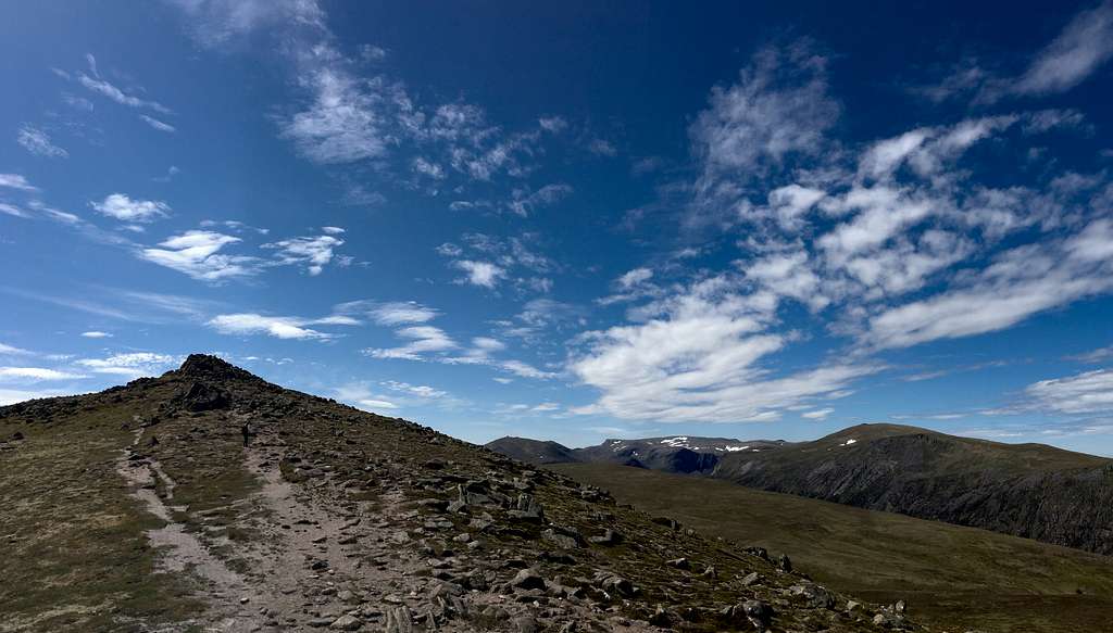
As the north ridge is met, it rises steeply and the path dissolves into several routes. Choose the best for you and ascend the rocky route until a “false summit” appears.
Continue past this, up to the true summit of Bynack More (1090m) which has a large cairn to mark it.
From here, to the south and west the views are excellent. West towards the summit of Cairngorm and the main summits of the other central Cairngorms peaks. Glen Avon and Beinn Mheadhoin to the south along with Beinn a’ Chaorainn and the surrounding Moine Bhealaidh (Yellow Moss). To the southeast, the tops of Beinn a Bhuird and Ben Avon may be visible.
From here, it is worthwhile to descend northeast to visit Bynack Beg (970m), a smaller and more grassy hill although, the summit itself is pretty rocky.
To descend, leave the top of Bynack Beg and contour eastwards back onto Bynack More. Continue on a level route to pick up a path on its south ridge to descend and retrace your earlier steps northwards all the way back to the car park.
Approx 20 km – 12.5 miles.
Red Route
This is a circular route that takes in the Munros of Bynack More and its associated “tops”, Bynack Beg and A’ Choinneach along with Cairngorm and its “top” Cnap Coire na Spreidhe. It is a route that is popularised by several sources but is not marked by many paths on the Ordnance survey map so may require a degree of wayfinding over the rough slopes.
From the car park at Coire na Ciste, head southwest to cross the Allt na Ciste, then turn north, then northeast on a feint path that contours around the hillside just to the south of Lochain na Beinne. Cross the outflow then head uphill towards Pt 737m as it is marked on the map.
Descend east into Strath Nethy and cross the river where you can, then ascend the other side of valley to climb towards the northwest ridge of Bynack Beg. Ascend this to the top (970m), then continue in a southeast direction to the summit of Bynack More (1090m) a relatively short distance away.
After admiring the summit views, descend southwards towards the tors known as the Little Barns of Bynack (the larger Barns of Bynack are further to the east). Then head southwest to Pt 940m and further up to the top of A’ Choinneach (1016m) Follow the ridge south then, turn downhill to the southwest to pick up a path to bring you down to the Saddle, a point just north of Loch Avon.
From here climb northwest on Cairngorm itself by taking another feint path. As you gain height, it’s possible to visit the summit of Cairngorm (1244m) to the southwest, then head back northeast to the top of Cnap Coire na Spreidhe (1150m). Return to the original path by heading north and east – avoid the ski paraphernalia to the right (east) - to descend Coire na Ciste and back to the car park.
Approx 15.5 Km – 9.7 miles.
Red Tape
No red tape.
However, Scotland has an Outdoor Access code, see link:
https://www.outdooraccess-scotland.scot/practical-guide-all
When to Climb
Spring, Summer or Autumn (Fall) depending on conditions.
Warning: The above descriptions are for use in reasonable summer conditions. Winter conditions can occur at almost any time of the year. In winter condition, these mountains are a much more serious proposition. Any paths may be covered by snow and ice and gale force winds are common. Ice axe, Crampons, the knowledge of how to use them allied with excellent map reading and compass skills are essential.
Accommodation
Hotels and self-catering accommodation around Aviemore. Many campsites in Aviemore, Coylumbridge and Loch Morlich but it’s probably best to book a place in advance during high season.
It is possible to wild camp in Scotland. See the Outdoor access code for more details.
External Links
Walk highlands - https://www.walkhighlands.co.uk/
SMC - https://www.smc.org.uk/
Cairngorms club - https://www.cairngormclub.org.uk/
Cairngorms National Park - https://cairngorms.co.uk/
The Cairngorms – Adam Watson (SMC guidebook)
The Munros – (SMC Hillwalkers guidebook )
The High Mountains of Britain and Ireland – I. Butterfield