
-
 8625 Hits
-
 82.48% Score
-
 15 Votes
|
|
Mountain/Rock |
|---|---|
|
|
37.90791°N / 107.6098°W |
|
|
San Juan |
|
|
Hiking |
|
|
Spring, Summer, Fall, Winter |
|
|
13454 ft / 4101 m |
|
|
Overview
 Hanson Peak as seen from the walk from UN 13075
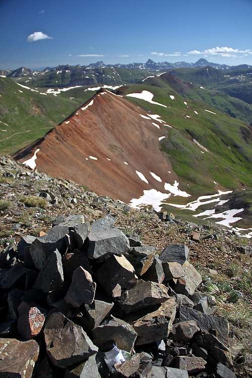
I chose to approach this peak from the southwest because I wanted to explore the area of a former Lake Emma. Maps are still marking a lake, but Lake Emma has devastated the Sunnyside Mine in 1978. Water from the lake invaded the tunnel system and flooded several levels of the mines. Sunnyside Mine was established in 1873 and was one of the best producers in the area. In the 1960s it was producing 600 tons of ore per day. On Sunday, June 4 1978, a tunnel about 70 feet under Lake Emma collapsed and completely drained the lake. Thousands of gallons of water and millions of gallons of mud and rocks exited through American Tunnel at Gladstone, more than 2 miles away and 1,500 feet lower. Since the disaster occurred on Sunday, the miners were not working, and no one was killed.
Colorado Rank: 286
Class: 2
Nearby Mountains (all 13ers):
California Mountain A 0.56 miles
Hurricaine Peak 0.80 miles
Unnamed 13075 0.95 miles
Bonita Peak 1.07 miles
Emery Peak 1.48 miles
Brown Mountain A 1.77 miles
Tuttle Mountain 1.82 miles
Proposal Peak 1.92 miles
Houghton Mountain 2.59 miles
Dome Mountain A 3.30 miles
Getting There
I will describe my approach to the mountain via Eureka Gulch Trail, but as mentioned below in the route section the area is full of 4WD roads and the approach from Placer Gulch may be easier and closer.Drive from Silverton towards Eureka, Highway 110. It is initially paved, then changes into a well maintained 4WD road, open and snow plowed even in the winter. Pass through Howardsville at 4.3 miles and continue to Eureka at 8 miles. Cross the Animas River over a bridge and after 0.4 miles take a sharp left onto CR 25 (not signed, but pretty obvious road to the left). The route climbs sharply along a shelf road. It is easy driving, I believe 2 WD vehicle would make it also. It is about 3.6 miles on this road.
I would like to mention that road it kept open till Eureka in the winter. If you choose to hike this mountain in the winter, you will have to hike the 3.6 miles of the Eureka Gulch Road.
Route
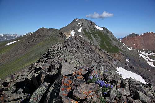
Many options exists, I chose via drained Emma Lake and southwest slopes. 2nd external link in External Link section describes even easier route from the southeast. The area has a rich mining history and there are many 4WD roads leading high and close to Hanson Peak.There is no established trail. The slopes are not very steep and mostly grass. Higher up there is some scree section, but nothing hard or uncomfortable. The ridge in between Hanson Peak and UN 13075 has almost looking trail at some sections and is easy with great vistas in all directions.
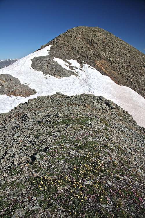
 Summit view from Hanson
 | 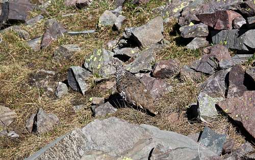 Ptarmigan - well camouflaged
 |
 Hanson Peak
 | 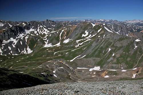 Site of drained Lake Emma
 |