
-
 10220 Hits
-
 84.27% Score
-
 18 Votes
|
|
Mountain/Rock |
|---|---|
|
|
37.86077°N / 107.59994°W |
|
|
San Juan |
|
|
Hiking, Mountaineering, Scrambling |
|
|
Spring, Summer, Fall, Winter |
|
|
13370 ft / 4075 m |
|
|
Overview
Dome Mountain A is low 13er (mountain over 13,000 foot high) located north of historic town Silverton. It is probably my favorite peak in Silverton area. The summit is really scenic, pyramidal shaped and offers excellent views in all directions.Why Dome Mountain A? because there is a B - Dome Peak 12172 feet.
Colorado Rank: 344
Mountain Range: San Juans
Class: 2
Parent Lineage: Tower Mountain
Nearby 13ers:
- Tower Mountain 13,552 feet 1.29 miles
- Macomber Peak 13,222 feet 1.51 miles
- “Proposal Peak” 13,300 feet 2 miles
- “East Storm” 13,325 feet 2.13 miles
- Emery Peak 13,310 feet 2.23 miles
- Storm Peak A 13,487 feet 2.59 miles
- Unnamed 13075 feet 3.03 miles
- Galena Mountain A 13,300 3.13 miles
- Hanson Peak 13,454 feet 3.30 miles
- Crown Mountain 13,569 feet 3.80 miles
- California Mnt A 13,320 ft 3.8 miles
- Hurricaine Peak 13,447 feet 3.9 miles
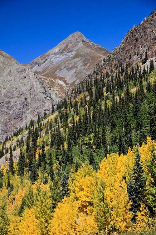 Dome Mountain from Stony Pass Road Dome Mountain from Stony Pass Road | 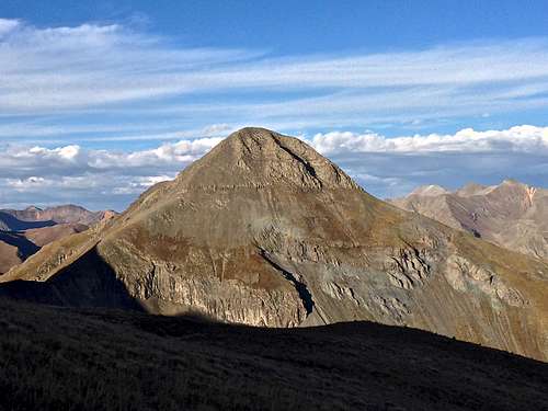 Dome Mountain A from Tower Mountain's ridge Dome Mountain A from Tower Mountain's ridge | 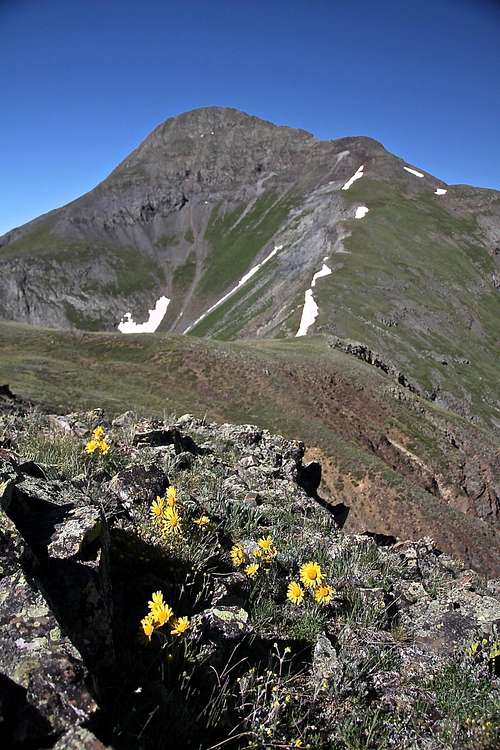 North-eastern approach North-eastern approach |
Getting There
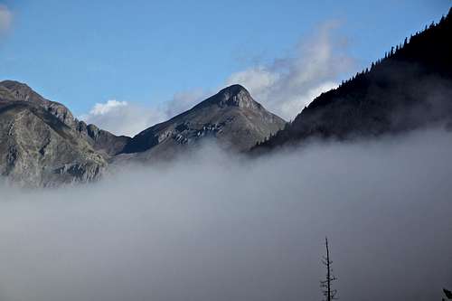 Dome Mountain raising above the clouds
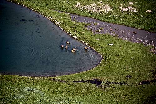 Elk taking a bath in an unnamed lake below Dome Mountain
I would like to mention that road it kept open till Eureka in the winter. If you choose to hike this mountain in the winter, you will have to hike the Eureka Gulch Road. Check for avalanche conditions prior venturing out there.
Route
As any mountain there are many routes up it. I read a trip report about going up the scree in between Dome Mountain and Point 13321 and ascending Dome's west ridge (above Cataract Basin). I will do anything to avoid the scree and chose a different route for that reason.Guide to Colorado Mountains with Robert Ormes (sort of a bible of Colorado Mountains) mentions climbing from SR 110. The book describes: "Dome Mountain is a rocky scramble on the ridge 1.5 miles east of Tower. It's much better climbed independently, starting about a mile northeast of Howardsville, then by way of an old miner's road to the base of Cataract Gulch. Bushwack up the approximately named gulch, bypassing the falls on the left, to the lower lake and onto the southeast ridge to the summit, using a couloir on the south face as a finish". This route appears steep, and most people choose my approach at least I believe so. (I met an older couple and the gentleman told me this is his 3rd time up and he always comes up from the north to avoid the scree).
My ascent was via Eureka Gulch towards the turn off for McCarthy Basin. I chose to walk in, but 4WD vehicles can drive in and as mentioned below there are excellent camping sites by the river South Fork of Animas, some in trees, some in meadows.
There is a trail going up the basin, follow the main trail, cross the South Fork of Animas River, and continue following pretty well kept trail. The trail winds through a forest and enters into open meadows with beautiful wildflowers in July and August. Continue till you see Dome Mountain (you will also see PT 13321 right next to it). Dome Mountain is the closer to you one. I ascended grassy slopes along a deep ravine before getting to the level with Dome Mountain. It does not matter whether you chose to go on its right or left side. The ravine is deep and has a creek running through it. This creek is draining from the unnamed lake on the north side of Dome Mountain. My goal was to ascend to this lake.
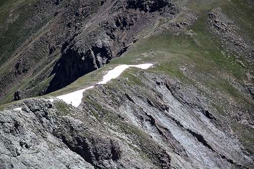
I ascended on the right side of the deep ravine, there was no trail, but the going was easy. Later I descended on the left side and there was even a trail at places with switchbacks (so I believe it was a true human trail, not just a deer trail). This section is steep, but safe. You will eventually end up at an unnamed lake on the north side of Dome Mountain. This lake is pretty and offers an excellent opportunity to take a break, and enjoy the scenery. From here you have 2 choices, either ascend via northeastern ridge, or via north ridge. I came up via northeastern ridge because the morning sun was in my back and it was better for photography. I also think the views are better and you get to see the true summit of Dome Mountain.
The northern ridge appears steeper and as you go up, you see only the false summit of Dome. (I descended this ridge). Both ridges offer hiking on mostly grassy slopes. I like avoiding the loose scree as much as possible.
Higher up both ridges come together and you continue on relatively stable talus to the summit. There are a couple of steps where you may need to use your hands (a couple of class 3 moves), but the ridge is mostly just a steep hike.
The summit is spectacular with a nice cairn. There was a summit register there and only about 6 people signed in since 2013 (the first sign if was from Jennifer Roach). Enjoy your panorama and descend safely.
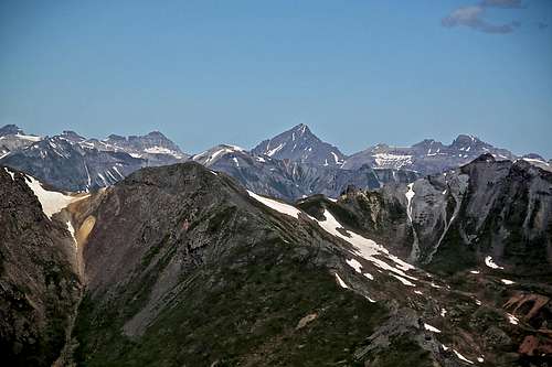 Mount Sneffels Mount Sneffels | 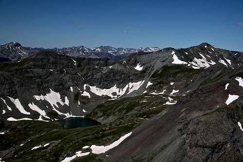 Macomber and Tower Mountain, Cataract basin below Macomber and Tower Mountain, Cataract basin below |
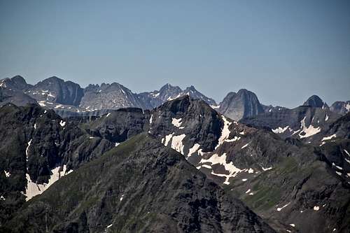 View into Grenadiers View into Grenadiers | 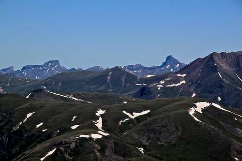 Coxcomb Peak and Wetterhorn Coxcomb Peak and Wetterhorn |
 Hikers on the ridge Hikers on the ridge | 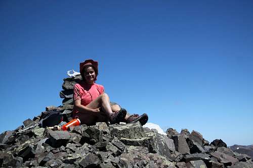 Resting on the summit Resting on the summit |
Red Tape
There is no red tape. Driving, parking and even camping at McCarthy Basin is free.When to Climb
Summer is obviously the easiest with a nice approach and no need to break the trail in a deep snow and no worry about an avalanche danger.Northern San Juan avalanche forecast for winter outings - click here.