
-
 9436 Hits
-
 88.19% Score
-
 26 Votes
|
|
Mountain/Rock |
|---|---|
|
|
37.89004°N / 107.79587°W |
|
|
San Miguel |
|
|
Hiking, Mountaineering |
|
|
Spring, Summer, Fall, Winter |
|
|
13555 ft / 4132 m |
|
|
Overview
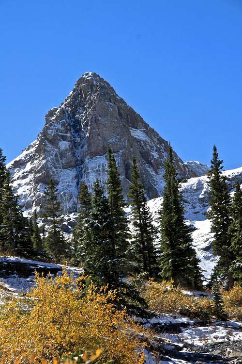
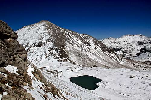
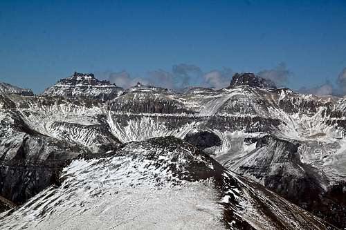
 Wasatch Mountain from the slopes of La Junta Peak
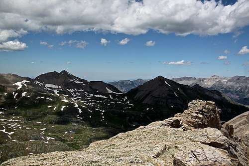 Wasatch Mountain and La Junta from T 11
Guide to the Colorado Mountains with Robert Ormes (sort of a Bible of Colorado Mountains) briefly mentions Wasatch Mountain. “The Wasatch Trail rejoins the East Fork Trail at 12,000’. The main summit of Wasatch Mountain (13,555’) is a steep but straightforward climb 0.75 mile to the east from this point. The converged trail ascends steadily 1.5 miles southeast to a 13,080’ pass south of Wasatch Mountain, separating Bear Creek and Bridal Veil basin."
Telluride Trails by Don Smarmuzzi is another great source describing the hike up Wasatch Mountain.
Colorado Rank: 214
Line Parent: Lookout Peak
Class: 2
Nearby Peaks:
- La Junta 0.67 miles
- "Oscars Peak" 1.03 miles
- Unnamed 13145 A 1.13 miles
- San Joaquin Ridge 1.31 miles
- "T 11" Bridal Peak 1.84 miles
- Palmyra Peak 1.87 miles
- Lookout Peak 2.11 miles
- Silver Mountain B 2.13 miles
- Three Needles 2.16 miles
- "T 10" 2.62 miles
Getting There
From the town of Telluride, drive through the main street = Colorado Avenue through the town. Continue on the same road towards Bridal Veil Falls. The road becomes Black Bear Pass road. This road will climb through several switchbacks and then levels when approaching Hydro electric station above Bridal Veil Falls.Route
 Nice scenery
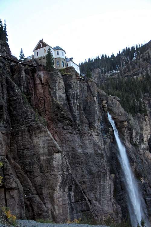 Bridal Veil Falls.
Bridal Veil Basin Approach - From the parking area above Bridal Veil Falls, pass through an opening in a gate and continue on an old mining road. The road steadily climbs up. At about 1.5 miles in, the road forks, the left leads to Blue Lake. Continue hiking on the less used right fork for ~ another 1.5 miles. Cross the Bridal Veil Creek, climb hillside and reach a bench area below Wasatch Mountain on your right (west). The approach section ends by a couple of small tarns that the road passes by.
Hike up Wasatch: From the tarns, walk uphill west, staying on the south side of the creek, and head in the direction of the Wasatch - La Junta saddle. The walking is easy, mostly on tundra with some rocky sections here and there. There is a heart shaped tarn below the saddle - elevation 12,815 feet. Climb13ers.com is describing route from the saddle to NNE ridge of Wasatch. The elevation at the saddle is 13,060 feet. I chose to ascend east slopes and intersect the north ridge higher up. It seemed easier with the fresh snow and there was less snow on the east slopes when compared to north side of the mountain. The route finding was very obvious.
Via Bear Creek Trail and Wasatch Trail - I have not done this hike all the way to Wasatch trail, only Bear Creek section. This is a beautiful hike which starts right in Telluride. Elevation at the start of the trailhead is 8,800 feet, so expect gaining a lot of altitude. Follow the Bear Creek Trail as it climbs though a forest of aspen and mixed conifers. Reach the junction with Wasatch trail after 2 miles. Turn right (west) at the junction and follow the narrow path as it climbs though switchbacks. At the top of the switchbacks the trail traverses high above the canyon floor for about a mile. Ascend the gully. Bear Creek cascades over rocks and wood debris next to the trail. Near the top of the gully pass the remnants of the Nellie Mine on the right (west) side of the trail. Beyond the mine cross a debris pile caused by a rock slide and come to junction with the East Fork Bear Creek trail for 0.9 miles to meet the Wasatch trail in the upper basin. A sign at the junction higher up points to the continuation of the Wasatch trail, crossing Bear Creek and climbing steeply up meadows over a rocky knoll. The final ascent to the saddle is quite steep, and from there you get great views of San Joaquin Ridge and Silver Mountain. To the east are the peaks and ridge rising above upper Bridal Veil Basin.
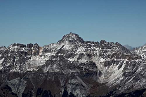
Views along the hike
 La Junta Peak + tarn at the saddle as seen from the slopes of Wasatch
 | 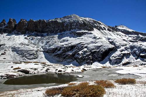 T 11 Bridal Peak
 |
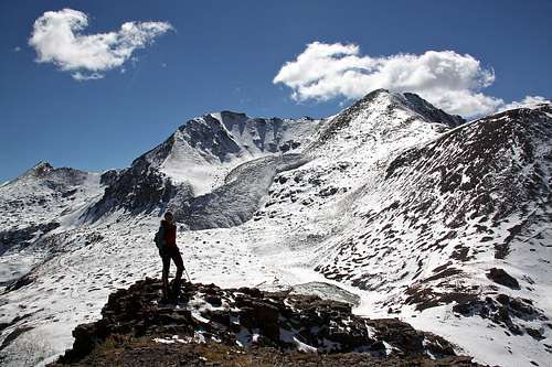
 Wasatch summit cairn with La Junta Peak in the background
 | 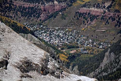 Telluride from Wasatch Mountain
 |
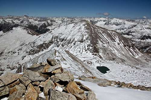
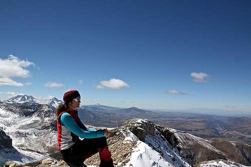 Summit of Wasatch Mountain
 | 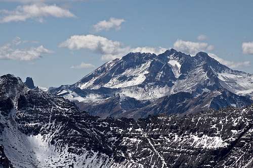 Mount Wilson and Lizard Head on the left
 |
 Mount Sneffels
 | 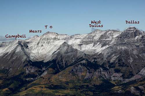 View North
 |
 Potosi and Teakettle
 | 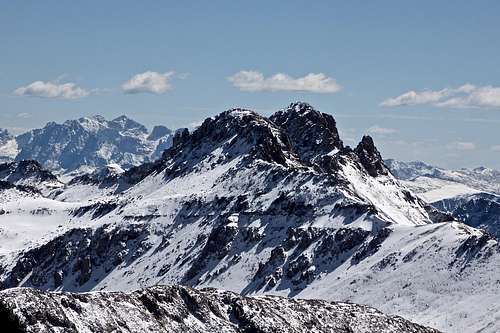 Lookout Peak
 |
Red Tape
Driving to Hydro electric station, parking, hiking are free. The parking by the hydro electric station is just along the road and is not very big - perhaps 6 cars.
When to Climb
Summer is the easiest, but any time of the year is doable. Just remember that you will be traveling through an avalanche prone area - if venturing out in the winter check North San Juan Avalanche Forecast.Camping
There is no good car camping along the road up Hydro electric station, perhaps the lower sections of the road.Primitive back country camping is always an option if you choose to spend the night in the nature. There are plenty of tarns higher up in Bridal Veil basin offering excellent camping opportunities and amazing vistas.
Developed campgrounds are located along highway 141: Sunshine Campground.
External Links
- Wasatch Mountain on 13ers.com
- Wasatch Mountain on List of John
- Wasatch Mountain on Climb13ers.com
- Wasatch Trail great description if hiking from Telluride
- Black Bear Pass Road