-
 600865 Hits
-
 99.98% Score
-
 201 Votes
|
|
Mountain/Rock |
|---|---|
|
|
39.11780°N / 106.4447°W |
|
|
14440 ft / 4401 m |
|
|
Under New Ownership
This wonderful page was transferred to me by long time SP member Alan Ellis. I am honored to be able to adopt it and will make sure to keep this page as up to date and accurate as possible. I would like to send many thanks to Alan and note that a decent portion of the text was written by him. Feel free to give me input on how to maintain this page.
Overview
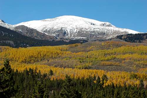
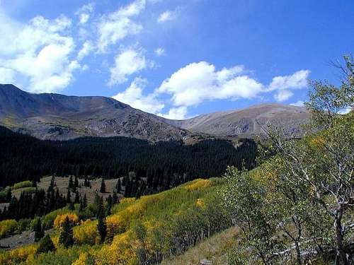
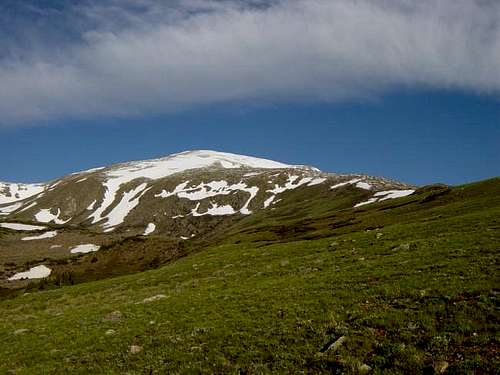
Mount Elbert has a lot to be proud of: It is the highest mountain in Lake County, highest in Colorado, highest in the Rockies, and second highest in the contiguous United States. But when you ask a non-climber or someone outside of Colorado, nobody has heard of it. However, that’s their loss, because Mt. Elbert is a spectacular peak and worthy of recognition and respect from all. One of the great things about Mt. Elbert is the relatively moderate terrain to the summit, allowing almost anyone with reasonable fitness to enjoy the mountain and its status.Located in the Sawatch Range of the Colorado Rockies, Mt. Elbert was named for Samuel Elbert who was a controversial territorial governor of Colorado in 1873. The first recorded summit of the peak was by H.W. Stuckle of the Haydon Survey in 1874. Since that time, it has been climbed by thousands and even been summited by jeep.
In the seventies, there was a movement among a group of folks that felt Mt. Elbert's next door neighbor, Mt. Massive, was more deserving to be Colorado's highest peak. They stacked rocks in an attempt to raise the height of Massive's summit on top. Many more detractors would tear the summit cairn down upon their visits, so the attempt at changing Massive's elevation was eventually given up and Mt. Elbert has retained the title as the highest. (Courtesy of Aaron Johnson). Although most (or all) guidebooks list Mt. Elbert as 14,433 ft., a 2002 recalculation of old surveyed elevations, resulting in a world-wide adjustment of peak elevations, concluded that Mt. Elbert is actually 14,440 ft. Denver post article. Despite this re-survey, most Colorado Climbers regularly use the old survey elevations.
There are five main routes to the summit, the two most popular and easiest are the South Mt. Elbert Trail and the North Mt. Elbert Trail, both being well trodden class one trails. These relatively easy paths to the summit are busy in the summer, attracting all types of hikers and climbers, young and old. Like any high peak, weather, altitude, and personal ability must be considered before attempting Mt. Elbert. But with a little preparation and planning, Mt. Elbert offers a wonderful climbing and outdoor experience. The most important thing to remember about climbing this mountain (or any other in Colorado) is to start early....like sunrise....to avoid dangerous afternoon storms. If you see dark puffy clouds building, turn around and get off the mountain.
Getting There
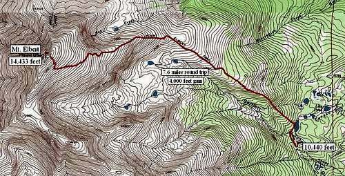
Mt. Elbert is located in central Colorado near the little town of Twin Lakes about 140 miles west of Denver, 50 miles south of Vail, and 40 miles east of Aspen. The closest large town is Leadville, approximately 16 miles northeast.The trailheads for routes are: South Mt. Elbert Trail Trailhead for the east ridge route, North Mt. Elbert Trail Trailhead for the northeast ridge, South Halfmoon Creek Trailhead for the northwest ridge, Black Cloud Trailhead for southeast ridge, and Echo Canyon Trailhead for the southwest ridge route. Please note the below photo and route graphics by Kane which shows several of the less common routes and variations of routes of Mt. Elbert. The most popular and standard routes for Mt. Elbert are the South Mount Elbert Trail and the North Mount Elbert Trail as described below.
South Mt. Elbert Trailhead: (9560 ft) From Leadville, drive south approximately 10 miles to the intersection of U.S. 24 and Colorado (CO) 82. From Buena Vista drive north 20 miles to the same intersection. Once on CO 82, drive west 4 miles to Lake County Road 24 (Do not confuse with U.S. 24). Turn right (north) on Lake County 24 and drive one mile to Lakeview Campground. The trailhead is on the northwest side of the campground and is also an access point for the Colorado/Continental Divide Trail in which a short section runs from Lakeview to the North Mt. Elbert Trailhead. Shortly after Lakeview Campground, turn left into an obvious parking area, overlook, and dirt road. High clearance vehicles can drive to 10,440 ft. by driving west past the parking lot on a rough road for 2 miles until the road ends and you see other vehicles parked. The upper trailhead is on the north side of the parking area. Cross a creek via a footbridge and continue a short distance until reaching a signed intersection of the Mt. Elbert/Colorado/Continental Divide Trail where you turn left. See the left side bar or click here for the South Mt. Elbert Trail.
North Mt. Elbert Trailhead: (10,050 ft.) From Leadville, drive 3.5 miles south on U.S. 24 to Colorado (CO) 300. Turn right (west) on CO 300 and drive .7 miles. At .7 miles, turn left (south) on Lake County 11 which is a newly paved road. Drive south 1.8 miles on Lake County 11 and turn right (west) at the signed intersection for Halfmoon Creek. Continue southwest past the Halfmoon Creek Campground and the Elbert Creek Campground until reaching the signed North Mt. Elbert Trailhead at 6.9 miles. Note: This trailhead is also referred to as "South Colorado/Main Range Trailhead" in some guidebooks. It is an access point for the Colorado/Continental Divide trail, a short section of which runs from here to the Lakeview Campground to the south.
South Halfmoon Creek Trailhead: (10,240) Follow directions to the North Mt. Elbert Trailhead except continue another 2.1 miles to the signed South Halfmoon Creek trailhead.
Black Cloud Trailhead: (9700 ft) From the intersection of U.S. 24 and CO 82: West on CO 82 for 10.5 miles to a right turn (north) to the signed trailhead.
Echo Canyon Trailhead: (10,000 ft) From the intersection of U.S. 24 and CO 82: West on CO 82 for 12.5 miles to a right turn (north) where there is a cabin and a sign for Echo Canyon.
Red Tape
No permits or fees are required to park, climb, or hike.Mt. Elbert is located in the Leadville Ranger District of the San Isabel National Forest.
Leadville Ranger District, San Isabel National Forest, 2013 N. Poplar, Leadville, CO 80461 Phone: (719) 486-0749 Fax: (719) 486-0928.
When To Climb
As with most Colorado high peaks, June through September is considered the summer climbing season. However, Mt. Elbert is also climbed in the dead of winter by experienced mountaineers. It is a popular ski mountaineering destination due to low avalanche danger on several of the routes. Louis Dawson recommends using the South Mt. Elbert Trail and the North Mt. Elbert Trail for winter ascents. Violent thunderstorms are a daily occurance in summer. Plan to be off the summit or ridges by early afternoon to avoid lightning danger. Start very early and allow 6-8 hours for climb and descent.
Winter Climbing of Mt. Elbert
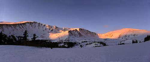
Winter is a great time to climb Mt. Elbert. Afternoon thunderstorms are not an issue, but winter brings an entire new set of conditions that must be considered. The standard winter route is via the east ridge (South Mt. Elbert Trail) which begins at the overlook near Lakeview Campground. The 4WD road to the upper trailhead is closed in winter.This is a great winter route because there is no avalanche danger if you stick to the route. However, do not take the mountain lightly in winter. Since the 4WD road is closed, this equates to an 11-mile round-trip climb. Due to the distance, some climb Mt. Elbert in winter as an overnighter, with a camp either at the 4WD upper trailhead or on the shoulder in the conifer just below treeline. But most still climb it in a one-day push....however, expect a LONG day. The road to the upper 4WD trailhead is easy to follow and snowshoes will sometimes be needed. Once at the upper trailhead, the route finding can be tricky because the trail cannot be seen (due to snow). Once you reach the upper trailhead, cross the footbridge and head northeast past the ponds (on the right) until reaching this sign a short distance later. Continue past the sign approximately 200 yards until coming to a second sign where you turn a hard left (northwest). Climb northwest up the steep slope through the aspen forest. With luck, you'll run into the switchbacks, but if not, the general rule is to head directly northwest until reaching the shoulder just below treeline. Normally, previous hikers have created a "trench" in the snow to follow, but after a large fresh snowfall, the trench may not be evident. Also, there are sometimes orange ribbons tied to trees to mark the winter route up through the apens. Once on the shoulder, follow the standard route using the maps below.
Gear: Ice axe and crampons are generally not needed; however, conditions may dictate otherwise. Normally, snowshoes are a MUST from the trailhead until reaching treeline, but sometimes they are needed all the way to the top depending on conditions and/or recent snow and winds. Or....they may not be needed at all if the snow is hard packed. The upper ridge above treeline is windswept and snowshoes are not generally needed.
Camping and Lodging
There are several Forest Service campgrounds nearby requiring fees. The closest to the South Mt. Elbert trail is Lakeview Campground as described in "Getting There" section. Lakeview has a campground host from May 15 until September 8. It has 59 sites at $12.00/night and will accomodate an RV up to 32 ft. Drinking water, pit and flushing toilets, no showers. Reservations may be made at Lakeview Campground. The closest campgrounds to Halfmoon Creek and North Mt. Elbert Trailheads are Halfmoon Creek Campground and Elbert Creek Campground located on the road to the trailheads as described in the "Getting There" section. Elbert Creek has 17 sites at $13.00/night and will accomodate up to a 16 ft trailer. Open from May 30 to September 30, it has drinking water, pit toilets, but no showers. Halfmoon Creek has 24 sites at $13.00/night and will accomodate up to 16 ft trailer. Open from May 20 to September 30, it has drinking water, pit toilet, but no showers.
There are approximately nine other Forest Service campgrounds nearby. Call the Forest Service at (719) 486-0749 or see their website. They will send you a packet with free information.
Primitive camping is allowed pretty much anywhere on the mountain. Avoid camping along the 4wd road, next to a trail, or in the parking areas.
Sugar Loafin' RV Park and Camground: 4 miles west of Leadville on CO 300. (719) 486-1031. Full service RV campground. Showers available.
Lodging: In Twin Lakes, The Nordic Inn Bed and Breakfast is the best place to stay for Mt. Elbert climbers. John Slater, owner, has being running the Nordic for 18 years and is an expert on the mountain. The Nordic Inn is highly recommended. Further down highway 82, the Mt. Elbert Lodge, B&B and cabins, is within walking distance to two trailheads, Black Cloud and Echo Canyon. Leadville, Aspen, and Buena Vista offer the closest hotels, motels, and bed and breakfasts outside of Twin Lakes. Aspen, to the west, also has lodging but is considerably more expensive. There is a hostel in Leadville at 500 E. 7th which has $3.00 showers and rooms for $15.00/night. (719) 486-9334.
Mountain Conditions
Most of the trails to the summit are well maintained and easy to follow. In fact, in some sections above treeline, the trails have become multi-trails where people have started new ones to avoid the deep ruts of the old trails. Try to avoid starting new trails and stick to the established path to minimize impact. Treeline is at approximately 12,000 ft; therefore, you have about 2400 ft of climbing in weather-exposed terrain.
Weather and Current CondtionsDoppler Radar
Additional Radar
Maps
San Isabel National Forest (U.S. Forest Service)Quadrangles: Mount Elbert, Mount Massive (USGS)
Trails Illustrated #127 - Aspen/Independence Pass
Latitude 40 - Aspen/Crested Butte/Gunnison
Online Maps
Note: The trail for the South Mt. Elbert trail is marked incorrectly on the Mt. Elbert 1/24 quad. The correct route is displayed in the maps below.
External Links
Also see Gerry Roach's "Colorado's Fourteeners" book for more great information


vanman798 - Sep 9, 2009 12:02 pm - Hasn't voted
14,433 ftMost other sites list the evelation as 14,433 ft. See http://peakbagger.com/peak.aspx?pid=5736 for example.
Alan Ellis - Sep 9, 2009 4:21 pm - Voted 10/10
Re: 14,433 ftPeakbagger.com is incorrect. You need to read paragraph three of the main Mt. Elbert page.
vanman798 - Sep 9, 2009 6:06 pm - Hasn't voted
Re: 14,433 ftThanks, I should have read that "a recent survey of several Colorado peaks, including Mt. Elbert, concluded that Mt. Elbert is actually 14,440 ft." By the way, who does these surveys? Is it the USGS? Must be someone else cause the USGS site (see http://egsc.usgs.gov/isb/pubs/booklets/elvadist/elvadist.html#14,000) lists it at 14,433 ft, but that is a 1967 figure (from the National Geodetic Survey). Sorry, I'm just very curious as to when and who did the most recent survey and came up with 14,440 ft.
Alan Ellis - Sep 9, 2009 9:27 pm - Voted 10/10
Re: 14,433 ftIt is not recent, but happened in 2002. Here is a 2002 article from the Denver Post: Denver Post
Scott - Sep 9, 2009 9:50 pm - Hasn't voted
Re: 14,433 ft (not a resurvey)If interested, it really wasn't a resurvey as mentioned on the mountain page. It was just a recalculation of the old surveyed elevations and Elbert was not resurveyed. It's actually a world wide adjustment (some areas went up and some down) and not unique to Mount Elbert or Colorado. It's actually a recalculation of the geoid: Geoid definition Most elevations in the world changed with the new calculation.
Alan Ellis - Sep 9, 2009 10:20 pm - Voted 10/10
Re: 14,433 ft (not a resurvey)Scott, I made changes to the text on the main page. Let me know if it sounds right and is accurate. Thanks.
Scott - Sep 9, 2009 10:28 pm - Hasn't voted
Re: 14,433 ft (not a resurvey)Looks good. I guess there will be lots of different elevations floating around out there for a long time. I haven't bothered changing all my SP pages to the new calculated elevations!
vanman798 - Sep 10, 2009 12:19 pm - Hasn't voted
ThanksI appreciate the information. I think Scott is right when he says "I guess there will be lots of different elevations floating around out there for a long time." This re-calculation makes me wonder about the Borah Peak story - that it rose 7 feet after a 1983 earthquake. Prehaps the National Geodetic Vertical Datum of 1988 is responsible for the 7 foot rise more so than the earthquake. Anyways… Thanks
xDoogiex - Jul 25, 2011 12:47 pm - Hasn't voted
camp pricesElbert Creek and halfmoon creek campgrounds are now 13$
Alan Ellis - Jul 25, 2011 2:56 pm - Voted 10/10
Re: camp pricesThank you. I'll make the change. AE
Vic Hanson - Jul 9, 2017 7:50 pm - Hasn't voted
Re: camp pricesWas just at Lakeview Campground a few minutes ago and the price is now $19. Lots of free boondocking just beyond there.
Humnaman@gmail.com - Mar 21, 2015 3:38 pm - Hasn't voted
questionhello! sir, i was just doing a project on mount Elbert and wanted to know What seasons do we have here ,precipitation, storms etc. and what natural disasters can most probably occur here and some prominent physical features ,i couldn't find the relevant information on the net and thought you could be a great help. thank you! and sorry for being a bother
frankg - Sep 8, 2016 1:11 pm - Hasn't voted
Camping and LodgingThe Nordic Inn Bed and Breakfast in Twin Lakes, CO mentioned in the Camping and Lodging section for Mount Elbert is actually now called the Twin Lakes Inn. The Inn and its owners and staff couldn't be nicer. The link on the site will take you to the correct website for the Inn.
MSD - Sep 21, 2016 11:46 am - Hasn't voted
UPDATE: South Mt. Elbert Trail - 4WD to Upper TrailheadAttempted to go to the upper trailhead Monday, September 19, 2016 in a stock 2016 Jeep Cherokee 4x4. Had to turn back within ½ mile. Ruts were too deep to manage. Only one vehicle was at upper trailhead ... a Jeep Wrangler with a serious lifting kit. Would not consider this a typical "4WD" recommendation ... more of an "Off Road" vehicle recommendation. Hiked from the lower trailhead, then NOT up the road BUT along the common CDT/CT Trail which adds about 5 miles roundtrip to the posted summit estimations.
sam807 - Sep 19, 2017 1:34 pm - Hasn't voted
First 14erI climbed Mt Elbert during October, 2016. It was beautiful weather with a few clouds in the afternoon. Unless you have a solid four-wheel drive vehicle, you will not be able to drive up the access road. One part of the road had a stream with sizeable rocks crossing it. We parked at bottom and hiked the two something miles up to the trail head. The trail is well defined and winds through beautiful aspen woods until it breaks out into a wide slope. From there, you start gaining more serous elevation. The switchbacks on the last bit of the hike are a little tiring, but overall, the hike isn't too strenuous. This mountain is a good introduction to 14ers.
Doubleawilly - Sep 1, 2019 4:32 pm - Hasn't voted
Camp fee updateJust completed this one. Camping at Halfmoon and Elbert Creek campgrounds near the North Mt Elbert trailhead are now $20 not $13
James Bednar - Oct 7, 2019 9:59 am - Hasn't voted
My toughest state highpoint- yet!!I conquered Mt Elbert in July 2009 during the 4th of July weekend. My main thought then was to nab this highpoint, then drive on down to New Mexico and nab that highpoint. Nope - that was NOT happening!! Living on the flat prairies of Kansas for some time, vastly over estimated my abilities for mountain hiking. Arrived trail head around 7:30AM and returned to trail head at 7:00PM!! Most of the hike was moderate for me until getting past the tree line, then the hiking became more strenuous. Had to take quite a few breaks just to catch my breath - hike for about 10 minutes then rest for about 15 minutes. Had plenty of people pass me by and they all kept encouraging me to continue on. After about 7 hours of hiking, I eventually made it to the summit and some awesome views of the mountain tops!!! Yep - some snow/ice encountered. Had a small rain squall pass through the area during the hike up, but nothing to worry about. Had lunch at summit and admired the views for about 1/2 hour. Descent down took roughly 5 hours and reached the parking lot. Must admit, could not walk straight for about 2 weeks afterwards, was all tuckered out. The camp ground was full for the holiday weekend, so drove south and spent the night in Salina, CO, and watched the fireworks there. This was my 21st state highpoint visited.