

-
 17138 Hits
-
 73.06% Score
-
 3 Votes
|
|
Area/Range |
|---|---|
|
|
46.75492°N / 121.13525°W |
|
|
Hiking, Mountaineering, Trad Climbing, Bouldering, Ice Climbing, Scrambling, Skiing |
|
|
Spring, Summer, Fall, Winter |
|
|
8184 ft / 2494 m |
|
|
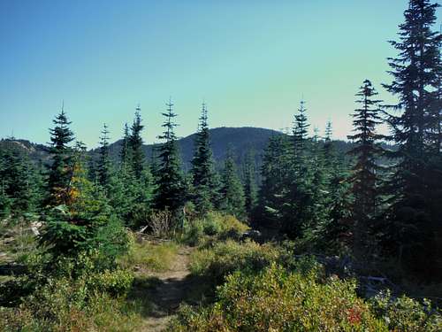
Overview
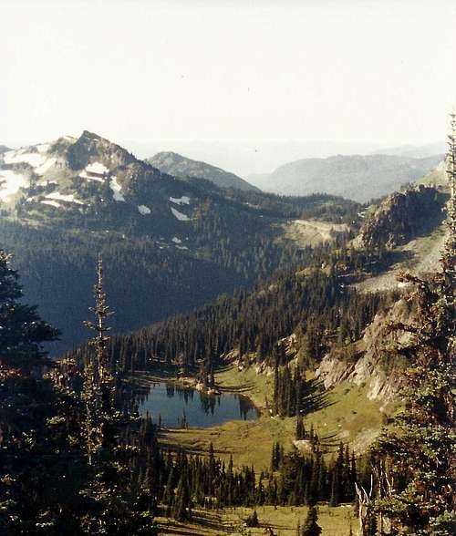
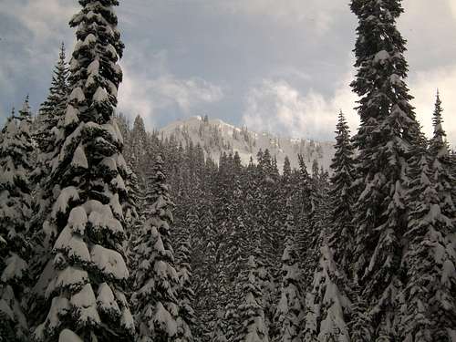
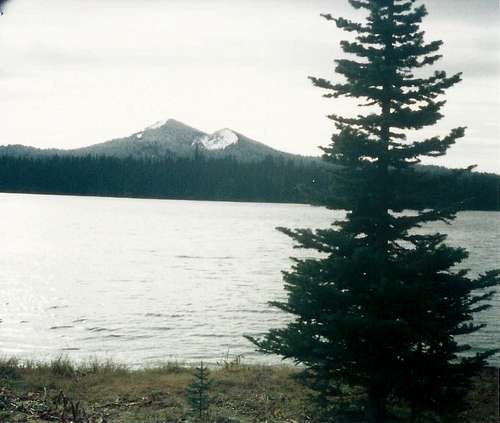
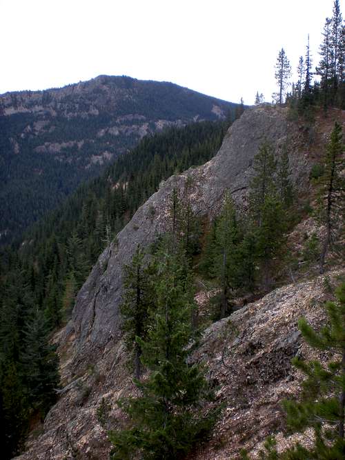
The Naches Ranger District is located on the eastern slopes of the Cascade Mountains in Washington state. The district makes up the southern end of the Wenatchee National Forest, encompassing 518,982 acres with a low elevation of 1930 feet at the Tieton River and a high elevation of 8184 feet on the summit of Gilbert Peak (Mt. Curtis Gilbert). The district has a diverse assortment of ecosystems ranging from glaciated alpine areas along the Cascade Crest to almost desert shrub-steppe areas only 20 miles to the east with nearly everything else in between.The Cascade Crest forms the western boundary of the district where the Pacific Crest Trail runs north and south. The Gifford Pinchot National Forest, Mt. Rainier National Park, and Mt. Baker Snoqualmie National Forest border the district west of the Cascade Crest. The Cle Elum Ranger District is located to the north and the Yakama Indian Nation Reservation to the south. A mixture of Washington State Dept. of Natural Resources, Dept. of Fish and Wildlife, and private lands border the district to the east. There are checkerboard land ownerships on the fringes of the district to the north, east, and south. Portions of the Goat Rocks, William O. Douglas, and Norse Peak Wilderness Areas lie within the district.
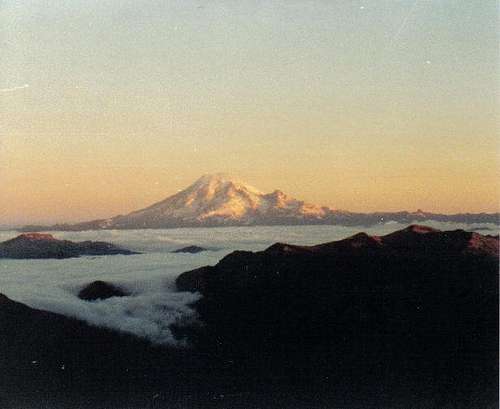
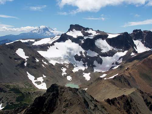
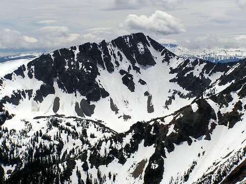
Mt. Rainier at sunrise from Bear Creek Mountain
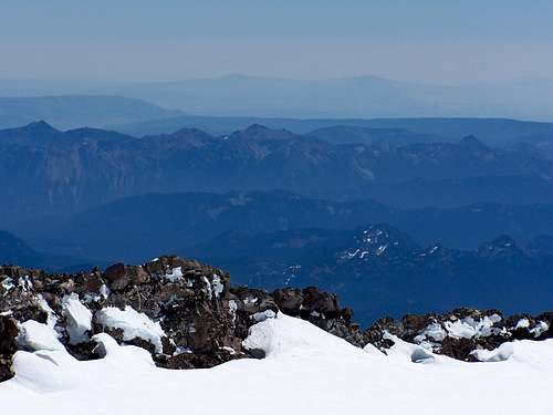
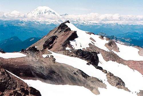
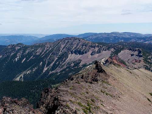
Mt. Aix and Nelson Ridge from Mt. Rainier summit
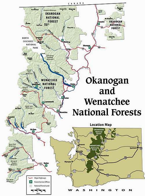
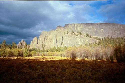
Wenatchee National Forest, Naches Ranger District at southern end
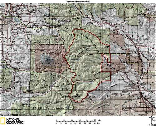
Naches Ranger District (red line is boundary)
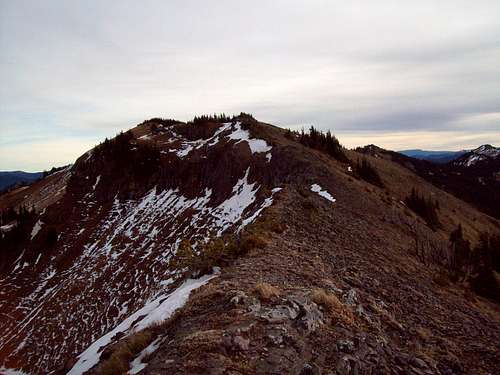
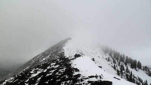
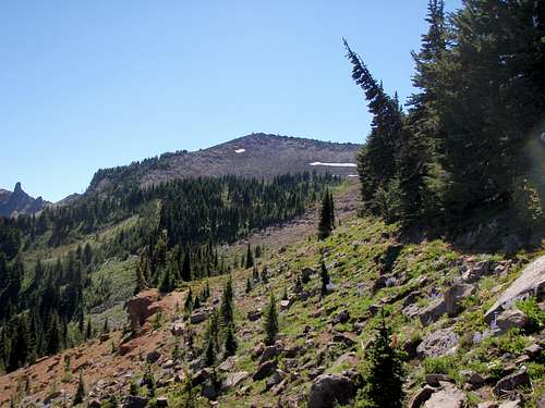
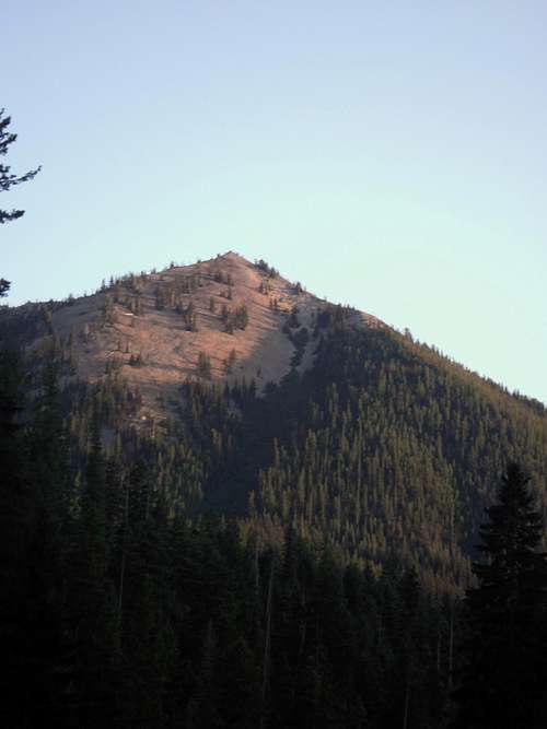
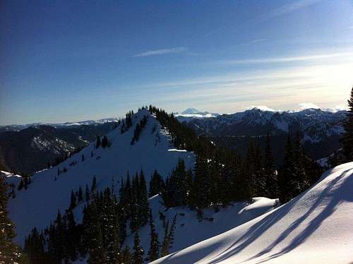
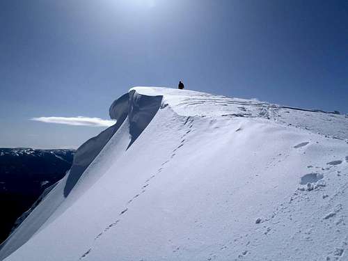
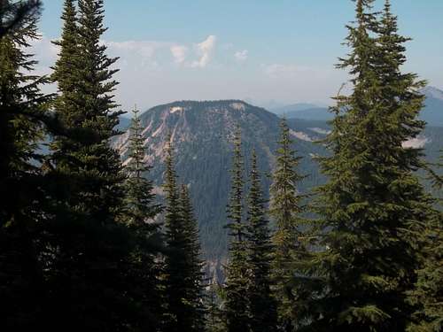
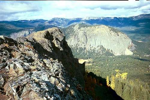
Naches Ranger District Summits
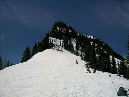
There are 55 summits (peaks, mountains, points, rocks, buttes, tables, hills) named on published government maps (USGS or US Forest Service) that can only be accessed on foot by trails or scrambling. I am probably the first person to ever climb all of these summits. I have also climbed many additional summits which are not given names on published maps, but have been named by others or myself. In addition to these climbs, I completed ski ascents on all 6 named summits which can be reached by roads in the summer. Eventually I would like to create a page on summitpost for each of these summits as there is currently only pages for 10.| Named on Map (55) | Elevation (ft.) | |
 | Gilbert Peak | 8184 |
 | Old Snowy Mountain | 7930 |
 | Ives Peak | 7840 |
 | Tieton Peak | 7768 |
 Mt. Aix Mt. Aix | Mount Aix* | 7766 |
 | Bismarck Peak | 7585 |
 | Bear Creek Mountain* | 7336 |
 | Nelson Butte | 7160 |
| Devils Horn | 7090 | |
 | Fifes Peaks (NW, W, E, Far E) | 6917 |
 | Norse Peak | 6856 |
| Rattlesnake Peaks | 6850 | |
 | Shellrock Peak | 6835 |
 | Hogback Mountain | 6789 |
| Spencer Point | 6650 | |
 | Old Scab Mountain | 6608 |
| Burnt Mountain | 6536 | |
 | Crown Point | 6484 |
| Goat Peak* | 6473 | |
 | Naches Peak | 6452 |
| Arnesons Peak | 6450 | |
 | Ironstone Mountain | 6441 |
| Strobach Mountain | 6397 | |
| Gold Hill | 6383 | |
| Pear Butte | 6372 | |
 | Pickhandle Point | 6361 |
 | Tumac Mountain* | 6340 |
| Quartz Mountain (Hike) | 6300 | |
 | Mount Clifty | 6245 |
 | Yakima Peak | 6226 |
| Crag Mountain | 6208 | |
| Bootjack Rock | 6000 | |
| Cramer Mountain | 5992 | |
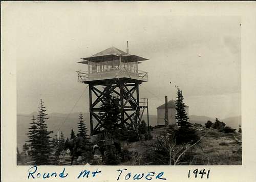 | Round Mountain* | 5970 |
 | Spiral Butte | 5929 |
| Twin Peaks | 5924 | |
| Bald Mountain* (Hike) | 5898 | |
| Fryingpan Mountain | 5740 | |
 | Blowout Mountain | 5735 |
| Pyramid Peak* | 5715 | |
| Jumpoff Joe Lookout* (Hike) | 5670 |
| Devils Table | 4682 | |
| Goose Egg Mountain | 4566 |
 | Kloochman Rock | 4532 |
| Red Rock | 4478 | |
| Meeks Table | 4458 | |
| Red Rock | 4478 | |
| Westfall Rocks | 4060 | |
| Haystack Rock | 3932 | |
| Chimney Peaks | 3870 | |
| Edgar Rock* | 3840 | |
| Deadhorse Hill | 3637 | |
| Kamiakan Butte | 3516 | |
| Sentinel Rock | 3040 | |
| Windy Point | 2650 | |
| No Name on Map (14) | Elevation(ft.) | |
| Moon Mountain | 7527 | |
 | Mount Baldy | 7049 |
| Dog Mountain | 7041 | |
| Buffalo Hump | 6960 | |
| “Placer Peak” | 6904 | |
 | Threeway Peak | 6796 |
| Blue Slide Lookout* | 6785 | |
 | Dewey Peak | 6710 |
| “Sheep Rock” | 6708 | |
| Cupalo Rock | 6600 | |
| House Rock | 6350 | |
| “Cedar Point” | 6162 | |
| Pigtail Peak (Hike) | 6000 | |
| Frenchmen Butte | 4128 | |
| Ski Ascent (6) | Elevation (ft.) | |
| Darland Mountain* | 6981 | |
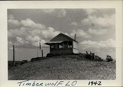 | Timberwolf Mountain* | 6435 |
| Clover Springs* | 6351 | |
| Raven Roost* | 6199 | |
| Little Bald Mountain* | 6108 | |
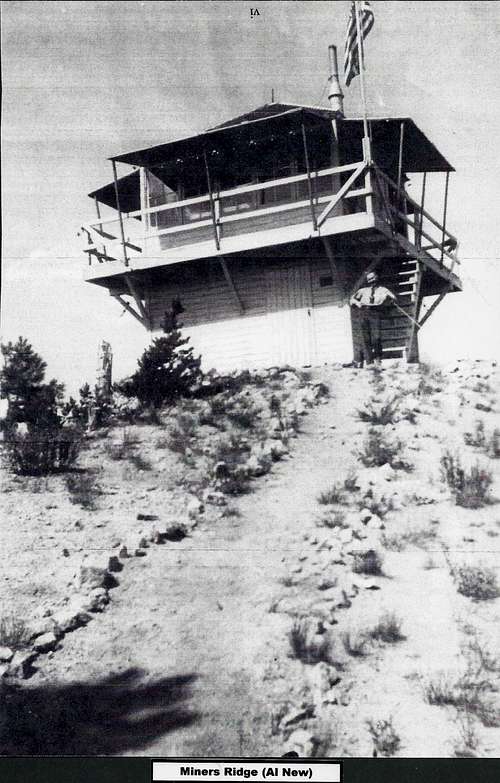 | Miners Ridge* | 6072 |
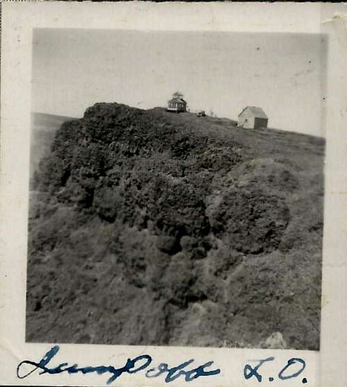
* = Fire Lookout existed historically. Most have been demolished. Miners Ridge was only included since a fire lookout had existed.
Elevations are from USGS Quad maps and the US Forest Service Naches Ranger District map.
Getting There
From Seattle head south on SR-410 into Mt. Rainier National Park and continue on SR 410 over Chinook Pass or turn on to SR-123 south to US-12 and enter over White Pass. From Portland head north on I-5, then east on US-12 over White Pass or turn north onto SR-123 and turn east onto SR-410 over Chinook Pass. From Yakima head west on US-12 and either continue on US-12 or take SR-410 at the Y junction. I suppose it would also be possible to enter by a number of gravel and unimproved roads such as those crossing Naches Pass or Green Pass. You could also hike into the Naches Ranger District on any of the various trails leading into the district such as the Pacific Crest Trail.Red Tape
Northwest Forest Pass is required to park at most trailheads. Wilderness entry permits are required when visiting Wilderness areas, but are free and can be obtained at the trailhead or where the trail enters the wilderness area. My climbing partner Mike Hay built the permit boxes for his Eagle Scout project.External Links
Wenatchee National ForestNOAA Weather
Northwest Weather and Avalanche Center
WSDOT Pass Report
Naches Valley Chamber of Commerce
Central Washington Mountain Rescue
Boy Scouts of America Camp Fife
Camping
For campgrounds see Naches Valley Chamber of CommerceMany peaks are located in wilderness areas which offer ample locations for backcountry basecamps. Basic wilderness regulations are in place such as camping at least 100' from lakes. There are no permanent fire restrictions. During mid to late summer, fire bans may be in effect for lower elevations, but rarely for higher elevation wilderness areas.
PeakAddict - Mar 16, 2011 9:15 pm - Voted 10/10
ElevationsThere are some discrepancies in the elevations of the Naches Ranger District peaks with the topographic maps. The following are the correct elevations as shown on the topo map. Perhaps the incorrect elevations came from older, out of date, topo maps and the Ranger District just hasn't updated them. An easy way to verify the following is to find the peak at http://listsofjohn.com/PeakStats/searchindex.php?State=WA. When at the peak's page, then click "Full Screen Topo Map", then magnify further, if need be. Old Snowy Mountain, 7880'+ Ives Peak, 7920'+ Bear Creek Mountain, 7337' Nelson Butte, 7160'+ Devils Horn, 7040'+ Fifes Peak NW, (This is actually Fifes Ridge, West. See http://listsofjohn.com/PeakStats/Climbers.php?Id=49608), 6920'+ The map shows an elevation of 6917', but if you look closely, that is below the summit. There is also a Fifes Ridge, East, http://listsofjohn.com/PeakStats/Climbers.php?Id=49943, at 6520'+ Fifes Peak, West, 6880'+ Fifes Peak, Middle, 6793'+ Fifes Peak, East, 6375' Rattlesnake Peaks, North, 6850' (agrees with SummitPost) Rattlesnake Peaks, South, 6583' Spencer Point, 6680'+ Crown Point, 6480'+ Arnesons Peak, 6400'+ Gold Hill, 6295' Tumac Mountain, 6320'+ Quartz Mountain, 6280'+ Bootjack Rock, 5920'+ Spiral Butte, 5920'+ Twin Peaks, East, 5920'+ Twin Peaks, West, 5843'. Added to the list. Bald Mountain, 6115'. Added to the list since the lookout, below, was not on the highest point, the true summit. See http://listsofjohn.com/PeakStats/Climbers.php?Id=50337 Bald Mountain lookout site, 5898'. A better name for where the lookout used to be, since it was not on the highest point, the true summit, above. Fryingpan Mountain, 5720'+ Blowout Mountain, 5750' Jumpoff Lookout, 5670'. The correct name. Jump Off Joe is a different summit. See http://listsofjohn.com/PeakStats/Climbers.php?Id=54586 Jumpoff Lookout Peak, 5760'+. Added to the list since the lookout above is not on the highest point, the true summit. See http://listsofjohn.com/PeakStats/Climbers.php?Id=50669 Westfall Rocks, West, 4060'. Agrees with SummitPost. Westfall Rocks, East, 3295'. Added to the list. Chimney Peaks, East, 3870' Chimney Peaks, West, 3840+. Added to the list. Edgar Rock, 3680'+ Sentinel Rock, 3040'+ Windy Point, 2640'+ Timberwolf Mountain, 6391' Raven Roost, 6160'+ Miners Ridge lookout site, 6040'+ Miners Ridge, 6080'+. Added to the list since the lookout above is not on the highest point, the true summit. See http://listsofjohn.com/PeakStats/Climbers.php?Id=50170
MattDurkee - Apr 30, 2011 12:36 am - Hasn't voted
Re: ElevationsThanks for the interest in my page. I understand your personal need for only using USGS Quad maps to determine elevations, but because this is a page and a peak list for the Naches Ranger District, I have also incorporated exact elevations given on the Naches Ranger District map which is for sale at the Naches Ranger District office. I used the exact elevations from the USGS Quad maps if available. If not available on the USGS Quad maps, but available on the the Naches Ranger District map, I used those instead of estimating an elevation based on USGS contour lines. I did see a couple of elevations that I do need to fix out of the list you created, but most of the original elevations you had listed as discrepancies were taken, as I mentioned, from the official Naches Ranger District map published by the US Forest Service. I think it is fair to point out that some of the USGS Quads are becoming somewhat out of date also. Take Mt. Rainier for example, the website you mentioned that has a USGS Quad shown which lists 14,410' for Mt. Rainier. Recent survey work has officially changed this elevation to 14,411'. I also apologize for the late reply as I have been extremely busy for quite some time with raising two newborns, trying to finish my master's thesis in geology, and working. I probably should not even have taken the time to create this page yet, but I wanted to get it out there. I will be happier when I can get back to climbing more.