
-
 8491 Hits
-
 73.06% Score
-
 3 Votes
|
|
Mountain/Rock |
|---|---|
|
|
46.85446°N / 121.25865°W |
|
|
Yakima |
|
|
Hiking, Scrambling |
|
|
Summer, Fall |
|
|
7049 ft / 2149 m |
|
|
Overview
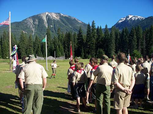
"Mt. Baldy" is the prominent mountain located above Goose Prairie, WA. The mountain does not have an official name on any maps, but the boy scouts who attend Camp Fife at Goose Prairie affectionately refer to it as Mt. Baldy because of its exposed bald rocky northern ridge. The hike is a favorite of the boy scouts.
Mt. Baldy is located on the northern end of Nelson Ridge.
The elevation of Mt. Baldy according to the USGS quad map is 7049 ft.
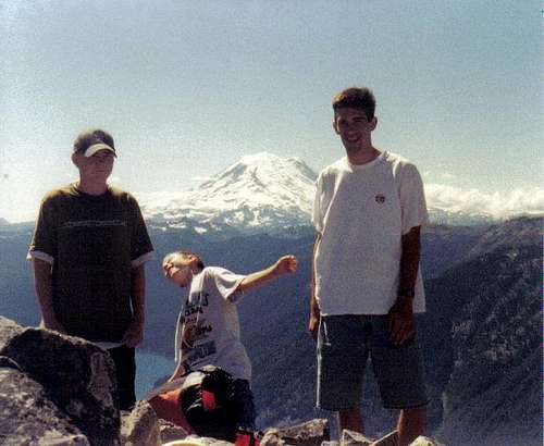
Mt. Baldy summit - July 2000 Gotta love the kid faking falling off the cliff
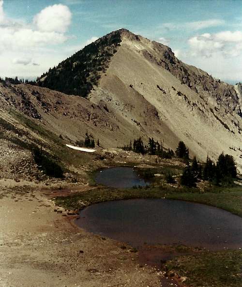
Mt. Baldy (right) from Camp Fife
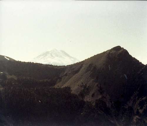
Mount Baldy from "Buffalo Hump" Mount Rainier in background
Getting There
Thunder Creek Trailhead: Turn off SR-410 east of Chinook Pass onto the Bumping River Road. The trailhead is located past Goose Prairie just after a bridge crossing of the Bumping River near the Bumping Crossing Campground.
The round trip length: ~12 miles.
- Give or a take a little because the switchbacks in the headwaters aren't shown on the map.
Elev. Gain: ~3800 ft.
The trailhead may not be well marked. Walk or drive up a short road from the Bumping River Road and find the trail that crosses and then proceeds along Thunder Creek.
The trail steepens with some switchbacks before reaching a saddle at the headwaters of Thunder Creek. Leave the trail official trail and take game trails to the west around the headwaters of the creek. Descend into a beautiful basin meadow bench. Bauer Lake is located on another lower bench. Occasionally golden trout are planted here, but not sure if there is any carry-over from year-to-year. I didn't catch any the one time I tried.
Attain a ridge above the meadow basin and south of a saddle. Walk up a path through some scree up the south ridge to the summit.
Other Routes:
It would be possible to reach Mt. Baldy on a traverse of Nelson Ridge from the south or from Clover Springs via "Buffalo Hump" from the north, but this is uncommon.
Red Tape
Technically a free wilderness permit is required, although there may not be a box at the trailhead.A U.S. Forest Service Northwest Forest Pass parking permit is not required at this trailhead.
An ice axe may be handy in early season. The trail and headwaters should be mostly snowfree by mid-July.
Camping
Various options within the headwaters of Thunder Creek. Small ponds and meadows may be nice for camping.
Richmond Lake located over the main saddle on trail to the east is also an option.
The Bumping Crossing Campground is located by the trailhead and Bumping Lake Campground are options for car camping.
There also other plenty of dispersed campsites in the area.
Other Forest Service campgrounds are located down the Bumping River Valley.