
-
 7486 Hits
-
 72.08% Score
-
 2 Votes
|
|
Mountain/Rock |
|---|---|
|
|
46.82358°N / 121.20501°W |
|
|
Yakima |
|
|
Hiking, Scrambling |
|
|
Spring, Summer, Fall |
|
|
7160 ft / 2182 m |
|
|
Overview
Nelson Butte is a great early to mid-season scramble east of the Cascade Crest.The USGS quad map or U.S. Forest Service Naches Ranger District map does not provide an exact elevation of the summit. The elevation is 7160+ ft. based on the contour lines.
The mountain consists of volcanic rock from very old blown out volcanoes that once dominated the ancestral Cascades long before Rainier and the other modern volcanoes.
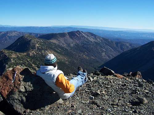
Nelson Butte from Mt. Aix - Late Sept.
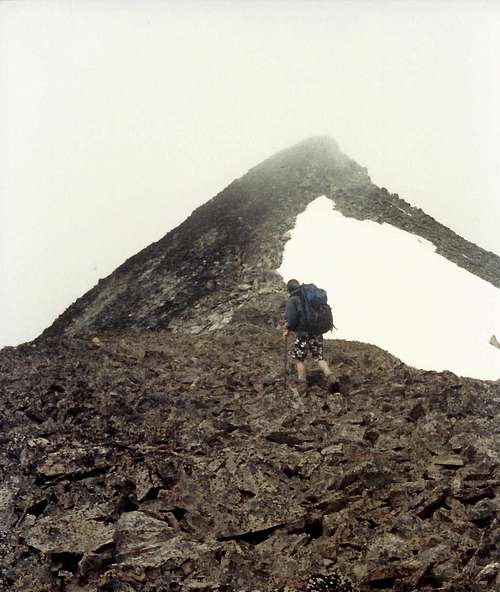 Nelson Butte summit in fog
Getting There
Buck Lake Approach:
From SR 410, take the Nile Rd. (lower or upper bridge) and then the Rattlesnake Creek Road (Bethel Ridge turnoff) to McDaniel Lake. Continue on the Forest Service road above McDaniel Lake until it ends at the trailhead for the east end of the Mt. Aix Trail.
Other Approachs:
Other, longer approaches are possible including from the west Mt Aix. trailhead on Deep Creek Road in the Bumping Valley or to the north at various trailheads. A traverse from Mt. Aix is also possible.
Route
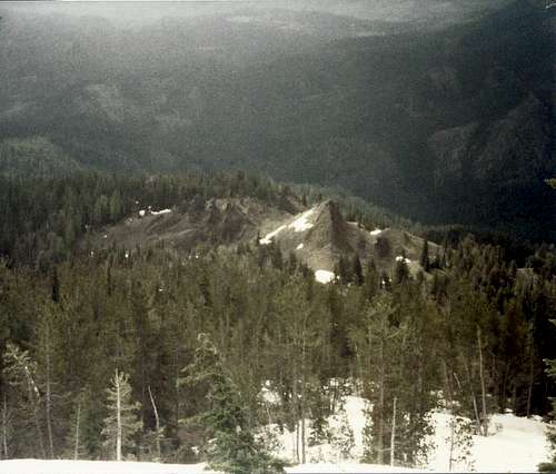
There is no trail to the summit of Nelson Butte, a couple of possible routes that can be combined for a loop are provided:![Nelson Butte]()
Nelson Butte from the spires - Early July
Nelson Butte from the spires - Early July
Buck Lake Direct:
Roundtrip distance: ~8 miles
Elev. Gain: ~3200 ft.
Leave the trail after passing Buck Lake and hike up steep forested slopes to the left of an open scree slope. There are some cool spires and a campsite at the top of the ridge.
An alternative is to leave the trail not far from the trailhead and follow along the top of the ridge located above the trail and Buck lake on game trails to the spires.
From the spires, scramble up the southeast ridge of Nelson Butte. Snow lingers in the ridge into June and an ice axe is helpful. Later climb on talus and sometimes unstable boulders.
Dog Creek Trail Saddle (West):
Continue on the trail past Buck Lake and take the Dog Creek trail to a saddle on the west side of Nelson Butte. From the saddle, scramble up the west ridge to the summit.
Red Tape
- Wilderness permit required
- Free and can be obtained at the trailhead or just down the trail.- Typical wilderness regulations (12 heart beat limit, no wheeled devices [e.g. bicycles, game carriers], etc).
- U.S. Forest Service Northwest Forest Pass does not appear to be required at the eastern Mt. Aix Trail trailhead (to Buck Lake).
- For a list of Wenatchee-Okanogan National Forest trailheadsrequiring a Northwest Forest Pass for parking please see their website.
- To avoid checking a U.S. Forest Service website for every trip I recommend oneof two things:
- Buy an annual pass and leave in your glove box so you have iteither way (assuming you are going on more than a couple hikes for the year).
- Park at least 1/4 of a mile from the trailhead (some trailheads havesigns posted just before arriving at the trailhead).
When to Climb
Late spring (with an ice axe) through fall. By early July most snow should be melted off the west and east ridges.
Camping
Buck Lake is the best trail campsite.
A small campsite is also available on the ridge above Buck Lake near the spires.
Car camping at McDaniel Lake is also pleasant through early summer.
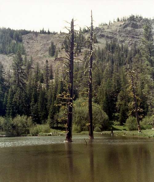
The ever appealing Buck Lake. How did those trees get in the middle of the lake?
Buck Lake Ridge Spires below Nelson Butte