
-
 15141 Hits
-
 88.19% Score
-
 26 Votes
|
|
Mountain/Rock |
|---|---|
|
|
37.21092°N / 112.90144°W |
|
|
Scrambling |
|
|
Spring, Summer, Fall, Winter |
|
|
6715 ft / 2047 m |
|
|
Overview

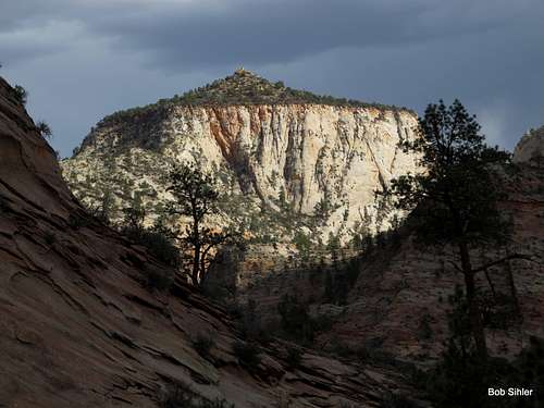
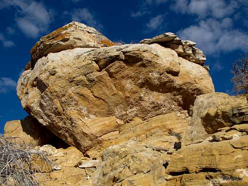
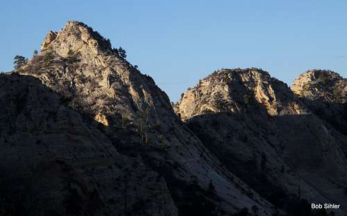
Without taxing too many brain cells, one can figure out why this peak is called Nippletop (unofficially)-- from some angles, the summit block looks like a nipple on a breast (although I think the summit block of Jenny Peak looks much more so). At the summit, there is a USGS benchmark with the elevation, but not the peak's local name, given.
Although it's only about a mile and half from the road, journeying to and climbing Nippletop feels like a real wilderness experience. Why?
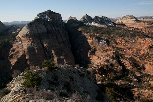
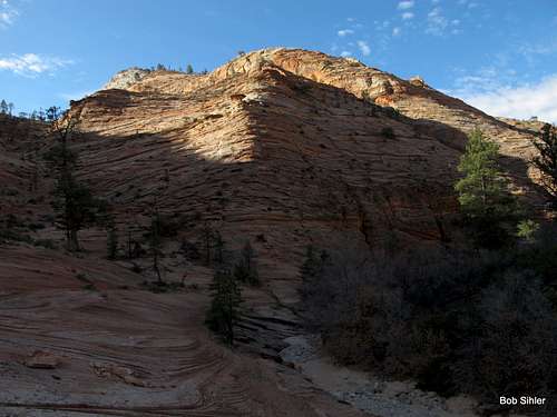
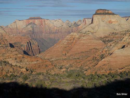
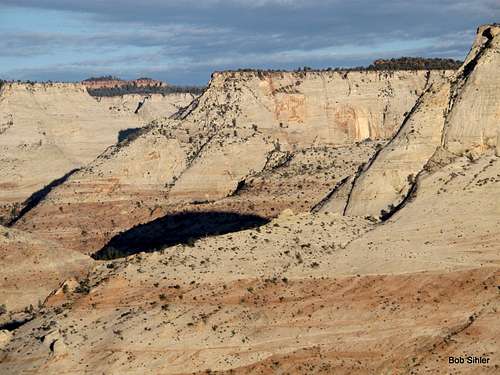
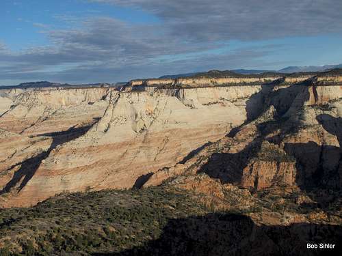
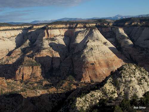
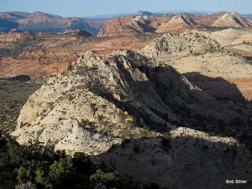
Nippletop is among the obscure peaks on the east side of the park. Because only one peak east of the Zion-Mt. Carmel tunnel and not considered part of the Zion Canyon group-- Checkerboard Mesa-- has a name on USGS maps, and because there are only two officially maintained trails originating out there-- Tunnel Overlook and East Rim-- the east side is Zion's flyover country, so to speak; the majority of visitors are people on their way to or from Zion Canyon, and they do little more but stop and wander a few yards from the roadside to take some pictures. Thus, the east side, with its many unnamed peaks and its numerous washes and canyons, is a haven for scramblers and explorers who delight in isolation and secret wonders. In addition to all the peaks, there are several small slot canyons of varying difficulty levels, including Keyhole Canyon, a dark, very narrow technical slot.
Offering two Class 2-3 routes with a brushy summit plateau (but easy traveling) capped by an open Class 3 summit with 360-degree views, Nippletop is well worth the modest effort necessary to reach its highpoint, and there are views of parts of the Zion backcountry that few ever see.
Getting There
From Zion Canyon, drive east through the Zion-Mt. Carmel Tunnel, which many people apparently see as a highlight of a Zion trip but which I have always found tedious since so many drivers feel compelled to go very slowly and to honk their horns in the tunnel as well. Tip: go through before 8 A.M. to avoid most traffic and to avoid being subject to traffic control in order to let RV's and other oversized vehicles through.Continue east to a second tunnel. About 1.9 mi past that second tunnel, park in a pullout on the south (right) side of the road. It holds maybe 5-6 cars. Early in the morning, you should not have trouble finding a place to park here, but this spot is a popular stop from mid-morning through late afternoon. Most of those who stop here seem to do so in order to scamper 20-30 feet up the slickrock slabs north of the road and have their pictures taken, but many are there because this is one end of the Keyhole Canyon route (technical slot whose lower end is less than a five-minute walk north up the wash on the other side of the road) and because this is the starting point for approaches to Aires Butte and South Ariel Peak. And others simply seem to like exploring the wash on the south side of the road.
Should the parking area be full, try to use one of the smaller turnouts nearby; there is one just 0.1-0.2 mi east and another about the same distance west.
Route
I've heard of three different routes and used two of them; all three overlap at some point. You're looking at Class 2+/3 conditions on any of the routes. RT distance will be approximately 3 miles, and elevation gain will be 1300-1500' according to the exact route.The first is what I've heard called the North Ridge. The key to this route is easier to find when heading up than when heading down, and I therefore recommend it as an ascent route. (I used it as my descent route and did not have any real trouble but did waste a little time locating the key from above.)
North Ridge
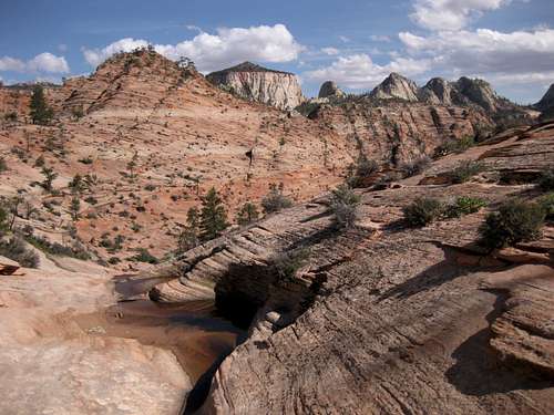
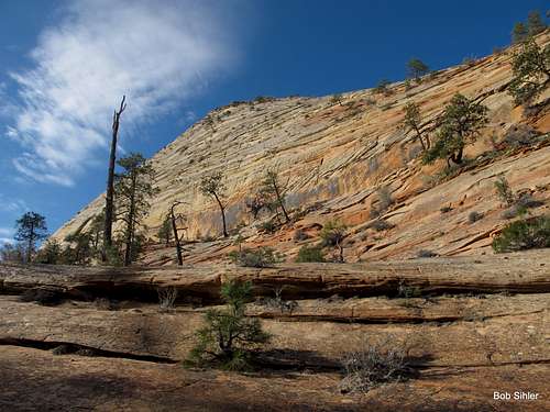
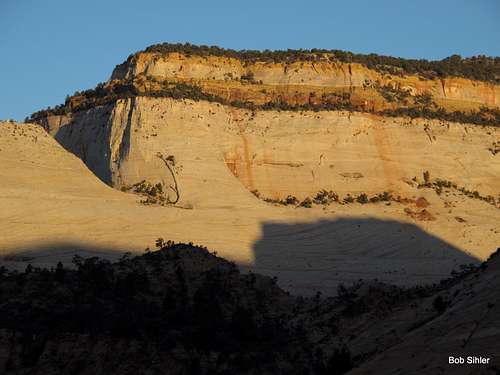
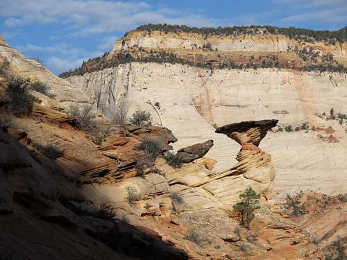
From the parking area, drop into the wash to your south and follow it a short distance west and then bear left to enter a wide, obvious slickrock watercourse (see below).
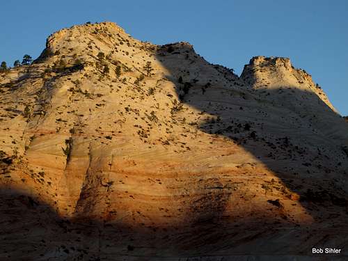
Hike up this watercourse, which is steeper than it looks but difficult only on the thighs and lungs, until you near a brushy-looking saddle. On your right is the north ridge of Nippletop, which includes a false summit before leading to Nippletop proper.
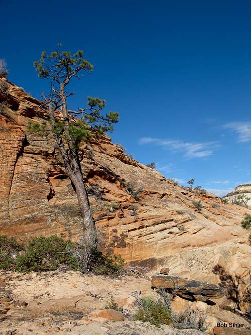
When things look about as they do in the first picture below, look back, up, and right a little bit for a large tree practically leaning against the cliff (see second picture below). You will find Class 2+/3 terrain there that will allow you up onto the crest of the ridge. You might see a cairn marking the spot.
Now things are smooth sailing over the false summit and continuing south until you reach the final steep ridge leading up to Nippletop's summit plateau. Here, the ridge becomes narrow, sandy, and brushy as well, and finding the right way up (Class 3) may be a little tricky but is not difficult.
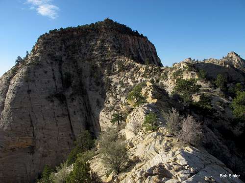
Head up to the summit block. You'll find that the going is not as brushy as it appears from a distance. Scramble up the summit block and enjoy the outstanding views.
North Saddle
Follow the directions above but attain the saddle at the head of the watercourse instead of trying to gain the crest of the north ridge. Cross the saddle and head downhill a short distance until you see a picturesque slickrock bowl opening up on your right; it is not necessary to get into the bowl by going all the way down to the drainage exiting it.
Class 2-3 clambering will get you to the saddle between Nippletop and its false summit. From there, follow the directions above as given from beyond the false summit.
After climbing the peak, I was curious to read other online accounts of visiting it. There wasn't too much that I found, but one trip report was by someone who had missed the correct drainage early on but found a scrambling way up to the crest of the north ridge, north of the false summit.
West Side
After climbing the peak, I was curious to read other online accounts of visiting it. There wasn't too much that I found, but one trip report was by someone who had missed the correct drainage early on but found a scrambling way up to the crest of the north ridge, north of the false summit.
 |  |  |
 |  |  |
 |  |  |
Red Tape
$25 entrance fee for Zion these days. You can save $ in the long run by buying an annual pass or interagency pass if either suits your needs.When to Climb
Best fall and spring. Winter carries the potential of snow and ice on the steep, exposed sections. If you climb it in the summer, start out very early. The heat will turn the surrounding sandstone into an oven by late morning.Camping
There are no campgrounds on the east side of the park, but the Watchman Campground, near the Visitor Center, is not far away. This campground is open all year, and you can make reservations for certain months at recreation.gov.Less than a mile from the park's east entrance, there is a campground/RV resort right off the road, with a store and restaurant across the street. I have never stayed there, but I have stopped there for snacks and showers, and the staff have been very friendly.