
-
 4470 Hits
-
 78.27% Score
-
 9 Votes
|
|
Mountain/Rock |
|---|---|
|
|
37.21206°N / 112.93112°W |
|
|
Trad Climbing, Scrambling |
|
|
Spring, Summer, Fall, Winter |
|
|
5800 ft / 1768 m |
|
|
Overview
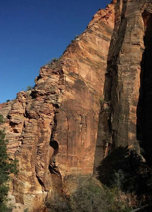
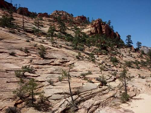
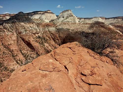
Northern Side of Red Jenny
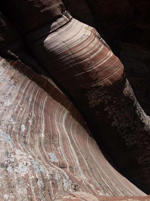
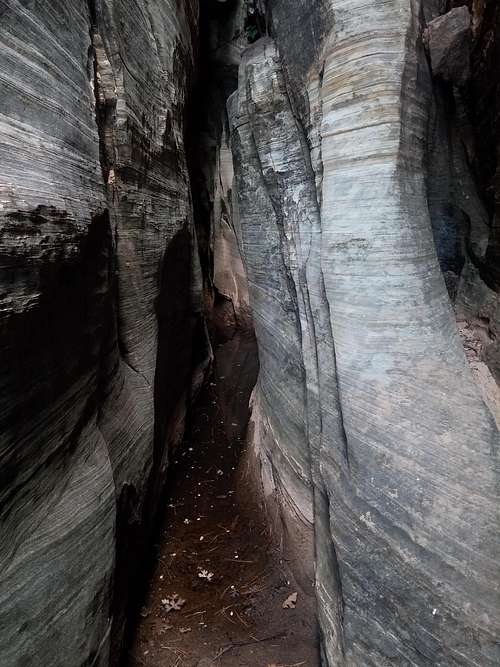
Because only one peak east of the Zion-Mt. Carmel tunnel and not considered part of the Zion Canyon group-- Checkerboard Mesa-- has a name on USGS maps, and because there are only two officially maintained trails originating out there-- Tunnel Overlook and East Rim-- the east side is Zion's flyover country, so to speak; the majority of visitors are people on their way to or from Zion Canyon, and they do little more but stop and wander a few yards from the roadside to take some pictures. Thus, the east side, with its many unnamed peaks and its numerous washes and canyons, is a haven for scramblers and explorers who delight in isolation and secret wonders. In addition to all the peaks, there are several small slot canyons of varying difficulty levels, including Keyhole Canyon, a dark, very narrow technical slot.
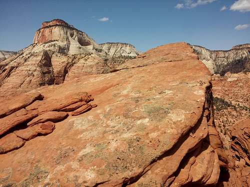
Aside from the great views, there are some other pretty awesome things about this cool little peak:
- The easiest route up, though the most complicated due to route-finding issues, goes at Class 3 if you are careful and more likely at Class 4. Two other routes are 5.4 and 5.8 unless you find workarounds, so this peak is not a gimme, which I like.
- Being so close to the road, this peak is a good objective even in the hot Zion summer. It took me just 35 minutes to reach the summit, and that was due to some trial-and-error with options on the 5.4 route. Were I to climb it again, I have little doubt that I would do it in under 30 minutes, maybe even as quickly as 20.
- You can link this peak with the false summit north of Jenny Peak and with Jenny Peak itself for one outstanding loop. However, this comes with a warning (see below).
Warning: Just about a week before the submission date of this page, a highly reliable source told me he had recently learned from park staff that Red Jenny is closed to human usage. Unlike the case with Jenny Peak, where there is a sign along the way (conveniently, just past the crux) clearly stating there is a closure, there are no signs (at least none I saw in April 2015) on the ridges or on the slopes or in the nearby washes informing anyone of this. As author of this page, I do not endorse proceeding into closed areas one knows are closed. The choice is yours, as are the consequences.
Getting There
0.8 mi east of the Zion-Mt. Carmel Tunnel is a turnout (room for one car, maybe two if the drivers are cooperating) on the south side next to a large rock outcrop. Park here. See the picture below for reference.
If there is already a car there and there is not enough room for yours, park at the closest available turnout and walk back; that spot provides the easiest way in the vicinity down into the wash below.
This is where to start for the NE ridge and the eastern slopes. You can reach the NW ridge from here as well, but there is a better turnout with good access further west.
Update December 2021: The Park Service has blocked off this pullout, and the nearest parking areas are not close. The best way to start the approach may now be to have someone drop you off at the closed pullout.
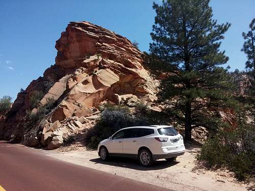 The Pullout
Route
From the turnout, follow a use trail into the wash below.
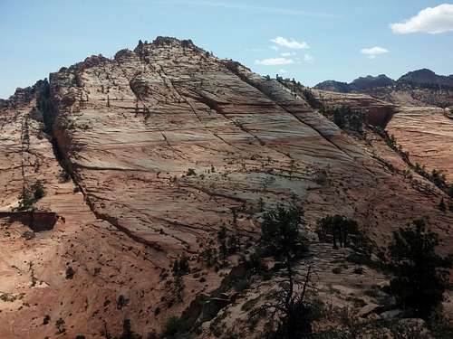
- NE Ridge (5.4)-- Once in the wash, head west a short distance and ascend slabs to the start of the ridge. Work your way up the steepening ridge. Climb the 5.4 crux or find an exposed, zig-zagging workaround along the slabs to the left. Back on the ridge, use game trails, bushwhacking, or anything better that you see to work south of the summit. Scramble up into a beautiful slickrock bowl and find one of many ways to the top, which is a small, exposed block overlooking hundreds of empty feet on its north side. Even if you use the workaround option, this is a Class 4/5 route. Gear: This rock is soft; leave the stoppers, cams, etc. behind. If you want to protect the route, you will need long slings to wrap around trees and sturdy bushes.
 Northeast Ridge Northeast Ridge |
 Red Jenny Summit Red Jenny Summit |
- NW Ridge (5.8)-- From both above and below, this route looks like a walkup. However, that same reliable source who told me this peak is in a closed area also says that there is a short but unavoidable 5.8 pitch en route. He says is it about a third of the way up, goes for about 40', and is unprotectable.
- East Slopes (Class 3/4)-- After dropping into the wash, head east instead. Bear right into the first tributary wash. When you see slickrock slopes heading up to the peak and a beautiful slickrock expanse above, start finding a way up. If you reach a waterfall on the left and a short, dead-end slot on the right, you have gone too far. Good route-finding skills are imperative if one wants to stay off Class 5 terrain. I "found" this route on my descent.
 East Slopes East Slopes |
 Slickrock Waterfall Slickrock Waterfall |
 The Short, Dead-End Slot The Short, Dead-End Slot |
If you are going to defy the closures and do a Jenny-"North Jenny"-Red Jenny loop, there are some lines between "North Jenny" and the Red Jenny-"North Jenny" saddle that appear to work, but I have not tried them.
There are no bolts or rap stations, so if you want to rap down, you need the gear for that and need to know you will be leaving things behind, which really isn't good since this peak is so pristine. Use a 60m rope for the NE ridge and two of them for the NW.
RT Distance: 1-2 mi, depending on the route.
Elevation gain: about 700', plus about 100' on the return.
 East Temple East Temple |
 Progeny, Ant Hill, Aires, South Ariel Progeny, Ant Hill, Aires, South Ariel |
 North Jenny North Jenny |
Red Tape
$35 entrance fee for Zion these days. You can save $ in the long run by buying an annual pass or interagency pass if either suits your needs.
As noted already, consider the closure area.
As noted already, consider the closure area.
When to Climb
Best fall through spring. If you climb it in the summer, start out very early. The heat will turn the surrounding slickrock into an oven by late morning.
Camping
There are no campgrounds on the east side of the park, but the Watchman Campground, near the Visitor Center, is not far away. This campground is open all year, and you can make reservations for certain months at recreation.gov.
Less than a mile from the park's east entrance, there is a campground/RV resort right off the road, with a store and restaurant right across the street. I have never stayed there, but I have stopped there for snacks and showers, and the staff have been very friendly.
External Links
More information about regulations, camping, and more: Zion NPS Site.