-
 17828 Hits
-
 90.81% Score
-
 33 Votes
|
|
Mountain/Rock |
|---|---|
|
|
46.49540°N / 12.04570°E |
|
|
Hiking, Via Ferrata, Skiing |
|
|
Spring, Summer, Fall, Winter |
|
|
8448 ft / 2575 m |
|
|
The Averau-Nuvolau Group

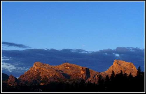
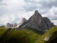
Between Passo Falzarego, 2105 m, and Passo Giau, 2236 m, there lies a nice and popular mountain group, usually referred as Averau-Nuvolau group. It consists of a handful of lower, but typically dolomitic mountains, which are due to their good accessibility, nice look and great panoramas very popular. This is the playground of the nearby Cortina d'Ampezzo town.
In order not to have too many levels of grupation, I shall post separate pages, one for each major mountain of the group. Here is a more extensive list, in the east-west direction:
> Ra Gusela, 2595
> Nuvolau, 2574 m. A ridge summit with the hut on top.
> Becco Muraglia, 2271 m. A less important pek, rising from the plateau, E of Nuvolau.
> Cinque Torri, 2361 m. The famous five self-standing rocks, very popular for climbing.
> Averau, 2649 m. A dominant, tower-like mountain in the centre of the main ridge.
> Croda Negra (Punta Gallina), 2518 m. A ridge mountain west of Averau.
> Monte Pore, 2405 m. An elevation on the very south.
Explore the below map-guidebook for also other summits!
Overview
Nuvolau is easily reachable from the NW side, so it is one of the most visited mountains of Dolomites. Even more because of the reason, that just on top of it a mountain hut stands. This is a ridge mountain, towards the south-east connected by a ridge to the neighbouring, a bit higher Ra Gusela. To the west, Nuvolau is descending to the Forcella Nuvolau, which separates Nuvolau from Averau. The southern side of Nuvolau has a form of a steep, almost vertical wall, which both summits, Ra Gusela and Nuvolau share. Close to the summit of Nuvolau there are a few picturesque towers in this ridge. So, the south-eastern summit ridge is very short, but steep enough that the trail in the last part is protected by a few meters of steel cables. The north-western ridge is also fairly steep, but just north below it a broad slope descends towards the Forcella Nuvolau. There a comfortable trail ascends, where hundreds of tourists climb the summit. From the upper station of the Forcella Nuvolau cableway they have only good 20 minutes to the top.
From the summit we have a striking view down towards the Passo Giau and all around on the giants of Dolomites. The rocky towers of Averau across the Forcella Nuvolau are seen in their best shape. Enjoying a sunrise or sunset from the hut might be an experience one remembers the whole life.
Getting There
|
For a broader picture, see the pages: Cortina Dolomites and Dolomites! |
Routes Overview
Non-climbing Routes
Two marked trails are passing Ra Gusela and Nuvolau around the southern and northern side. Around the south side the trail No. 452 goes on Forcella Nuvolau (1 h), around the north side the trail No. 443 goes to Rif Scoiattoli (1 h 30 min).
1. Ferrata from Passo Giau
Around the eastern and northern side of Ra Gusela the trail No. 443 goes. It's an easy walk, with two sections of easy ferrata (grade A). On the map the trail to the ferrata entry is drawn closer to Passo Giau, but as that path is much deteriorated it is better to continue around the mountain till the well marked crossroads, where we deter left. Now we ascend over moderately steep slopes in many turns, finally reaching the Gusela walls. Through a ravine we ascend a small notch, where the ferrata starts. It is very short and fairly easy. Over the first rocks we go up towards the right, cross by a ledge shortly horizontally towards the right and through a short, again steeper ravine exit on the upper plateau. A nice view on the Nuvolau and right behind it on the Averau opens. The summit of Ra Gusela rises towards the left above the karst plateau. From this point we continue over the upper karst plateu. The landscape is very nice. Karst, rocky formations are intermitted with beautiful grassy patches, in late spring and summer full of blossoming flowers. In some 10 minutes we reach the point, where the trail starts ascending steeply again towards the south-east ridge. In a few turns we reach it, the southern horizons open, we can enjoy them with the bizzare rocky towers in front. Now we continue by the ridge towards the right, climb over some 15 meters high summit rocks with the help of steel cables and hit the summit hut. 1 h 15 min.
2. From Forcella Nuvolau
A broad trail leads us towards the east. Soon it crosses a distinct rocky barrier, above which we have only a moderately steep, broad slope to the top. 30 minutes, easy walk.
Harder Climbs
In the neighbouring Ra Gusela there are harder climb routes, if you have any data about possible Nuvolau climbs, please post!
Mountain Huts
Rif. Averau, 2413 m, on Forcella Nuvolau. See the chapter above how to reach it!
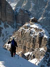
Rif. Nuvolau, 2575 m, on top of Nuvolau. From Rif. Averau reachable in 20min, from Passo Giau in 1h (easy ferrata).
Rif. Scoiattoli, 2225 m, near Cinque Torri. Reachable by cableway (or 1h from the Falzarego road).
Rif. Cinque Torri, 2137 m, below Cinque Torri. Reachable by a mountain road in 1h from the Falzarego road.
Rif. Fedare, 2000m, Rif. Piezza, 2175 m, Rif. Passo Giau, 2236m, by the road on Passo Giau.
Rif. Bai de Dones, 1889m, Rif. Col Gallina, 2054 m, by the road on Passo Falzarego.
When To Climb?
Any time of the year.


