Explorer Series
Product Description
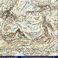
Scale 1:25 000 (4 cm to 1 km, 2½ inches to 1 mile)The series covers every part of England, Scotland and Wales - however remote.
Maps specially designed for walkers, off-road cyclists, horse riders and all involved in outdoor activities.
Features
- Camping and caravan sites
- Picnic areas and viewpoints
- Selected places of interest
- Rights of way information for England and Wales
- National Trail and Recreational Path routes shown
- Selected tourist information
Images
 |  |
Reviews
Viewing: 1-2 of 2 |

mountainmanmark - Mar 13, 2008 8:08 am - Hasn't voted
My Preferred Map
These are my preferred maps whether it be for the South Downs Way a national park or Glen Coe. Although I agree with Dan above, there is some details that don't need to be there and get in the way. I would also advise to keep an eye for updates. I had a classic case three years ago. I used to train kids for the Duke of Edinburgh award and on one training hike, I said I'll meet them where the national path crosses the road. I waited, got a phone call "where are you" at the car park where the NP crosses the road, "so are we". It turned out that although my map was under 10 years old, the latest map had the new route of the National Path. Easily done.
Viewing: 1-2 of 2 |
Nanuls - Sep 8, 2007 11:23 am - Voted 5/5
A bit too detailedIn the end it is a very good map and will be the first choice for many, however I advice that, if available, you use Harvey Maps services mountain maps as the are specifically tailored for climbers, mountaineers and walkers.