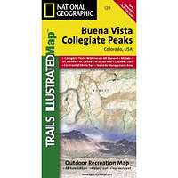
Buena Vista/Collegiate Peaks CO natg (National Geographic Maps: Trails Illustrated Map # 129)
| Page Type | Gear Review |
|---|---|
| Object Title | Buena Vista/Collegiate Peaks CO natg (National Geographic Maps: Trails Illustrated Map # 129) |
| Manufacturer | National Geographic Maps |
| Page By | redsplashman23 |
| Page Type | Dec 4, 2012 / Dec 4, 2012 |
| Object ID | 8404 |
| Hits | 2246 |
| Vote |
Product Description
Coverage includes Gunnison and San Isabel national forests; Collegiate Peaks Wilderness; the cities of Buena Vista, Princeton, Rockdale and Winfield; Cottonwood, Hartenstein and Bear lakes; the Arkansas River; Cottonwood and Browns passes. 14ers: Mt Oxford, Belford, Harvard, Columbia, Yale, Missouri Mountain and Huron Peak. Includes UTM grids for use with your GPS unit.Features
Map: 2 pagesPublisher: Natl Geographic Society Maps; 4 edition (May 1, 2006)
Language: English
ISBN-10: 1566953251
ISBN-13: 978-1566953252
Images
 |