Harveys British Mountain Maps
Product Description
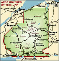
Harvey Map Services and the British Mountaineering Council have colaberate to produce 3 definitve maps of some of Britains most popular mountain areas. The maps have a scale of 1:40 000 with summit area maps of 1:15 000 and 1:20 000 printed on the back. The areas they cover are Snowdonia, the Peak District's Dark Peak and the Lake District."The 1:40,000 scale used by British Mountain Maps is excellent for hill walking. These maps provide clear, detailed information." Sir Chris Bonnington
Features
Cover all the key mountains on a single mapPrinted on plastic - durable, tear-resistent and 100% waterproof
Made in cooperation with the British Mountaineering Council
Colour shading for easy identification of hills and valleys
Less than half the weight of a laminated map
Detailed 1:15,000 enlargements of Snowdon and Tryfan; Detailed 1:20,000 enlargement of the Kinder plateau; and Detailed 1:20,000 enlargements of Scafell and Pillar
Geological map of Snowdonia, The Peak District and The Lake District supplied by the British Geological Survey
Mountain incident and first aid advice
Tips on using your map and compass
Useful local phone numbers and websites
Images
 |  |  |  |  |  |
 |
Nanuls - Aug 8, 2007 5:48 pm - Voted 5/5
Perfect Mountain MapAn excellent map all round, and the only map you should by if visiting one of the areas covered.