
-
 7313 Hits
-
 81.18% Score
-
 13 Votes
|
|
Mountain/Rock |
|---|---|
|
|
43.75738°N / 109.97338°W |
|
|
Mountaineering |
|
|
Summer |
|
|
11175 ft / 3406 m |
|
|
![Pinnacle Butte NW-- Summit]()
Pinnacle Butte NW-- SummitOverview-- Pinnacle Butte NW
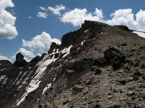
Pinnacle Butte NW-- Summit
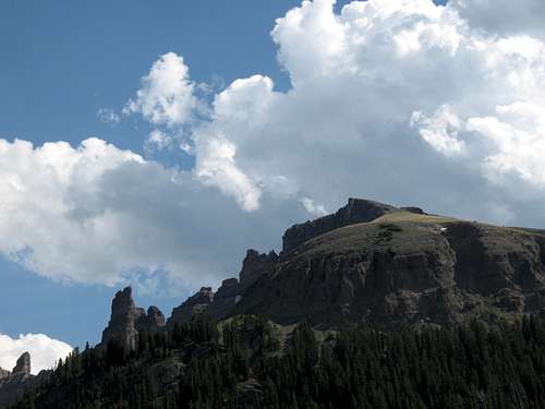
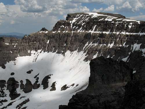
At 11,175', Pinnacle Butte NW is the third-highest of the five main summits of the Pinnacle Buttes, and it is the second-hardest of them to climb. Pinnacle Butte NW is not technically difficult to climb, but reaching the summit requires three sections of climbing on untrustworthy rock; in places, the climbing is moderately exposed and is Class 3, though some might argue that it creeps into the vague world of Class 4.
On some maps, this peak is labeled as "Pinnacle Buttes West."
On some maps, this peak is labeled as "Pinnacle Buttes West."
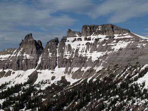
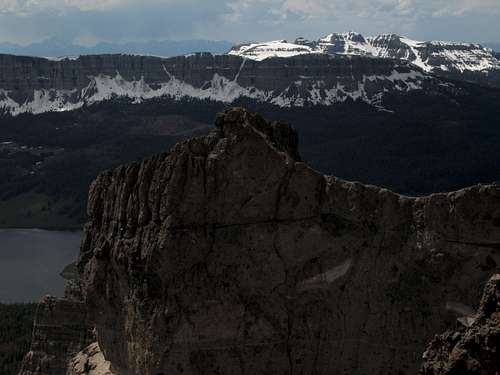
From below, the peak is probably best viewed from the vicinity of Brooks Lake, where it and its neighboring cliffs and spires dominate views to the east.
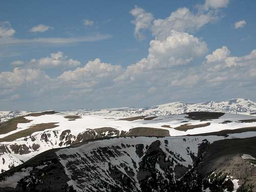
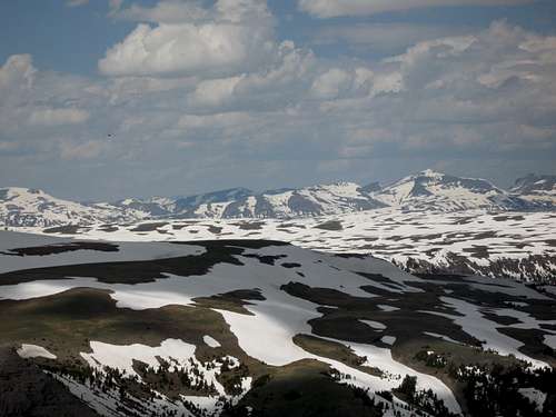
Each of the five peaks has its own perspective when it comes to views. Pinnacle Butte NW has outstanding afternoon views, and I did climb it in the afternoon, that reveal the main and NE Pinnacle Buttes in full detail; the flat-topped tundra heaven of Austin Peak to the north; the massive Buffalo Plateau beyond it; and Younts Peak, the most remote mountain in the Lower 48, even beyond that. To the east are the expanses of the Wind River Range and the Washakie Wilderness portion of the Absaroka Range.
If you obey the weather rules and climb in the morning, the views are still far short of disappointing; to the west, you look over Brooks Lake, the Brooks Lake Cliffs, and Mount Sublette and Sublette Peak, all the way to the unmistakable profile of the Tetons.
(Of course, you see all of those no matter what time of day it is; the description is based on the lighting.)
Getting There
About 7 miles east of Togwotee Pass on U.S. 26/287 northwest of Dubois, turn onto the road for Brooks Lake and follow this good unpaved road for 4 miles, where a road heads right for the Bonneville Pass Trailhead. This road is marked on maps as a 4wd road, but it is passable for passenger cars. The road ends at the trailhead in 1.7 miles. The elevation here is about 9300’.
Route Information
North ridge
Round-trip distance: 4.5-5 miles, depending on exact route.
Elevation gain: about 1900', with about 1400' of it in the last mile.
Difficulty: Off the trail, mostly Class 2 with moderate bushwhacking, but sections of Class 3/4 at the summit.
Begin hiking the Dunoir Trail to Bonneville Pass, which is signed as being 3 miles away. Very soon after you start out, you have to ford Bonneville Creek. In early summer, this may be knee-deep. Later in the summer, you may be able to rock-hop the crossing.
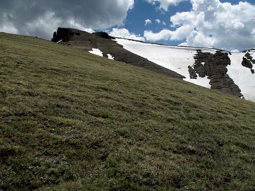
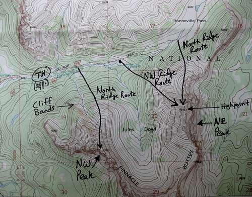
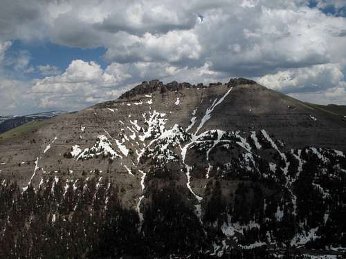
As you hike, pay attention to the two prominent ridges extending toward the trail from the mountain. The first one, which I call the Northwest Ridge but really runs more N-NW, is more direct but has cliff bands that can't be climbed directly, so finding a way up to the crest of the ridge may slow you down quite a bit.
Northwest ridge
I recommend the second ridge, which I call the North Ridge.
There is a very steep, obvious drainage between the two ridges. Your best bet is to leave the trail directly across from the drainage, cross Bonneville Creek again, and work along the left side of the drainage to access the ridge. My climbing partner and I found a log crossing of the creek and a use or game trail following the drainage for a short distance, but these features are not easily seen from the main trail; don't worry about finding them.
A note on locating the ridge-- about a mile along the trail, you pass Jules Bowl, a huge basin that opens up views of the main, NE, and NW summits of the Pinnacle Buttes and which is still marred in its lower reaches by the remnants of a clearcut. If you reach Jules Bowl, you have gone too far, but you can leave the trail there, cross the creek, and head through some relatively open forest courtesy of the clearcut to reach the North Ridge.
North Ridge-- if you have this exact view, you've gone a little too far along the trail.
Hike up the steep forest to the crest of the ridge. When there is still snow in the forest, the bushwhacking is much easier, but beware postholing and buried deadfall. Treeline is around 10,600, so your bushwhacking elevation gain will be 1000-1100'.
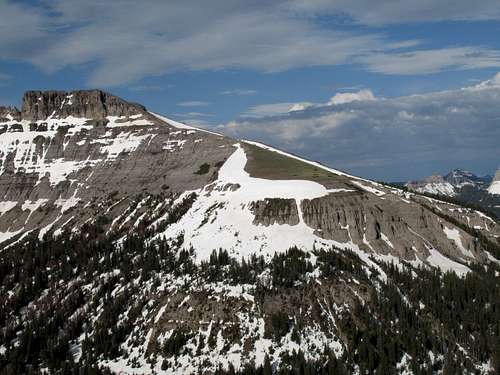
Above treeline, follow the gentle but steep ridgeline to the summit. Views are spectacular as you go, and you can walk inches from sheer drops along the cliffs of this mountain.
Ridgeline walk
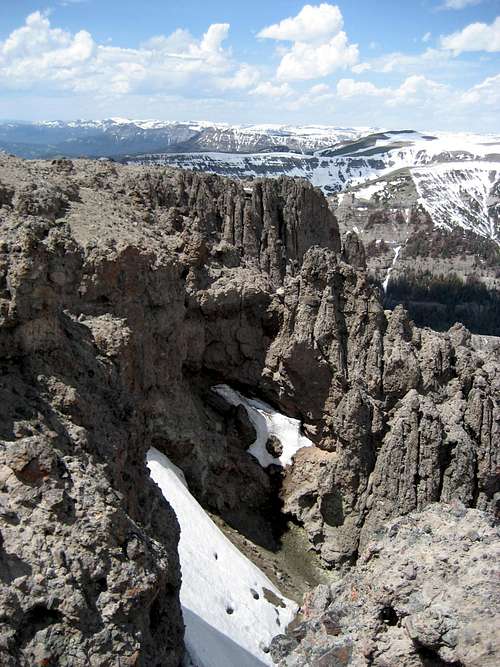
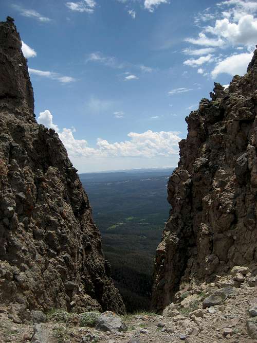
At the summit, you find you're not really at the summit. The true highpoint is a short distance south. To get there, you have to negotiate three notches. None of them are very long climbing-wise-- maybe 15' at the most. The climbing is Class 3 verging on Class 4 and is on breccia, which in the Absaroka Range is notoriously unstable. On these sections at least, the rock is not too bad, but it still comes loose easily. The exposure of the climbing itself is mostly negligible, but you do want to take care when you bottom out in each notch. The notches occur where the mountain narrows to the meeting of two opposite-side cliffs or couloirs, and you have only a few feet of room before things start to drop drastically.
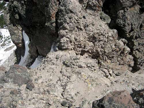
One of the notches-- by musicman82
There is a cairn at the summit, but no register. Creep to the edges for some dizzying perspectives.
Topo Map
Views
By musicman82
By musicman82
Red Tape
This is prime grizzly country, which means special rules about food storage and personal behavior are in order. I will not list them all here. Bottom line: If you don’t know, don’t go.Camping
The Brooks Lake and Pinnacles campgrounds are both located about a mile past the turnoff for the trailhead. Summer 2007 fees were $10/night. Both are small campgrounds that operate on a first-come, first-served basis, and Brooks Lake is very popular with fishers, so don’t show up after 3 P.M. on a nice summer day and expect to find an open site. The campgrounds have trash bins, bearproof lockers for food storage, pit toilets, and water (though the water at Brooks Lake was shut off in July 2007).Both campgrounds are among the most scenic developed campgrounds you will ever see. Brooks Lake is surrounded by open meadows and towering cliffs and pinnacles.
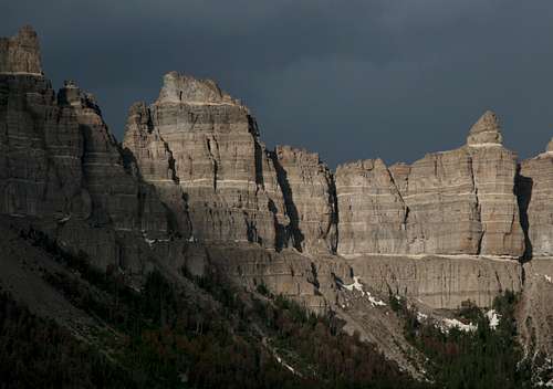
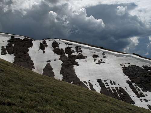
Pinnacle Buttes and stormy skies from Brooks Lake
External Links