-
 15120 Hits
-
 81.84% Score
-
 14 Votes
|
|
Mountain/Rock |
|---|---|
|
|
46.46048°N / 114.30001°W |
|
|
Ravalli |
|
|
Hiking, Skiing |
|
|
Spring, Summer, Fall, Winter |
|
|
8606 ft / 2623 m |
|
|
Overview
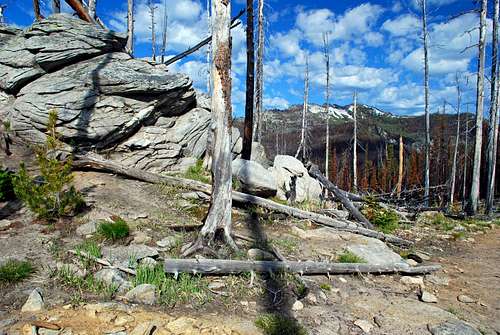
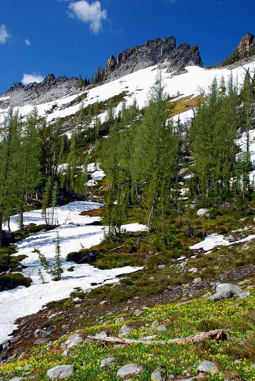
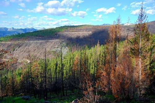
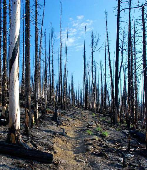
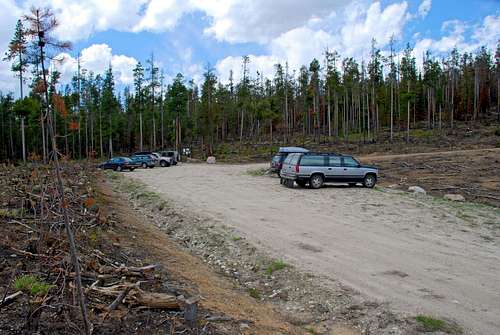
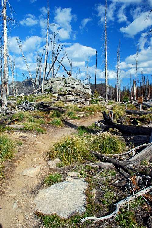
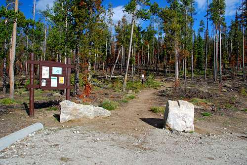
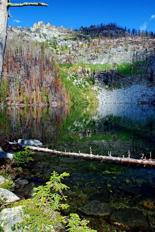
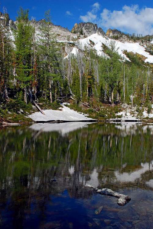
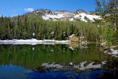
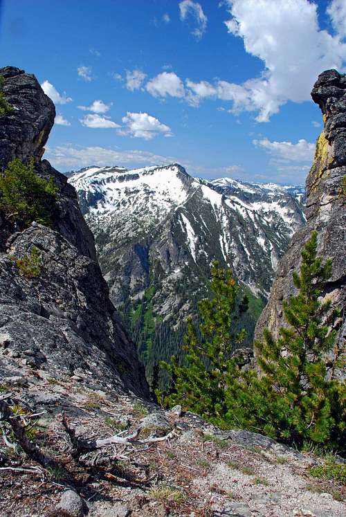
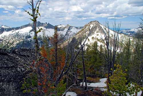
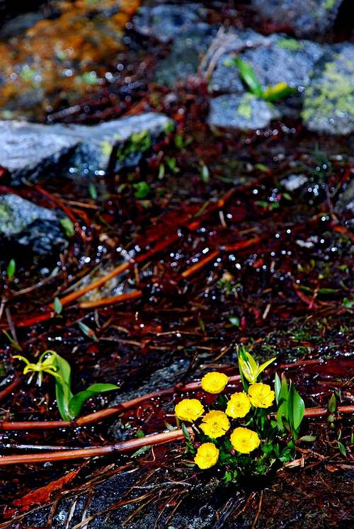
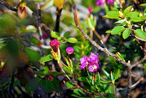
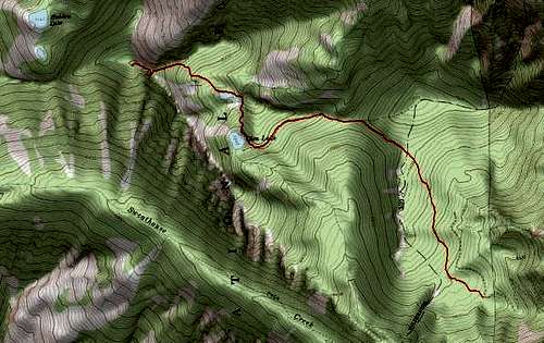
Latitude & longitude – 46.46048 N / 114.30001 W Route type – Hike Elevation – 8,608’ Class level – Class 1 Length of time required to complete route – less than 4 hours (one way) Glen Lake is a popular destination for those who hike in the Bitterroot Mountains, very popular. In fact it’s so popular, many “serious” hikers and climbers refuse to even go there. In a way, I think this is unfortunate, because the area has much to offer. Granted, the area immediately around Glen Lake can be crowded, especially on weekends. But for those willing to make an extra effort, (I believe that should include “serious” hikers and climbers), the areas north and west are interesting, and, in some sense, spectacular. For there lies Point 8608. Before you dismiss Point 8608 as “just another hike destination” I’d like to make a couple of points. First, in the approximate mile between Glen Lake and Point 8608, you gain over 1,000’ of elevation. That is not “just a hike”, especially when you consider that most of the gain occurs during the last half mile. And second, the exposure along the ridge-crest as you near the highpoint is nothing less than spectacular. Glaciers have left their mark on this area, leaving behind gendarmes along the crest and deep cuts into the southwest facing cliffs. The various gendarmes offer Class 3 to mid-Class 5 climbing and everything between. If you have the temerity to stand atop a couple of these towers of rock and look down, it will take your breath away. Completely. The drop is hundreds of feet. Straight. Down. The views along the ridge-crest of Point 8608 are terrific. To the east is the Bitterroot Valley, the Sapphires beyond. North, just across the Big Creek Drainage, lie Saint Mary’s Peak and the Heavenly Twins. South-southwest is Gash Point, one of the area’s most popular back-country ski destinations. But it is the western vista which I find the most spectacular. Point 8608 is along the north side of a cirque from which flow the headwaters of Sweathouse Creek. As the ridge-crest around the cirque proceeds west, then south before swinging back east to reach Gash Point, it includes Point 8618 (southwest of Hidden Lake) and Point 8839 (north-northwest of Bear Lake). Between those two highpoints is an extremely craggy ridgeline which simply demands one's attention. And, just peeking over the left (south) shoulder of Point 8839 you can see the summit of Sky Pilot, standing tall at 8,792’. Then, stretching far into Idaho and the western horizon, are more mountain summits than you can count. Magnificent! 2006 – The Gash Creek FireOn July 24, 2006 at 4:01 pm, a fire in the Gash Creek area was reported to the Forest Service. The fire eventually grew to cover more than 8,500 acres. The fire was easily visible from many points in the Bitterroot Valley and at times was rather spectacular. This was especially true one evening when a huge abandoned slash pile near the Glen Lake Trailhead ignited. Because this happened in a shallow cirque, after dark, the mountain looked like a spewing volcano. Many trees and other plants were killed or damaged, but more survived and will likely flourish with the lessening of competition. The “look” of the area has certainly changed, but to state categorically that “things are worse” would be to take a short-term view. Things always "change." When I visited on June 16, 2007, animals were returning to the area. I could hear male woodpeckers rat-a-tat-tatting on dead trees, calling for mates. There were plenty of ungulate tracks along the trails, from both dear and elk. Chipmunks were in evidence, especially in the areas most hard hit by the fire. Though there are some areas of the forest which were absolutely scorched by very hot wind-driven fires, if you look closely many parts of the woods are already showing signs of recovery. Often one of the first plants to recover, Bear Grass is beginning to leaf out in most areas. Still, there are large numbers of dead trees left standing from the fire, and one would expect many of them to fall on the trail; however since the trail to Glen Lake is very popular, it’s likely the Forest Service will make an effort to keep the path clear. Getting thereGlen Lake TrailheadAbout 2 miles north of Victor, MT, turn west from Hwy 93 at Bell Crossing. The intersection has a blinking yellow light, and is marked with a Forest Service sign for the Big Creek Trailhead. In less than a half mile the road turns 90 degrees to the right (north), quickly followed by another 90 degree turn, this time to the left (west). In about a mile, you will reach FR 738 which turns slightly to the right in a northwesterly direction. As you proceed uphill, you will pass through the area of the old Curlew Mine before reaching an intersection. The right (northwest) fork goes downhill to the Big Creek Trailhead. You want to take the left (south) fork onto FR 1321. In about 6 more miles you will reach the Glen Lake Trailhead, marked with a Forest Service sign. Make sure you stay on the main road. There are several spur roads which will take you to dead-ends. There are no restroom facilities at the trailhead. CampingThere are several camp sites around Glen Lake and the other unnamed lakes. Glen Lake is the most-used, but the third lake in the chain is the most scenic. But be advised, bomber-sized mosquitoes live around these lakes, just waiting for new blood. Yours!Area Restrictions (Red tape)As the trail to Glen Lake passes over the first saddle, it moves into a designated wilderness area. Please act accordingly.The RouteFrom the trailhead, the trail goes gently uphill as it proceeds north-northeast along the side of a ridge on which sits a saddle between the trailhead and Glen Lake. It’s not long before you enter an area of forest which received serious damage from the 2006 fire. The trail turns northwest just as it reaches the saddle about 1.3 miles from the trailhead. Notice the many rock piles along the crest of this ridge, granite remnants of old volcanic intrusions. The boundary of the official Wilderness area follows this north-south ridge. Looking west-northwest from the saddle, you can see Point 8608 in the distance. West-southwest offers a view of Gash Point. As the trail traverses along the side of a ridge from the saddle to Glen Lake, it passes through an area of the forest which suffered some of the most severe damage. The ground seems to be composed entirely of ash and the trail is littered with downed trees. It may be possible to lose the trail in this area if one doesn’t pay close attention. Fortunately, many people who frequent Glen Lake often pass this way and leave their footprints in the ash. When in doubt, just look for footprints. Once the trail reaches Glen Lake you may want to pause to wash the ash residue from your hands as you admire the gendarmes along the ridge-crest above the west side of the lake. From the east side of Glen Lake, the trail continues northward and uphill as it crisscrosses a small stream. Again, the trail in this area has been practically obliterated by the fire, but you won’t get lost if you follow the stream toward its source. After traveling about .2 mile uphill, the trail reaches a small unnamed lake. Though Glen Lake is a popular destination, few travel beyond its shores. Despite the fact this small lake is so close to Glen Lake, hardly anyone knows of its existence, and an even smaller number visit. Here, the views of the ridge-crest gendarmes are even better than from Glen Lake. The trail swings around the northeast corner of the lake and turns west-northwest. After passing over a small rise, you reach the second unnamed lake. (Topo maps show this lake and the first unnamed lake as a single lake. That is incorrect. This second lake is several tens-of-feet higher and only connected to the first and lower unnamed lake by a small stream and falls.) Slightly larger than the first unnamed lake, this is my favorite. The views are even more spectacular and the seclusion superior. The day I visited, the area was sprinkled with thousands of spring wildflowers. Leaving the area of the lake the trail proceeds northwest toward the ridge leading to Point 8608. The steepness of the trail begins to increase rather substantially. Once the base of ridge is reached, the trail turns west-southwest as it traverses toward the crest. Point 8608 is at the point where the crests of two ridgelines meet. To say the back sides of these ridgelines fall off sharply would be an understatement. Straight-down would be more like it. Talk about exposure. Wow! The ridgeline coming from the south (passing along the west side of the three lakes) is covered with gendarmes, many of which look climbable. The highpoint is difficult to determine. I used a GPS to help me decide the “true” highpoint is atop one of the larger and more rounded piles of rocks toward the western portion of the broad and cutup top of Point 8608. I’d guess there is at most a few feet of difference between several of the rock pile tops. Feel free to make your own choice. <! single row table with two pictures > When to GoThis summit is visited all year. Though it requires that one begins to hike farther down the road (how far down depends upon the amount of snow, your vehicle’s ground clearance, and your driving skills). Backcountry skiers frequently use this area.Essential gearGood footwear and clothing appropriate for the current weather conditions are all that’s required. If you go during the winter, depending upon snow conditions, you may want skis or snow shoes.Route Statistics |


