
-
 16738 Hits
-
 85.36% Score
-
 20 Votes
|
|
Mountain/Rock |
|---|---|
|
|
37.85830°N / 107.9342°W |
|
|
San Miguel |
|
|
Hiking |
|
|
Winter |
|
|
12930 ft / 3941 m |
|
|
Overview
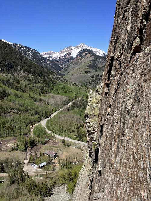
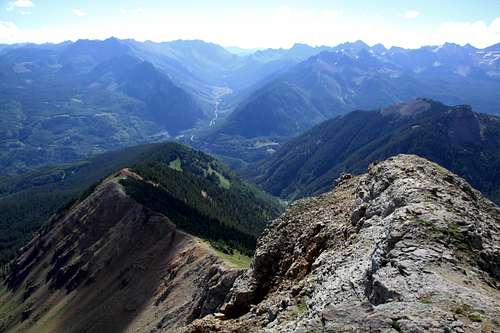
Sunshine Mountain and its east ridge as seen from climbing Ophir Wall
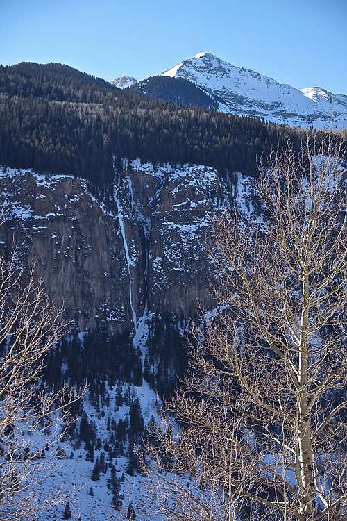
Sunshine Mountain as it loomes above Ames Ice Hose WI5/M6 icefall
Do not confuse Sunshine Mountain with 14er Sunshine Peak (14006 feet = 4269 meters). And to add to the confusion, there is also Sunshine Mountain 13er, located also in San Juan Mountain Range but in Hinsdale County (13,321 feet = 4060 meters).
Guide to the Colorado Mountains with Robert Ormes (sort of a bible of Colorado Mountains) provides only a brief description and access from Bilk Creek Trail, I chose a different approach via East Ridge.
Colorado Rank: 696
Parent Lineage: Lizard Head
Class: 2+ (expect off trail travel)
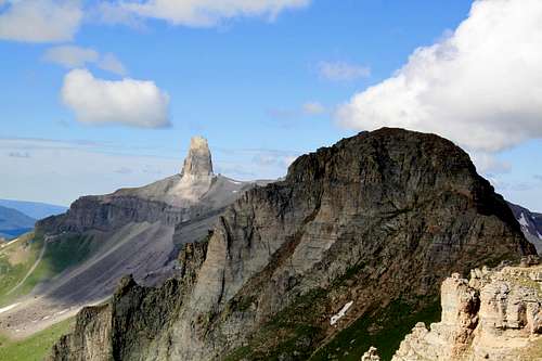
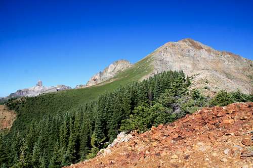
East Ridge of Sunshine Mountain with Lizard Head
Getting There
From the town of Telluride drive south on CO -145 towards the tiny town of Ophir, past the turn off to Ophir continue south for 0.1 mile only and turn right/west on an unsigned dirt road. Drive straight downhill on this road to an intersection and continue straight here. There will be a sign for Galloping Goose trail (popular trail with mountain bikers). At the next intersection, stay right. Try to follow signs for Galloping Goose Trail. Park where the road has a sharp turn and the Galloping Goose is leaving this road and leading south onto a single track. There is a little place for about 3 cars. The elevation here is about 9,000 feet and you are very close to the Lake Fork bridge. I would not recommend low clearance vehicles, but the road is passable. The part of the road is pretty narrow shelf road and there were many fallen rocks on it from the cliffs above (I drove after rain).Route
East Ridge of Sunshine Mountain
East ridge of Sunshine Mountain
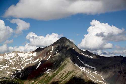
Wilson Peak from Sunshine Mountain
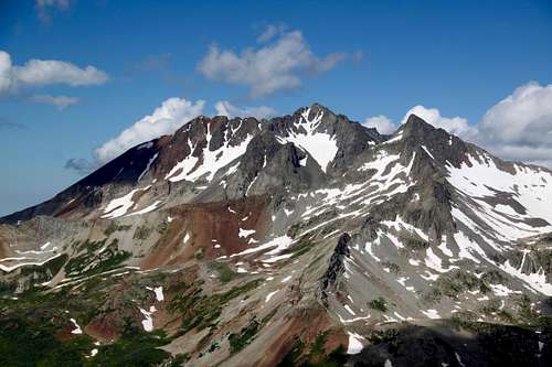
Mount Wilson and Gladstone
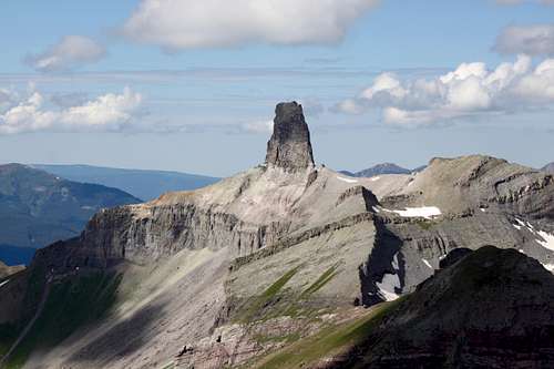
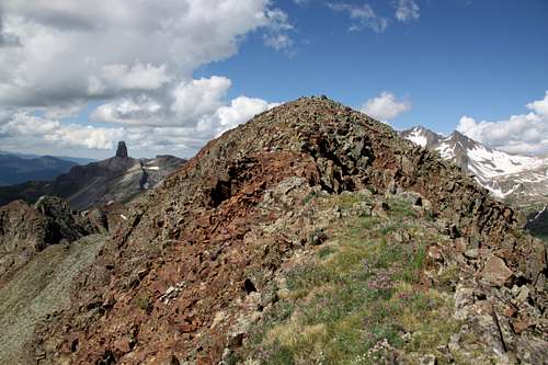
Lizard Head from Sunshine Mountain
Sunshine Mountain - east ridge
Distance: about 7.5 miles round trip with nearly 4,000 feet of elevation gain
Description: From the parking lot at a curve, start hiking on Galloping Goose Trail (signed) on a nice trail, cross the Lake Fork of San Miguel River on a nice wide bridge and continue up the trail for a short distance 0.15 miles (5 min) until you come to a green gate with some thick vegetation. It will be on the east side of the trail (left). Leave the Galloping Goose Trail here and continue on much fainter trail past the green gate. You can see that there used to be an old road, but it is overgrown with vegetation and small trees. Go up the road and at the 3rd switchback leave the road into the aspen forest. Walk up the hill for a few minutes until you hit this road again (I did follow the road on the way down, but lost it). Cross the road here at a place where you see a faint path leading into the aspen forest and there should be a small cairn.
The vegetations is so thick here that any path gets easily covered with grass quickly. I continued up through aspens eastward and a little north until I reached a large meadow with a survey benchmark. Elevation here is about 9,760 feet and you walked only 0.7 miles.
Continue up the meadow through forest, wildflowers in the summer, tall grass. If you look backwards, you can see the pass going towards Ophir. I would recommend to turn around and checking the area, returning back can be confusing in this dense forest. I remembered I head to be in the direction of Ophir.
Higher up the forest becomes more covered with fallen trees and some zig zagging will be necessary. Aspens are less frequent and you will see more pines.
Higher up the forest becomes more covered with fallen trees and some zig zagging will be necessary. Aspens are less frequent and you will see more pines.
At 10,280 feet the ridge becomes more obvious, and you start to encounter some signs of travel with an occasional trail.
11,360 feet there is a small rocky bump and the views open - the east ridge of Sunshine appears steep from here and you can seen Lizard Head. Stay on the ridge, walk around little notches, it is not steep here, so the walking goes fast.
12,080 feet - start walking up the grass covered with wildflowers in July, it is steep, but easy, and not much scree at all.
Higher up there is a short rocky section, which requires a little bit scrambling. The rock is pretty stable here - class 2+.
Above this rocky section, there is a short easy terrain and a little steep looking red loose summit ridge. Follow the trail which you can start to see and it by passes below the steeper section and zig zags up the ridge.
From the ridge you can see the actual summit.
There is geological survey marker, summit cairn and glass register from 2014.
Enjoy the views - you get one of the best views of Lizard Head from here. To the east is Mount Wilson, Gladstone Peak and Wilson Peak.
Winter can be challenging since you will have to break the trail and always remember avalanche danger.
Red Tape
Parking, hiking are for free.When to Climb
Summer is the easiest time since the terrain is dry and free of snow. Fall can be spectacular, especially when aspens are changing color.Winter can be challenging since you will have to break the trail and always remember avalanche danger.
Spring - I would imagine the snow staying pretty long on the ground in the dense forest, consider snow shoes, or very early morning start before the snow melts.
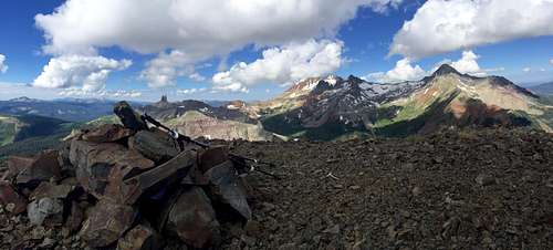
Panorama view from the summit of Sunshine Mountain: Lizard Head, Mount Wilson, Gladsone Peak and Wilson Peak