
-
 13201 Hits
-
 83.69% Score
-
 17 Votes
|
|
Mountain/Rock |
|---|---|
|
|
44.90352°N / 110.05658°W |
|
|
Mountaineering, Scrambling |
|
|
Summer |
|
|
10543 ft / 3214 m |
|
|
Overview
How can you not be interested in climbing a mountain with a name like the one this one has?
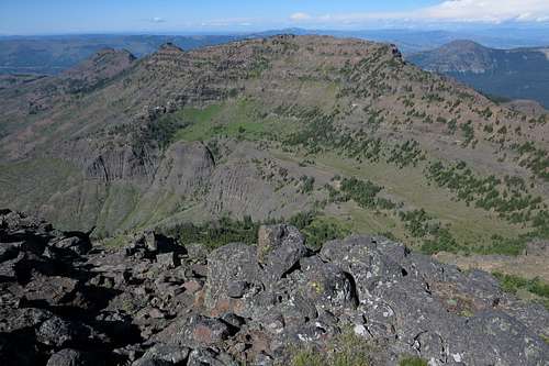
For anyone with experience in route-finding and with loose, exposed rock, the Thunderer is a nice objective since it is neither easy nor difficult. Views are rewarding since they reveal paved roads in one direction and some of America's most rugged and most remote country in another.
Like many peaks guarding Northeastern Yellowstone's Lamar Valley, often called the American Serengeti (a little misleading since most of the grizzlies seen are older dudes with huge lenses standing behind tripods, most cougars sighted are bored wives in the passenger seats, and most wolves observed are younger men chatting up the bored wives while the husbands snap thousands of photos of bison and elk), the Thunderer seems to be almost within spitting distance of the road, but actually getting to the summit requires much more time and effort than one might think, and the journey there truly is a journey into the American wilderness.
In Select Peaks of Greater Yellowstone, which now seems to be out of print, Thomas Turiano writes that back in the 1990s MSU grad student Nathan Varley climbed the Thunderer and several other peaks in northeastern Yellowstone and placed registers atop 10 of them, including the Thunderer. When I was at the summit in July 2015, I found neither a cairn nor a register, and I can come up with two plausible explanations for this:
- Someone, likely a ranger or a zealous climber unhappy about human structures on remote peaks (I must admit to feeling this way at times) removed the register and dismantled the cairn if there was one. This is more likely than the other possibility, especially since in recent years I have climbed three of the 10 peaks Varley placed registers on but did not find a register on any of them.
- The register was/is on the other summit of the Thunderer. If one were to climb this peak after first climbing Mount Norris (immediately south of the Thunderer), he or she would reach a summit higher than Norris and seeming to be the Thunderer's summit. However, it is not. This possibility, while plausible, is pretty unlikely; the person who climbed these peaks and placed registers almost certainly would have known where the true summit was.
As you climb the peak, keep a lookout for wildlife, both out of caution and enjoyment. The peak is in what people like to call "prime grizzly country," but there are other animals out there, too; on the day I climbed the peak, I got to watch a herd of mountain goats, including some babies, working their magic on the cliffs.
Also, keep an eye open for petrified wood. There is a lot of it on this mountain and in this section of Yellowstone, but please limit yourself to seeing it and photographing it; removing it is illegal.
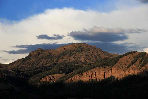
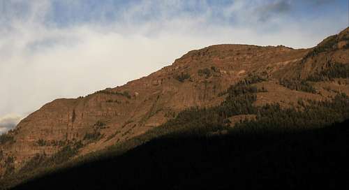
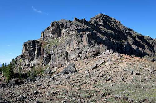
The Thunderer
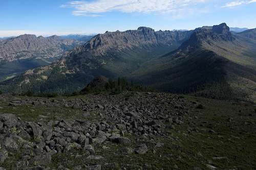
Sweeping View
Getting There
Park at the trailhead for the Thunderer Cutoff Trail. Signs alert you.
This parking area is between the Northeast Entrance and the Tower/Roosevelt junction. Although I forget the exact distance, it is much closer to the NE Entrance than it is to the junction.
 The Thunderer Massif | 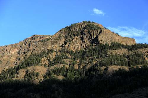 The Thunderer Massif |
Route
The Thunderer-- Northeast Ridge from the Road
The good news: the second half of the route is fun, and the views are remarkable.
The bad news: the first half of the route, all on a trail, is dull.
From the parking lot, descend about 100' to Soda Butte Creek. Now ford the stream. This could actually be the crux depending on conditions. When I did it, the water was no more than knee-deep, but I know that it can be waist-deep and swift.
After the ford, the trail crosses mostly level ground for a little bit and then heads up into the woods. From here to the pass after which the trail drops into some really remote country, it's really a slog for anyone who doesn't get excited about the scenery in a dense forest. A couple of times, there actually are views of surrounding mountains, but for the most part, this feels like hiking at lower elevations of the East or the Pacific Northwest.
Finally, about 3.5 miles from the start (I think the sign says 3.7), you reach the pass. After telling the trail what you think of it, head southwest up a broad, forested shoulder. Try to find the crest and stick with it. If you find game trails, use them. There actually is a nice one that gets one just about to where things really open up and start becoming enjoyable.
Now head south along what here is the very broad northeast ridge of the Thunderer. You may come across a nice game trail that bypasses some steeper parts and eventually pops you out where the ridge begins to narrow and become more open.
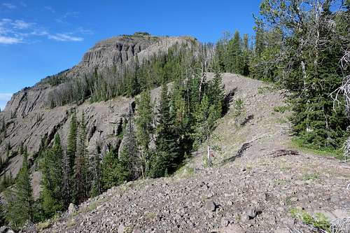
The Thunderer-- Northeast Ridge
Continue up the steepening ridge and reach what is both the physical and psychological crux of the route: a large face that appears to have no way up. Don't turn back; as you get closer, you will see that the right side is not as steep as it looked and that it will go. In fact, it goes at a very pleasant 200' or so of Class 3 scrambling.
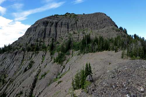
The Thunderer-- Northeast Ridge
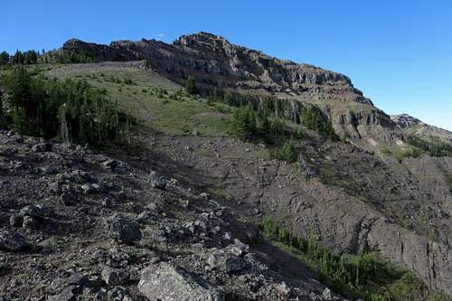
Keep following the ridge, finding two more significant obstacles. The first is an outcrop that can be surmounted by either Class 3 or Class 5 scrambling. The second is a long cliff band. While it is possible to climb up the end of the cliff band and then traverse some sketchy but workable rock to better ground, it is safer and easier to drop a bit to the left and follow some ledges until you find a Class 3 route back up to the top of the ridge. From that point, it's all walking to the summit.
If you decide to go for the spicy option, here are some observations and advice:
- It is not that difficult; in approach shoes, I climbed nearly to the top but hesitated on a particular move there because the key hold was loose (and in the Absarokas loose holds frequently pull out under little pressure) and a fall would have put me on the ground.
- I'd put the move at around 5.4.
- If for some reason you have brought gear along, go with passive pro if you want to try protecting the pitch. Honestly, I would not trust even passive pro in this rock, but I absolutely would not trust a cam; the force after loading would probably explode the rock. Gear anchors likewise would probably be really sketchy for belaying the second.
- There are no really good reasons to climb this short pitch other than for fun or to save a little time, but you are not going to save any time if you actually rope up.
 The Thunderer-- Northeast Ridge | 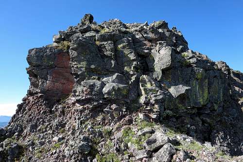 First Obstacle |
 The Thunderer-- Northeast Ridge | 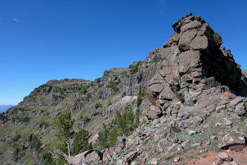 Second Obstacle |
Round-trip distance is about 11 miles, and elevation gain is around 3800'.
The Thunderer-- Summit
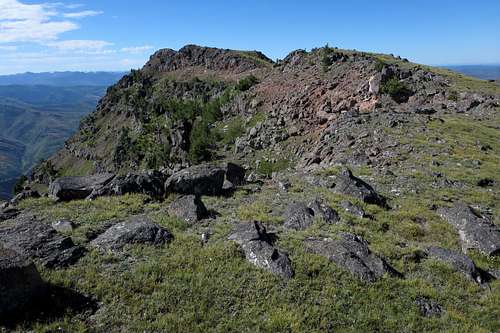
Mount Norris and the South Summit of the Thunderer
Red Tape
The park entry fee was $25 as of July 2015, and that fee covers a week of access. Other passes are available at higher cost but at better value depending on your usage.
Parts of Yellowstone are virtually littered with antlers, petrified wood, and minerals. It is illegal to remove any of these.
Carrying pepper spray is highly recommended. There are a lot of grizzly bears in Yellowstone, and the northeastern section is one of the best habitats for them. Exercise great caution around bison as well; every year, people getting too close to these "harmless" animals get charged, trampled, or gored.
When to Climb
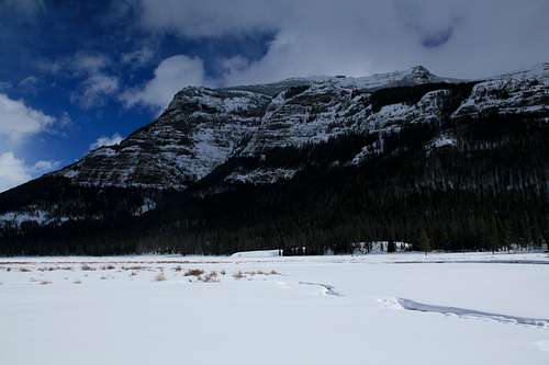
This section of the park is open all year, and, properly equipped, one could climb this peak in any season. However, summer and early fall are the best times for good weather and snow-free conditions.
Camping
There are two campgrounds in this part of Yellowstone, Pebble Creek and Slough Creek. Pebble Creek is quite close to the Thunderer, and Slough Creek is farther west. Both tend to fill early, often by 9 A.M., and all sites are first-come, first-served. These campgrounds have water and pit toilets.
If you cannot get a campsite or choose not to, there are lodging options at Roosevelt Lodge (within the park at Tower Junction) and in the gateway communities and Silver Gate and Cooke City.
The Thunderer