
-
 11965 Hits
-
 83.1% Score
-
 16 Votes
|
|
Mountain/Rock |
|---|---|
|
|
37.85749°N / 107.40186°W |
|
|
Hinsdale |
|
|
Hiking |
|
|
Spring, Summer, Fall, Winter |
|
|
13657 ft / 4163 m |
|
|
Overview
 Carson Peak from Bent Peak
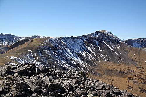
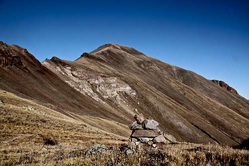 Carson Peak from Continental Divide and Colorado Trails
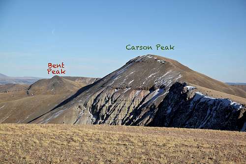 Bent and Carson from Tundra Top
 It combines really well with Bent Peak and other 13ers in the area for an easy short stroll. A strong person can also combine with other 13ers starting from Carson Pass: walk over Bent Peak, Carson, Tundra Top, Cataract Peak, UN 13580 B and then UN 13581, return back to Carson Pass and hike east to also claim Coney Benchmark. This would mean a long day. I started late, a little after 12 in the late October, so did only 3 peaks at a nice relaxing pace with long times on the summits. ![Carson City ghost town]() Carson City ghost town
Carson City ghost town![Carson Pass]() Carson PassWager Gulch/Carson Pass: from the town of Lake City, drive south on highway 149 and then turn right onto County Road 30 to Lake San Cristobal, part of the scenic alpine loop drive (very popular in the summer). The road is paved past the lake then turns to graded dirt, passable for all passenger cars. About 2 miles past the Williams Creek campground, watch for a road turning off to the left (south) for the old townsite Carson. It is well signed as "Wager Gulch" road. From this point you need a high clearance 4 WD vehicle.
Carson PassWager Gulch/Carson Pass: from the town of Lake City, drive south on highway 149 and then turn right onto County Road 30 to Lake San Cristobal, part of the scenic alpine loop drive (very popular in the summer). The road is paved past the lake then turns to graded dirt, passable for all passenger cars. About 2 miles past the Williams Creek campground, watch for a road turning off to the left (south) for the old townsite Carson. It is well signed as "Wager Gulch" road. From this point you need a high clearance 4 WD vehicle.
![My idea of mountaineering]() My idea of mountaineering - siesta on the summit of Carson Peak
My idea of mountaineering - siesta on the summit of Carson Peak
Carson Peak is located along the Continental Divide. The Continental Divide is a mountainous hydrological divide of the watersheds that drain into the Pacific Ocean and those that drain into the Atlantic Ocean.
Technically, it is a very easy walk up especially if coming over from Carson Pass and over Bent Peak. The continuation towards "Tundra Top" offers some interesting and exposed ridge section on a very loose terrain. You can also drop to a Continental Divide trail below at a few spots. If hiking with kids and dogs I would recommend going over Bent Peak.
The closest town is Lake City - one of the more beautiful historical Colorado towns, definitively worth stopping by and exploring. Also, a little bit past the turn off for Lake San Cristobal along the Colorado Hwy 149 is the monument to the famous Colorado Cannibal Alfred Packer.
Ghost Town of Carson - has several well preserved buildings from the silver and gold mining era. The ghost town is on private property, visitors are allowed. Carson was founded in 1889 when some 500 miners worked the mountain top. Eventually the winters took their toll and the residents left. They say it was one of the most inaccessible mining camps in Colorado. The elevation is 11,600 feet. There is also Old Carson located on the south side of the divide, it was an earlier mining camp and the Old Carson is not that well preserved.
Guide to Colorado Mountains with Robert Ormes mentions Bent Peak together with Carson Peak: "Bent Peak (13,393') and Carson Peak (13,657') can be reached from Wager Gulch Drive. Drive 8.5 miles up the Lake Fork Road from its junction with Hwy-149, about 2 miles south of Lake City. The Wager Gulch jeep road takes you south 5 miles, passing the ghost town of Carson en route, to a saddle at 12,360' on the divide. The road continues as a rough jeep road over a 13,000' ridge and then south and east to Heart and Pearl Lakes. From the saddle on the divide, Bent Peak is a mile west-northwest, Carson another mile".
Colorado Rank: 170
Parent Lineage: Line Parent: "Northwest Pole"
Proximate Parent: "Quarter Peak"
Class: 2
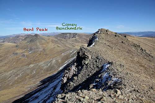
Nearby Peaks:
- Bent Peak 1.18 miles
- "Tundra Top" 1.22 miles
- "Cataract Peak" 1.41 miles
- Unnamed 13581 1.48 miles
- Unnamed 13580 B 1.61 miles
- Coney Benchmark 3.01 miles
- "Quarter Peak" 3.46 miles
- Half Peak 3.57 miles
- Northwest Pole 3.85 miles
- Pole Creek Mountain 4.53 miles
Getting There
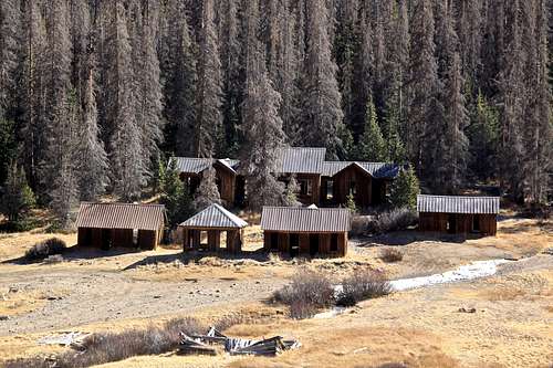 Carson City ghost town
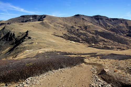 Carson Pass
Head up the road through aspen and conifer forest. The road climbs steeply, higher up you will encounter a few primitive camping spots. The road was not very difficult, and I would almost say that the roughest section were lower down. I chose to stop at the old townsite of Carson since per other reports the road higher up was supposedly in a bad condition. However, as of October 2016, the road was good to go all the way to the Carson Pass. Carson Pass is not signed, but it is an obvious highest point of the road. There is plenty of parking. If you choose to park at the ghost town of Carson as I did, it will add about one mile to your hike, and some elevation gain. The Wager Gulch Road is about 5 miles long and the driving is slow.
Route
East Ridge - an easy tundra stroll from the Bent Peak. Rated as class 1+. Start at the Carson Pass, hike to the obvious summit of Bent Peak, and from here you can view your way to the summit of Carson Peak. There is no trail in between Bent and Carson (at some places some elk trails), but walking is easy on grass and short sections of talus. It is about 1.2 miles in between the peaks, and the saddle between Carson and Bent Peak is at 13,020 feet elevation.West Ridge - a lot more interesting route with some exposure on a narrow and loose ridge for a short section. I used this route for my way up "Tundra Top". The initial descent on west ridge is easy, then it becomes rocky and finally at the low point it becomes a very narrow exposed and loose ridge. Pay some caution here. You can see Colorado Trail and Continental divide trail on the south side. The route finding is very obvious. There are section where you can drop down to CDT and Colorado Trail, but I chose to stay high and continue towards the summit of "Tundra Top".
The summit of Carson Peak offers nice views, there is a summit cairn and glass sign in register.
 Bent Peak from the East ridge up Carson Bent Peak from the East ridge up Carson | 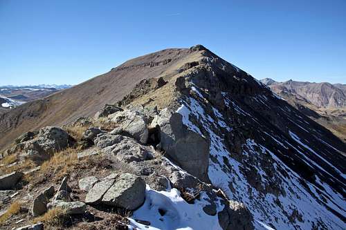 Carson - East Ridge Carson - East Ridge |
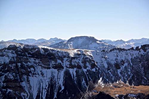
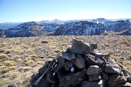 Summit cairn Carson Summit cairn Carson | 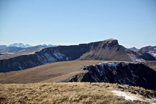 Half Peak with a boring looking "Tundra Top" below it Half Peak with a boring looking "Tundra Top" below it |
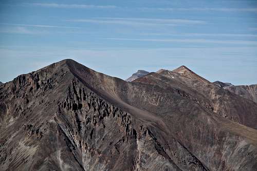 Sunshine and Redcloud Sunshine and Redcloud | 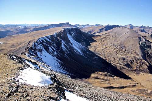 Tundra Top and Cataract Peak Tundra Top and Cataract Peak |
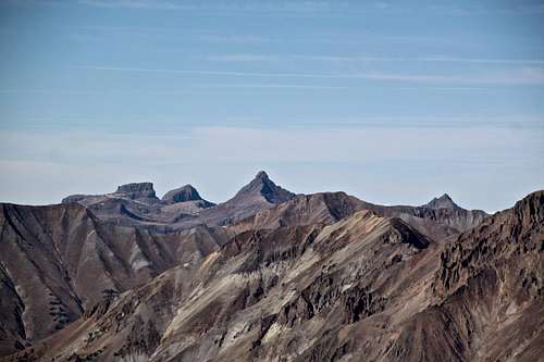 Wetterhorn Peak Wetterhorn Peak | 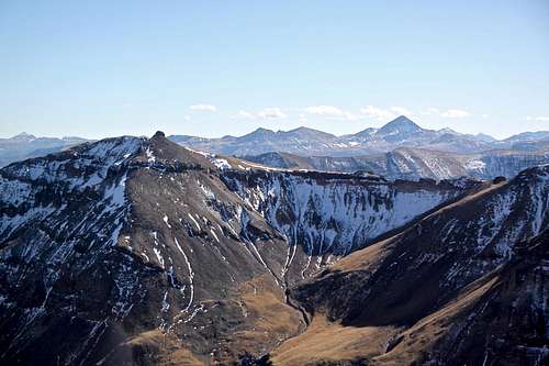 UN 13581 and Rio Grande Pyramid UN 13581 and Rio Grande Pyramid |
 Pole Creek Mountain Pole Creek Mountain | 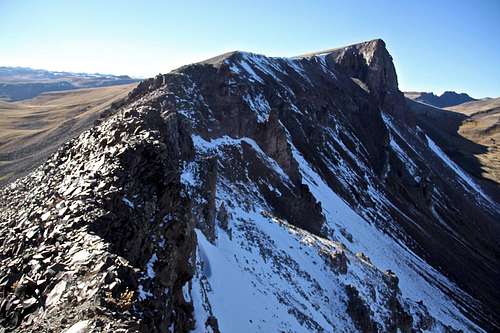 Carson - West ridge Carson - West ridge |
 CDT and Colorado Trail below west ridge of Carson CDT and Colorado Trail below west ridge of Carson | 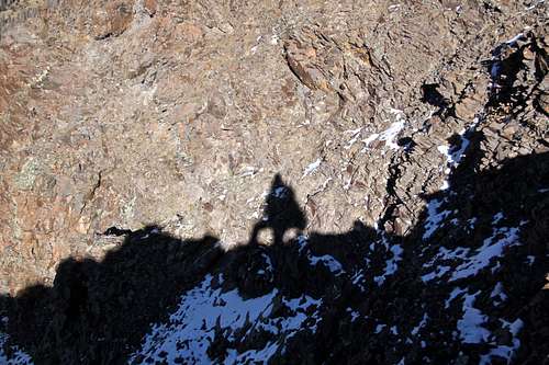 Shadow on the rocks Shadow on the rocks |
Red Tape
Driving to trailhead, parking and hiking are free. The peak is not a part of wilderness area. It is located in the Gunnison National Forest.
When to Climb
Summer is obviously the easiest, but autumn and spring are excellent as well. Winter would add a longer access, and some avalanche exposure. (The road up Wager Gulch is a little bit over 5 miles long and is closed in the winter).
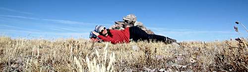 My idea of mountaineering - siesta on the summit of Carson Peak
Camping
Primitive camping along Wager Gulch road - higher up. The lower part of the road goes through some private property and the road is too narrow and steep to stop and find a parking spot.
Forest Service Campgrounds:
- Lake Cristobal: Wupperman campground, on the east side of Lake San Cristobal, 15$ per night, vault toilets, grills, picnic tables. Reservations possible.
- Williams Creek: no reservations. First Come, First Serve basis. 14$ per night. There is drinkable water. 23 campsites.
- Mill Creek Campground: 7$ per night, BLM campground, 22 sites.
I don't stay in campgrounds since there are so many options for primitive camping in a high country.