
-
 15823 Hits
-
 80.49% Score
-
 12 Votes
|
|
Mountain/Rock |
|---|---|
|
|
44.08790°N / 103.7227°W |
|
|
Pennington |
|
|
Hiking |
|
|
6358 ft / 1938 m |
|
|
Overview
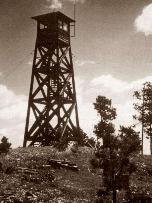
The old fire tower on Castle Peak
The site of a former Black Hills fire tower south of Rochford, Castle Peak is a ranked summit that provides some good hiking and a great summit view of the Deerfield – Rochford area and beyond. According to Lists of John, Castle Peak ranks #30 for Black Hills summits, and has 448 feet of prominence. Located about 25 miles west of Rapid City, the summit is on public lands managed by the Mystic Ranger District of the Black Hills National Forest (605-343-1567).
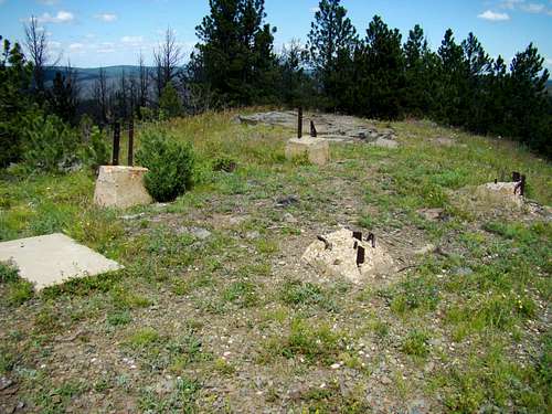
Fire Tower Ruins
The old wooden fire tower that stood at the summit for many years, was built around 1937. There used to be a cabin and garage by the tower that was used for living quarters for the ranger. Ironically, the fire tower was burned in 1964.
This area of the Black Hills saw rapid settlement in 1877 with major gold strikes nearby in the Rochford area. Rochford was founded that year and the population mushroomed to almost 1,000 people within two years. As the gold played out, people moved away. By 1900 there were only a few hundred people left. Now the population is about 25. This area is north of the Pe’ Sla, or Reynolds Prairie area, which is sacred to the Sioux tribe.
With binoculars, some of the major Black Hills peaks you can see from the summit, would include Harney Peak, Sylvan Peak, Hat Mountain, Crooks Tower (but only if you know where to look), Terry Peak, White Tail Peak, Flag Mountain, and Custer Peak.
Getting There

First Junction
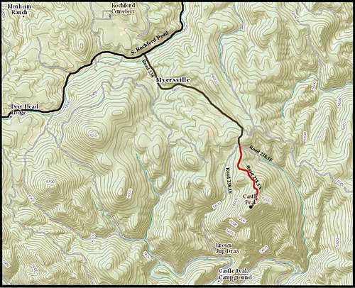
Road 238, about 2.6 miles south of the unincorporated village of Rochford, and which intersects with South Rochford Road, is the reference point for most trips to Castle Peak. You can get to Rochford by paved road, on the North Rochford Road from Highway 85. From Deadwood, it is about 23 miles. If you are traveling from Newcastle, Wyoming, it is about 63 miles to Road 238.
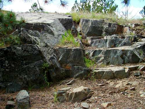
Natural Stairway at the Summit

Second Junction

Third Junction
For those traveling by way of Deerfield Lake, which would include those traveling from Rapid City or Hill City, access to Road 238 is about 10 miles from the South Rochford Road intersection with Deerfield Road.
As you travel up Road 238, please be aware you are in an area called “Myersville”. It shows up on some maps. The residents there make it very apparent they want no trespassing, and they have posted their own 5 MPH speed limit signs at the start of Road 238.
To reach the main route to the summit of Castle Peak, drive up Road 238 for about 1.4 miles. Avoid driving down intersecting roads, which would include 238.1N and 238.1B. You should come to a 3-way junction, with 238.1E as the right road, 238.1F as the left road, and 238.1A as the center road. The center road is your route. There are enough roads and junctions on and around Castle Peak, that taking the wrong one will waste your valuable time.
The photo series to the right show the sequence of road junctions going to the trailhead.
Route
Castle Peak Summit Route
It is only a little over 1 mile to hike to the summit from this 3-way road junction. The trail/road is well-defined with no junctions from this point to the summit, so it is very simple and straightforward from here on.
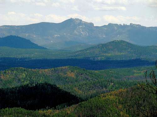
View of Black Elk Peak from the summit
Please be aware there is occasional traffic to the summit, usually in the form of ATV’s. When you see how rough, narrow and steep the old fire tower road is further up, you will see why few people would attempt this “road” with a Jeep or SUV. But ATV’s seem to handle this fine. Castle Peak lies in the Pennington USGS Quad. One of the best maps for this area is the National Geographic Black Hills North Map. Also very helpful is the free Black Hills Motor Vehicle Use Map, available at all the forest service offices in the Black Hills.
Red Tape
Castle Peak is on public land, managed by the National Forest Service. As long as you observe campfire and firearms regulations, you should have no problems on the public lands. Also, if you respect private property in the area, you should have no problems with the owners. Please be aware, though, that the area is used in season by hunters. Wearing orange when you hike during hunting seasons is wise.
When to Climb
This area is open year around. But, like most summits, hiking during lightning storms or blizzards is not wise. Use your best judgment. For the latest weather forecast and conditions, click on the link below:
Castle Peak - Rochford Area Weather Forecast & Conditions
Camping
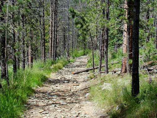
The upper trail to Castle Peak
The closest camping to Castle Peak is the Castle Peak Campground. Information links are available below:
Castle Peak Campground
Deerfield Lake, about 10 miles south, also has a variety of camping and lodging options. You can access their links below:
Mountain Meadow Resort at Deerfield Lake
Deerfield Reservoir Complex Campgrounds
If you choose to do some back-country camping on National Forest Land, please be aware of their guidelines:
Black Hills National Forest Camping Regulations
Resource Information

Castle Peak Geodetic
This is the information to contact the managing office for this part of the national forest:
Mystic Ranger District
8221 South Highway 16
Rapid City, SD 57702
(605) 343-1567