
|
|
Mountain/Rock |
|---|---|
|
|
45.79173°N / 10.89706°E |
|
|
Hiking, Via Ferrata |
|
|
Spring, Summer, Fall |
|
|
5699 ft / 1737 m |
|
|
Overview
Corna Piana 1737 m
In this page it will be described a mountain named Cima Corna Piana, situated near Monte Altissimo di Nago in the Monte Altissimo - Monte Baldo area and belonging to the Prealpi Venete e Trentine, not to be confused with the namesake and highest Corna Piana in the Prealpi Bergamasche. Corna Piana is a minor but very interesting mountain, due to the fact that it is located within the Corna Piana Botanical Reserve, which hosts a great variety of floral species including various endemics and some rarities. The reserve is part of the larger "Monte Baldo Local Natural Park", created in 2014 by the Municipalities of Baldo on the Trentino side and which brought together the protected areas of the area in a single management.
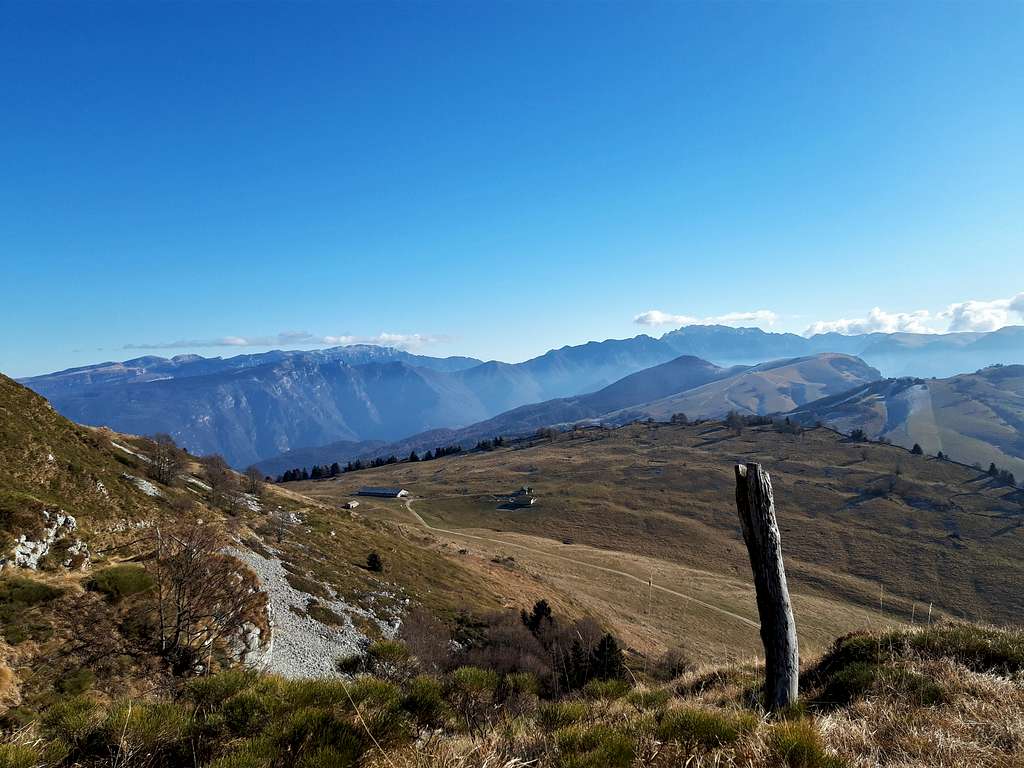
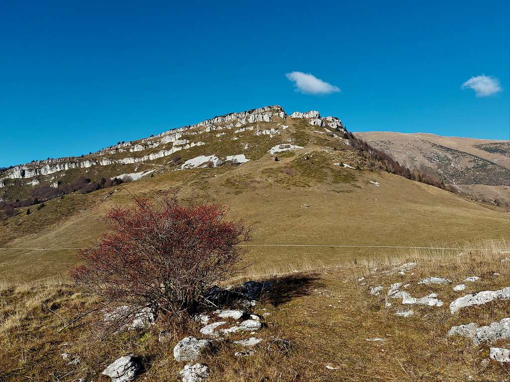
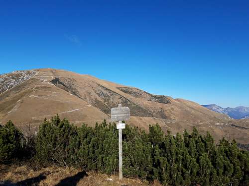
The name Corna Piana reflects the environmental situation, it is a vast limestone platform, almost a small plateau, supported by a rocky barrier to the south, the Crone de Bes. Moreover the top of Corna Piana offers vast views of the Monte Baldo group, Monte Altissimo di Nago, the Vicentine Prealps, the nearby Corno della Paura and Monte Vignola and glimpses of the Valle dell'Adige and the Valle del Sarca. The interest of this mountain is also linked to the presence of the Sentiero Attrezzato delle Vipere, which allows you to reach the summit with an easy itinerary partially aided with metal cables, particularly suitable for beginners tackling this type of terrain for the first time.
Another important reason of interest: the area is affected by the works carried out for the Great War, such as the "Generale Graziani road" known as Strada Panoramica del Baldo and the branch (dirt road closed to traffic) towards Monte Altissimo di Nago. There are numerous positions, trenches, areas for heavy artillery, holes and traces of barracks. Corna Piana and Monte Altissimo were occupied by the Italians at the beginning of the conflict in order to control upper Garda and the access routes to Val d'Adige.
Getting there
The starting point is Passo San Valentino 1314 m, connecting the valleys of the Aviana and Sorna streams, in the North-Eastern area of the Monte Baldo massif by means of a panoramic road, entirely asphalted - From A22 Autobrennero exit Rovereto Sud and follow the signpost to Mori, then to Altopiano di Brentonico. Take the road SP3, pass the town of Brentonico and at the fork keep right to Passo San Valentino.
Sentiero Attrezzato delle Vipere
Cima Corna Piana across Sentiero Attrezzato delle Vipere
Summit quote: 1737 m
Difficulty: EE
Difference in level: 405 m
Time required: 3 hours round trip
Starting point: barrier beyond Passo San Valentino 1329 m
Interesting itinerary with a very short and easy aided stretch that does not require the use of the Via ferrata gear.
The start is from the barrier beyond Passo San Valentino. Park the car along the road, not accessible beyond the barrier. Alternatively it's possible to start walking from Passo San Valentino and follow the road by walking (parking lot nearby the restaurant). From here take walk on the road for about 5 minutes and then take to the right the path "Sentiero delle Vipere" n. 650. Initially walk along a steep meadow, to almost immediately enter the beautiful beech forest that you climb up a steep path with hairpin bends until you reach the starting sign of the equipped section.
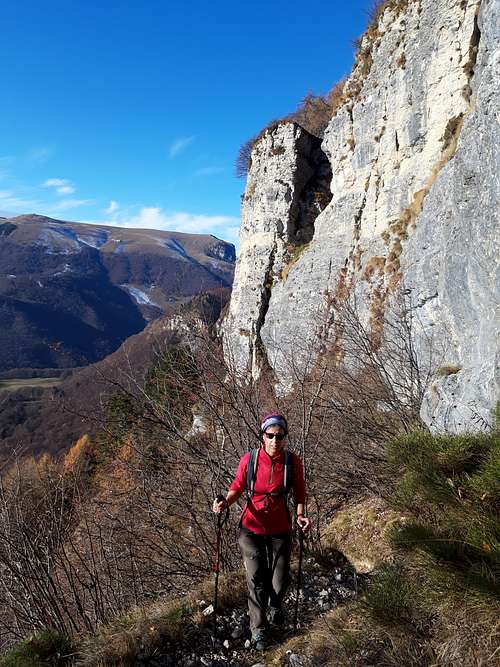
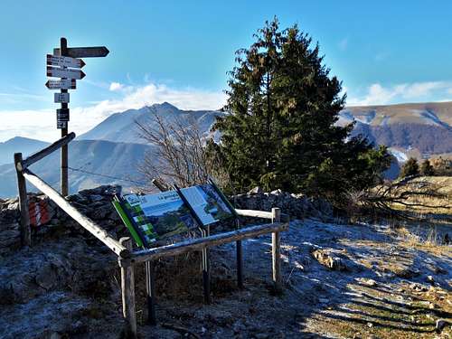
Pass immediately two very short rock walls equipped with metal steps. After these low walls you quickly reach the succession of grassy ledges with vegetation cutting the wall and equipped with metal ropes. In the final part, you pass some hairpin bends on stepped ground, after which you come out into a beautiful clearing with info panels from where it appears a beautiful view of the Bes meadows and the elongated Cima di Corna Piana which appears protected by steep limestone walls. Now cross the Bes meadows slightly downhill in the direction of the Malga Bes, reaching the alm then a crossroads. Here you take a small road on the left which you follow briefly and then ignore it to take a track to the right that climbs towards the mountain. The path climbs obliquely to reach the rocky walls, reaching the left end of the flat summit ridge. Reached the ridge, turn right and walk along the not very steep summit ridge skirting the trenches and various WWI gun emplacements until you reach the summit.
Descent: there are two possibilities.
A - from the summit reverse the same itinerary to reach the crossroads near Malga Bes. From here take the forest road n. 18 which reaches the paved road that descends from the Refuge Graziani. Following the paved road you return to the barrier near the San Valentino Pass
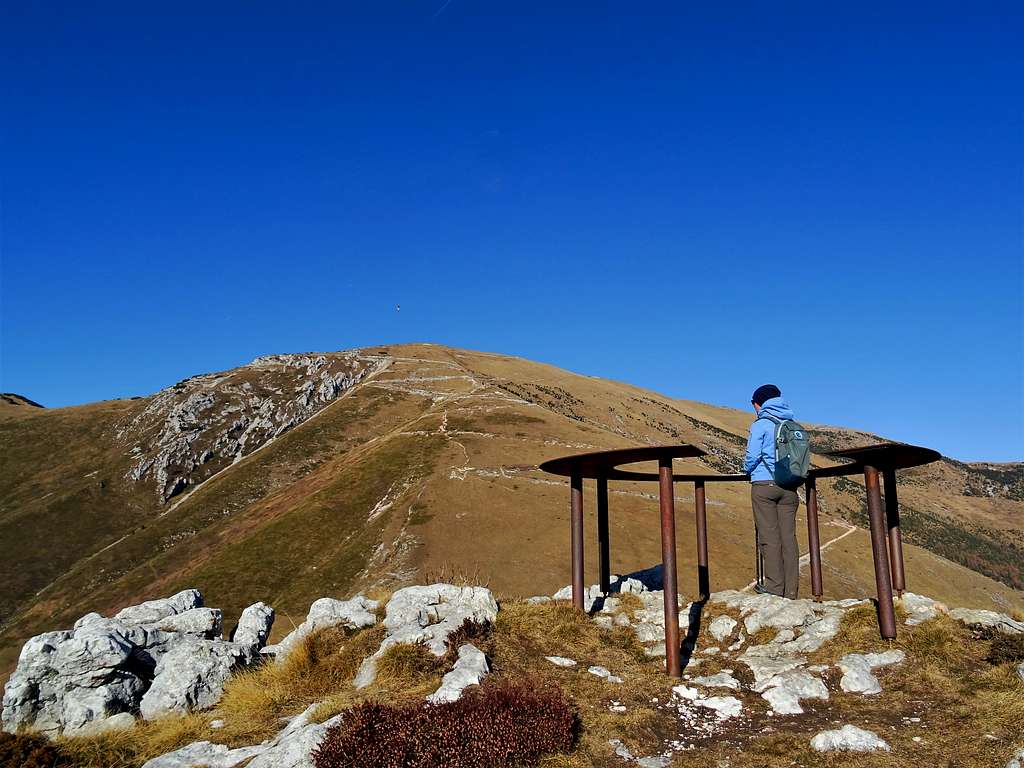
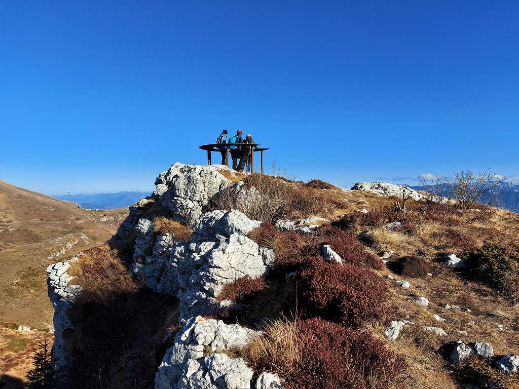
B - from the summit reverse along the ridge and reach a crossroads from where, instead of returning to the Bes meadows, you head right in the direction of the Monte Altissimo towards a second hill which you will soon reach. Here there is a beautiful "table de orientation" through which it is possible to identify all the surrounding mountains at 360°. From this second peak you always go down towards Monte Altissimo di Nago to reach the Refuge Graziani. From here, take the asphalted road to the left that runs for a few kilometers passing near the Rifugio Fos-ce. After a couple of tunnels the road continues to finally reach the barrier.
Red Tape
No fees no permits required. The transit of private vehicles is not allowed on the road beyond the San Valentino Pass.
When to Climb
The best period goes from April to November.
Accomodation
Different possibilities of accomodation in Brentonico and surroundings.
Rifugio Graziani
Rifugio Fos-ce
Bibliography
"Ferrate dell'Alto Garda" - Fabio Della Casa - Idea Montagna Edit. 2014