
|
|
Mountain/Rock |
|---|---|
|
|
46.09805°N / 11.14392°E |
|
|
Trentino |
|
|
Hiking, Sport Climbing, Scrambling |
|
|
Spring, Summer, Fall, Winter |
|
|
3599 ft / 1097 m |
|
|
Overview
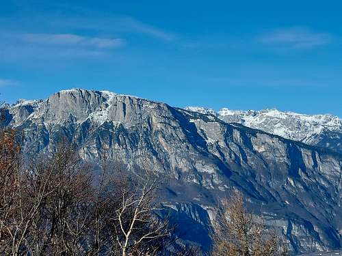
Monte Calisio 1097 m
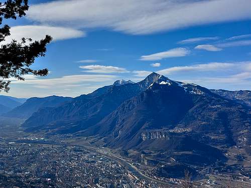
Monte Calisio 1097 m is a mountain slightly exceeding the altitude of one thousand meters and closely dominates the Adige Valley and the town of Trento, as well as the inhabited centers that surround the town, such as Villamontagna, Montevaccino and Gardolo, now all suburbs of Trento.
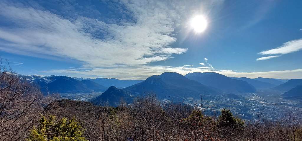
The mountain is also called Argentario and is a very popular destination in all seasons also due to its proximity to the town. Despite this fact it offers a beautiful environment of woods and rocks and along its slopes there is a remarkable network of different itineraries to reach the top. The summit offers a magnificent view of the Adige Valley, part of the Valsugana and the surrounding peaks.
Monte Calisio hosts what has been defined as the largest fortress in Trento built by the Austro-Hungarian Empire. There was no fighting on this mountain, but inside the mountain it was made one of the most advanced achievements of the Austrian Military Engineers of the First World War. Thousands of tons of rock were excavated and still today the Calisio offers the opportunity to visit tunnels, caves, concrete bases of an anti-aircraft battery, a reflector and battery posts as well as observation points.
Getting There
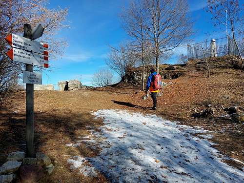
From Trento take the SS47 della Valsugana towards Padova. At the first exit, leave the main road and turn right towards Cognola - Povo - Martignano. Follow the signpost to Cognola. You cross the village uphill and continue to head towards Villamontagna which is reached at an altitude of 570 m. This is one of the possible starting points. Alternatively, for a shorter route, from Villamontagna it is possible to drive up to the Rifugio Campel, where there is a parking lot just beyond the refuge and where it starts the shortest route to the summit.
Monte Calisio loop from Rifugio Campel
Difficulty: E
Difference in level: 250 from the parking lot at 758 m
Pleasant walk starting from the Rifugio Campel.
Access
Driving up from the village of Villamontagna you reach the Rifugio Campel. A hundred meters after the refuge there is a convenient parking.
Route
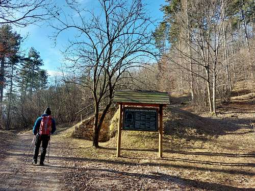
From the Campel car park, take on the left the path SAT 421 and follow it, then take the 403. It passes near the Calcara del Campel (very short detour on the path 403a to visit the calcara , an interesting and well-preserved artifact for the production of building lime.
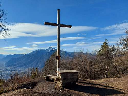
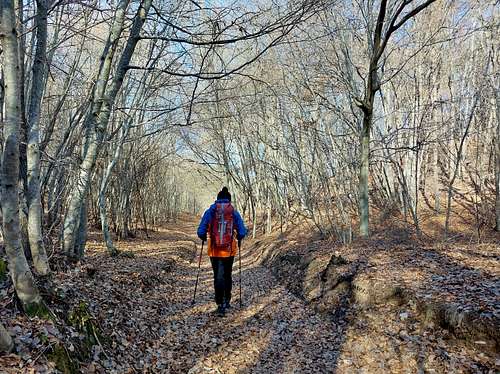
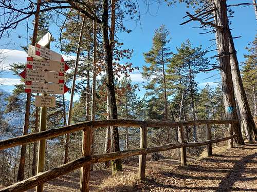
Resume the path 403 and continue climbing regularly in the beautiful wood, then descend slightly, start climbing again and cross a second lighter hollow in the locality Sella di Val Mistai. Then the path starts to rise again, until it reaches the summit cross from which you can enjoy a beautiful view towards Monte Celva and Marzola, the summits of Monte Bondone and further away the Valsugana with the Vigolana group and the Lagorai mountains. On the summit plateau there are some artifacts from the Great War. The cross is not actually on the very top. To reach the highest point, cross briefly the large wooded summit plateau to the West, go near a wooden signpost on the western edge of the summit and briefly to the right at the top. From here it is possible to complete the panorama with a North view toward the Alto Adige and a North West view to the Paganella and the Brenta Dolomites.
Descent: reversing the forward path, various variants possible.
Route from Pinara
Difficulty: EE (a very short stretch with fixed ropest)
Difference in level: 700 m from Pinara
Exposure: NW
The trail n. 401 to Monte Calisio starts from Pinara 391 m near the village of Martignano, to the right of the road to Montevaccino. It climbs steeply with numerous hairpins in the black pine forest, reaching the Prademala locality at 460 meters. At this crossroads ignore the Sentiero delle Milizie (401A) to Maderno, closed due to landslides. The path proceeds in the wood, rapidly gaining altitude and finally exiting on the mule track of Strada della Flora, from which it shortly reachs the mule track of Quattro Strade, an important crossroads near the former Rifugio Monte Calisio, unfortunately in a state of abandonment.
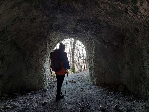
The ascent becomes easier as you walk on a former military road that leads, after a few hairpin bends, to a wooded shoulder on the north-western ridge of the Calisio. Along the path you reach the entrance of a first tunnel (Stól) which constitutes the lower access to Forte Monte Calisio, then you reach with wide hairpin bends the Stoi locality at 1040 m below the summit.
Here starts the main tunnel that leads up to the summit (torch and helmet required). However, you can also choose to go up by following the main path.
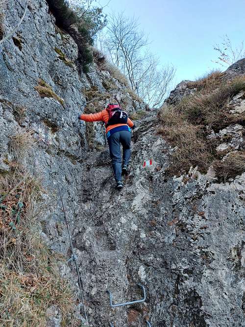
After the crossroads with the path 430 coming from Montevaccino-Forte Casara you arrive at the base of a short and easy rocky outcrop, equipped with some metal ropes and steps and about 5 meters long. From Stoi it is also possible to reach the ruins of the former Casara fort in about 20 minutes. After the fixed equipment we continue in the woods between some positions and trenches and soon we arrive on the rounded summit of the mountain.
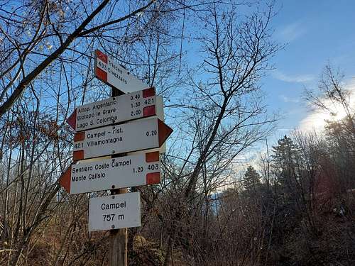
From Lago Santa Colomba to Monte Calisio
Difficulty: E
Difference in level: 250 from Lago di Santa Colomba
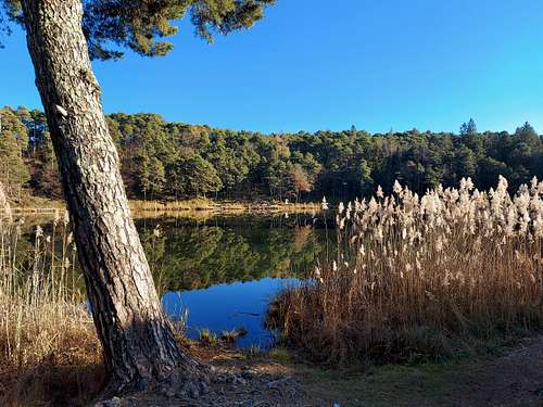
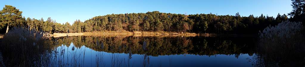
The Lago di Santa Colomba is located on the road that connects Civezzano and Albiano. Once you have reached the small lake, take the path SAT 421, getting the Le Grave biotope, where there is a reed bed, the ideal habitat for some amphibians and birds. The wide path to Monte Calisio continues uphill, passes next to the remains of the Casara bastion, where it begins to narrow and continues to the top.
Red Tape
No fees no peermits required
Summit views
When to Climb
All year round
Accomodation
Various possibilities in the surrounding villages.
Bibliography
- Sui Monti del Trentino, SAT - Euroedit srl
- Il Monte Calisio: ieri oggi domani, S.A.T. sezione di Cognola, Ed. Arca, Trento 1992
- Il Calisio e la Grande Guerra, Volker Jeschkeit, - Curcu Genovese, Trento 2008