
-
 5688 Hits
-
 84.27% Score
-
 18 Votes
|
|
Mountain/Rock |
|---|---|
|
|
38.98385°N / 122.79454°W |
|
|
Lake |
|
|
Hiking, Scrambling |
|
|
Spring, Summer, Fall, Winter |
|
|
2874 ft / 876 m |
|
|
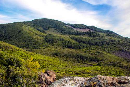
Overview
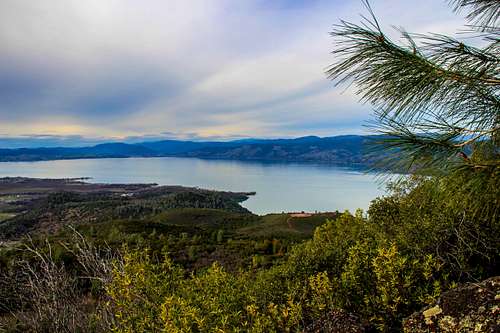
Northwest Clear Lake from Clark Peak
The summit rocks are class 3 and there are fine views of the north part of Clear Lake and surrounding mountains.
The round trip hike is approximately 4 miles with a 1,000' el. gain.
Getting There

Gate at trail head to Clark Peak

Dirt road up from Soda Bay Road
Route

The "K" rocks at a break in the use trail

Old orchard with Clark Peak above before the use trail
Poison oak may also be out in force on the summit use trail!
![West view from Clark Peak summit rocks]()
West from summit rocksThe route to this peak runs through Clear Lake State Park and there are no posted restrictions.![Snow Mtn. from Clark Peak]()
Snow Mtn. from Clark PeakYear around. Probably spring or fall would be best. There could be snow in winter and it can get upwards of 100 degrees in the summer.![Pine Mtn. across Clear Lake from the Clark Peak trail]()
Pine Mtn. from the Clark Peak trailClear Lake State Park offers a nearby camping option.![Mt. Konocti from Clark Peak]()
Mt. Konocti from Clark Peak Click here for the weather and forecast for Kelseyville.
Red Tape
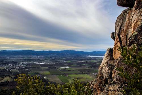
West from summit rocks
When to Climb
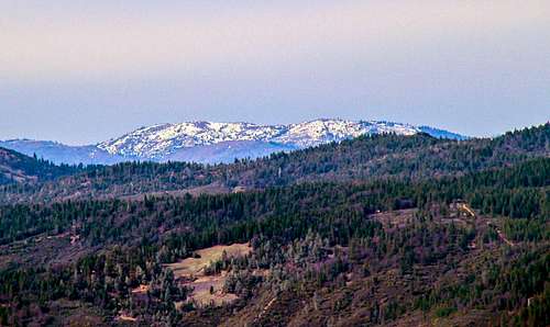
Snow Mtn. from Clark Peak
Camping
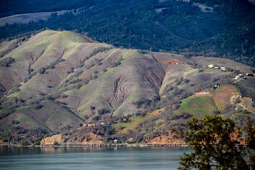
Pine Mtn. from the Clark Peak trail
Current weather and forecast
Mt. Konocti from Clark Peak
Bob Burd - Mar 11, 2014 12:30 pm - Voted 10/10
Poison OakDon't forget to mention that the use trail has an abundance of poison oak to avoid as well! As always, your pictures are far better than my own. You actually make it look worthwhile to visit. :-)
Noondueler - Mar 11, 2014 8:21 pm - Hasn't voted
Re: Poison OakThanks Bob. I actually didn't see any poison oak at this time. Just that nasty brush whatever it is. I did a ridge above Lakeport yesterday and had to plow through a bunch of it on an old fire road there. Checked good for ticks and was ok! You're right the brush up here can be a real bear! I know you did a piece on ticks a while back. What do you recommend for dealing with them when you have to go through stuff like that? -Windsor
Bob Burd - Mar 19, 2014 3:53 pm - Voted 10/10
Re: Poison OakI'm wondering if the PO just wasn't leafing out when you were there, but it was definitely in abundance when I went through. Regarding ticks, my recommendation is pretty much spelled out in the article you referenced - wear light-colored clothes, long sleeve shirt/pants. Check for the pests periodically (but don't get obsessive) and do a thorough check when you shower later.
Noondueler - Mar 19, 2014 7:51 pm - Hasn't voted
Re: Poison OakMaybe it was lack of rain, too in early in the season. There wasn't enough for me to take notice. I will mention it though since it will no doubt be back. Thanks again Bob.