
-
 9203 Hits
-
 80.02% Score
-
 12 Votes
|
|
Mountain/Rock |
|---|---|
|
|
38.88280°N / 105.0613°W |
|
|
El Paso |
|
|
Hiking |
|
|
Spring, Summer, Fall, Winter |
|
|
11838 ft / 3608 m |
|
|
Overview
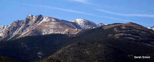
Pikes Peak Highway with Elk Park Knoll in Right Foreground
| Many locals know Elk Park Knoll better for being the site of the long-defunct Pikes Peak Ski Area. The ski area closed down for good in 1984 after 30 years of operation, but the old runs can still be seen when driving on Hwy 24 east from Woodland Park, and remnants of the operations can be viewed when hiking Elk Park Knoll from the south. Elk Park Knoll provides fantastic views with a dose of local Colorado Springs history, all very convenient to the metro area. Rank: Unranked Prominence: 218 feet USGS Quad: Woodland Park |  |  |
Getting There & Route Information
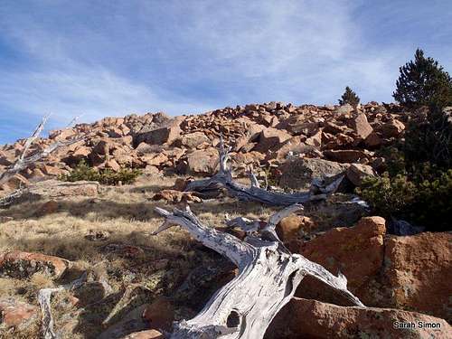
The boulder hop to the summit of Elk Park Knoll. 3 Nov 2012
Approaching Elk Park Knoll from the south (Elk Park pullout). 3 Nov 2012
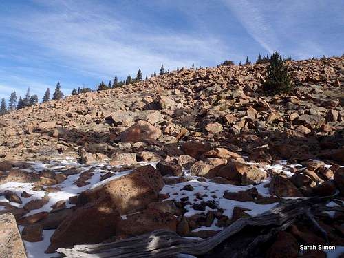
An easy boulder hop is required to reach the summit of Elk Park Knoll. 3 Nov 2012
Many will visit this summit from near mile marker 14 on the Pikes Peak Toll Road. From here the hike is less than a mile roundtrip. The route first descends from the Elk Park Turnout parking area, then re-ascends to gain summit of Elk Park Knoll on blocky boulders.
Per the Pikes Peak website:
Just before Mile Marker 14, you'll see a gate on the left (north) side of the Highway. This marks a steep turnoff that leads to Elk Park Pullout. Please be extremely cautious if you take this turn. The road is very steep and drivers often can't see over their car hood to ensure no one else is coming up this single-lane dirt road. If your vehicle has a long wheelbase, you may want to avoid this turn entirely as it is difficult to rejoin the highway without backing up on the return from Elk Park Pullout.
You may also wish to park at Mile Marker 10 and hike up the mountain. Either way, there is no trail to this summit.
Red Tape
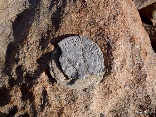
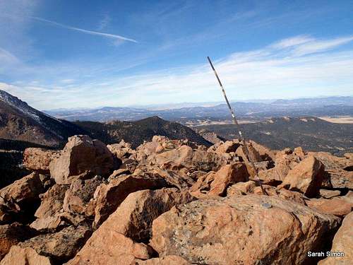
Summit Marker
If accessing Elk Park Knoll entirely on foot via a hiking approach from Cascade or thereabout, there are no fees to access the area. The biggest red tape to be aware of is to ensure you do NOT walk along the Pikes Peak Toll Road and cross only in designated crossing zones.
For those driving up the Pikes Peak Toll Way, usage fees and curfews apply.
•Curfew: Generally speaking, the gates at the tollbooth close at 7:00 PM in the summer and 5:00 PM in the winter. Check the Pikes Peak Highway Website or call 719-385-Peak to check when the gates will be closed for the day you plan to visit.
•Fees: As of this writing, the fee for the Toll Road is $10.00 per adult (16 and over $5.00 per child (6 - 15) or total $35.00 per car. Cash and credit cards (Visa and Master Card) are accepted.
Camping
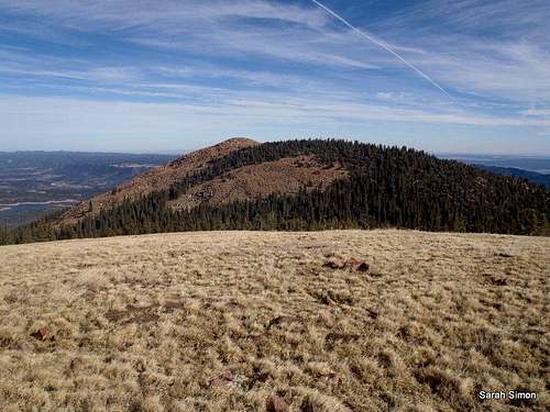
Views of Pikes Peak (14114 ft / 4302 m) from the summit of Elk Park Knoll 3 Nov 2012
The Pikes Peak Highway (toll road) from the summit of Elk Park Knoll. 3 Nov 2012
• South Meadows Campground: Site has 64 camp sites with parking areas up to 30' long within the 8,000' elevation. Camping season is year round with a user fee of $15.00/per night/per site. The camp-ground has paved roads. Limited sites are reserved by calling 1-877-444-6777. Reservations may be made 240 days prior to arrival and there is a reservation fee. There is also a 2-night minimum stay if your reservation is for Friday or Saturday nights.
• Colorado Campground: Site has 81 campsites with parking areas up to 30' long within the 7800' elevation. Camping season usually begins late May and runs until early September. The user fee is $15.00 per night/per site. This campground has paved roads. Limited site reservations can be made 240 days prior to arrival by calling 1-877-444-6777. There is a reservation fee. There is also a 2-night minimum stay if your reservations are for Friday or Saturday night.
• Painted Rocks Campground: This camping area has 18 campsites with parking areas up to 30' long within the 7800' elevation. Camping season usually begins in May and runs through early September. A user fee of $13.00 per night/per site is charged. Limited sites are reserved by calling 1-877-444-6777 and can be made 240 days prior to arrival. There is a reservation fee.
Additionally, the Crags Campground sits on the western slope of Pikes Peak and provides a convenient campsite option for anyone visiting “Little Pikes” from west. This 17-site campground sits at 10,100 feet in elevation about 8 miles south of Divide.
Weather & Seasons
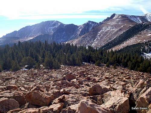
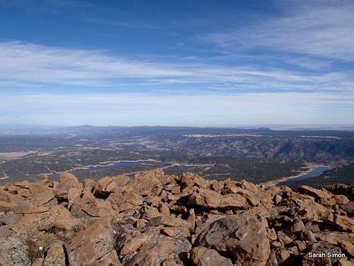
Views to the east (toward Colorado Springs) from the summit of Elk Park Knoll 3 Nov 2012
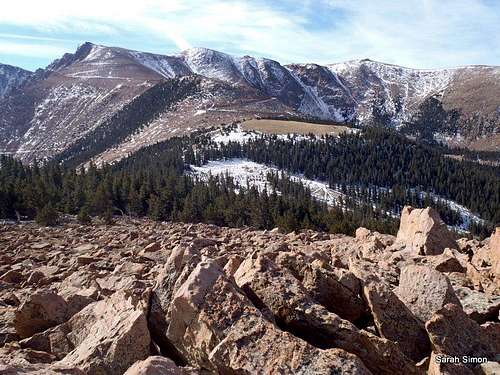
Views north
Views west
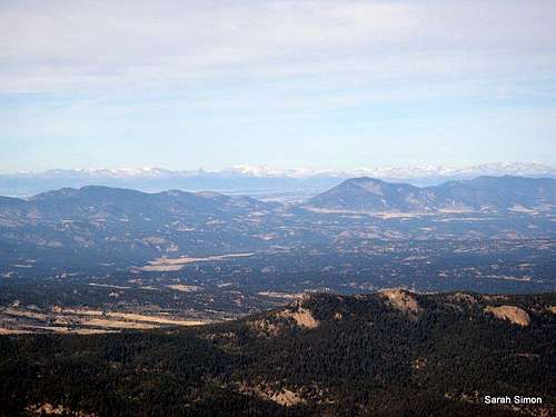
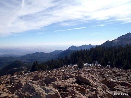
Distant western views
•Summer all but guarantees dense crowds and the dreaded afternoon thunderstorm. Start your day early and anticipate sharing the mountain with plenty of folks.
•Fall means shorter days, but also less afternoon thunderstorm threat. The aspen on the lower reaches of the mountain will delight, as will the orange-tinged alpine tundra. This is the high country, however, so be alert to rapidly changing weather and snowfall, even when the weather in Colorado Springs is quite pleasant.
•Spring and Winter may bring deeper snow, but less dense crowds. Barring a major snow event, the road to the summit of Pikes Peak generally is kept open to keep the tourist crowds happy and this peak should be accessible most days of the year, as a result.