How we got there
For the past 2 years, Grant and I planned to do the Pemigewasset (pemi) loop. The loop is achieved by combining the Lincoln woods, Osseo, Franconia ridge, Garfield ridge, twin way and Boncliff trails to make a massive 31.6 mile loop back to your car. This loop was named the second hardest day hike in North America by backpackers magazine. Most Normal people attempt the loop in 3 days, spending the nights at either the Garfield ridge and Guyot campsites or the Greenleaf (a bit out of the way) and Galehead huts. The loop includes 8 4000 footers (Flume, Liberty, Lincoln, Lafayette, Garfield, South twin, Bond and Bondcliff) with an optional 4 side trips to other 4000 footers (Galehead, North twin, Zealand and West bond) ranging in an distance between a mile to 2.8 miles each round trip. Being the smart lads that we are, Grant and I opted the join all 4 side trips to our hike, adding an extra 7.4 miles for a foot aching, knee busting, back breaking total of 39 miles.
In 2014, after weeks of planning, the forecast called for heavy rain and a good chance of T-storms all weekend. Being our first hike in the white mountains, we did not know how much exposure we were going to be subjected to on the hike so we took the wise decision to stay at home and postpone the hike to next year. 2015 came along and again the pemi loop was in our sights. This time, the weather called for nice weather on days 1 and 3 but again chances of t-storms on day 2. We sadly called off the hike and felt like we were never going to get to hike in the whites, ever! Our regrets for not going soon turn to relief and sadness after we hear that a man had died, struck by lightning on mount washington, on what was suppose to be our day 2.
Now to 2016. Sick of trying to find a good 3 day weather window to do our loop (3 day weather windows don't happen in the whites), we had our second smart idea. "Lets do it in two days!" I told Grant kind of as a joke but also hoping he would say yes. After a few days of crunching numbers, Grant came back with a "I think we can do it". We settled on the May 13-15 weekend which we were hoping was too early for bugs, extreme heat and thunder storms. Not knowing if we were able to actually do the loop in 2 days, we both took Friday off. We were going to start our hike on the Friday to give us a buffer zone on Sunday in case we weren't able to deliver. We drove down on Thursday night and got to the Stoney brook motel in Franconia at 9:30 that night. This time, the forecaster were calling for heavy rains (up to an inch) on Friday afternoon anytime after 3pm. The rain would stop around 2-3am on Saturday and start up again anytime after 4pm continuing on thru out the day Sunday. Wanting to beat the worst of the rain, we woke up at 3:45am on Friday and got going.
Here we go
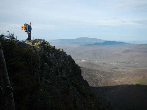
We got to the Lincoln woods parking lot at 4:45. Not knowing how to pay for our stay, it took use a few minute the locate the iron ranger and the envelopes to pay (3$ a day). We got going at 5, crossing the pemigewasset river and then following it for 1.4 miles via the Lincoln woods trail which is the remains of an old railway track. At our first junction, we stopped to de-layer and took the Osseo trail which would bring use 4.1 miles further to the summit of our first 4000 footer, Flume. At 6:30 or so, we stopped for our first break. Looking at the map, Grant and I were not on the same page as to how far we had already traveled. To my surprise, and to Grant's "I told you so" moment, we reached the summit of Flume at exactly 7:30. Only two and a half hours into our trip, we had already traveled 5 and a half miles with more then 3000 feet of elevation gain and I had already lost my first location debate with Grant. The Osseo trail must not be used very used very often or is very well maintained. Not much rock hoping or mud hoping, just 4.1 miles of great dirt packed trail.
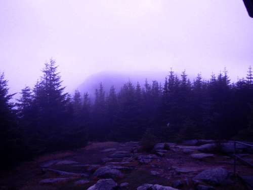
![Lookout near Flume's summit]() Lookout near Flume's summit
Lookout near Flume's summitAfter Flume, the Osseo trail changes to the Franconia ridge trail which would lead use to our next summit 1.1 miles away, 4459 foot tall Mount Liberty. From the summit of Liberty we carried on 2.2 miles the little Haystack mountain (not an official 4000 peak due to prominence) which brought use the terrain we were here for, an uninterrupted hike above tree line for nearly 3 miles. Sure, treeless summit and 360 degree views were all over the Adirondacks, where we usually hike, but full ridges of vistas and scenic views for more then an hour and a half, that's truly what brought use to this section of the white mountains.
![somewhere on the rigde]() somewhere on the rigde
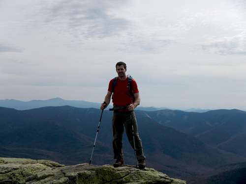
somewhere on the rigdeFrom little Haystack, we climbed the ridge to the top of Lincoln (5089') 0.7 miles away and then onto the highest point in the pemigewasset wilderness Mount Lafayette (5260'). From this summit, one can head west, down the Greenleaf trail to the AMC's Greenleaf hut 1.1 miles downhill from the summit. We didn't actually stay there but it is an "out of the way" accommodation option for people doing the loop in more then 2 days. At this point the wind was whistling over the mountains warning use of the weather changes to come. We spent 10 minutes, crouched behind a rock, soaking in the view from Lafayette's summit and having a well deserved snack. The bare ridge line was showing use the way towards our next summit, mount Garfield. It was now 10:15 by the time we left the summit of Lafayette and we headed downhill 0.8 miles to the Skookumchuck-Franconia ridge-Garfield ridge junction. We took the Garfield ridge trail towards our next summit which was now 2.7 miles to the north-east. By the time we reached the bottom of the Lafayette-Garfield col, we had dropped about 1500 feet only to have an 800 foot or so climb back up to the summit of mount Garfield (4500').
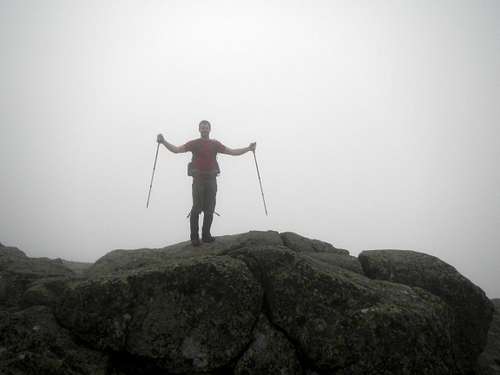
![Top of Lafayette]() Top of Lafayette
Top of LafayetteBy now, the sunny skies we started with at 5am had changed to a full overcast and we knew it was just a matter of time before rain would start. Mount Garfield is a real pain and really makes you work for yours fifth 4000er of the day. From the top of Lafayette the trail had already dropped 1500', back up 800' to the summit and now it drops another 1000' to the Garfield-Galehead col. A real spirit breaker :) . To add to the miserable ups and down, the trail was starting to get covered in ice/snow. We put on our micro-spikes which at this point we didn't know we were going to wear then for almost the rest of the hike. On the summit, you can find the remains of what seems to be the foundation to and old hut or shelter which would now only make a great bathtub for 20 tired hikers. From the summit of Garfield its downwards 0.2 miles to the Garfield trail junction, we stayed on the Garfield ridge trail (the Garfield and Garfield ridge trails are two different trails. If you are doing the pemi loop, stay on the Garfield ridge trail) and an other 0.2 miles onwards we found the water source for the Garfield ridge campsites. This is a great spot to fill up now empty water bottles as we did at this spot. From the water source, its 2.7 miles to the Galehead hut (our lodging for the night).
![Top of Garfield]() Top of Garfield
Top of GarfieldIt's now 2:30 by the time we reached the hut and it's still not raining. We got greeted by the caretaker who filled use in on the accommodations and took our 33$ each for our stay that night (the hut is 33$ for non amc members and 27$ for member. This fee changes throughout the season). The Galehead hut was great, comfy bed, electricity, running water and propane stove. They even have snacks, t-shirts and other merchandise you can purchase. From the hut, we could see the summit of our sixth 4000 footer of the trip. Even though our plans were to hike up Galehead (2024') on day one, we knew it was just a matter of time before the rain would start. We decided, from the comfort of the hut, to have a late lunch and then make a decision one weather to make the 1 mile round trip or not. As we were eating, exactly and the weatherman predicted, the rain started and the call was made, "tomorrow it is". We were pretty happy about the decision to leave at such an early time, if we would have left 30 minutes later, all our stuff would have been wet. At 4 o'clock the first person from an other group walked in and every half hour, it seemed, one or two people would stumble into the hut soaked to the bones. Four guys even left their co-hikers (which were slower then them) behind to sleep in their tents or at the Guyot campsites while they made a late entry into this dry haven. This influx of hikers lasted until about 8pm at which time I decided to rest for the night. We would again start at 5am to avoid the afternoon rains that were possible for Saturday. The night was not great. The dampness from all the wet cloths made our bunkroom feel like a cold sauna. I would wake up every 2-3 hours all sticky from the damp atmosphere and cold.
Even if the sleep was not great, 4am came along pretty quickly. We grabbed all of our stuff from the room and exited to the living/dining area so to not bother everyone else who were still sleeping. After packing up our gear and having an oatmeal breakfast we headed up the top of Galehead. Half way up to the summit, we realized we still had our packs on, "what a bunch of dummies", we thought (this summit being a side trip, we could have left the backpacks at the hut). We dropped our packs, hit the wooded summit of Galehead marked by a cairn and then walked back down to our packs and back to the hut.
![View of Galehead from hut]() View of Galehead from hut
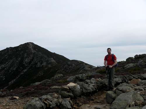
View of Galehead from hutFrom the hut, we now headed east to the summit of South twin (4902') via the twinway trail. This climb is a steady 0.8 miles uphill which gain over 1000'. The trail at this point is covered in patches of ice. We could have possibly bare booted this section of the trail but the micro-spikes almost made it too easy. It's now 6:15 and we were still in the clouds, hoping they would clear out of the way soon so we could have some views. From South twin, we dropped our packs and travelled 1.3 miles north to, easy enough, North twin (4761'). The 2.6 mile round trip was relatively easy but still full of ice. At 7:30, we picked up our packs again from the top of South twin and this time headed south-east towards Guyot, 2 miles away.
![View on Southtwin]() View on Southtwin
View on SouthtwinGuyot, over 4500' but not on the official list probably dues to prominence is where the twinway and bondcliff trails meet. The twinway continues east and the bondcliff goes to the south towards the 3 bonds brothers. We opted to follow twinway an other 1.4 miles to the east to make our third side trip of the day and our 9th 4000er of the weekend to Zealand mountain (4260'). 3/4 of the way to Zealand, Grant and I look at each other. God Damit! We were still carrying our packs on a trail we were going to double back on. We dropped our packs in shame, walked an othe 10 minutes to the summit and then walked back to our packs for a quick snack and water break. We then headed back to the twinway-Bondcliff junction where we took a later trail south toward the Guyot campsites where one can refill his water bottles (we bypassed the campsites since we had lots of water left).
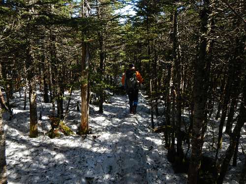
![Snow on the trail, Mid May]() Snow on the trail Mid May
Snow on the trail Mid May0.2 miles past the junction to the Guyot campsites is an other junction. This time the detour was a mile long round trip to West bond (4540'), our last side trip of the day (4th) and 10th 4000 footer of the weekend. This time we actually dropped our packs at the junction, not 5 feet from the summit like the previous side trip we had taken. The summit of West bond is totally worth the half hour detour and probably offers you the best bang for your buck out of any of our 4 side trip. The summit is quite small but gives you a 360 degree view of everything you hiked so far, about 28 miles at this point. We didn't stay very long, as my camera was still on my pack and so were our snacks and water. We hiked back to our packs which litterally took use 35 minutes from pack to pack.
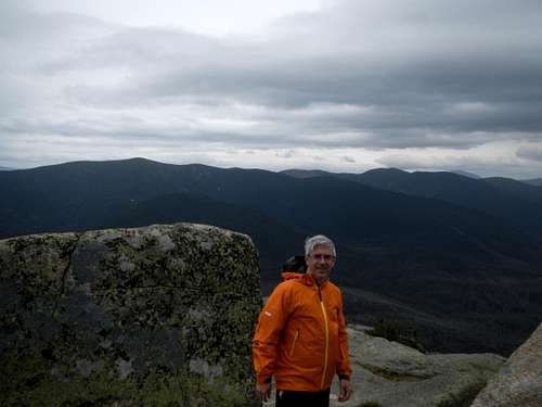
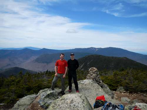
From the junction, it's an other half mile to the summit of Bond (4698') which is the highest of the bonds family. The view again is breathtaking and best of all, at this point, the snow is starting to disapear from the trail. This lad with his dog took a picture of use both on the summit and we kept going down the open ridge to the jewel of the bonds and last (12th) 4000 footers of the weekend, Bondcliff (4265').
![Top of Bond]() Top of Bond
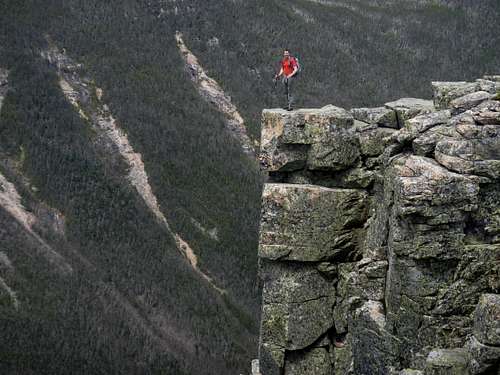
Top of BondBondcliff is just as beautiful as all the other mountains on this journey and probably the second most famous mountain on the loop (after Lafayette). It's not famous for its views (although great), the epic climb or its highest point but for the cliff from which you can stand on while someone takes a picture of you from about 200 feet away. If you enter Bondcliff on google, you will find hundreds of people who have posted a picture of themselves online standing on that very cliff. So, like good tourists, we both took turns standing on top of the cliff while the other ran to the picture spot and snap a few photos. It was now 1:30 and we knew all of our uphill was behind us. We stayed on the summit for about 15 minutes (the longest time we took on any summit this weekend) then packed out stuff and started the long 9 and a half miles or so bacvk to the car.
![Photo op. on Bondcliff]() Photo op. of Bondcliff
Photo op. of BondcliffFrom the summit of Bondcliff, the hike back down is again, like the trail up Flume, very nice and dirt packed which made it easy on the knees. The 4.4 miles back down to Lincoln woods trail was fairly uneventful except for our water bottle refills at a waterfall.The rest of the way back to the car seemed very long. Both Grant and I's bodies were starting to break down. I was sure that after every step my leg were going to cramp up, they were that tight. The conversations between Grant and I stopped. We were probably both swearing in our heads or encouraging ourselves without caring about the other one. At 4;50 we walked over the Lincoln woods bridge which crosses the pemi river. At the car, we were both grunting like cave men but we both otherstood the others message in a long forgotten but still used language. We were both hurting bad. After a 2 minute attempt to try to bend our bodies in my toyota Prius C, we headed straight to Black Mountain burger co. for a well deserved snack.
In resume, we hiked 39 miles in two days and went over 12 4000' mountains with about 12000' of elevation gain. We spent our night at the Galehead hut which was 33$ for non-AMC members during the off season. The trail was covered in snow or ice from the Lafayette-Garfield col all the way to the summit of Bond, the worst of it being from south twin to Guyot. We wore our micro-spikes almost all weekend. The weather could not have held off any nicer than it did considering the forecast. The trail from Lincoln woods parking to the top of Flume and from the top of Bondcliff to the parking lot is all dirt packed and very well maintained / easy on the knees.
Any questions or concerns about this extension of the Pemi loop or of other versions of the loop, feel free to ask.


Comments
Post a Comment