|
|
Mountain/Rock |
|---|---|
|
|
36.19053°N / 112.36073°W |
|
|
Hiking |
|
|
Spring, Summer, Fall, Winter |
|
|
6729 ft / 2051 m |
|
|
Overview
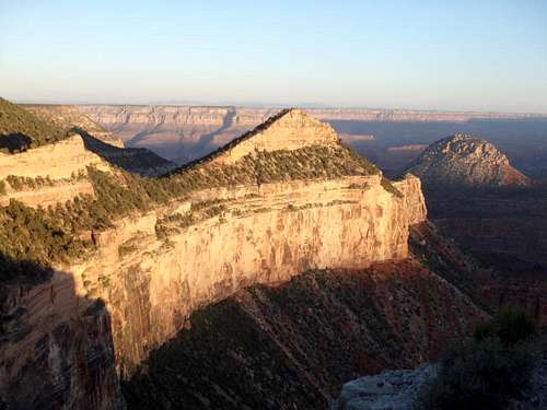
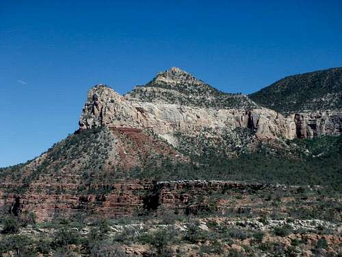
Fossil Mountain is arguably the easiest summit on the South Rim of the Grand Canyon. Located about 20 miles west of Grand Canyon Village on the south rim, the summit is a short, easy cross country affair utilizing use trails with class 2 at worst. The summit is well named, with seashell fossils studding the rocks leading up to the summit, and fantastic views to Mount Huethawali to the west and across the higher formations to the east. This is a solid summit for those looking to get into Grand Canyon summits, with the hardest part of getting there being the difficult dirt road to the start of the route at Havasupai Point. Nearby Mount Huethawali is another easier GC summit, and the two would make for good introductory GC summits while exploring the area.
Fossil from the South Bass Trail
Getting there is arguably more challenging than the climb itself. From Tusayan, drive north 0.9 miles from the last traffic circle north of town and turn left on to Forest Road 800, which quickly hooks south and becomes Forest Road 328. This is a nice place to camp at large if you're looking to avoid camping fees along the south rim. The first few miles of the road are in pretty good shape and slowly get worse as you pass the turn off for Rowe Well Road, an unrestricted road that connects Grand Canyon Village to the South Bass Trail (and a means to pick up a permit and not have to leave the park to get back to FR 328). Stay on 328 as the path becomes progressively more rutted. If you encounter soft mud that sucks at your tires early- turn back, it gets much, much worse and the road is truly impassable when wet. At a bit over 20 miles you'll cross into Havasupai Land and at ~22 miles, you'll reach a gate at Dodd Tank. This is occasionally staffed by a member of the Havasupai tribe collecting payment to pass through (more on that below). If no one is around, keep driving FR 328 (there is a dirt track which bypasses the gate to the left/south) for another 2 miles to reach Pasture Wash, which is described as a four way intersection, but in reality is two forks in rapid succession. Take the right forks both times and follow the handmade signs for the South Bass Trail. Continuing straight goes to Topocoba Hilltop, currently closed to nontribal members. Beyond Pasture Wash, the road gets even worse with ruts a good 8 inches deep. At this point you'll be heading northeast and will leave the tribal lands, reentering the National Forest. Another 2 miles will bring you to the National Park Boundary, and shortly after you'll pass an old NPS ranger station on the left, which has been out of use for decades. The road gets slightly better back on NPS land and you reach the South Bass trailhead about 3 miles from the NPS boundary. Just before reaching the South Bass Trailhead, there is a sharp turn off to the right, which goes another 3 miles past Signal Hill (and a cool old firelookout) all the way to Havasupai Point. I was able to negotiate the route with a Subaru Forester, but I needed every millimeter of clearance, and most of the other cars I saw in the area were lifted. Clearance is more important than AWD/4WD, although even the toughest car would struggle if the road was mud. The turn off to Signal Hill isn't too bad, although there were two rockier spots that made me a bit nervous.
Route
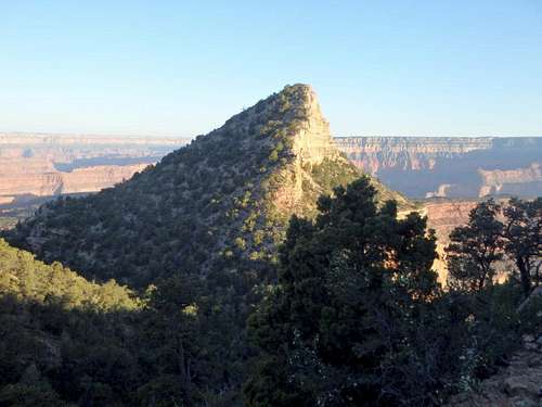
Fossil Mountain from just above the saddle.
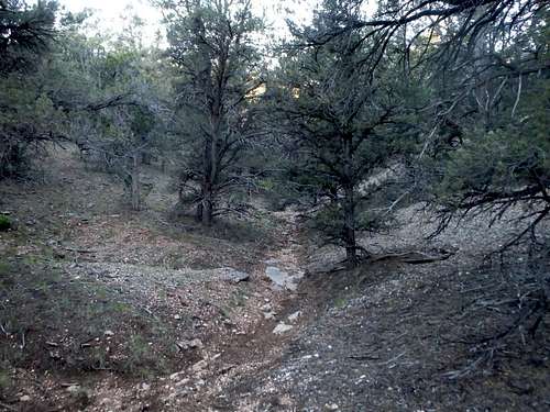
The gentle ravine.
Red Tape
This hike is entirely on NPS land, and technically a permit is required for any overnight use in the area of South Bass Trail including the trailhead, which has several nice campsites. That being said, this area is not frequently patrolled, and you could probably get away with camping there and not picking up a permit first- up to you if you'd like to risk it.
Crossing through the Havasupai Land is another issue. While most information online and even a sign at the gate suggests a $25 fee to pass through (which to be fair, is cheaper than what the NPS charges for entrance these days), based my most recent interaction with a tribal member at Dodd Tank, the Havasupai now expect you to call in advance to make a reservation to pass through, and seem to charge a similar fee structure as Havasu Falls- per hiker/ per day, even if you're on NPS land the entire time. I can not find this information anywhere else, and it may have been a misinformed tribe member, but something to be aware of if you're planning a trip to this part of the Grand Canyon.
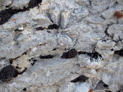
Namesake fossils!
When to Climb
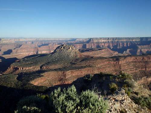
Summit view west.