
|
|
Mountain/Rock |
|---|---|
|
|
36.07071°N / 112.09045°W |
|
|
Trad Climbing |
|
|
Spring, Summer, Fall, Winter |
|
|
6071 ft / 1850 m |
|
|
Overview
Along the South Kaibab Trail in Grand Canyon National Park stands O’Neill Butte, a prominent Supai sandstone summit admired by 1,000s of hikers each year. It serves as a focal point for those trekking down to ‘Ooh Ahh Point’ and Cedar Ridge, and is one of the more highly photographed features in the park. Since the South Kaibab Trail skirts the base of O’Neill, it is also one of the most accessible summits in the park, at least for those with some technical climbing skills. O’Neill Butte has at least 5 different established lines to the summit ranging from 5.0 to 5.9, with plenty of opportunity to develop others for anyone looking for a project. The 3 pitch North Face routed rated 5.0 (described below), is the most common route up. Don't let the low 5th class rating lull you into a false sense of security- Grand Canyon summits are historically sandbagged and the rock tends to be soft and loose. Therefore, the majority of parties will want two ropes for this attempt, not only to protect the leader, but for the dramatic 150+' rappel directly down the East Face. A light rack with singles up to #3 or #4 will be more than sufficient.
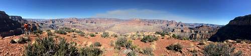
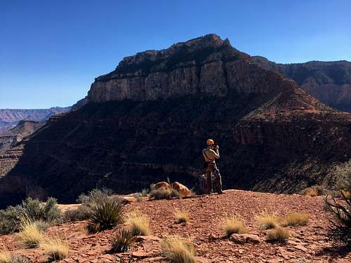
Summit Panorama
To get to the south Kaibab Trailhead, enter Grand Canyon NP via one of the various South Rim entrances. You can either park at the Mather Point visitor center and take the shuttle bus to the South Kaibab Trailhead, or park in one of the picnic areas near the turnoff for the trailhead, which adds about 0.25 miles of road walking each way.
You can reach the base of the North Face by hiking the South Kaibab Trail 1.5 miles down to Cedar Ridge (pit toilets). Continue down several more switchbacks to the obvious saddle with O'Neill Butte. Leave the trail here and find a use trail that skirts the east face to the northeast corner. Climb some easy class 3 near a very large pinyon pine tree up one ledge to the center of the north face and start of P1.
From the base of the north face:
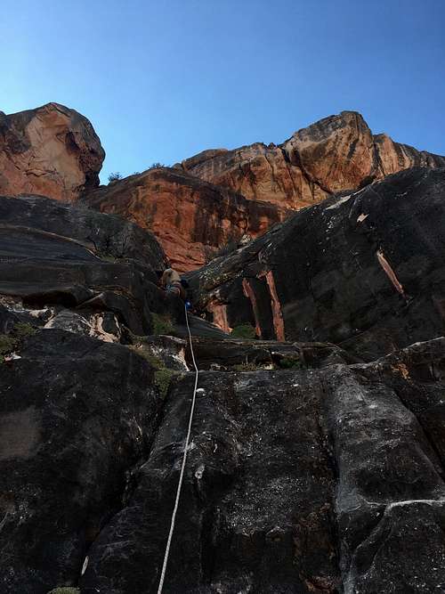
P1- About 50' of class 4 in the center of the face, up smooth dark slabs. This is the easiest pitch and some parties may choose to skip the rope.
P1- About 50' of class 4 in the center of the face, up smooth dark slabs. This is the easiest pitch and some parties may choose to skip the rope.
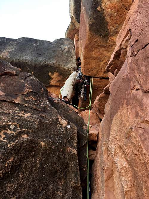
Pitch 2, the squeeze chimney just above the 10' dihedral.
P3- At the top of the squeeze pitch, move the belay about 10' south to an obvious chimney. Very easy climbing in the lower half ends with a slightly exposed mantle move out and to the right. A horizontal crack at the mantle can be use to protect the move with cams (BD #3 or #4) as well as passive pro with a nice narrowing partway across.
At the top of the third pitch, pick up a use trail to the northeast corner of the summit cliff bands with some brief and easy class 3 to the summit.
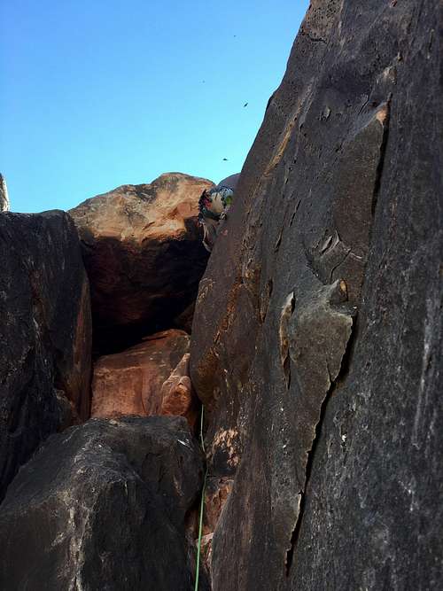
Pitch 3, with a tricky mantle exit.
To descend, scramble down the summit cliff bands and hike along the brim of the east face, finding a large dead pine tree near the center several feet from the edge. Don't let the fact that it's dead scare you, this has been used for rappelling for at least 20 years. Current setup is webbing with a Quicklink, plan on bringing more webbing as needed, which gets beat up pretty badly by the AZ sun.
Admission to GCNP is $30 for 7 days. I highly recommend the "America the Beautiful" Pass for $80, which covers the entrance fees for all federally managed parks and land for one year. No additional permits are needed unless you're planning on incorporating this into a backcountry trip, however the nearest water source is the Colorado River and Phantom Ranch.
The trailhead itself is closed to cars the majority of the year, and you'll need to plan on taking the shuttle bus from the Mather Point Visitor Center or park in one of the picnic areas near the turnoff for the trailhead, which adds about 0.25 miles of road walking each way.
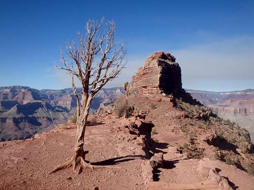
O'Neill Butte
As with most hiking in Arizona, Fall and Spring are the best. Summer can be brutally hot, with no water sources. Winter can bring serious ice on the first 200' of the South Kaibab Trail, which is entirely in shade on the north facing wall of the rim.
Summit of O'Neill, looking south
There are two developed campgrounds on the South Rim: Mather (which takes reservations) and Desert View.
There is plenty of places for camping at large in the National Forest just outside the park including down FS 310, only a mile-ish past Grandview Point, with nice, free camping near Grandview Lookout Tower.
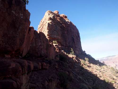
East Face of O'Neill