
-
 2647 Hits
-
 81.18% Score
-
 13 Votes
|
|
Mountain/Rock |
|---|---|
|
|
46.10852°N / 11.38369°E |
|
|
Download GPX » View Route on Map |
|
|
Hiking, Mountaineering, Scrambling, Skiing |
|
|
Spring, Summer, Fall |
|
|
7635 ft / 2327 m |
|
|
Overview
Introduction
The southwesternmost chain of the Lagorai group was a bit described already by Tiziana. When describing Sette Selle, one of the highest mountains of that subgroup, she mentions also crossing the ridge, stretching towards the SW. Monte del Lago is one of the summits in that ridge and as it is a nice hiking goal, I want to devote it here its own page.
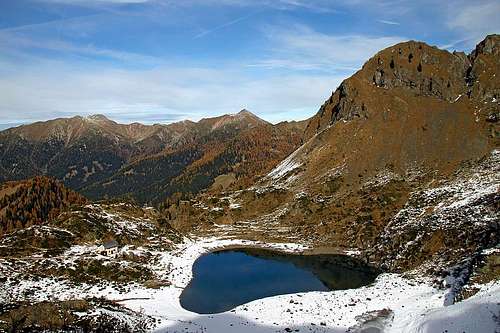
Lago Erdemolo

Summit cross
Monte del Lago Presented
On the southwest of the Lagorai group the mountains are built of red porphyr, which gives them some additional attraction. Not that they are more beatiful or that their shapes are more attractive, they are just different. In the area there are many trails, the key ones are also well marked. Many trails were built during the World War I and along them some other war remains can still today be seen. The summit is mainly visited by hikers. For harder climbing the walls are not high and steep enough. Actually, the SE side of the main ridge is almost to the top grassy, while the NW side is rocky and rugged, but only one or two hundred meters high. The area is popular also with tour skiers, who mainly ascend or cross some of its high saddles and notches.
Val de Mocheni
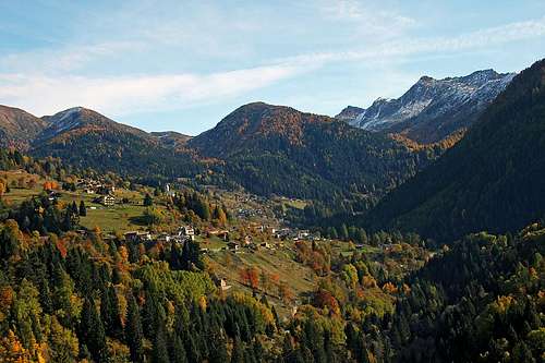
The valley west of our mountains (Italian: Valle dei Fersina) is famous as an enclave of German speaking people, who, isolated for centuries, developed their own dialect. That is why toponymes around the valley, including many mountains of our range, have (in addition to newer Italian) strange names, almost impossible to understand and pronounce. You can learn more about those people in the highest village, called Palu/Palai.
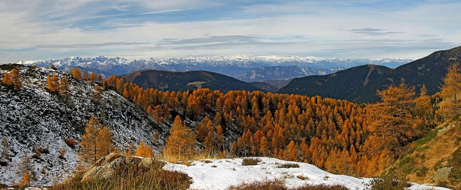
Summit Panorama
From Monte del Lago you have some very nice views around. Interesting are the summits of Lagorai group, the nearby on the NE, and the more remote towards the E. Towards the W the high towers of Brenta are seen, and towards the S most of the main groups and summits of the mountains above Sette Communi, and of Pasubio and Carega group.
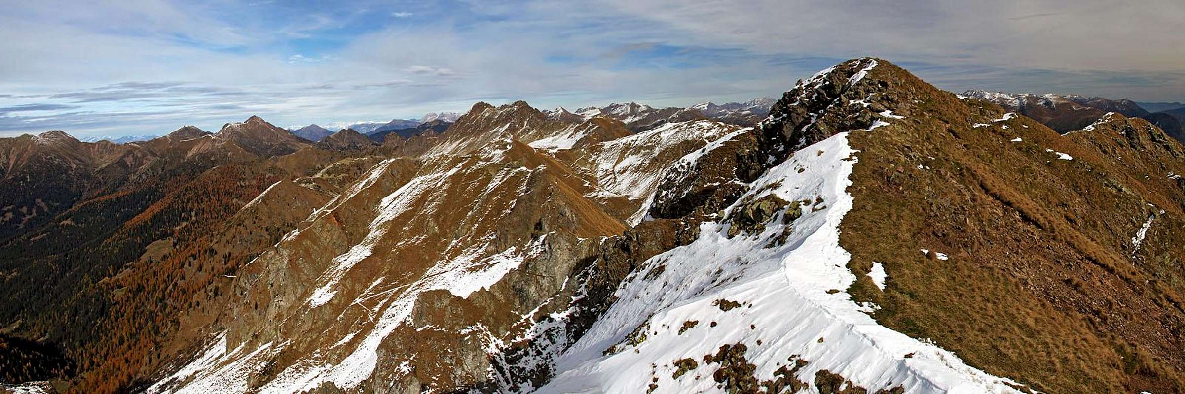 From Monte del Lago towards the NE
Geography
| As most of on-line maps are a bit inaccurate, I'll describe the neighbouring mountains more in detail. Otherwise I found as the best the old IGM 1:25000 map. From the SW the main crest is arriving into our area from the summits of Monte Gronlait, 2383 m, and Hoabonti, 2334 m. Just before Pizzo Alto, 2264 m, it is branching. The northern branch goes over Pizzo Alto on Lo Stocher, 1981 m, while the main ridge continues towards the NE. Just below Pizzo Alto there is the important Forcella del Lago (notch), 2213 m. Over it the path connects Val di Cave and the vally on the north, in which some 200 m below the notch the beautiful Lago Erdemolo lies. This is the lake, which gave the notch and our mountain their names. So, the main crest continues from the Forcella del Lago towards the NE. It rises slowly. The first bump in it is Point 2272 m, then comes the Point 2295 m. It hosts a small cross and is being most often visited. Still, the highest point is a bit further and is 2327 m high. (The altitude on the Kompass online map is completely wrong.) On the main summit a short side ridge branches towards the SE. Over a nice high saddle just below the summit the marked path continues towards the NE. The next named elevation in the main crest is Cima di Cave, 2296 m, and then the ridge gets broader and lowers for more than 100 meters, on 2184 m. That is Forcella di Cave, a narrow notch which offers another descent option towards the north. Further to the NE (and E) the main crest rises again on a two-headed mountain, called Sopra Conella. The SE summit is higher, 2308 m, the NW summit has 2296 m. The marked path continues over the high saddle between them and descends on the other side on the broad Passo Forcella delle Conelle, 2198 m. From there, you can again comfortably descend towards the north. Further towards the NE the highest part of the crest starts, with the summits Sasso Rosso, 2310 m, Sasso Rotto, 2396 m, and so on. |
Getting There
Cima del Lago can be ascended from many sides, but as the most convenient starting points these should be mentioned:
1. On the NW is the big parking place above Palu/Palai. It is on the altitude of 1525 m. The parking place is payable, but some park also along the road below it.
2. An even closer option could be the parking place at Agritourism Malga Pletzn, 1600 m. That is west of Lago Erdemolo, in Val Cava.
3. The third option is the long Val di Cave, SE of the summit. I don't have information how high into the valley you can drive with car.
4. A much more remote trailhead would be Rif. Panarotta, 1872 m, far on the SW. From there you can go by the main crest all the way towards the NE, over Monte Fravort, 2347 m and Monte Gronlait, 2383 m.
 Palù/Palai |
 Val di Cave and Valsugana |
Routes Overview
1. From Palu/Palai
This is a very nice hike up, on which we also visit the beautiful Lago Erdemolo. We can do a simple ascent - up and down by the same route, but more beautiful is a round tour. Depending on time and conditions on mountains, we can do a smaller or longer circle. If our main goal is Monte del Lago, then we best go in a counter clockwise direction. When on the main crest, we can any time decide when to start the descent, on the first, second or any other notch. The ascent route and the round hikes are not difficult. On the Swiss Hiking Scale, the difficulty would be T3. The ascent only will take us some 2 h 45 min (800 m of altitude), the shortest round tour some 5 h altogether.

Towards Lago Erdemolo

Towards Lago Erdemolo
Description. From the parking place we continue by the road, which soon starts turning right, towards the SE direction. It goes above the Torrente Fersina (creek). This is an ex mining area and on the inscriptions for marked paths which ascend left towards the Sette Selle hut you will see also plates, inviting us to visit the remains of mines (arranged for tourist visits). But we continue by the road, until it ends where it crosses the creek (not as shown on the Kompass map). Our path is No. 325. It goes very nicely across alpine meadows, from which we see the mountains of the main crest.
Above the meadows, the path tends towards the right, enters nice larch woods and then continues in a long arc towards the south. It is all the time easy and comfortable (T2/T1). After some 1 h 45 min we are on the edge, just W of Lago Erdemolo. Some 30 meters below us is the nice lake with a hut above its shore. On the other side the summit rocks and then steep slopes are falling from Monte del Lago towards the lake.

Towards Forcella del Lago

On Forcella del Lago
From a small saddle W of the lake we continue the ascent towards Forcella del Lago. The marked path crosses the slopes, at first towards the S, then towards the SE. The higher we go, the more beautiful are the views on the lake and its surroundings. When the steep slopes of Pizzo Alto are crossed, the path turns right up and comfortably ascends the notch, 2213 m. From the lake we needed 30 min.
On Forcella del Lago from the other side (Val di Cava) the path No. 323 comes and along the main ridge from the right also the path No. 325. There we turn sharp left and start ascending by the ridge (path No. 343). The path gets steeper and on some places require a bit more care. After the first ridge elevation we cross a flat part, where we can see the remains from World War I. Then crossing of the slopes continues. When the path reaches below the Point 2295 m, it turns steeply left up and in a few minutes we are by the small cross.
Forcella di Cave

Crossing M. del Lago
If we continue towards the NE, we can first ascend the highest summit, or continue by a marked path. It soon reaches by a horizontal crossing a high saddle in the side ridge and on the other side continues crossing. The path slightly descends and ascends, passes the summit of Cima di Cave and then continues by a broad ridge down on the Forcella di Cave, 2184 m. There we can turn left and descend by a fairly steep ravine towards the north. The descent path is marked and was even in snow conditions not difficult. The other option would be to continue towards the NE, ascend the high saddle between the two summits of Sopra Conella and then descend from the main ridge from the next saddle, from Passo Forcella delle Conelle, 2198 m.

Around M. Hoamonder
The descent from Forcella di Cave brings us some 200 meters lower on the popular marked path, which crosses the slopes below the main crest from Lago Erdemolo, all the way to Rifugio Sette Selle. When on that path, we either turn left and descend to the lake, or, more beautiful, continue right. The marked path ascends some 30 meters, reaches the broad valley below Passo Forcella delle Conelle, and then continues crossing the slopes of Monte Hoamonder. It is very nice and panoramic. When on the other side, it simply descends by the main valley towards the west, reaching soon the road and then by it the parking place.
2. From Val di Cave
I guess also from this valley SE of Monte del Lago we can do a nice round tour. Marked paths are reaching from the valley two notches: Forcella del Lago on the SW and Passo Forcella delle Conelle on the NE. So we can combine them and connect by crossing Monte del Lago (and ascending Sopra Conella as well).
Red Tape
There are no special limitations in the area.
When To Ascend?
Monte del Lago can best be ascended in dry parts of a season. That is from June till the first snow. We had End of October some fresh snow, but could do the round tour also without ice pick and crampons. Otherwise the summit ascent from Forcella del Lago goes mostly by the sunny southern slopes. In times of tour skiing from Forcella del Lago on both sides nice ski descents go. The very summit of Monte del Lago would be for skiing very steep and would in winter conditions normally require the usual winter equipment.
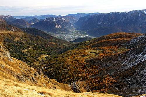
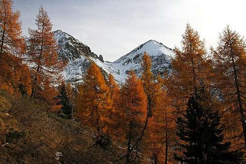
 Autumn in Lagorai - near Lago Erdemolo
Mountain Huts
Rifugio Lago Erdemolo, 2006 m. 1 h 45 min from the parking place above Palu/Palai.
Rifugio Sette Selle, 2014 m. 1 h 30 min from the parking place above Palu/Palai. It is already quite remote from Monte del Lago, much towards the NE.