
-
 19291 Hits
-
 82.74% Score
-
 16 Votes
|
|
Mountain/Rock |
|---|---|
|
|
37.45579°N / 106.79503°W |
|
|
Mineral |
|
|
Hiking, Skiing |
|
|
Summer, Fall |
|
|
11870 ft / 3618 m |
|
|
Overview
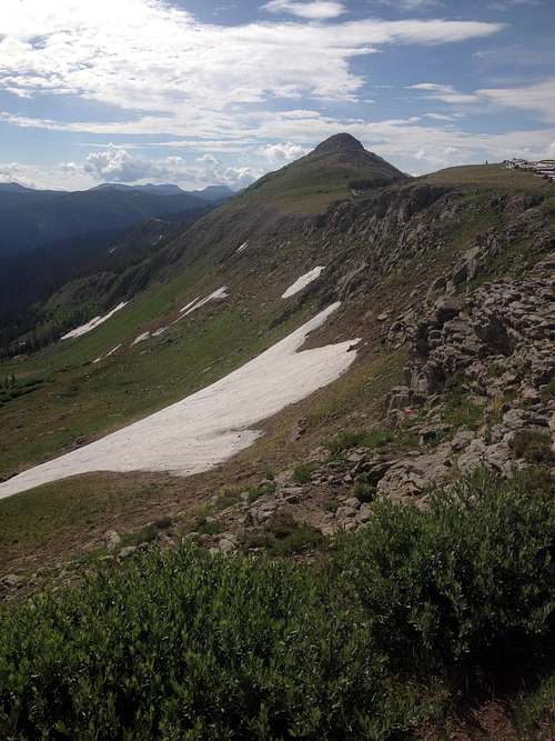
Alberta Peak
With its proximity to Wolf Creek Pass, this peak has a lot going for it: easy access, high mountain meadows, spruce-fir forest, a giant rock slide, an alpine trail that skirts steep cliffs, boulder hopping, and sweeping vistas of 12,000 and 13,000 foot peaks along the continental divide. Located in the Rio Grande National Forest just off of US Route 160, this peak is the high point on the summit ridge of the Wolf Creek Ski Area, which boasts the most snowfall in Colorado, approximately 430 inches annually. Although the near vicinity of the ski area may dissuade some hikers, those who venture to the summit will be rewarded with a pleasant and varied trek, as well as superb vistas.
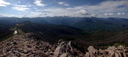
From the 11,870 feet summit the ski runs of the Wolf Creek Ski Area lie almost at your feet, with a log snow-fence and one ski-lift visible. Looking northwest, you can see nearby Treasure Mountain (11,910), the South-San Juan Mountain Range, and the Weminuche Wilderness (one of the wildest places in the state). The South San Juan Wilderness dominated by Montezuma Peak (13,150) and Summit Peak (13,300) completes the sweeping views to the southeast.
Treasure Mountain
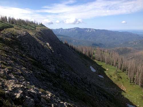
Unfortunately, you will also see the damaging effects of spruce beetles among the Englemann Spruce. The droughts of 2002-2004 gave the insect a foothold, and now 60-70% of the spruce trees are standing snags. Thankfully, there are younger trees growing among the dead evergreens, but the forest will take decades to recover from this barkbeetle scourge.
After summiting, other attractions await: 100-foot Treasure Falls is an easy hike from the parking lot just west of Wolf Creek; or head to Pagosa Springs and rent a tube from Pagosa Outside to float the San Juan River through downtown, take a dip in the world-renowned hot springs, or just enjoy a leisurely meal at one of the many fine restaurants.
Route
Continental Divide
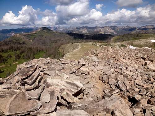
The route to the summit is part of the Continental Divide National Scenic Trail (CDT for short). This massive trail runs 3,100 miles between Mexico and Canada, and this particular section remains at nearly 11,000 feet for almost 70 miles. The trailhead starts at Wolf Creek Pass at 10,857 feet, and ascends to 11,870 feet; an elevation gain of 1,013 feet. The trail itself heads south and ascends the northern ridge of the ski area, then skirts the south-trending summit ridge to the west. The complete roundtrip mileage is 4.8 miles, but the hiking is pretty easy and straightforward on a well-maintained trail with a class 1+ rating. The biggest obstacle is the blocky summit ridge with some minor rock-hopping.
Getting There
Alberta Peak Cliffs
There are seemingly two trailheads here; one that starts on the left of the signposts (as you are looking at them), and one on the right. The trailhead to Alberta Peak (and the CDT) is the one on the left.
Map & Weather
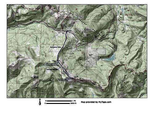
Alberta Peak Topo Map
When to Climb

Summit Ridge
Camping
Dispersed camping is allowed in the Rio Grande National Forest for a maximum of 14 days in any 30-day period.
There are also developed campsites near Wolf Creek Pass:
Wolf Creek & West Fork Campgrounds are located nine miles west of Wolf Creek on the West Fork Road (aka Forest Road 648). Wolf Creek is ½ mile off of US 160 and offers 26 sites. West Fork offers 28 campsites about 1 ½ miles off of US 160. Sites cost $20/night. For more info the contact number is 970-264-5254.