|
|
Mountain/Rock |
|---|---|
|
|
57.05769°N / 3.72642°W |
|
|
Hiking, Mountaineering, Ice Climbing, Scrambling |
|
|
Spring, Summer, Fall, Winter |
|
|
4127 ft / 1258 m |
|
|
Overview
Pronounced – Skor an lochan Ooain
Also known as: The Angel’s peak
Summit height - 1,258 m (4,127 ft)
Meaning – Peak of the green loch
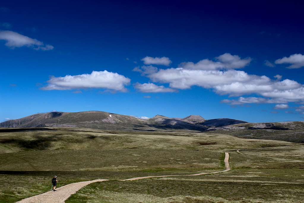
The Cairngorm National Park was formed in 2003 to protect this unique area. It is the UK's largest national park with a large mountain range at its heart and with many diverse communities around it. The habitat offers a secure haven for many rare species and the forests include remnants of the original, ancient Caledonian pine forest. These contrast with large areas of heather moorland.
There is a well-developed ski and tourist area beneath Cairngorm mountain in the lower reaches of Coire Cas. Here, there are parking, toilet and eating facilities. In winter, it’s possible to get a bus from Aviemore to the ski area to ease the parking congestion.
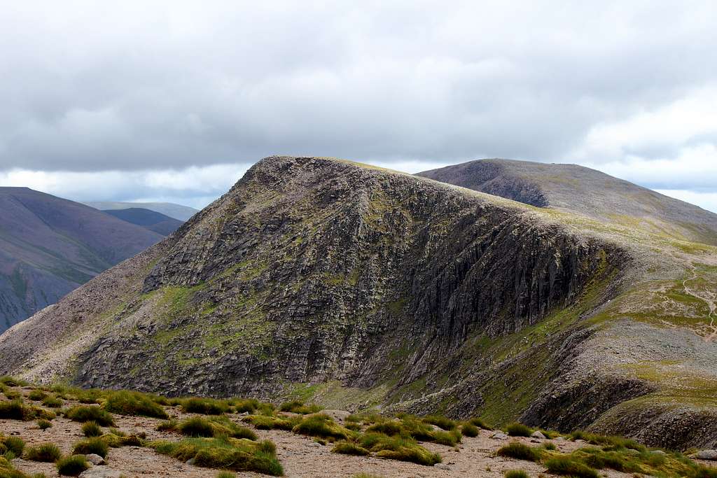
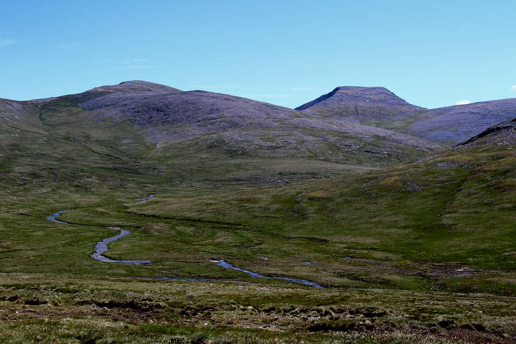
Sgor an Lochain Uaine is the fifth-highest mountain in the UK. The mountain takes its name from the small green loch or tarn which nestles in the corrie on its northeast flank. It is also known as “The Angel’s peak”. This name was allegedly bestowed on the mountain by Cairngorm club stalwart Alexander Copland at the end of the 19th century. It is thought that in a certain light, the ridges either side of the summit resemble Angels’s wings. The name also acts as a theological balance for Cairn Toul which has The Devil’s Point on its far side!
For many years it was referred to as being part of its nearby neighbour Cairn Toul but in 1997 the Scottish Mountaineering Council (S.M.C.) undertook a revision of its Munro tables and promoted it to Munro status in its own right. Like Cairn Toul, it is a remote mountain lying behind the northern corries of Braeriach and protected to the west by the Moine Mhor an extensive area of mountain tundra and bog set at around 1000 metres in height. To the east, it looks down at the Larig Ghru – the deep pass that separates the western section of the Cairngorms from the central section containing Ben Macdui and Cairngorm. To the south, behind Cairn Toul and The Devil’s point are many miles of hills, moor and bog.
Climbing Sgor an Lochain Uaine
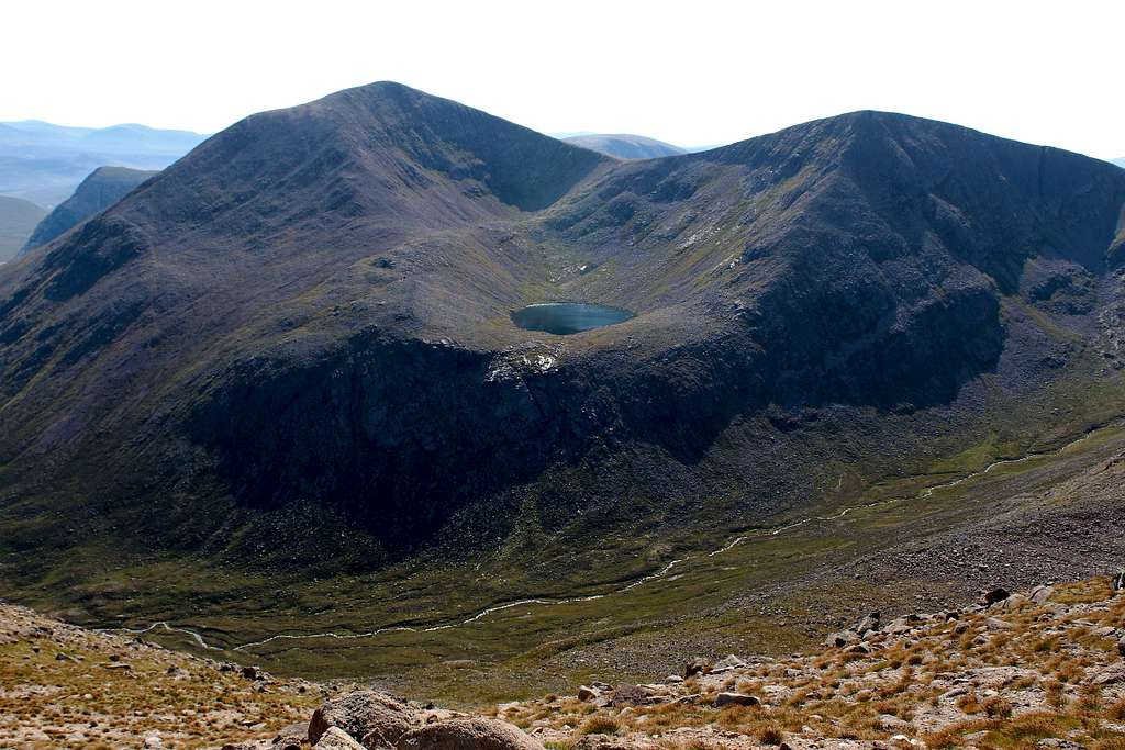
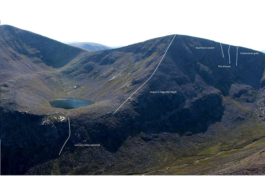
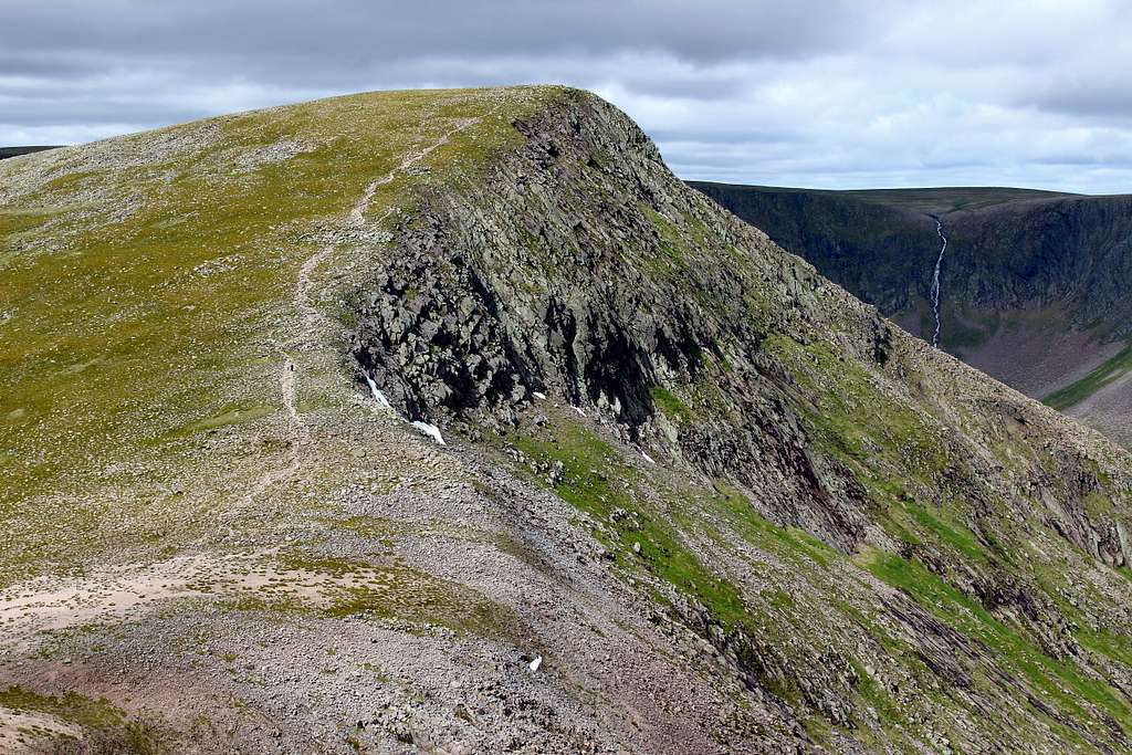
The mountain is another that is constructed of granite boulders and scree piled together as a result of the actions of ancient glaciers that covered this area. From the summit, down to the eponymous Loch Uaine runs the northeast ridge of the mountain also known as the Angel’s ridge. This is a well-defined ridge of boulders which offers an airy scramble in summer conditions and a Grade 1 winter route during colder months. The winter ascent can be preceded by an ascent of the Lochan Uaine waterfall. An 1800 ft frozen waterfall at Grade 2.
However, for further descent in summer, it would be necessary to head eastwards from the lochan and scramble down from there beneath Cairn Toul.
North and westwards from the summit lie cliffs in an area sometimes known as the Corrie of the Chokestone Gully. These cliffs are adorned with a handful of remote winter routes.
Southeast Couloir – Grade 2/3
Chokestone gully – Grade 3
The Shroud - Grade 4
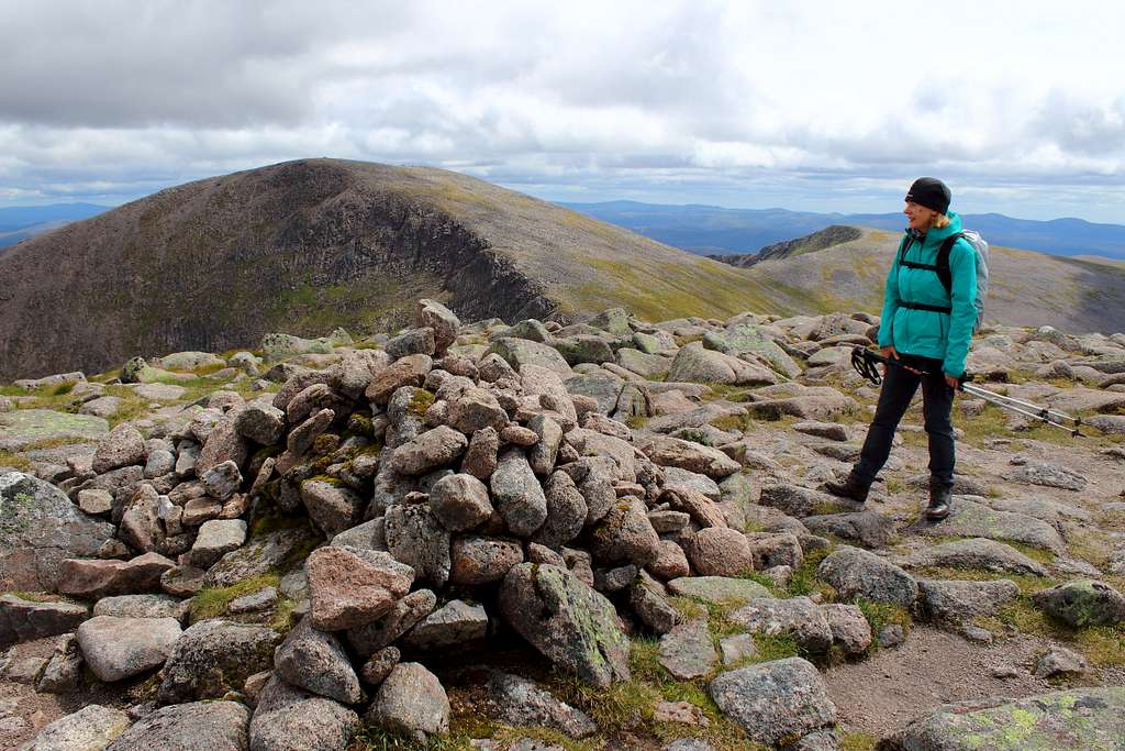
The summit of Sgor an Lochain Uaine is a fine viewpoint in which to appreciate the surrounding mountain environment situated as it is, in a high and very remote area of Britain. It’s possible to see uncommon (to the UK) arctic plants on its slopes and corries as well as specialist birds such as Ptarmigan, Dotterels and Snow Buntings.
However, the rise in popularity in recent times of “Munro – bagging” means that on most days in summer you will not be alone in your day in the wilderness.
Getting There
Aviemore is the main town to use as a base for the northern Cairngorms. It has many hotels and shops and provides a good bus service to the area as well as a good train service to the wider country.
By road, Aviemore is easily accessed from the main A9 road which links Glasgow with Inverness. From Aviemore, there are several possible starting points. a minor road runs to Loch Morlich, and from there onwards to the Cairngorm ski development at Coire Cas. This road can be used to access the Sugar Bowl car park (Map ref. 985085) – a pay and display amenity - on the road leading from Aviemore to Cairn Gorm ski area beneath Coire Cas.
There is free parking at the end of the road at White well (Map ref. 916087) and it’s also possible to reach it from Glen Feshie by parking near Achlean (Map ref. 851985).
If approaching from the south (Glasgow), take the M9/A9 roads to Perth, then the A93 north through Glenshee to Braemar. This has a limited number of shops and services. The only Bus service is the Stagecoach service no 201, Aberdeen to Braemar. There is no nearby train service and at time of writing, no Taxi service in Braemar
The starting point from the south is the National Trust car park at Linn of Dee. This is a pay and display car park (free for NT members).
Routes
The geographical position of Sgor an Lochain Uaine means that it is unlikely any mountaineer would set out to climb this peak purely on its own. It is ideal to include at least one (or more) of the nearby peaks in a grand day out in the high Cairngorms.
Whichever route you choose, this will be a long day out in remote mountains so make sure you are fully prepared.
There are three obvious starting points:
Linn of Dee National Trust Car Park – Map reference 062898
Whitewell – Map reference 915087
Sugar Bowl Car Park – Map reference 985075
Blue route
Start at the road end at Whitewell. Head east to join the main track which heads up Glen Eanich. Continue on this almost to the loch then head up into Coire Dhondail by a stalkers path. Scramble up besides the waterfall to a cairn at the end of the path. Take a compass bearing for the summit of Sgor an Lochain Uaine and follow this across the open hillside. Follow the southwest ridge to the summit.
Orange route
Start at the Sugar bowl car park and cross the road to descend and cross the river then, follow the path up towards the Chalamain gap. Descend to the Larig Ghru and ascend the Sron na Larig ridge. Follow the route to the summit of Braeriach. From here, follow the edge of An Garbh Choire to the summit.
Yellow route
From the Linn of Dee car park, follow the route to Derry lodge. From here cross the river and head west into Glen Lui (Glean Laoigh Bheag). Follow this path south of Carn a Mhaim, then north to Corrour Bothy. From here, head up towards The Devil’s point (another Munro) then northwest to Carin Toul and on to Sgor an Lochain Uaine.
Green route
From Whitewell, follow signs for the Larig Ghru. Continue on the path through the huge defile. It’s also possible to start this route at the Sugar Bowl car park. Continue southwards until you reach the Corrour bothy and pick up the yellow route from there.
This table shows the approximate distances from the start point to the summit of Sgor an Lochain Uaine by each route. These are all ONE WAY measurements. Therefore, you will need to either add two of the route distances together or double up on one (if returning the same way) to get the full route length.
|
Route |
Km (Approx) |
Miles (Approx) |
|
Linn of Dee – Sgor an Lochain Uaine (Yellow line) |
17.8 |
11.1 |
|
Whitewell – Sgor an Lochain Uaine (Blue line + Orange line) |
15.6 |
9.75 |
|
Whitewell – Sgor an Lochain Uaine via the Larig Ghru (Blue line + Green lines +yellow line) |
22.4 |
14 |
|
Sugar bowl AP – Sgor an Lochain Uaine via Braeriach (Orange line) |
14.5 |
9.1 |
|
Sugar Bowl CP – Sgor an Lochain Uaine via the Larig Ghru (Orange line + Green line + yellow line) |
20 |
12.5 |
There are other places to start depending on how long you want to make your route and its possible to include other Cairngorm mountains on extended trips.
Red Tape
No red tape.
However, Scotland has an Outdoor Access code, see link:
https://www.outdooraccess-scotland.scot/practical-guide-all
When to Climb
Spring, Summer or Autumn (Fall) depending on conditions.
Warning: The above descriptions are for use in reasonable summer conditions. Winter conditions can occur at almost any time of the year. In winter condition, this mountain is a much more serious proposition. Any paths may be covered by snow and ice and gale force winds are common. Ice axe, Crampons, the knowledge of how to use them allied with excellent map reading and compass skills are essential.
Accommodation
Hotels and self-catering accommodation around Aviemore. Many campsites in Aviemore, Coylumbridge and Loch Morlich but it’s probably best to book a place in advance during high season.
There are a limited number of Hotels, guesthouses and B&B premises in Braemar and there are many self-catering cottages in the area.
There is a caravan and campsite in Braemar, see the Braemar information page for details of all of these.
It is possible to wild camp in Scotland. See the Outdoor access code for more details.
External Links and References
Walk highlands - https://www.walkhighlands.co.uk/
SMC - https://www.smc.org.uk/
Cairngorms club - https://www.cairngormclub.org.uk/
Cairngorms National Park - https://cairngorms.co.uk/
Braemar information - http://braemarscotland.co.uk/
The Cairngorms – Adam Watson (SMC guidebook)
The Munros – D. Bennet (SMC guidebook)
The High Mountains of Britain and Ireland – I. Butterfield
Winter climbs in the Cairngorms – Allen Fyffe