|
|
Mountain/Rock |
|---|---|
|
|
36.43400°N / 117.355°W |
|
|
6584 ft / 2007 m |
|
|
Overview
This is the massive peak on the NE side of Panamint Valley. It's huge stripes are impressive and hint at an interesting geologic past.
The peak makes for a challenging day via any route. The summit itself is somewhat anticlimatic being rather flat at the top - after all, it is a butte. But the views over Panamint Valley and beyond make up for that.
Getting There
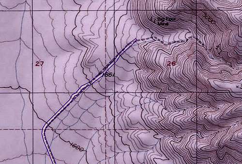
For the western and "Rockslide" routes, take the Lake Hill Road north from Highway 190 in Panamint Valley. The turnoff is about two miles east of the junction of Highway 190 and the Panamint Valley Road. Drive Lake Hill Road to the parking area for the Panamint Dunes. Here, the road curves northeast toward the mountains and the Big Four Mine.
The road soon gets rougher, then very rough, and a high clearance 4WD will be needed to get very far. When I climbed the western route, I played it safe and simply parked at the Dunes parking area and hiked from there. This extra easy distance provided a warm-up and wind-down.
This road reaches the Wilderness boundary soutwest of the Big Four Mine at around 36.4309,-117.3993. There may or may not be a sign or barrier here.

For the Towne Pass route, take Highway 190 to Towne Pass. This is the pass between Death Valley proper and Panamint Valley. There's plenty of space to park at the pass.
For the Lemoigne Canyon route, see the directions on the route page.
Red Tape
These routes lie within Death Valley National Park. So an entrance fee applies. Also, no ATV's, etc. are allowed on the dirt roads.
When To Climb
The cooler months of the year are recommended. The peak can accumulate some snow in the winter. Summer is inadvisable as it would be very hot, and probably too hot even to hike from Towne Pass.
Camping
Informal camp sites are available along the Lake Hill Road (approach for the west side and "Rockslide" routes) and the Lemoigne Canyon Road. Current regulations require you to drive at least one mile up either road before camping
Links
Death Valley NP Backcountry Map: https://www.nps.gov/deva/planyourvisit/upload/508-Backcountry-and-Wilderness-Access-map_.pdf
Death Valley NP Alerts & Conditions: https://www.nps.gov/deva/planyourvisit/conditions.htm
Death Valley NP on Facebook: https://www.facebook.com/DeathValleyNPS
[Death Valley Road Conditions on Facebook: https://www.facebook.com/DeathValleyRoadConditions Apparently no longer updated]

