
|
|
Mountain/Rock |
|---|---|
|
|
39.13160°N / 112.5511°W |
|
|
Millard |
|
|
Hiking |
|
|
Spring, Summer, Fall, Winter |
|
|
5751 ft / 1753 m |
|
|
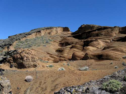
Pahvant Butte is also known as "Sugarloaf" by the locals.
![Pahvant Butte (UT)]()
The summit as seen from the south peak.![Pahvant Butte Utah]()
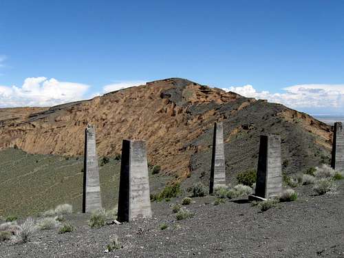
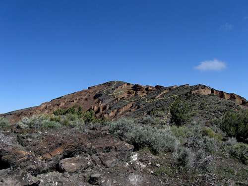
On the way to the summit
Standing by itself west of I-15, Pahvant Butte is very obvious to those driving either north or south on the interstate. With a volcanic history, Pahvant Butte is an interesting landform and worthy of both hiking and exploring. See this link for more information about the volcanic background. With a prominence of 1126 feet, Pahvant Butte is of interest to
those who are interested in ascending the peaks in Utah that have more than 1,000 feet of prominence.
An interesting note is that I saw the height of this mountain listed on other resources at different elevations but the elevation chosen is the one I found at List of Johns website.
Please see the links below to get more information about this most interesting landform and some references to the "Lace Curtain" are contained in some of the links.
![Pahvant Butte (UT)]()
As seen from I-15
Leave 1-15 near the town of Holden on US 6 and drive ten miles to the intersection of highway 100 with US 6. Turn south on highway 100 and take the first road that heads east (a dirt road that crosses a cattle grate). This road is suitable to non 4WD vehicles in dry conditions but should be avoided
if the road is wet or bad weather might be encountered. It becomes very muddy in sections when wet. It is roughly 8 miles on this dirt road to the southern end of the Pahvant Butte where it would be possible with a high clearance 4WD vehicle to go further but those with low clearence might be best served to park and hike from there. A steep ATV track ascends the southern flank of the southern summit and a road also goes up from the southern side to the top of the southern summit.
From Delta, take Highway 6/50 west to the intersection with Route 257 that leads to Deseret and Milford. Go south on Route 257 for 21 miles and turn left (east) on the road to Clear Lake Bird Refuge. Drive eastward 7.5 miles on the well-graded dirt road to the sign to Pahvant Butte. Pahvant Butte is easily visible, even from Delta.
![Pahvant Butte Utah]()
Triangulation structure on summit
None that I am aware of. I believe that Pahvant Butte is on BLM land although signage is not found indicating this. I saw no indications of private property or limitations. Use common sense in an area like this as during the week you might not see anyone should you have vehicle problems. The roads can become very muddy when wet and should be avoided until they have had a chance to dry completely out.


Utah Geologic Survey report (get the geologic history)
Old photograph
Wikipedia
Map
Pictorial trip report
Geologic report
The summit as seen from the south peak.
Overview
On the way to the summit
Standing by itself west of I-15, Pahvant Butte is very obvious to those driving either north or south on the interstate. With a volcanic history, Pahvant Butte is an interesting landform and worthy of both hiking and exploring. See this link for more information about the volcanic background. With a prominence of 1126 feet, Pahvant Butte is of interest to
those who are interested in ascending the peaks in Utah that have more than 1,000 feet of prominence.
An interesting note is that I saw the height of this mountain listed on other resources at different elevations but the elevation chosen is the one I found at List of Johns website.
Please see the links below to get more information about this most interesting landform and some references to the "Lace Curtain" are contained in some of the links.
Getting There
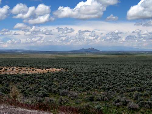
As seen from I-15
Leave 1-15 near the town of Holden on US 6 and drive ten miles to the intersection of highway 100 with US 6. Turn south on highway 100 and take the first road that heads east (a dirt road that crosses a cattle grate). This road is suitable to non 4WD vehicles in dry conditions but should be avoided
if the road is wet or bad weather might be encountered. It becomes very muddy in sections when wet. It is roughly 8 miles on this dirt road to the southern end of the Pahvant Butte where it would be possible with a high clearance 4WD vehicle to go further but those with low clearence might be best served to park and hike from there. A steep ATV track ascends the southern flank of the southern summit and a road also goes up from the southern side to the top of the southern summit.
From Delta, take Highway 6/50 west to the intersection with Route 257 that leads to Deseret and Milford. Go south on Route 257 for 21 miles and turn left (east) on the road to Clear Lake Bird Refuge. Drive eastward 7.5 miles on the well-graded dirt road to the sign to Pahvant Butte. Pahvant Butte is easily visible, even from Delta.
Red Tape
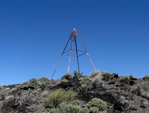
Triangulation structure on summit
None that I am aware of. I believe that Pahvant Butte is on BLM land although signage is not found indicating this. I saw no indications of private property or limitations. Use common sense in an area like this as during the week you might not see anyone should you have vehicle problems. The roads can become very muddy when wet and should be avoided until they have had a chance to dry completely out.
Camping
No campgrounds exist in the immediate area and the nearest towns would be Fillmore and Delta. Car camping would be probable near the mountain with the leave no trace ethics applied.Weather
My route
External Links
Desert Islands trip reportUtah Geologic Survey report (get the geologic history)
Old photograph
Wikipedia
Map
Pictorial trip report
Geologic report