|
|
Mountain/Rock |
|---|---|
|
|
40.60241°N / 112.61524°W |
|
|
Tooele |
|
|
Hiking |
|
|
Spring, Summer, Fall |
|
|
9141 ft / 2786 m |
|
|
Overview
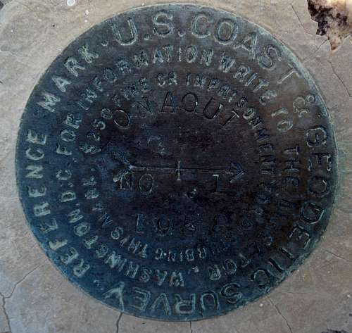
USGS Marker on Onaqui Benchmark
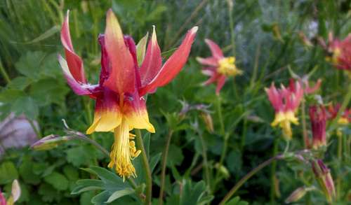
The Onaqui benchmark makes for a great late spring or early fall hike because of it's lower elevation relative to some of the other peaks in the area.
Notes
-There are 2 USGS Markers that were placed on this peak in 1938 (picture shown left).
-No register was found at this Benchmark. Please let me know if one is found or placed.
- If you are driving west through Grantsville, Ut on Main Street you will be looking directly at the Onaqui BM.
-There is a pretty good cairn at the top with the wooden remians of some sort of small tower or flag pole holder.
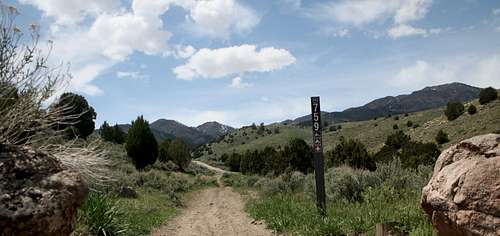
![West Canyon Trail head]()
West Canyon Trail head
![Onaqui Ridgeline]()
Ridgeline leading to Onaqui BM. Deseret Peak and N&S Willow in background.
![Onaqui summit cairn]()
Cairn at the summit.From the saddle look up and to the North. This ridge line can be taken all the way to the high point. There are about 4 good sized sub peaks all with 50-200 feet of prominence on the way. Most of this is easy class 2 scrambling. There might be a few spots of class 3 but can all be easily circumvented with the most basic of route-finding skills. There is no trail past the saddle.
Getting There
West Canyon Trail head
From Salt Lake
Go west on I-80 and take exit 99. Go south on Hwy 36 towards Tooele/Stansbury for 3 miles to a traffic light. Turn right at the light onto Hwy 138. After about 9 miles Hwy 138 becomes Main Street in Grantsville. Continue to the west side of Grantsville on Main Street. As you drive through town you should be able to see the Onaqui BM directly in front of you. On the west side of town Main Street ends as it curves to the North becoming Hwy 138 again. About 1/4 mile after the curve turn left onto a deteriorating paved road with a sign pointing you to West Canyon. After a mile or so the road becomes a well graded gravel road and progressively becomes rockier and rutted out in the middle section. The road is passable with a 2wd vehicle if taken slowly. The trailhead is about 5 miles from Hwy 138. Most of the dirt road is access through private land so please be respectful. There is one gate that you will need to open. Make sure you close it behind you so the cows don't end up in town.
Route
West Canyon Saddle and ridgeOverview
Trail head to summit (one way)- 5.3 miles; 3900 total elevation gain; 845 elevation loss.
0.0 Miles - ATV 2 track Trail starts at trail-head parking - Class 1
2.3 Miles - Left turn onto hiking trail. - Class 1
3.0 Miles - Saddle and start of ridge (minor scrambling) - Class 1 and 2
5.3 Miles - High point - Win
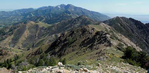
Ridgeline leading to Onaqui BM. Deseret Peak and N&S Willow in background.
Description
The trail starts out as a nice two-track ATV trail (which very infrequently has ATV and Motorbikes on it). This trail follows the West Canyon drainage for about 2 miles. Near the end of the ATV trail there is a hiking trail that continues up a left hand fork of the end of the canyon. Because this trail is only hiked by a handful of people each year, it starts out pretty well defined but can be difficult to see in places. Keep your eyes up for the large saddle on the south west end of the ridge line in front of you and head that direction. You will eventually find the trail again. If not you can easily hike up to the saddle without the trail. From this saddle you get the first really amazing views. On a good day you can see Pilot Peak in Nevada off in the distance to the west as well as almost all of the major ranges in northwestern Utah. One of the best views of Deseret Peak (the high point of the Stansbury Mountains and Tooele County) can be seen from this saddle.
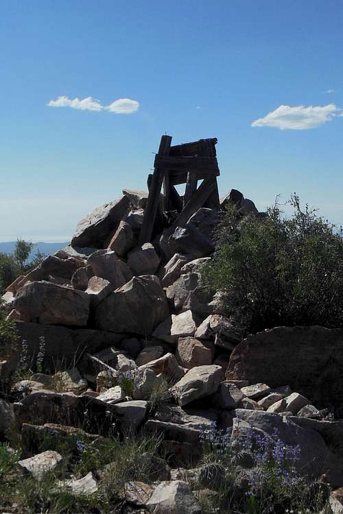
Cairn at the summit.
Shortcut Down
On the way down you can take a drainage leading down from the saddle between sub-peak 8904 and the last stretch of ridge line to the high point. The brush can get pretty thick in places. It is roughly 4 miles from the peak down to the trail head using this shortcut. The other bonus is not having to go back up and over any of the sub-peaks.
Waypoints
Trail head: -112.5729220, 40.5918120
Turn-off from ATV trail: -112.6080400,40.5886120,
West Canyon Saddle: -112.6133880, 40.5821990
High point: -112.6152190, 40.6026040
Saddle for shortcut down: -112.6187590, 40.5940210