
|
|
Mountain/Rock |
|---|---|
|
|
Scrambling |
|
|
Overview
[Note: August 2020. I adopted this page after it was orphaned by the original author. I have made no substantive changes to it - utahjimk]
Stansbury Island is the second largest island within the Great Salt Lake in Utah. There are three peaks on the island meeting a minimum of 300 foot prominence. The south peak is unnamed, the lowest of the three yet the most challenging. If I were making a list of the top 50 peaks to climb near Salt Lake City, I would definitely be adding the south peak of Stansbury Island. It's rarely climbed, exceptionally unique given its location and it is one of the few peaks in the Western Utah Desert that requires a class 3 route to summit. Even better, it can be climbed year round without too much snow. Because the elevation of the causeway leading out to the island is so low, well graded and used by trucks hauling salt all winter, you're likely to be able to drive to the trailhead in any vehicle. You also have stunning views. With snow, the Lakeview, Cedar, Stansbury, Wasatch and Oquirrh Mountains look incredible. All this and being surrounded by the 37th largest lake in the world.
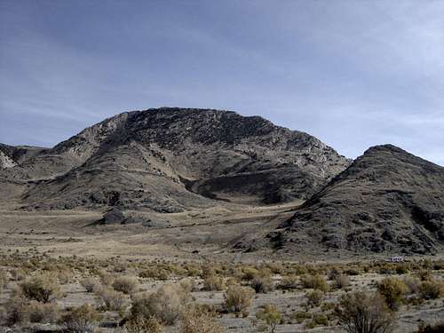 West side in summer
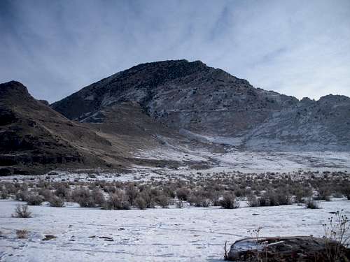 West side in winter
 From the ridge to the north
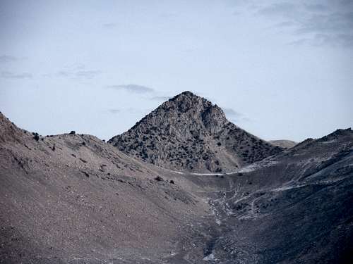 View from south while approaching it
Getting There
Take I-80 west from Salt Lake City past Tooele to exit 84 (the second Grantsville exit). After exiting and curving slightly left, go straight. In a short distance is a dirt road going straight as the pavement curves left. There is also a railroad crossing where the dirt road starts. From here, the turn for the trailhead is 6.9 miles. Just stay on the main road the entire time. The turn is not marked at 6.9 miles but currently there is a sign saying "Stansbury Island Interpretive Trail, stay on roadway". The turn right is at the sign. If the sign goes away, 500 feet beyond is another sign saying no trespassing, stay on roadway. After leaving the main road, it's a quarter mile drive up to the trailhead. Lots of parking, no facilities.
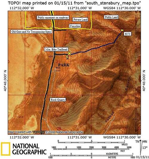 Map of Route
Red Tape
None for this route. There are sections of private property on Stansbury island used by cattle ranchers. A bit further on the road past the biking trailhead you will see a sign that indicates the private land status on either side of the road. But, the land above the foothills is public land. I marked some of the private land on the map. If your considering a route from the north, the road shown along the fence line is your best bet.
Camping
Camping is permitted in all public areas. I have seen campers at the end of the road along the fence line spur (see map). This area is popular with target shooters and not the brightest ones at that, choose a spot wisely.
When to Climb
The south peak can be climbed year round. Spring or fall would be best for temperature. Winter is best for scenic value. Summer would be awful. Only right after a snowstorm would the access be difficult. The south and southwest facing slopes melt out fast on the island.
West Face Route
Start walking toward the peak on easy gentle uphill terrain. Within a few minutes you options will become clear. You can cross a main draw going up the west face to it's right or a ridge to the left of the draw that goes up the same face, just a bit to the north. Either way, they both end at the upper face where the slope gets steep. This upper face is a maze full of rock obstacles, shoots and ledges all hiding among scenic junipers. Much of it is class 3 with several spots of low 5th class rock climbing. But, these sections of rock are short with no real exposure. If one were willing to explore every option, it might be possible to find an easier class 2 route. Once on the ridge, a series of false summits are encountered on the ridge traverse. The ridge climb has options. You could keep it mostly class 2 if you are willing to descend here and there but the rock is surprisingly solid for some nice class 3 or 4 routes.
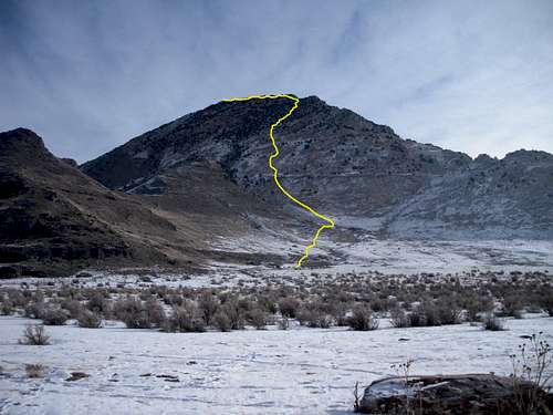 The Route I took
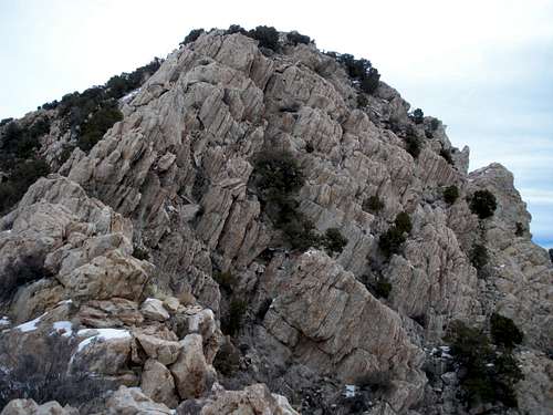 First false summit
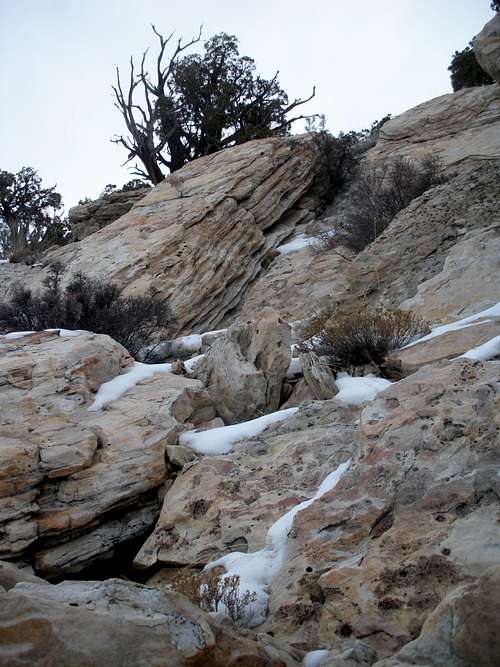 Class 3 climbing
External Links
 Looking South
 Sunrise
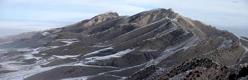 Looking north to the island highpoint