
-
 20322 Hits
-
 84.01% Score
-
 18 Votes
|
|
Mountain/Rock |
|---|---|
|
|
39.14763°N / 122.76558°W |
|
|
Lake |
|
|
Hiking, Scrambling |
|
|
Spring, Summer, Fall, Winter |
|
|
4618 ft / 1408 m |
|
|
Overview
South from Pinnacle Rock east shoulder
North from Pinnacle Rock
The Bartlett Springs Road climbs dramatically winding up from the north end of Clear Lake into the heights of the Mendocino National Forest. It reaches an elevation 4,000' at Bartlett Springs Summit and continues on down over ridges to Indian Valley Reservoir for a total of 26 miles. The road passes below the southwest slope of Pinnacle Rock, the highest peak in the area.
The southeast slope is doable from the road but much of it is nasty scrub brush, loose crumbly rock and scree which makes the little drive though the forest from the north to within a stroll of the summit rocks a welcome alternative. Pinnacle Rock once had a fire lookout and there are rock steps leading up a short distance to the class 2 summit rocks which are much more solid than the rock below.
The views are quite outstanding for the minimal effort. North is hulking Goat and Snow Mountain, to the east Rupert Ridge, Evans Peak and Wolf Creek Ridge, to the south is Clear Lake with Mt. Konocti and Cobb Mtn. on the horizon. To the northwest is Windy Point and Horse Mtn. with the Mayacamas Range to the west beyond Clear Lake.
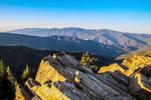
For the excellent views south and east go beyond Pinnacle Rock east on the road below it out about 1/4 mile to the open east shoulder. ![2 of the 3 Stooges]()
Taking a break on the Bartlett Springs RoadFrom the northwest: From the junction Of Hwy. 29 west of Upper Lake take Hwy. 20 7 miles southwest along the lake shore just past Nice to the Bartlett Springs Road.
From the east: From the junction with Hwy. 53 just east of Clearlake Oaks take Hwy. 20 16 miles northwest along the lake shore to Bartlett Springs Road.
Drive up Bartlett Springs Road as it winds up for 6.1 miles to Bartlett Springs Summit. At that junction take forest road 16N01 which goes to the left and follow it 1.3 miles to a T in the road. Go right a short distance and park.
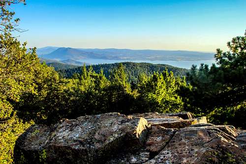
![Clear Lake from Pinnacle Rock]()
Clear Lake from Pinnacle RockThe road continues about half a mile to where it goes up to the left through some trees to the stone steps going up to the summit rocks which are hidden from view on the approach.
It is a short walk of less than half mile with a few hundred foot gain.
You can drive all the way to below the summit rocks if this last part of the road which is rutted is suitable for your vehicle.![Clear Lake with Mt. Konocti from Pinnacle Rock]()
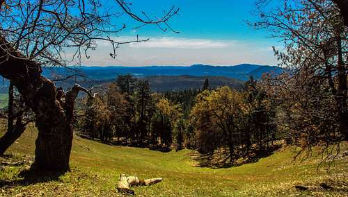
Clear Lake and Mt. Konocti from Pinnacle RockThis is Mendocino National Forest and there are no posted restrictions or permits required.![Long Valley from the Bartlett Springs Road]()
Long Valley from the Bartlett Springs Road.Year around. This peak gets snow in winter and the Bartlett Springs Road closes in that case. It gets hot in summer up to 100 degrees. ![East from Pinnacle Rock]()
East from Pinnacle RockThis is National Forest. Some of it goes through private lands but car camping is allowed.
For Mendocino National Forest camping info click here.
Getting There
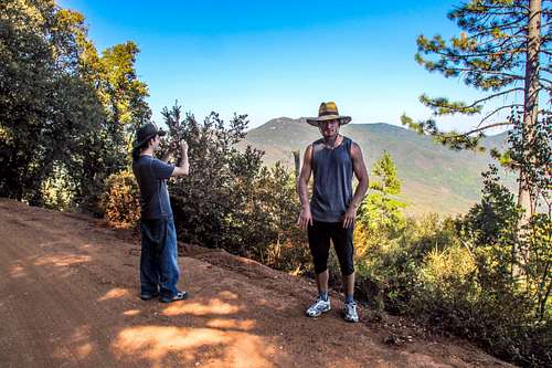
Taking a break on the Bartlett Springs Road
From the east: From the junction with Hwy. 53 just east of Clearlake Oaks take Hwy. 20 16 miles northwest along the lake shore to Bartlett Springs Road.
Drive up Bartlett Springs Road as it winds up for 6.1 miles to Bartlett Springs Summit. At that junction take forest road 16N01 which goes to the left and follow it 1.3 miles to a T in the road. Go right a short distance and park.
Route
Clear Lake from Pinnacle Rock
It is a short walk of less than half mile with a few hundred foot gain.
You can drive all the way to below the summit rocks if this last part of the road which is rutted is suitable for your vehicle.
Red Tape
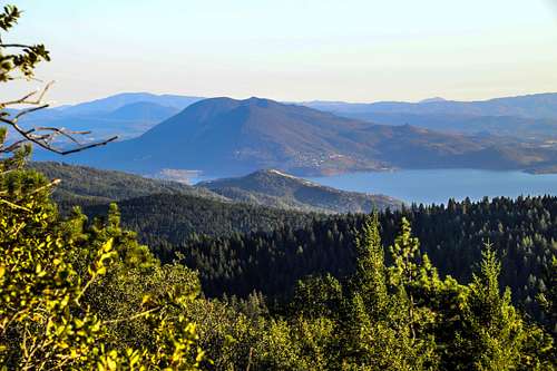
Clear Lake and Mt. Konocti from Pinnacle Rock
When to Climb

Long Valley from the Bartlett Springs Road.
Camping

East from Pinnacle Rock
For Mendocino National Forest camping info click here.