|
|
Mountain/Rock |
|---|---|
|
|
56.64287°N / 5.0307°W |
|
|
Hiking, Mountaineering, Sport Climbing, Ice Climbing, Scrambling, Skiing |
|
|
Spring, Summer, Fall, Winter |
|
|
3773 ft / 1150 m |
|
|
Introduction
Bidean nam Bian (Pronounced: Beetyan nam Beean) is most definitely, as described by many, the Queen of Argyll. Standing at a height of 1150m/3773ft, Bidean nam Bian (Munro No.23) is the highest of all the peaks in the Glencoe region, however by stark contrast, its summit is one of the smallest. This is reflected in the translation of the mountains name. The word Bidean meaning pinnacle and nam Bian meaning of the mountains, thus giving us the name Pinnacle of the Mountains. Its vast overall size is comprised of a complex array of ridges and peaks and it is these surrounding subsidiaries that complete the naming of the peak. Although these surrounding peaks have names in their own right, the entire massif has gradually adopted the tag of Bidean nam Bian. The average visitor to Glencoe will probably never clap eyes on the summit of Bidean as it is generally hidden from sight from most viewpoints. From the A82 road that runs through the heart of Glencoe and the car park close to the Allt na-reigh the peak is obscured from view by the famous Three Sisters of Glencoe and the pointy peak of Stob Coire nan Lochan.
The following peaks radiate from Bidean's ridges;
Beinn Fhada (Translation: Long Hill) 931m/3123ft. 1st of the 3 sisters.
Gearr Aonach (Translation: Short Ridge) 692m/2267ft. 2nd of the 3 sisters.
Aonach Dubh (Translation: Dark Ridge) 892m/ 2924ft. 3rd of the 3 sisters.
Stob Coire nam Beith (Translation: Peak of the Corrie of Birches) 1107m/ 3631ft, Munro Top.
Stob Coire Sgreamhach (Translation: Peak of the Fearful Corrie) 1072m/3517ft, Munro No.65.
Stob Coire nan Lochan (Translation: Peak of the Corrie of the Lochans) 1115m/ 3657ft, Munro Top.
This mountain is quite complex by Scottish standards and it may take several visits to truly appreciate its full complexity. It has three fairly narrow ridges that emanate north westerly towards Stob Coire nam Beith, north easterly towards Stob Coire nan Lochan and south easterly to Stob Coire Sgreamhach. From the ridge to Stob Coire nan Lochan two further ridges stretch out, dropping steeply on all sides to the glen floor, that of Aonach Dubh and Gearr Aonach (two of the three sisters). From the summit of Stob Coire Sgreamhach, on the south easterly ridge, a further ridge extends out into the glen (the first of the three sisters). It's a long ridge, hence its name being Beinn Fhada (Long Hill), that is more accessible than its siblings and gives the hill walker the possibility of a more varied route than the general ones used in ascent.
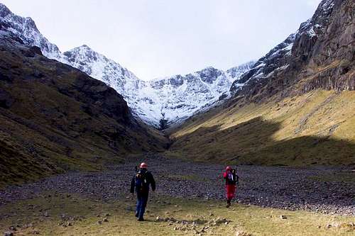
The most common routes of ascent run through the three great corries; Coire Gabhail (The Lost Valley), Coire nan Lochan and Coire nam Beithach. The Lost Valley is most definitely the most famous of the three corries and also the one that you will find is the busiest, especially in the summer months, when it is besieged with many tourists. The Lost Valley is hidden from view by a large cluster of trees, with a steep climb up through them revealing the valleys surprisingly flat and lush characteristics. All these aspects combined to provide the MacDonald clan of Glencoe with the perfect spot for stashing the cattle that they allegedly and regularly used to rustle from their neighbouring clans.
The route up and through the long lengths of Coire Gabhail eventually leads to the bealach between Sgreamhach and Bidean. The final stages to the bealach are covered in scree and the many feet trampling up and down over the years have caused serious erosion, making the going underfoot quite difficult. From here a beautiful ridge walk leads to the summit. The route through Coire nan Lochan follows the Allt (river) until reaching a small group of lochans. Carry on up either the north or west ridge to the summit of Stob Coire nan Lochan and along the northeast ridge to Bidean, admiring the views of its north face in the latter stages. The last route up Coire nam Beithach follows its Allt, climbing steeply until reaching the summit of Stob Coire nam Beith. From here travel along the northwest ridge, which carries a narrow snow arête under winter conditions, until reaching the summit.
Bidean nam Bian also provides some fantastic rock climbing and general mountaineering opportunities, with the Diamond and Church door buttresses being amongst the biggest draws that the peak has to offer. The lucky few that developed the routes up these having the pleasure of waking in the shadow of the mountain and then venturing up upon it to develop new routes. Among the first men to develop these routes was Norman Collie in 1894, who had only just earlier in the year established the route known as Tower Ridge on Ben Nevis, obviously had a keen eye for identifying any weaknesses in the rock.
Getting There
Airports
For arriving in Scotland and making your way to Glencoe, the best airports to arrive in are;
Car
From Glasgow take the A82 road via Loch Lomond northbound direct to Glencoe.
From Inverness take the A82 southbound via Fort William direct to Glencoe.
From Edinburgh take the M9 to Stirling, then take the A84 Callander road, becoming the A85 until merging with the A82 northbound road at Crianlarich then on to Glencoe.
Rail, Bus or Ferry
Traveline Scotland - A one stop shop for all of the above
Red Tape
There is no red tape in Scotland due to the Land Reform (Scotland) Act 2003 which incorporated the Scottish Outdoor Access Code. This code, which commenced on the 9th of February 2005, has established statutory rights of access to land and inland water for outdoor recreation.
The Land Reform(Scotland) Act 2003
The following aspects should be taken into consideration when you are in the Scottish countryside;
- Seek local advice in regard to deer stalking or grouse shooting activities
- Ensure that all gates are closed behind you
- During the lambing season (March to May) ensure that all dogs are kept on a lead
- Please refrain from feeding or annoying any animals
- Limited parking space is available at the start of many routes, please ensure that you are not blocking a road and/or entrance
- Parking is provided at the start of some routes by the local farmers, it is polite to ask if you can use this facility
- Try to refrain from crossing fields with animals and/or crops if an alternative route is available
- Ensure that you treat the local environment with care by leaving it as you found it and by taking any litter home with you
- Any camp fires should be carefully watched and only used away from dense forest areas
Local Accommodation
The best place to base yourself for climbing Bidean nam Bian is in or around the Glencoe area. Below is a selection of available accommodation;
Hotels
Lodges & B&B's
Hostels & Campsites
Caolasnacon Caravan & Camping Park
Wild Camping
Wild camping is totally legal in Scotland and can be done in various locations in Glencoe. This is due to the Land Reform (Scotland) Act 2003 that was mentioned earlier. Here are some of the basic rules that should be adopted when wild camping;
- The larger the group, the harder it is to keep impacts to a minimum. Keep groups small.
- Camp as unobtrusively as possible.
- Remember that noise travels from tents disturbing wildlife as well as humans.
- Enjoy the freedom of wild camping without leaving a trace of your passage. Protect our country's outstanding scenery and wildlife as well as the wilderness experience.
- Camping on the same spot harms vegetation. Aim to move frequently and do not stay for any longer than 3 nights in the same place.
- Lighting fires poses a high fire risk on peaty soils and close to tinder dry grass. A high risk of fire can exist at any time of year, and not just in times of drought.
- Watercourses and loch sides are important sites for birds and animals. Take extra care when camping near burns and lochs, and try to avoid camping immediately beside them.
- Always find a spot at least 30 metres from fresh/running water when going to the toilet.
- Bury excrement in a small hole (not under boulders). A trowel or ice axe can be used to lift a flap of turf.
- Remove all litter (even other peoples!) Think ahead and only carry in what you are prepared to carry out.
When To Climb
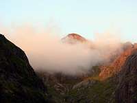
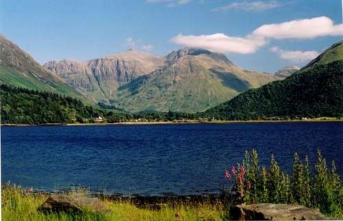 Bidean over Loch Leven. (Photo by:Andrew Hagen)
Summer
Bidean nam Bian is a popular destination in the summer months when most of the winter snow has subsided and at weekends a great wealth of people will be found on and around the many ridges and corries. The Lost Valley of Glencoe is also a popular destination for the tourists to visit so expect this area to be busy in the afternoons. Generally between the months of May to October there will be little snow found, although any still found will mainly be in the gullies or on northern facing sides of the peak.
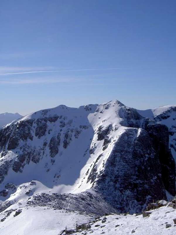
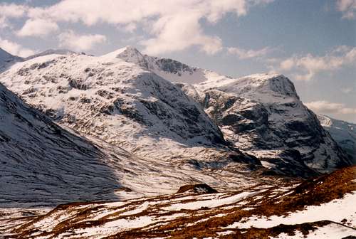 The Bidean Massif (Photo by:Daveyboy)
Winter
In winter, climbing Bidean nam Bian is a serious undertaking and should not be attempted by the inexperienced. Whatever you do, do not underestimate this mountain as it has claimed many lives over the years and will unfortunately continue to do so. The amount of daylight hours during the winter months in the area is also limited and you should ensure you have allowed enough time to be completed before the sun sets. There is a multitude of excellent climbing routes on Bidean and this is one of the many draws that the mountain has to the winter mountaineer.
Mountain/Weather Conditions
The weather conditions in Glencoe can alter rapidly and you should ensure you are fully prepared for all weather eventualities. The following websites will provide invaluable information on the expected conditions for your planned trip;
Mountain Weather Information Service - West Highlands
Mountain Forecast - Pap of Glencoe
Met Office Mountain Forecast - Southwest Highlands
Scottish Avalanche Information Service - Glencoe
As stated, the peaks in the Glencoe region sit close to the west coast of Scotland. This can have a strong affect on the conditions on the mountains and it is a regular occurrence for Glencoe to experience its very own weather system and for it to totally differ to the weather in the nearby towns and villages. More detail can be found on the reasons for this occurrence on Proterra's article: Mountain meteorology of Scotland.
Books & Maps
Books
Central Highlands by Peter Hodgkiss
The Munros by Donald Bennet & Rab Anderson
The Corbetts and Other Scottish Hills by Rob Milne & Hamish Brown
The Grahams and The Donalds by Rab Anderson & Tom Prentice
Glencoe Climbers Guide by Rab Anderson, Ken Crocket & David Cuthbertson
Highland Scrambles South by Iain Thow
Ski Mountaineering in Scotland by Donald Bennet & Bill Wallace
Hostile Habitats by Mark Wrightham & Nick Kempe
Scottish Hill Names by Peter Drummond
Ben Nevis & Glencoe by Ronald Turnbull
Maps
OS Explorer 384 - Glencoe and Glen Etive
OS Landranger 41 - Ben Nevis: Fort William & Glencoe
Harvey Superwalker Map - Glencoe
External Links
Mountain Rescue Committee of Scotland
Heading For The Scottish Hills
The Scottish Mountaineering Club


