
-
 23294 Hits
-
 92.32% Score
-
 38 Votes
|
|
Mountain/Rock |
|---|---|
|
|
45.62262°N / 121.96091°W |
|
|
Scrambling |
|
|
Spring, Summer, Fall, Winter |
|
|
1814 ft / 553 m |
|
|
Overview
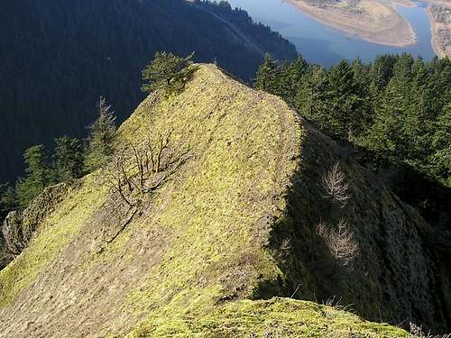
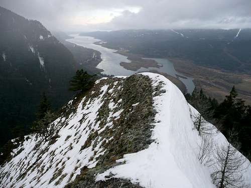
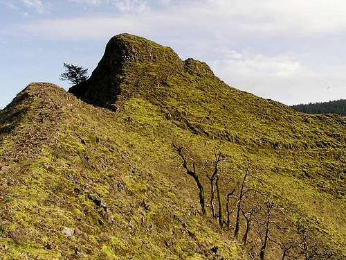
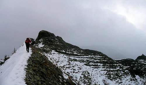
Munra Point is located on the western end of Oregon's half of the Columbia River Gorge across from the better-known Beacon Rock. It is an exciting scramble that won't steal your whole day from you but will give you great views up and down the Gorge. What this one lacks in total elevation it makes up for in scenery, variety and uniqueness. The route starts as a steep hike and turns into a scramble over basalt columns and tree roots. It culminates in an open, exposed and very steep tri-ridged horn about 1800 feet above. The route is unmaintained although it is easy enough to follow. Not one of the more known hikes in the Gorge, it is one of the more rewarding. While it can be done year round, special care should be taken as it is exposed Class 3 scrambling a lot of the way with a Class 3-4 groove to access the final summit ridge. Some rappel this section on the way down and in wet weather, it is not a bad idea.
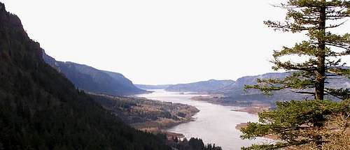
Munra Point can be seen in this photo of the Gorge as the second point from the right. There is one route to the summit but three ways to access it (see Route Page for more information). It lies between the Tanner Creek drainage to the east (left in this photo) and the Moffett Creek drainage to the west. These points in the Gorge resemble the familiar Hawaiian coastal peaks in the thin ridges and sheer dropoffs.
Munra Point was named after Katherine Sterrett Munra, known as Grandma Munra. She was a pioneering woman who ran a railroad eating house in Bonneville. There is also a railroad station (siding) named after her by the Union Pacific Railroad near Pendleton, Oregon.
This is truly a unique climb in the Gorge. The open ridged summit is one of a kind and access is amazingly easy. The easiest way to climb/hike is to start right from Interstate 84. The route is only 1.5 to 2 miles but in that distance you gain about 1740 feet. It's a great scramble workout that one can do in a morning and be back home quickly (or on to another Gorge hike). There is a steep path to the exposed northeast ridge viewpoint. One could also take the south ridge eventually into the woods but it heads into the protected Bull Run Watershed, Portland's water source and there is no trespassing there.
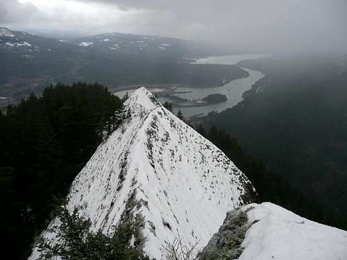
Photo Resources
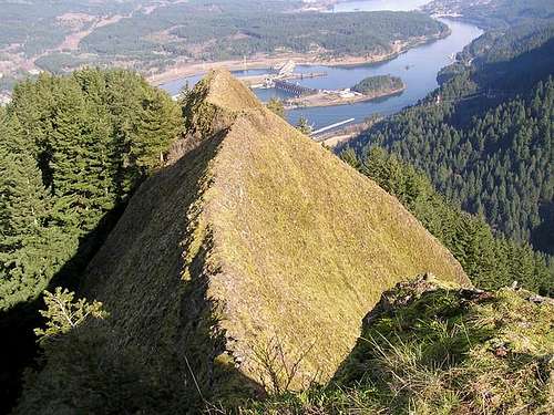
Photo Journal with 3D Map
Other photo jounral
YouTube Panorama from the Summit
Getting There
From Portland, take I-84 east to about milepost 39. Just after signed Moffett Creek, pull off the highway onto the shoulder at the brown Bonneville Dam Exit 40 sign at the large somewhat gravel pullout. I generally back in and park as close to the sign to avoid road rocks and to try to be out of view as best one can.
This peak can also be access from proper trailheads in either direction. Please see the Route Page for detailed directions to those.
Red Tape
Northwest Forest Passes are required if you park and use one of the east or west trailheads. No fee or permit if you park on the shoulder/pullout on I-84.
Camping
This is a day use area and the trail is only 3 miles round trip. If you wish to camp nearby there are campgrounds at Eagle Creek just a mile or two east in the Gorge from Munra (seasonal).
Other camping resources:
Mt. Hood National Forest Campgrounds
Places To Stay in Oregon:The Gorge includes lodging, RV parks and campgrounds.
Mountain Conditions
Gorge Weather Link
Gorge Weather Cam
Columbia River Gorge National Scenic Area