
|
|
Area/Range |
|---|---|
|
|
45.82730°N / 11.14470°E |
|
|
7323 ft / 2232 m |
|
|
Overview
22 january 2006From Mount Pazul to Alpe Pozze and Col Santo: the heart of Pasubio
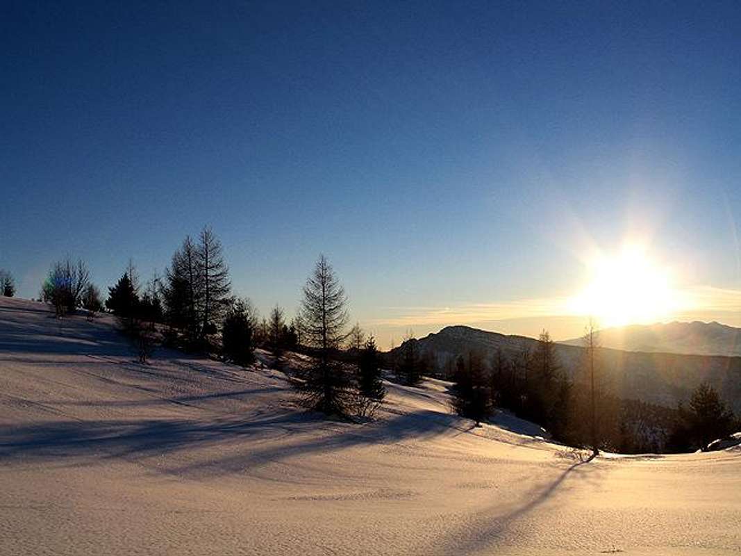
PASUBIO PANORAMIC VIEW
Geographical Classification: Eastern Alps
The Pasubio massif
is 160kmq wide and it is situated between Folgaria and Lavarone tableland and the Carega group,
in the south eastern borders of Trentino and Veneto region.
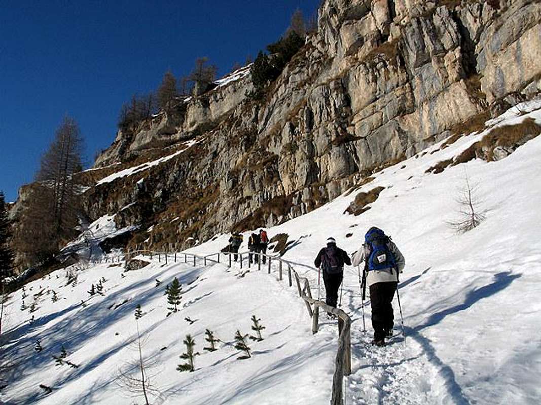
It is famous because it was the scenario of Great War: in fact this massif was a strategic position from 1916 the end of the war. The Pasubio is crossed by trails and roads build around 1917 by Italy during the sad war with Austria ( the famous " Strada delle gallerie" or Road of Tunnels ...52 galleries.)
Today you can walk along the famous "Path of Peace" along this Road of Tunnels to the top of M.Pasubio and the Italian and Austro-Hungarian peaks, the Lancia Refuge and crossing the European path E5.
From its summit (northern side) there is a remarkable and great view: from the Baldo range to thePiccole Dolomiti group and the Padana plain,
from the tableland of Folgaria and Lavarone to the Adige Valley and Dolomiti di Brenta.
Pasubio is bordered by four Valleys:
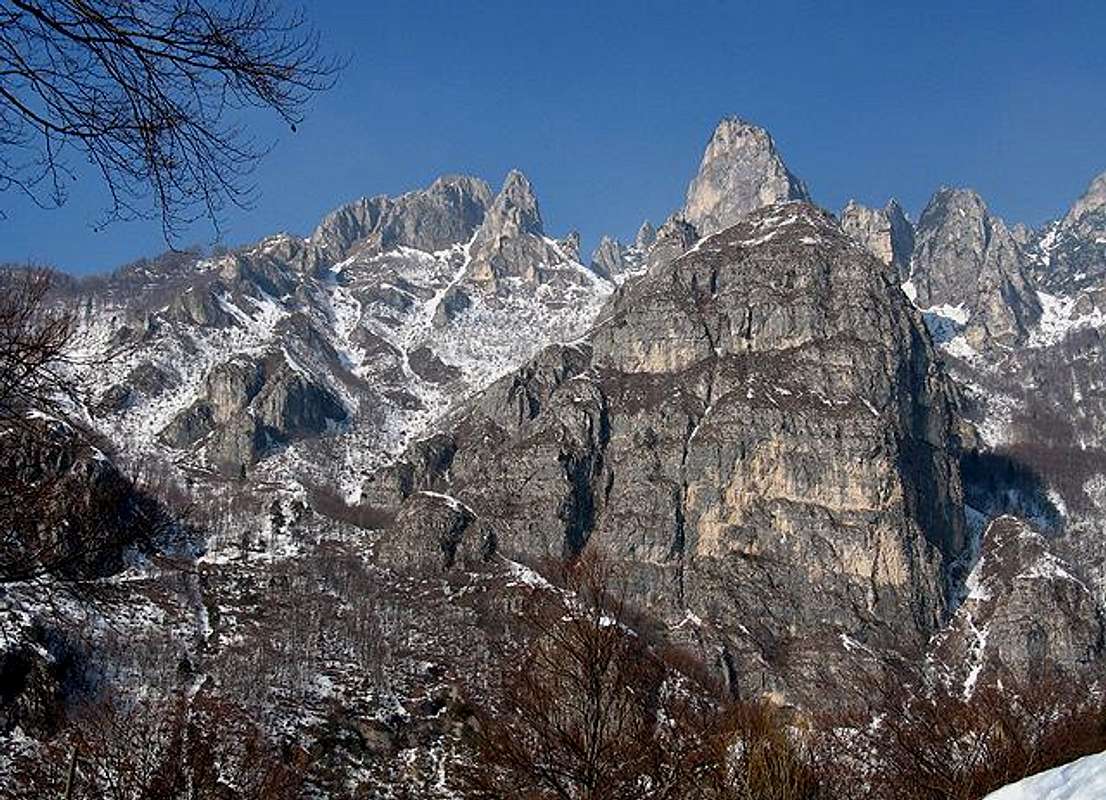
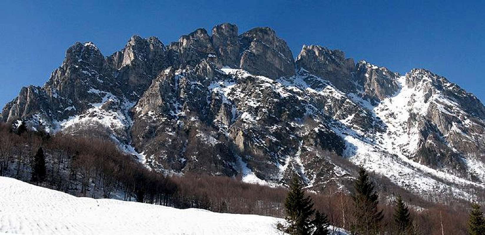
The morphology of this side is dolomitic with steep rocky walls and pinnacles of the higher summits: Pasubio,Roite,Soglio dell'Incudine.
It is characterized by an impressive rocky front : from Punta delle Lucche to Sogli Bianchi.
The Pasubio massif is crossed by two important roads that go along the Pian delle Fugazze Pass in Vallarsa Valley and the Borcola Pass in the Terragnolo Valley. The most important road is in Vallarsa (Via Regia)

 |  |  |  |  |
Main Summits
 |  |  |  |  |
Geology
The range consist of sedimentary rocks, limestones and dolomites and metamorphic rock: Dolomia, Calcari grigi, Biancone, Rosso Ammonitico, Basalti, Porfidi Triassiche, Scisti cristallini,Scaglia Rossa venetaBoundaries
 |  |  |  |  |
Hiking Route
Access to the Pasubio by the Vallarsa Valley| Vallarsa | Anghebeni | SS 46 del Pasubio (versante NE centro Vallarsa) path 102 , Monte Trappola(1403m.) |
| Vallarsa | Valle deiFoxi | path 102, Bocchetta di Foxi (1743m.) Corno Battisti (1769m) |
| Vallarsa | Raossi | path 135,Val di Piazza, Cima Menderle ( 1544m.) path133 Alpe Cosmagnon, Bocchetta delle Corde, Monte Testo (1998m. |
| Vallarsa | Valmorbia | path123,Monte Trappola (1403m.), Sella Battisti, Corno Battisti ( 1760m.) |
| Vallarsa | Valli del Pasubio | Pian delle Fugazze (1162m.), Passo del Xomo, Bocchetta Campiglia, path366 ( strada delle Gallerie), versante Bella Laita, Passo fontana d'Oro (1880m.)Val Canale ( Soglio Rosso), Porte del Pasubio, Rifugio Papa |
| Vallarsa | Valli del Pasubio | Pian delle Fugazze (1162 m.),path339, Val di Fieno,Sentiero Baglioni,Selletta di Cosmagnon,Monte Pasubio (2232m.), Soglio dell'incudine |
| Vallarsa | Valli del Pasubio | Passo Pian delle Fugazze (1162m.) Val di Fieno, Strada degli Eroi, Galleria del gen. d'Havet ( val Canale) Rifugio Papa (1934m.) |
NORTHERN SIDE OF PASUBIO
Trambileno
From Rovereto ( 2.10 hours) drive to Vallarsa Valley in the direction of Trambileno, Pian delle Fugazze Pass.. there is a cross 3 km. after with a road sign: "Rifugio Lancia".
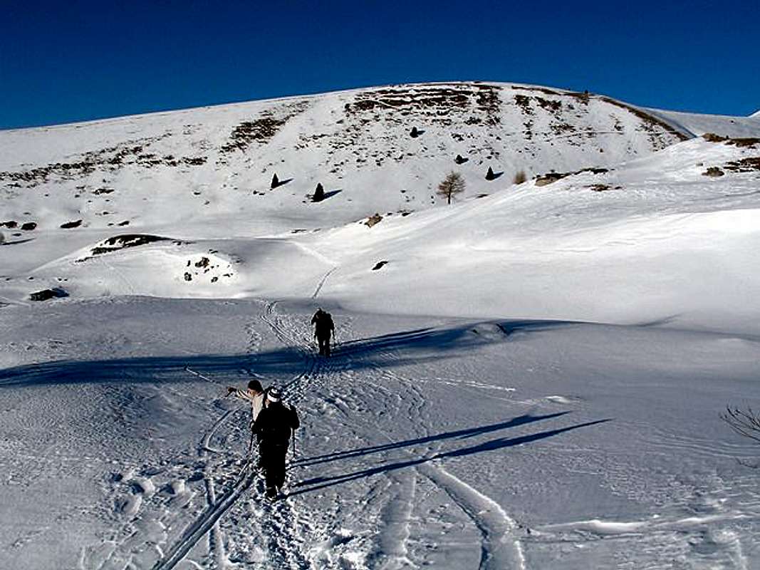
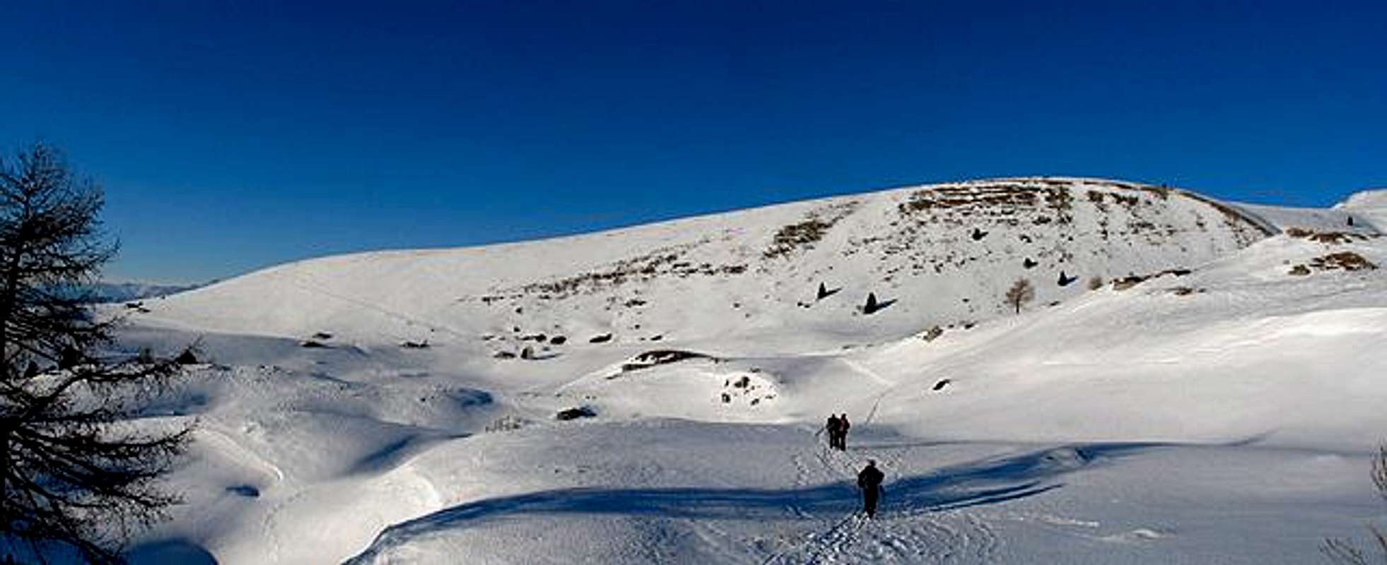
Drive till Giazzera (1092m.) and then go by feet along the "segnavia101" . The path hiking in the wood and then it became an easy forestal way. till Malga Cheserle.The path 101 arrive then to the beautiful Alpe Pozza and the Refuge Lancia (1650m.).. From the refuge take the segnavia132 that cross all Alpe Alba prairies: here you can enjoy the solitude and the great view and panorama around you (1823m. about) You come back by the segnavia 101 .
Alpe Pozze : the heart of Pasubio
Starting from Giazzera one comes to a subsidence : the Cheserle plan, bordered by M.Testo (E), by Pazul (NE) and by M.Spil (SW) Going along the mule track toward SW till the wide depression of Pozza Ronda, bordered on its S side by M.Testo and on its N side by steep walls coming down from alpe Alba.
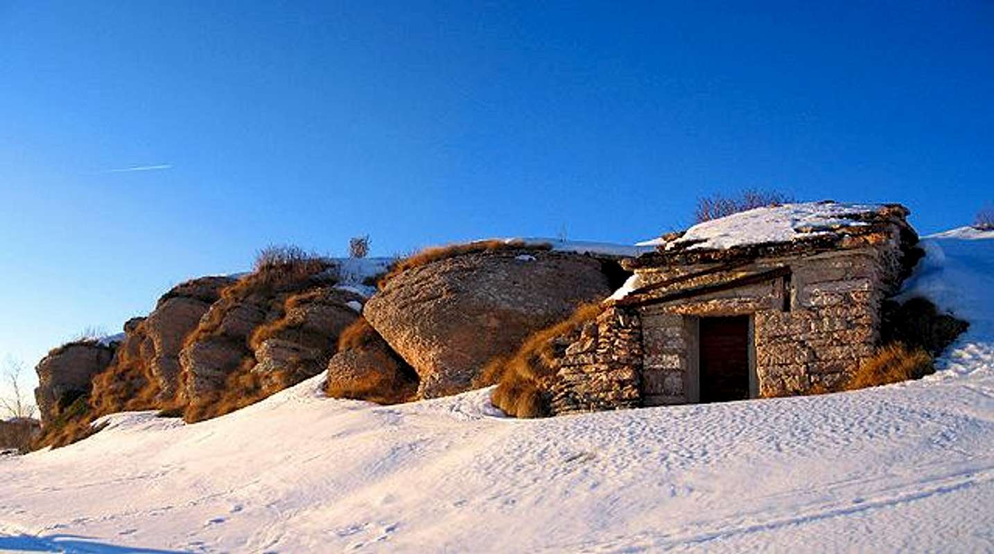
Further on till the centre of the massif, the hollow of Alpe Pozze: a wide basin between the Col Santo and Col Santino (NE) and the ridge joining the M.Buso to Roite (SE).Here, near the Pasubio meadows (Alpe Alba) lies the Rif. Lancia.Giving a glance toward SE one can see the Capiluzzi saddle, between Roite and M.Buso and, in background, the higher summits of Pasubio : Dente Austriaco, Dente Italiano e Cima Palon (tragic stage of First World War) bordered by the Piana of Cosmagnon: the entire area is surrounded by steep rocky walls, the one small plan hosts the Rifugio Papa and the malghe Pasubio e Pasubietto
 |  |  |  |
Getting there
From Vallarsa ( north Pasubio)Car:
Vallarsa can easily be reached from north and south on the Brennero state road 12 or the motorway A22, exit at the toll gate of Rovereto Sud, from there on the SS46 Pasubio or the road SP89.
Train
To the railway station of Rovereto and from there by bus.
Airplane
The nearest airports are Verona Catullo (90 km), Venice Marco Polo (195 km), Milan Linate (245 km) and the new airport in Bolzano (60 km
"Sentieri Pasubio Carega" 1:25.000 sezioni vicentine del CAI
"Rovereto Monte Pasubio" kompass 101 1:50.000
"Dal Tonale al Monte Pasubio" E5 Sentiero della Pace Helmut Dumler
 |  |  |  |  |
Refuges
Rifugio "Vincenzo Lancia"Gruppo: Pasubio Localizzazione: Alpe Pozza
Quota: 1825 Comune: Vallarsa
Telefono: 0464/88068 Gestore: Ilia Chizzola (0464/90812)
Rifugio "Papa"
Gruppo Pasubio
Ubicazione: Porte del Pasubio
Comune: Valli del Pasubio
Provincia: Vicenza
Proprietà CAI Schio, Via A. Rossi 8, 36015 Schio (VI), tel. 0445/525755 (+fax)
Telefono *0445/630233
Gestore Renato Leonardi, Via Cà Bottara 9, 36015 Schio (VI), tel. 0445/671026 opp. 328/0339538, E-mail: renatolr@tin.it
Posti 60
Routes Overview
 |  |  |  |
 |  |  |  |  |
Info
VallarsaA.P.T. di Rovereto e Vallagarina
Corso A. Rosmini, 6
38068 Rovereto, Italy
Tel +39 (0464) 430363
Fax: +39 (0464) 435528
E-Mail info@aptrovereto.it
Vallagarina and Rovereto info
Vallarsa info
Tiroler kaiserjaeger
Pasubio:sulle orme del soldato
Weather forecast
For weather and avalanche conditions in Trentino look at this pages:wetterzentrale
Meteotrentino
Meteo Alpin
Società Meteorologica Italiana