
-
 8975 Hits
-
 80.49% Score
-
 12 Votes
|
|
Route |
|---|---|
|
|
54.44788°N / 3.1988°W |
|
|
Mountaineering |
|
|
Summer |
|
|
A long day |
|
|
5.0 (YDS) |
|
|
UK Grade 3s scramble |
|
|
II |
|
|
OVERVIEW
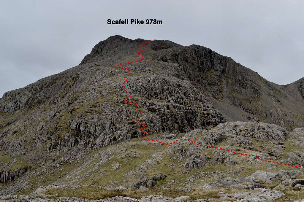
Pen by Thor's Buttress is one of a highly recommended pair of long (by UK standards) 3 star rated, Grade 3 scrambles arising from one of the remotest and most beautiful corners of the English Lake District – and which both can ultimately lead to the top of Scafell Pike, highest mountain in England at 978m (3209ft). The other is Ill Crags South East Face, which I wrote up as a route page on SP in May 2014.
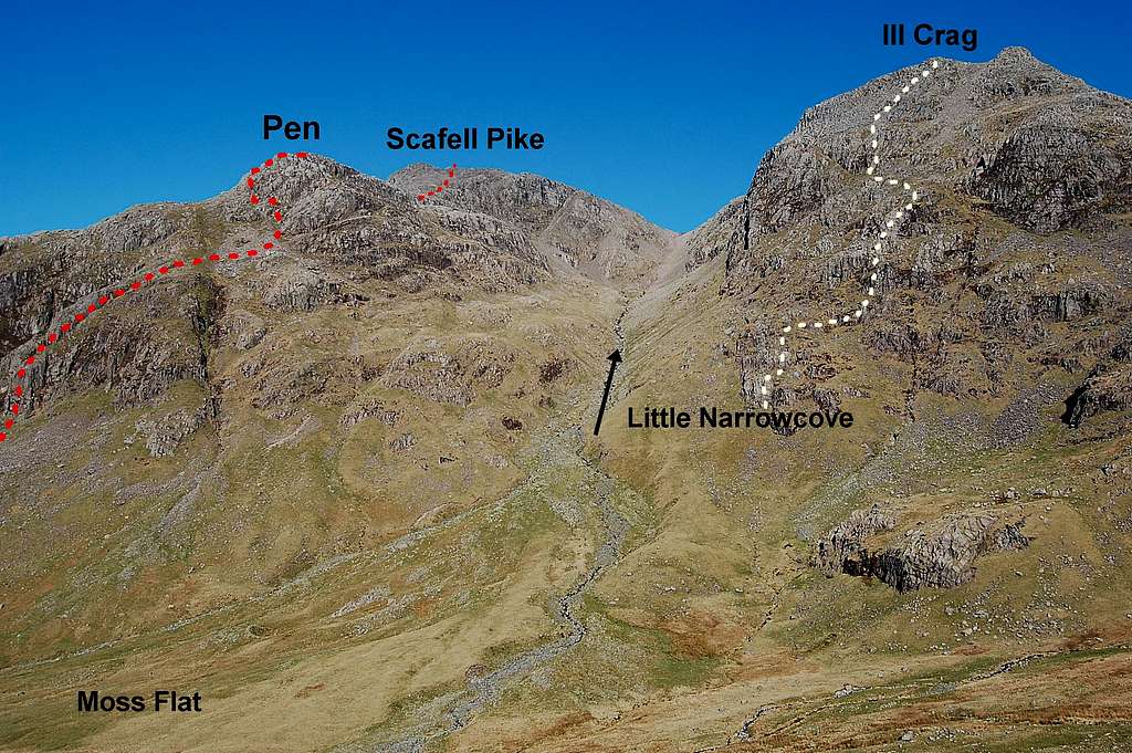
Two classic Grade 3 scramble routes: Pen by Thor's Buttress and Ill Crags SE Face
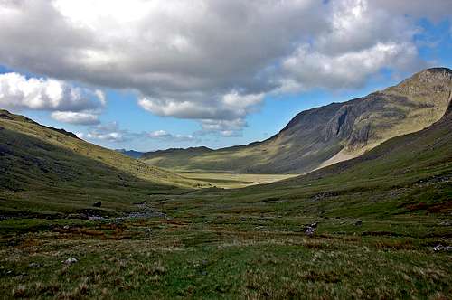
Both these fine scramble routes rise up out of Great Moss, a remote sanctuary at the northern extremity of Upper Eskdale. Access routes are long from either the North (Borrowdale) or South (Eskdale). Indeed, by English standards this route is about as remote as it gets; a true mountaineering expedition – rivaled only by the great scrambles on Pillar 892m, a few km to the west.
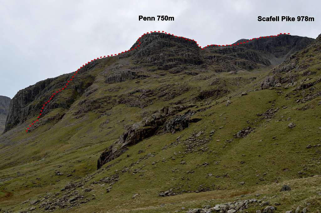
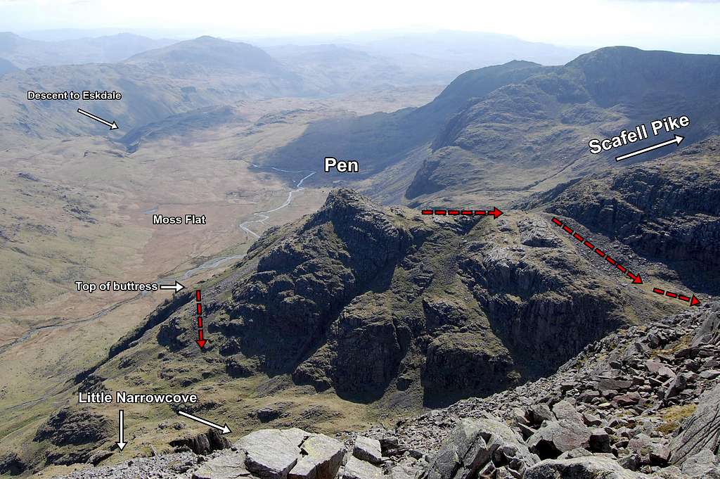
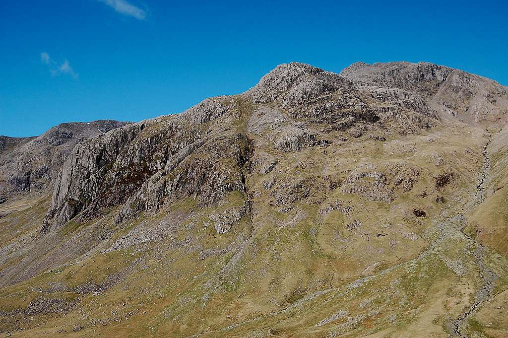
Pen 752m (2,466ft) is a tiny subsidiary top of Scafell Pike. It is to be found at GR 222 068 (54°27’07’’N 3°12’07’’W) - and is too tiny to feature on OS 1:50 000 and only just features on the 1:25 000 map. From most directions it is rendered utterly insignificant by its parent – and other subsidiary tops like Ill Crag and Broad Crag, which are nearly as high. Only from a view point at northern extremity of Great Moss does Pen cast a more impressive profile – and then it presents as a formidable mountain, whose summit is guarded by two tiers of rocky buttresses – one of which features Thor’s Buttress.
 Pen and Scafell Pike from beyond northern extremity of Great Moss | 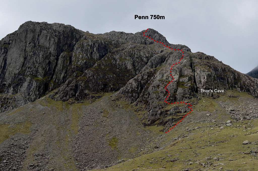 Pen and Thor's Buttress from Great Moss |
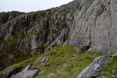
From down in the bottom of Great Moss, the rocky cone culminating in the top of Pen can be seen to arise above two big crags: the left (southern) is the formidable Esk Buttress (marked as Dow Crag on OS map); the right (northern) is the more broken and easier angled Thor’s Buttress, some 100m high – and which is split by the deep cleft known as Thor’s Cave. Our route follows a tortuous course left of Thor’s Cave and roughly up the middle of the buttress, before angling towards the summit cone of Pen. To reach the top of Pen involves approximately the same again; about another 100m of height gain – initially on easy angled boulder slopes at the top of the buttress – but then back to more challenging slabs and small rock steps up to access the little summit.
The top of Pen represents the finish to the route. Then it is possible to pick a careful line of descent down loose, broken slopes behind the peak and down into the hanging valley of Little Narrowcove – and away – or up the serried ramparts of Ill Crag SE Face to ‘bag’ the second of the two scrambles. This latter option is recommended in guide books I have read. I can now personally vouch for the worthiness of both these routes. However, on reaching the top of Pen, the pull of continuing upwards – to climb the upper ramparts of Scafell Pike – is very compelling. This latter option adds about a further 200m of ascent which, added to the 250m already climbed from the bottom of Great Moss, makes for a total of around 450m of ascent. The route to the top of Pen is very much grade 3; with a little exposure, some route finding issues and one or two quite tricky rock-climbing moves. One guidebook I read described the route from the top of Pen to Scafell Pike as being ‘at about the same standard’. It is quite steep and a fairly long way in distance – and the profile certainly looks impressive, as seen from Little Narrowcove. However, it is actually much easier. I would suggest the first half would deserve Grade 1 in scrambling grade, but thereafter is no more than a walk, albeit up a steep track zig-zagging up scree – so a little strenuous.
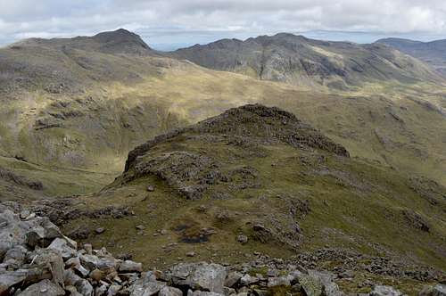
Pen seen from Ill Crags summit, looking somewhat dwarfed. The wide open space of Great Moss is beyond.
Seriousness: In common with the Ill Crags scramble this is a remote and little frequented mountaineering route. This is a principle attraction. But a consequence is that there are few signs to mark the route – no trail nor ‘polish’ on the rocks. Most of the rock is clean and a delight to climb but there are a few potentially damp mossy corners which are slow to dry out – and where care is needed. There are also a few loose rocks around. This is not a route to tackle in bad weather or if visibility obscured by mist. I found the route a little more challenging than Ill Crag, although not quite so long. I was happy to solo Ill Crag – but on Thor’s Buttress as well as on the final rocky cone of Pen I was glad to have the protection of a rope in a number of places. I would therefore argue the route grade deserves the enhancement of grade 3s for ‘serious’.
Route Description: because navigating is a little tricky it will be helpful to break route up into 3 distinct sections:
- Thor’s Buttress
- Pen summit pyramid
- Scafell Pike summit
Grade: The route falls into the category of ‘hard scramble’ or ‘easy rock climb’. With an international readership in mind, using the 5 most used classification systems, the following grades will be about right:
- UK scramble Grade 3*** (*system denotes quality) + as above I'd add the enhancement of ‘s’ for serious
- UK climbing adjectival grade ‘Moderate’ (although I'd say some individual moves worthy of difficult)
- French adjectival grade ‘Peu Difficile’ UIAA Grade II (normally scramble grade 3 would equate to about UIAA II, but there are definitely some moves of III)
- USA/YDS somewhere between Class 4 - YDS 5.2 (have been made aware this is controversial at this end of the scale - have therefore given a range to try to avoid upsetting either camp!)
Exposure: South-east - so catches morning sun, but in shade in the afternoon. If not exposed to sun in the morning it will most likely remain damp in some of the mossy corners – as noted above under ‘seriousness’.
VIDEO TRIP REPORT
After climbing Ill Crags SE Face in April 2014 I resolved to return to climb Pen by Thor's Buttress as well. Finally on 24th May, after two attempts foiled by weather/conditions, another opportunity cropped up. At short notice I got to climb the route with Jon, an old climbing companion from the 1980's - with whom I had climbed the best and hardest climbs I ever did in the Alps and had also made a not quite so successful attempt on Broad Peak in 1987. Apart from a rock climb in North Wales a decade ago, I hadn't climbed with Jon since we reached 7000m together on Broad Peak 28 years before. With a trip to the Andes planned for February 2016, Thor's Buttress provided an excuse for a reunion as well as for us to fit in a bit of training...
GETTING THERE
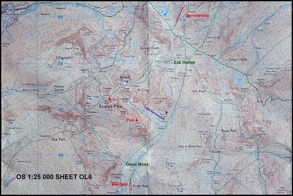
Copied from OS Map OL6 The English Lakes SW area 1:25,000
It is also possible to reach Upper Eskdale from Cockley Beck and Moasdale, also to the south.
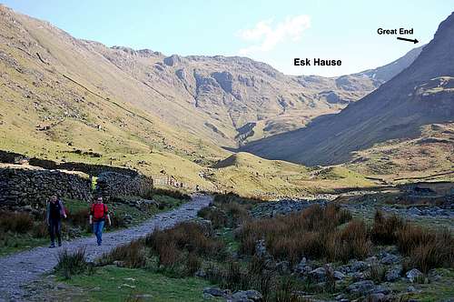 Esk Hause from Seathwaite/Borrowdale approach | 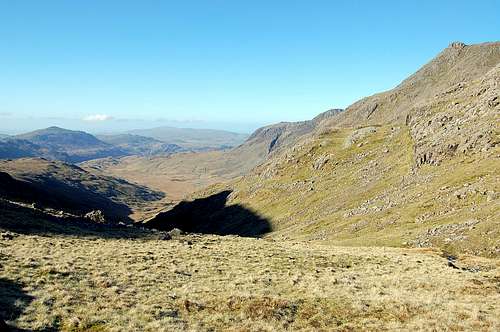 Great Moss from Esk Hause - Eskdale in far distance |
From the North: Parking is available at Seathwaite (54°29’59.62’’N, 3°10’45.54’’W) OS GR 236 123, at southern end of Borrowdale. From here follow path south alongside Grains Gill Beck for 2km before rising steadily up to the base of the spectacular precipices of Great End. At this point there is a T junction. Follow route to left (south east) and gently rising to reach the flat area known as Esk Hause at 759m, 2300ft (OS GR 233 082). Descend 1000ft from Esk Hause following narrow valley to the south south west towards Great Moss. Follow banks of a little stream which will eventually become the River Esk. About 2 hours from Seathwaite.
At OS GR 227 066 and at start of Great Moss Flats, the stream is joined by another smaller stream descending the narrow side valley of Little Narrowcove to the northwest.
Final approach: Both the northern and southern approaches converge at the top (northern) end of Great Moss and roughly half a kilometer SW of the confluence of streams at the entrance to Little Narrowcove. The start of the climb up Thor's Buttress is at OS GR 224 065, about 200m distance away and 50m above the main trail traversing Great Moss, up at a joining of two scree fans.
ACCOMODATION
Great Moss offers near perfect camping options - if weather favourable!
Bed & Breakfast
There are at least 2 B&B options within 3 miles of Borrowdale to the north, but not so easy to find options for Eskdale side. See link:
Camping
In addition Great Moss flats offer near perfect camping out in the wilds at the foot of the climb. A fine trip would be to walk in from either the north or south and set up a camp on Great Moss and then tackle the climb early next morning - when it may be illuminated by the rising sun. But remember: this is the English Lake District - and the weather doesn't always cooperate!
ROUTE 1: THOR'S BUTTRESS
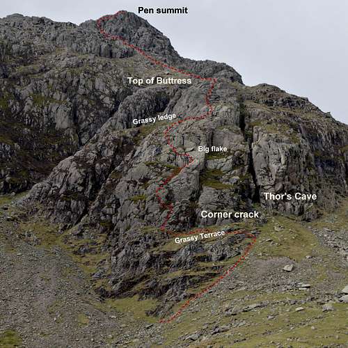
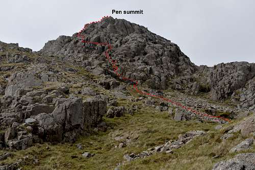
Topo of route showing main features
The very bottom of Thor’s Buttress actually starts about 30m below these features at a joining of two scree fans. However the rocks down here are mossy and unattractive to climb. To all intents and purposes the route starts from a steep grassy terrace arising just above these lower rocks but below the cave - and traverses across below the corner crack – before ultimately petering out at a corner about 50m left (south) of the fall-line from the cave.![At start Pen by Thor's Buttress]()
At the surprisingly steep start to the climbing...
At the surprisingly steep start to the climbing...
Bypass the lower mossy rocks of the very bottom of the buttress by following hints of a trail rising up the L edge of RH (northern) scree fan. Scramble over boulders and little steps to access the grassy terrace and traverse left just past the corner crack (which is bounded on L by vertical wall). Just at this point follow a narrowing of the grassy terrace as it eases round a heathery corner. The rocks of the buttress are intimidatingly steep at this point albeit still broken by little heathery steps. This is where the route starts – before ascending sharply and with a little difficulty straight up to a ledge of grass and heather. (It is possible to make a rising traverse further along the grass terrace to the L corner of the buttress, where it overlooks a broad shallow gully. This actually looks to be a more plausible start to the route. But it isn’t! The start is as described above, literally just round the corner and around 10m from the corner crack.)
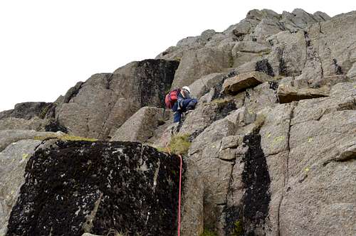
Having climbed the first step to the heathery ledge an exit is made leftwards up over an awkward block – to gain access to a sort of ramp rising from L to R up the crest of the rocks forming LH wall of the corner crack system – up towards, but not quite too, an obvious boulder flake, which is prominent enough be seen from Moss Flat. The ramp system ascending L to R which leads up to it can also be identified easily from below.
The route now angles away leftwards following line of least resistance, away from the vicinity of the flake (and also away from the edge of the wall dropping into the corner crack). At some point there is an awkward pull up onto top of another block – just challenging the use of a knee (as no respectable member of the Alpine Club ever should!).
At about 2/3 the way up to the top of the buttress (less than half way to the top of Pen) a long grassy ledge spans across nearly the full width of the upper part of the buttress. This ledge is also readily identifiable from below. Above the ledge the upper buttress is guarded by what at first sight seems to be an impregnable wall. The Cicerone guide book mentions a ‘mossy scoop’ as providing ‘the key’. Certainly the wall further along the ledge and to the left of what we identified as this ‘scoop’ gets steeper – and correspondingly less plausible as a ‘scramble’ route. The photo shows what we decided was the scoop – and this was straight forward to climb; initially steep, but the angle soon relents to easy angled slabs for a few meters – before a mildly dramatic looking steepening (see photo), which is straight forward and soon leads to the top of the buttress.
 Grassy ledge near top of buttress guarded by impregnable wall... | 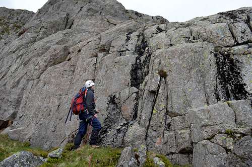 ...but at right end of wall "the Mossy Scoop provides the key"... | 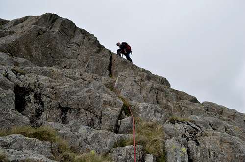 ...followed by enjoyable climbing to the top of the buttress |
ROUTE 2: PEN SUMMIT PYRAMID
Climbing the buttress disposes of approximately 100m of height. About another 100m remains to reach the top of Pen. As the photo topo shows, initially the route is a grassy plod, but this soon gives way to scree and then to the lower rocks of the summit pyramid. It may be tempting to go straight for the top at this point. The average angle doesn’t seem that steep and this would surely be possible. However the angle soon steepens further and the way is increasingly barred by short difficult walls and it gets progressively harder - and soon breaks into serious rock-climbing going this way. It is better to follow the system of ledges and rock steps leading left towards the LH skyline – where an easy rocky arête soon leads to the top of Pen.
 Summit pyramid of Pen from top of buttress | 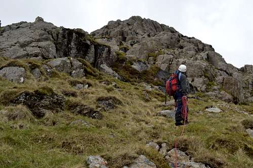 Final ascent Pen - debating which way to go... |
As above, guidebooks suggest dropping down into Little Narrowcove – to either return home, job-done - or to find the grade 3 scramble to the top of Ill Crag. This would be a very strenuous option and make for a very long day – especially if the journey were then lengthened even further by joining the main Scafell tourist path ‘motorway’ to the highest point in England.
It makes for a fine mountaineering finish to head direct for the summit of Scafell Pike, via the continuation of the rocky spur behind Pen and heading towards the north-west.
 Going straight up possible but harder... | 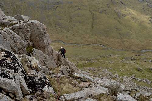 Following one of several ledges going L provides the way... | 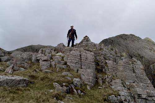 ...to an easy rocky crest followed by summit of Pen 752m |
ROUTE 3: SCAFELL PIKE SUMMIT
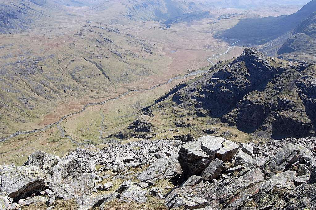
On continuing on over the top of Pen a broad rocky saddle is to be found. To the R is Little Narrowcove. To the L broken rocky ground drops steeply into a shallow gully which ultimately drops down and round into Moss Flat, behind. Ahead is the broad south-east spur of Scafell Pike. ![Scafell Pike from Pen]()
Ahead is the broad south-east spur of Scafell Pike summit
Ahead is the broad south-east spur of Scafell Pike summit
One of the guidebooks described this final 210m ascent to the top of England as being at the 'about the same standard' of the route just climbed. The Cicerone guide-book describes the way ahead in terms of “…a further two rock tiers and then a long walk to the summit of Scafell Pike…” but it doesn’t suggest a grade.
The first of these rock tiers represents the steepest and most technical section and is known as ‘Rough Crag’ on the 1:25 000 OS map. This requires some easy scrambling at about grade 1 standard. A smaller but similar tier soon follows. Thereafter the route follows an undulating but progressively rising course, all of a sudden on a well-defined path now - which seems to appear from nowhere (and is not marked on the 1:25,000 map).
 Pen from 'Rough Crag' 1st rock tier on south-east spur | 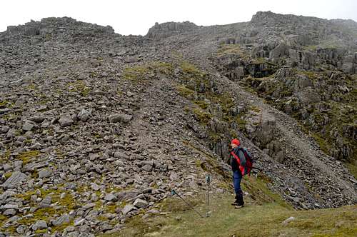 Final scree ascent to Scafell Pike | 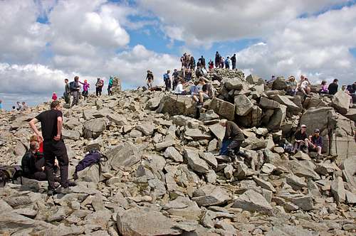 Scafell Pike summit gets many visitors on a fine summers day |
Following on from the two rocky tiers the terrain is initially composed of grassy slopes strewn with boulders, but the final riser is of pure scree – with the narrow but still well defined path following a series of short switch-backs all the way up to the wide boulder plateau at the top of the Pike. On arrival at the edge of the summit plateau the large square shaped cairn making the highest point is dead ahead and about 200m away.
Summit view
Two weeks before climbing Thor's Buttress with Jon I walked to the top of Scafell Pike via Little Narrowcove with my son Keith (too wet and late in day to tackle the scramble). We walked out above the clouds to enjoy a murky but atmospheric sunset up on summit at 8pm on 9th May. See short video clip below:
DESCENT
Escape routes
Below the top of Thor’s Buttress there are no escape routes other than to reverse the route or continue to the top.
At the top of the buttress (facing forwards towards Pen) it would be possible to descend the broken slopes to the RIGHT into Little Narrowcove, but rock-steps abound, which would be hard to spot from above – and it may be tedious as well as even a little dangerous to try to piece together a route (see image) - but quite possible
A perhaps safer albeit longer option is to keep going over Pen, but aiming to pass on the left side of the summit cone and so to reach the broad saddle between Pen and Scafell Pike. As described above the further to the left the easier the terrain gets on Pen summit pyramid. Once on the saddle best course is to find a way down into Little Narrowcove below and to the RIGHT - but not immediately. Again rock steps abound and there are some very big ones immediately below, as can be seen on image. A much safer line can be found on the scree slopes passing to the right (east) of the lowest rocks of 'Rough Crag' (1st tier on ascent to Scafell Pike) heading in a north then north-westerly direction and towards the top end of Little Narrowcove. After approaching 500m of careful descending traverse along the screes it should be possible to cut down to the right and reach the main walking trail in the bottom of this narrow hanging valley. Once on this trail any route finding difficulties are over, even in bad visibility. There are two options now: the first is to descend Little Narrowcove to Great Moss - and thence either further down and to Escdale - or up and over Eskhause to Borrowdale; the second is to actually ascend Little Narrowcove up to the pass between Scafell Pike and Broad Crag. At this point the main, well marked tourist path down to Borrowdale is reached - well trodden and with large cairns every 30-40m over Broad and Illl Crag, past Great End – to Esk Hause and ultimately back down Grains Gill to Seathwaite and Borrowdale.
Pen - escape routes
Return to Eskdale from Scafell Pike:
From summit follow the main tourist path (with frequent large cairns) down to the col between the Pike and Broad Crag. This is the pass at the very top of Little Narrowcove. Turn RIGHT (south-east) into this valley and follow the rougher path downwards. After a loss of 1520ft/465m height the flats of Great Moss are reached – and thence a return following the River Esk south all the way back down to Brotherilkeld.
Return to Borrowdale from Scafell Pike.
The above route can be followed all the way down to Great Moss – but at the bottom instead of turning south the river Esk could be followed northwards, up towards its source at Esk Hause – from where there is an easy descent back down to Borrowdale. (This would actually be best option if descending from Pen). However, if route had been followed all the way to the top of the Pike then the tourist path is extremely easy to follow with such a well trodden trail and the frequent cairns marking the route. Note that the descent ascends first over Broad and and then over Illl Crag, before descending past Great End – to Esk Hause and ultimately back down Grains Gill to Seathwaite and Borrowdale. (See map enlargement in "Getting There" above)
 Summit view showing tourist path to Borrowdale | 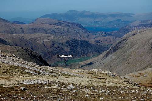 Borrowdale in sight just before descent to R to Esk Hause | 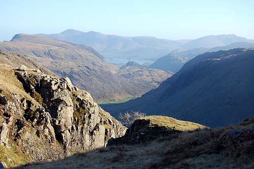 Below Esk Hause and with final descent to Seathwaite ahead |
TIMINGS
The climb: About 2 ½ hours from the valley bottom near Moss Flat to the top of Pen, using a rope to protect the more difficult sections (half this time if solo and unroped). About an hour from the top of Pen to the summit of Scafell Pike. Total 3 ½ hours from Great Moss to top of the Pike.
Northern (Borrowdale) approach: 2-3 hours from Seathwaite to the bottom of the climb via Esk Hause; 2 hours for descent to Seathwaite, Borrowdale from the summit of Scafell Pike.
Grand total all included = 7 - 9 hours.
Southern (Eskdale) approach: 3 hours from Brotherilkeld to the bottom of the climb via Esk Gorge; 3 - 4 hours for descent and return via Little Narrowcove. Grand total all included 9-11 hours.
EQUIPMENT
Usual hill attire and wet weather gear. (remember - this is England - and The Lake District)
Compass/whistle/torch. First Aid Kit.
Helmet.
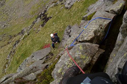
Rope, harness, selection of slings – even if to be climbed ‘solo’ (to protect an unscheduled descent). A selection of chocks is useful since secure sling placements are not always easy to find. In May 2015 my companion and I found it helpful to move together with a half rope between us, alpine style – and placing odd bits of protection – but periodically 'pitching it' and moving singly as terrain dictated.
Map: OS Explorer Map 1:25 000, sheet OL6, “The English Lakes, South-western area – Coniston, Ulverston & Barrow-in-Furness”
RED-TAPE
None in particular – beyond usual following of the country code and care round any live-stock especially in Lambing season April/May time.
It is advisable to let someone know where you are going, especially if solo climbing – and especially since this route is remote and infrequently visited. (On a perfect day on 18th April 2014 I didn’t see a soul when I climbed the Ill Crags scramble – and neither did we on Thor’s Buttress on 24th May 2015 – all the way up from Moss Flat to the summit of Scafell Pike).
LINKS/GUIDES
Guide Book
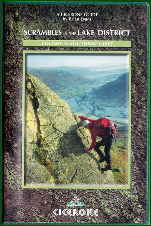
“Scrambles in the Lake District” volume 1, South Lakes by R.B. Evans – 1st published 1982, revised 2005 – Cicerone Press.![Cicerone Lakes Scramble Guide]()
Cicerone Lakes Scramble Guide
Cicerone Lakes Scramble Guide
Links
Pen with Scafell Pike behind - early morning view from above Great Moss April 2014