
|
|
Mountain/Rock |
|---|---|
|
|
39.93350°N / 107.2892°W |
|
|
Garfield |
|
|
Summer, Fall |
|
|
11490 ft / 3502 m |
|
|
Overview
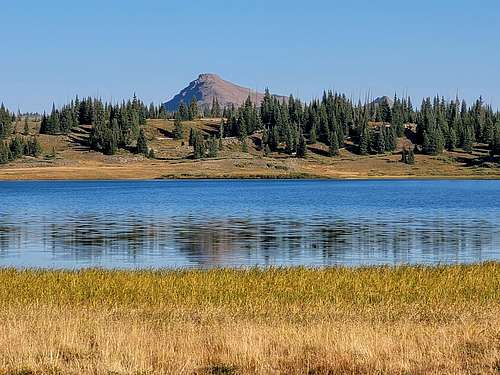
"Twin Lakes Peak" is an unofficial name for Peak 11,460 in the Flat Tops of Colorado. It is the 21st or 22nd highest ranked peak in the range (Blair Mountain and Twin Lakes Peak share the same elevation) and it is a relatively obscure and unknown peak. Most people wouldn't consider the peak to be a destination on its own, but a peak to climb for completeness or as a side diversion.
Since the peak is far away from any popular destination in the Flat Tops, most visitors in the area don't notice the peak and it really doesn't stand out much in comparison to other nearby peaks such as Trappers Peak or Big Marvine Peak.
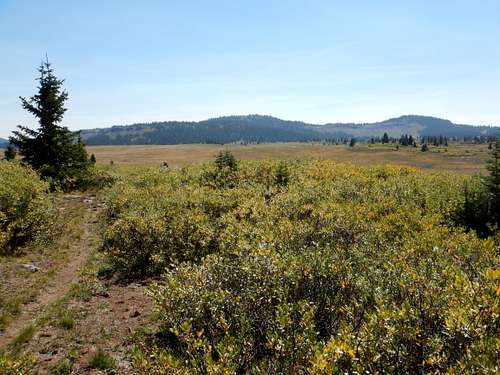
The Flat Tops are more of a huge elevated plateau rather than a typical mountain range, but the plateau has been eroded into many individual peaks and summits, and most of them are flat-topped, or dome-like as is this one. The mountain area composing the Flat Tops contains over 110 lakes full of fish, and also has some of the most extensive areas above timberline in Colorado.
Flat Tops: 11,000+ Foot Peaks with 300+ feet of Prominence
Getting There
There are four main ways to reach the trailhead. I have only driven to two of them. The trailhead is near Trappers Lake.
There is a road from the west and Meeker, one from the east and Yampa or Phippsburg, one from the northeast and Oak Creek, one from the north and Hayden, and one from the northeast and Pagoda (village) and Hamilton. I know only the roads from Hamilton and Pagoda, but very few Coloradoans will be coming from that direction (Craig), so it seems rather pointless to describe the drive in detail. Most people will be driving in from the Meeker or Yampa areas. After Pagoda or not far past Buford, all roads are gravel and in good condition in summer.
From Meeker:
From just north of Meeker and along Highway 13, turn east on County Road 8. Follow County Road 8 to Buford. Follow the road another 17 miles and turn right (south) on FS Road 205 to the Trappers Lake Lodge. There are several roads here, but they are well marked. Follow the road (FR 209) marked for the Wall Lake Trailhead and Park there.
From Yampa or Oak Creek:
I haven’t come in this way, so directions will be brief. Use a map. Briefly put you can reach country road 8 (see above) from either CR 25 from Oak Creek or CR 21 from Yampa. From there, you follow the road all the way over Ripple Creek Pass and down to FR 205. Turn left and follow the directions above.
From Hayden:
I haven’t come in this way, so directions will be brief. Use a map. Briefly put you take CR 53 south to CR 29. Turn left (east) and follow CR 29 to CR 55. Turn right (south) and follow the road to the junction with CR 8. Take CR 8 over Ripple Creek Pass and follow the route above.
From Hamilton:
Unless you live in Craig, few Coloradans will use this route and thus the directions won’t be detailed. From Hamilton (13 miles south of Craig and along Highway 13), drive east on Highway 317 to Pagoda. Highway 13 turns into county road 29. Turn right on CR 55 and follow the remaining directions from the route from Hayden.
Routes Overview
There are several routes available and the mountain can be climbed from many directions. A few possibilities will be discussed here.
Trappers Lake Route
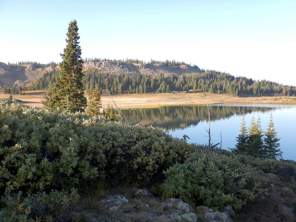
The route from Trappers Lake is the shortest route up the mountain. Briefly put, from the Wall Lake Trailhead, follow the trail for 0.7 miles south before turning right and staying on the Wall Lake Trail to the top of the plateau (2.0) miles from the previous junction mentioned. From there, turn right and hike another 0.9 miles which is mostly gentle walk on a trail to the next junction. Stay left at the next junction (the trail to the right is really indistinct so it isn't much of a trail junction) and follow the trail another 1.8 miles to Twin Lakes. This is about 5.4 miles from the trailhead.
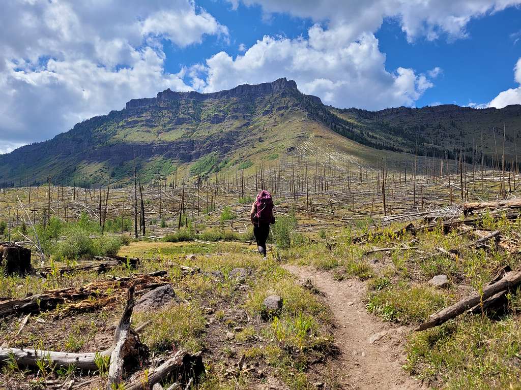
Twin Lakes Peak is the peak to the south of Twin Lakes. From the lake, one of several routes can be taken. Route find up to a bench and cross the small plateau before making the final climb to the peak (about a mile from Twin Lakes, depending on your route). There is some minor scrambling and some fallen timber to skirt, but no major problems. This climb can be done as a day hike (about 13 miles round trip), but many people will want to spend more time in the area to climb other peaks, visit other lakes, to fish, etc.
Other Routes
The above is only one route possibility. Other routes are from the Big Fish Trail from the HImes Peak Trailhead, East Marvine Creek or Marvin Creek from the Marvine Creek Trailhead, or the Doe Creek Trail from the Meadows Trailhead. Most people would want two days or more when using these routes.
A good map is required for any of these routes.
Red Tape
• Entering or being in the area with more than 15 people per group, and a maximum combination of 25 people and pack or saddle animals in any one group is prohibited.
• There is no permit system in place in the Flat Tops Wilderness but we do ask that visitors sign in on provided trailhead registration forms.
• Camping within one hundred feet of any lake, stream or trail, or any “No Camping” or “Wilderness Restoration Site” sign or within ¼ mile of Trappers, Hooper, Keener or Smith Lakes is prohibited.
• Building, maintaining, attending or using a campfire within one hundred feet of any lake, stream, or trail or within ¼ miles of Trappers, Hooper, Keener or Smith Lakes is prohibited.
• Storing equipment or personal property or supplies for longer than 10 days is prohibited.
• Hitching, tethering or hobbling any pack or saddle animal within one hundred feet of any lake, stream or trail is prohibited.
• Possessing any pack or saddle animal within ¼ mile of Trappers Lake except for watering or through travel is prohibited.
• Possessing a dog or other animal that is harassing wildlife or people or damaging property is prohibited. There is no leash law in the Flat Tops, however dogs must be kept under verbal control at all times.
• Possessing or using a wagon, cart or other vehicle including a wheelbarrow or game cart is prohibited.
• Shortcutting a switchback in a trail is prohibited.
When to Climb
The peak could be climbed year-round, but most of the roads to are only open only from around Memorial Day or early June to sometime in November, so outside this time period, this would probably be a very long trip unless you had a snowmobile.
Mid August to mid September is good because the mosquitoes are gone. This place is mosquito heaven in late June and to mid July.
The Flat Tops (especially the northern and western section) receive much snow, so despite the lower altitude than the 14'ers, the peaks remain buried in snow until mid-July. Snowshoes are recommended in June. The Flat Tops have many mosquitoes in July, and sometimes into early August. From September and into December is hunting season, so wear blaze orange and use extreme caution. On the plus side, hunter traffic usually keeps the Ripple Creek Pass road open until around Thanksgiving weekend. Late November might be the best time to make a “winter conditions” ascent because after the road closed, this would be very long trip.
Camping
There are many campgrounds in the area and at Trappers Lake. On summer and holiday weekends, they are crowded. In the backcountry there are many campsites. Twin Lakes has a few campsites, but be aware that it is cold at night! In early September I recorded a 6F temperature, by far the coldest temperature I have ever recorded in Colorado at that time of year.
Mountain Conditions
CLICK HERE FOR WEATHER FORECAST OF THE AREA
Weather and climate data for Marvine Ranch at 7800 feet elevation is below. *National Weather Service Data 1972-1998. Expect much wetter conditions at higher elevations. The area around Twin Lakes Peak will average around 10-15 degrees colder in the daytime than Marvine Ranch; nighttime temperatures won't have as big of a difference.
| MONTH | AVE HIGH | AVE LOW | REC HIGH | REC LOW | AVE PRECIP (in) |
| JAN | 33 | 1 | 59 | -38 | 2.43 |
| FEB | 36 | 3 | 56 | -42 | 2.30 |
| MAR | 42 | 11 | 63 | -32 | 2.55 |
| APR | 49 | 18 | 75 | -16 | 2.20 |
| MAY | 61 | 27 | 78 | 5 | 2.41 |
| JUN | 72 | 33 | 92 | 15 | 1.57 |
| JUL | 77 | 38 | 89 | 23 | 1.94 |
| AUG | 75 | 38 | 90 | 21 | 1.91 |
| SEP | 68 | 31 | 87 | 11 | 2.16 |
| OCT | 57 | 22 | 76 | -10 | 2.16 |
| NOV | 40 | 11 | 65 | -30 | 2.26 |
| DEC | 33 | 2 | 63 | -44 | 2.53 |