
-
 1464 Hits
-
 76.66% Score
-
 7 Votes
|
|
Mountain/Rock |
|---|---|
|
|
37.87480°N / 107.3364°W |
|
|
Hinsdale |
|
|
Hiking |
|
|
Spring, Summer, Fall, Winter |
|
|
13260 ft / 4042 m |
|
|
Overview
 13260 from CDT
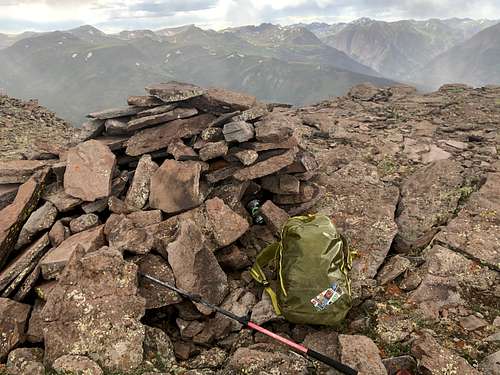 13260
13260The area along Wager Gulch is beautiful to explore. There is a well preserved ghost town of Carson and many 13ers waiting for you to summit. The only disadvantage is that the road up Wager Gulch is rocky and rough - you do need a high clearance 4WD vehicle and the road is closed in the winter (after the first snow fall and does not open until the snow melt, around June).
The closest town is Lake City - one of the more beautiful historical Colorado towns, definitively worth stopping by and exploring. Also, a little bit past the turn off for Lake San Cristobal along the Colorado Hwy 149 is the monument to the famous Colorado Cannibal Alfred Packer. Ghost Town of Carson - has several well preserved buildings from the silver and gold mining era. The ghost town is on private property, visitors are allowed. Carson was founded in 1889 when some 500 miners worked the mountain top. Eventually the winters took their toll and the residents left. They say it was one of the most inaccessible mining camps in Colorado. The elevation is 11,600 feet. There is also Old Carson located on the south side of the divide, it was an earlier mining camp and the Old Carson is not that well preserved.
We are so lucky to have so many mountains in Colorado. There are 53 official 14ers (mountains over 14,000 feet = 4267 meters) and 584 official 13ers (mountains over 13,000 feet = 3962 meters) + many unranked peaks, and I am not even mentioning 12ers.
Colorado Rank: 434
Class: 1+ (trail, grassy slopes and very little talus)
Parent Lineage: Coney Benchmark
Nearby Peaks:
- Unnamed 13140 B (unranked) 0.90 miles
- Coney Benchmark 1.19 miles
- Bent Peak 2.63 miles
- Carson Peak 3.79 miles
- Unnamed 13581 4.19 miles
- "Cataract Peak" 4.82 miles
- "Tundra Top" 4.93 miles
Getting There
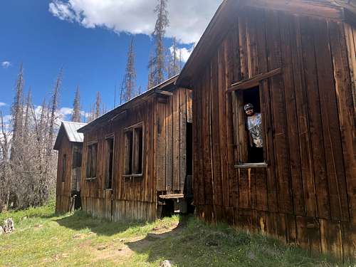 Carson ghost town
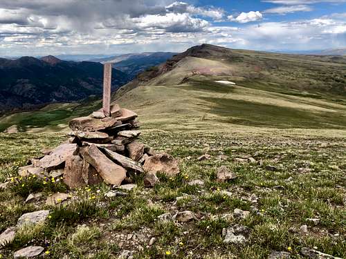 Unnamed 13260 B
Route
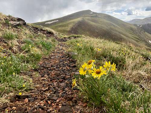
Most people drive the to top of Carson Pass and continue up 4WD road towards Coney BM. We camped at Carson and I followed the road up the pass, then over Coney Point to UN 13260B - this section was all night, most of it on a nice trail. I opted to descent on mostly grassy slopes towards Carson and ended up bushwhacking for about 1/2 miles through unpleasant terrain to reach our campsite.
Red Tape
There is no red tape. Driving the 4WD road, visiting the Carson ghost town, primitive camping, hiking are all free of charge.
When to Climb
Summer is obviously the easiest, but autumn and spring are excellent as well. Winter would add a longer access, and some avalanche exposure. (The road up Wager Gulch is a little bit over 5 miles long and is closed in the winter).
Camping
Primitive camping along Wager Gulch road - higher up. The lower part of the road goes through some private property and the road is too narrow and steep to stop and find a parking spot.
Forest Service Campgrounds: Lake Cristobal: Wupperman campground, on the east side of Lake San Cristobal, 15$ per night, vault toilets, grills, picnic tables. Reservations possible. Williams Creek: no reservations. First Come, First Serve basis. 14$ per night. There is drinkable water. 23 campsites. Mill Creek Campground: 7$ per night, BLM campground, 22 sites. I don't stay in campgrounds since there are so many options for primitive camping in a high country.