|
|
Mountain/Rock |
|---|---|
|
|
46.85280°N / 121.759°W |
|
|
14411 ft / 4392 m |
|
|
Overview
The mountain was originally named Tahoma or "Great Snowy Peak" by the Yakima Indians. Captain George Vancouver renamed it after Admiral Peter Rainier of the British Navy during a scouting expedition on May 7, 1792. This name was hotly contested for over 100 years, because Americans felt it shouldn't be named after a British officer who had never even been to the U.S.
The first ascent is believed to be in 1852, but is undocumented. The first recorded ascent was on August 17, 1870 by General Hazard Stevens and Philemon Van Trump, via the Gibralter Ledges route. James Longmire introduced the climbing party to the Yakima Indian Sluiskin who provided the party with assistance in getting to the base of the mountain. They climbed in 1 day from their camp just below the Gibralter Ledges. Upon reaching the summit, they nearly collapsed due to exhaustion, but managed to find a steam vent to hide in.
On March 2, 1899 president William McKinley authorized the creation of Mount Rainier National Park protecting 235,625 acres, including over 35 square miles of glaciers blanketing the mountain. There are 25 large named glaciers on Mount Rainier, including the enormous Emmons, which flows down the east face.
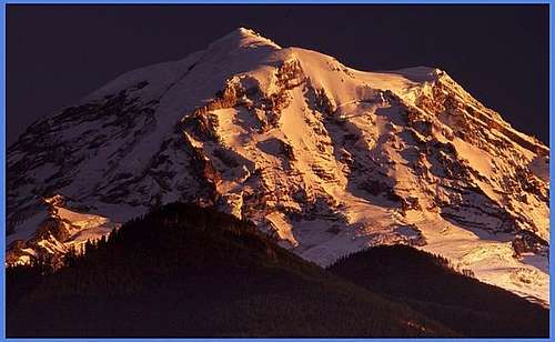
It is the highest volcano of the Cascade Range and the fifth highest mountain of the continental USA. This is a huge mountain with multiple glaciers and routes of all technical levels. Mount Rainier, the most heavily glaciated peak in the contiguous United States, offers an exciting challenge to the mountaineer. The regularly climbed routes are the Disappointment Cleaver and the Emmons Glacier which are consider class 4 routes. More than 10,000 people a year try to scale this mountain and many expeditions for bigger mountains come to Rainier for their training runs.
The summit of this mountain is unique to mountains. There are actually 3 separately classified summits of this peak, Columbia Crest which is the highest point at 14,411 feet, Point Success at 14,158 feet to the southwest, and Liberty Cap at 14,112 feet to the northwest all separated by a large crater. The most standard routes actually bring you to the crater rim at 14,150 feet. A lot of climbers consider this as the summit, or close enough, but to attain the true summit, it is an hour walk round trip a quarter mile across the crater to Columbia Crest. Here you can find a summit log.
---- A Word on the Height of the Mountain ----
There has been some questions regarding the true height of the mountain recently. In books it is reported as 14,410 and 14,411. There are a couple sources (unofficial) that report as high as 14,414. However, the National Park Service and all other official sources recognize the height as 14,411.05 feet. This is based on a recent survey of the mountain. This is 12.6 inches taller than figured in 1956 (hence the 1 foot discrepancy in many books). Using data from a constellation of satellites and the number-crunching power of modern computers, Bothell surveyor Larry Signani calculated the mountain's height at 14,411.05 feet—just 12.6 inches taller than the official height computed in 1956 by the U.S. Geological Survey, using traditional triangulation methods.
The new measurement is even closer to the 14,411.1 feet logged in 1988 by many of the same people involved in this latest effort. The new measurement was made using Global Positioning System, or GPS, data, which surveyors can now use to pinpoint elevations with unprecedented accuracy. In late August, a team of six surveyors climbed the summit carrying two lightweight GPS receivers, which detect electronic signals from 24 GPS satellites orbiting the earth. Measurements are calculated by timing how long it takes the satellite signals to reach the receiver and by doing a lot of mathematical gyrations.
Getting There
Mount Rainier National Park has great road access from all directions in the summer, however many of the roads are closed in the winter. There is an entrance fee of $15.00 for a vehicle. The pass is good for 7 days. A Mount Rainier pass is available for purchase and is good for one year. The price of the pass is $20.00. Do the math ... if you are going to make more than 2 trips into the park in a given year, consider buying the year long pass.
Following are directions to the climbing access areas:
Paradise, Longmire and Westside Climbing Access:
These climbing routes are accessed through the Nisqually entrance at the southwest corner of Rainier National Park. This is the only entrance that is open year around. Access from Yakima is through the Stevens Canyon entrance and is closed in the winter.
From Seattle (Airport): Take I-5 south to I-405. Go 3-4 miles on I-405 and take State Route 167 south. Drive about 21 miles to State Route 512. In 3 miles, exit on the right onto State Route 161 south. Stay on 161 through Puyallup and Graham into Eatonville. Turn left at the stop sign in Eatonville. There is a sign to Mount Rainier there. Follow the narrow 2 lane road to the end. Turn left on SR 7 and continue to the town of Elbe. Stay left on SR 706 in Elbe and drive approximately 13 miles east through Ashford to the entrance of the park. (Note: Ashford in the base for RMI and the Summit House if you are renting equipment or using RMI for a guide service). Once you enter the park, it is about a 30 minute scenic drive to Paradise. From the East: Take I90 west and get off at exit 110 on I82 east. Head south for approximately 30 miles, then turn west unto route 12 just before Yakima. To get to Paradise, continue on route 12 for approx. 60 miles then make a right unto route 123 and follow the signs. For the Emmons glacier route, go 20 miles on route 20, then turn right unto route 410. Once inside the park, make a right on route 123 then a left on Sunrise Park Road. Note that all access to Mount Rainier from the east is closed in the winter and early spring. For a winter climb, first drive to Seattle then follow the directions from there.
Mowich Lake and Carbon River Climbing Access:
From Seattle (Airport): Take I-5 south to I-405. East 3 miles on I-405 then take SR 167 south for 11 miles. Take SR18 at the Auburn exit. Follow SR18 for 1 mile to SR164 (Auburn-Enumclaw exit). Take a left at the stoplight onto SR164 towards Enumclaw. Take a right on SR410 (stoplight) and go 4 miles to Buckley. Take a left on SR165. Follow this road through Wilkeson and Carbonado. Beyond the 1 lane bridge there will be a fork in the road. Stay right and continue about 17 miles to Mowich Lake. If you are going to Ipsut Creek Campground (for Carbon Glacier) stay left at the fork and continue 16 miles to the campground.
White River Climbing Access:
This provides the best entry and exit for the routes on the north and northeast sides of the mountain.
From Seattle (Airport): Follow directions to SR410 (see above). Stay on SR410 31 miles east of Enumclaw to the park boundary and arch. Continue 5 miles to the White River-Sunrise turnoff. Turn right. The White River ranger station in 1 mile down that road.
Red Tape/Climbing Permits, Fees and Reservations
From the National Park Service Web Site:
Climbers must register to travel above 10,000 feet or onto glaciers. Primary registration locations are the Paradise Ranger Station, White River Wilderness Information Center, and the Wilkeson Wilderness Information Center. The climbing fee is $45 per person per calendar year. The fee is payable when registering. Climbing fees help recover costs for protecting the mountain's delicate and unique alpine environment, staffing the mountain's high camps and ranger stations with climbing rangers, managing upper mountain human waste and providing rangers who can rapidly respond to incidents on the mountain. For more information on climbing fee check out FAQ's about Climbing Fees
An in-park Wilderness Reservation System is available for climbers and backpackers planning trips during the May 1 to September 30 period. A reservations office is staffed at the Longmire Wilderness Information Center during the summer months. Beginning April 1st, reservations can be made by printing and completing a Reservation Request Form and faxing it to (360) 569-3131 or mailing it to: Wilderness Reservations Office, Tahoma Woods Star Route, Ashford, WA 98304. Tel. (360) 569-HIKE. There is a $20 reservation fee for advance reservations. This fee is in addition to the climbing permit fee and does not guarantee a spot in the public shelter at Camp Muir. Reservations can be made for trips between May 1st and September 30th.
- Reservation fees and climbing fees are due at the time of reservation.
- Reservations will not be accepted if they are faxed or postmarked before April 1st.
- For more information go to FAQ's about Climbing Reservations or the Reservation Request Form.
Each climber must present or purchase their Mount Rainier Climbing Pass and present a valid photo I.D. at the time they register for their climb.
To speed your climbing registration process you may elect to purchase your Mount Rainier Climbing Pass in advance. Simply download a Climbing Pass Purchase Form, complete the form and fax or mail to the park.
When To Climb
Climbs have been made and are commonly made all year long, but the best period is from May to August. In recent years, Mount Rainier has become quite popular to climb in the winter and early spring. Since the road to Paradise from Longmire is the only plowed access to Rainier this time of year, most ascents are made on the south side of the mountain. The two standard routes both use the hut at Camp Muir as a high camp. The first route is Gibralter Ledges, usually referred to as the "Gib Ledges", which ascends the ledge system between the Nisquilly and Ingram Glaciers. The other route is the Ingram Glacier Direct or as a variation late in the season Disappointment Cleaver route, which is used by Rainier Mountaineering from December to the end of May for their clients. If you take the Ingram route during heavy snow conditions, do not cut through Cadever Gap. Several parties have died from avalanches here. See the table below for the full descriptions of routes and their approaches.
Camping
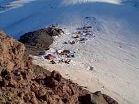
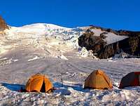
Parties may camp for a maximum of 14 days in the backcountry. Maximum party size is 12 people, with any team larger than 5 considered a group. High camps on the standard routes are located at Camp Muir on the south side and Camp Schurman on the east side.
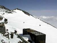
Camp Muir: Located at 10,080 ft., facilities include a Ranger Station, solar toilet, and the Muir Public Shelter which will accommodate approximately 25 people on a first-come, first-served basis. Tent camping on the glacier is another alternative. There is a hut at Camp Muir that is only for Rainier Mountaineering Inc. Unless you are climbing with them, you may not use it or the facilities associated with it.
Camp Schurman: Located at 9,440 ft., facilities include a Ranger Station and a solar toilet. Tent camping on the glacier.
Climbers must melt snow for drinking water at both high camps. Treat or boil water.
Additional Camping Information:
Location Max Number of People Muir Snowfield 36 Camp Muir 110 Ingraham Flats 35 Camp Hazard 36 Kautz Alpine Zone 36 Camp Schurman 48 Emmons Flats 24 Thumb Rock 12 Rainier Summit 36
Route Overview
| Route Name | Duration | Difficulty (Alpine Grade) | Elevation Gain | Max Grade | SeasonApproach | |
|---|---|---|---|---|---|---|
| Disappointment Cleaver | 2 days | II | 9,000 feet | 35 degrees | June to Sept. | Paradise |
| Ingraham Glacier Direct | 2 days | II | 9,000 feet | 35 degrees | January to May | Paradise |
| Ingraham, Gibraltar Rock | 2 days | II | 9,000 feet | 50 degrees | January to May | Paradise |
| Gibraltar Rock | 2-3 days | V | 9,000 feet | 80 degrees | January to May | Paradise |
| Gibraltar Ledges | 2 days | II | 9,000 feet | 50 degrees | January to May | Paradise |
| Gibraltar Chute | 2 days | II | 9,000 feet | 50 degrees | January to June | Paradise |
| Nisqually Headwall | 2 days | III | 9,000 feet | 60 degrees | January to June | Paradise |
| Nisqually Ice Cliff | 2 days | III | 9,000 feet | 55 degrees | January to June | Paradise |
| Nisqually Cleaver | 2 days | III | 9,000 feet | 60 degrees | January to June | Paradise |
| Nisqually Cleaver Ramp Exit | 2 days | III | 9,000 feet | 80 degrees | January to June | Paradise |
| Nisqually Icefall | 2 days | III | 9,000 feet | 60 degrees | January to June | Paradise |
| Fuhrer Finger | 2 days | II | 9,000 feet | 45 degrees | January to Sept. | Paradise |
| Fuhrer Thumb | 2 days | II | 9,000 feet | 45 degrees | January to July | Paradise |
| Wilson Cleaver | 2-3 days | IV | 9,000 feet | 65 degrees | January to June | Paradise |
| Wilson Headwall | 2 days | III | 9,000 feet | 55 degrees | January to July | Paradise |
| Kautz Ice Cliff | 2-3 days | V | 9,000 feet | 85 degrees | January to June | Paradise |
| Kautz Glacier Direct | 2 days | III | 9,000 feet | 70 degrees | January to July | Paradise |
| Kautz Glacier Chute | 2 days | III | 9,000 feet | 60 degrees | January to July | Paradise |
| Kautz Headwall | 2-4 days | III | 9,000 feet | 55 degrees | January to July | Paradise |
| Kautz Cleaver | 2-4 days | II | 9,000 feet | 35 degrees | January to July | Paradise |
| Eastern Success Couloir | 2-4 days | II | 11,500 feet | 45 degrees | January to July | West Road |
| Central Success Couloir | 2-4 days | II | 11,500 feet | 45 degrees | January to July | West Road |
| Fickle Finger of Success | 2-4 days | II | 11,500 feet | 50 degrees | January to July | West Road |
| Success Cleaver | 2-4 days | II | 11,500 feet | 45 degrees | January to July | West Road |
| South Tahoma Headwall, Cleaver Exit | 2-4 days | III | 11,500 feet | 65 degrees | January to July | West Road |
| South Tahoma Headwall | 2-4 days | III | 11,500 feet | 55 degrees | January to July | West Road |
| Tahoma Cleaver, Buttress Entry | 2-4 days | III | 11,500 feet | 50 degrees | January to July | West Road |
| Tahoma Cleaver, Lower Buttress | 2-4 days | II | 11,500 feet | 45 degrees | January to July | West Road |
| Tahoma Cleaver | 2-4 days | IV | 11,500 feet | 75 degrees | January to July | West Road |
| Tahoma Glacier | 2-4 days | II | 11,500 feet | 45 degrees | January to July | West Road |
| Tahoma Glacier, The Sickle | 2-4 days | II | 11,500 feet | 45 degrees | January to August | West Road |
| Sunset Amphitheater Ice Cap | 2-4 days | III | 11,500 feet | 50 degrees | January to July | West Road |
| Sunset Amphitheater Headwall | 2-4 days | V | 11,500 feet | 80 degrees | January to June | West Road |
| Sunset Amphitheater Headwall Couloir | 2-4 days | III | 11,500 feet | 55 degrees | January to July | West Road |
| Sunset Ridge | 2-4 days | III | 11,500 feet | 55 degrees | January to August | West Road |
| Edmunds Headwall | 2 days | III | 9,400 feet | 55 degrees | Jan-July Sep-Oct | Mowich Lake |
| Central Mowich Face, Shelf Exit | 2 days | IV | 9,400 feet | 65 degrees | Jan-July Sep-Oct | Mowich Lake |
| Central Mowich Face | 2 days | III | 9,400 feet | 55 degrees | Jan-July Sep-Oct | Mowich Lake |
| North Mowich Headwall | 2 days | IV | 9,400 feet | 55 degrees | Jan-July Sep-Oct | Mowich Lake |
| North Mowich Ice Cliff | 2 days | V | 9,400 feet | 85 degrees | Jan-July Sep-Oct | Mowich Lake |
| North Mowich Icefall | 2 days | IV | 9,400 feet | 55 degrees | Jan-July Sep-Oct | Mowich Lake |
| Ptarmigan Ridge, Lower Shelf | 2 days | IV | 9,400 feet | 55 degrees | January to July | Mowich Lake |
| Ptarmigan Ridge, Upper Shelf | 2 days | IV | 9,400 feet | 55 degrees | January to July | Mowich Lake |
| South Ptarmigan Ice Cliff | 2 days | IV | 9,400 feet | 55 degrees | January to July | Mowich Lake |
| North Ptarmigan Ice Cliff | 2 days | IV | 9,400 feet | 55 degrees | January to July | Mowich Lake |
| Liberty Wall Ice Cap | 2-4 days | IV | 11,400 feet | 50 degrees | Jan-July Sep-Oct | White River |
| Liberty Wall Ice Cliff | 2-4 days | V | 11,400 feet | 80 degrees | Jan-July Sep-Oct | White River |
| Liberty Wall Direct | 2-4 days | IV+ | 11,400 feet | 50 degrees | Jan-July Sep-Oct | White River |
| Liberty Ridge | 2-4 days | III+ | 11,400 feet | 55 degrees | January to July | White River |
| Willis Wall, Thermogenesis | 2-4 days | IV | 11,400 feet | 60 degrees | January to June | White River |
| Willis Wall, West Rib | 2-4 days | IV+ | 11,400 feet | 60 degrees | January to June | White River |
| Willis Wall, Ice Cliff | 2-4 days | V | 11,400 feet | 85 degrees | January to June | White River |
| Willis Wall, Central Rib | 2-4 days | IV+ | 11,400 feet | 60 degrees | January to June | White River |
| Willis Wall, East Rib | 2-4 days | IV+ | 11,400 feet | 60 degrees | January to June | White River |
| Willis Wall East | 2-4 days | IV | 11,400 feet | 55 degrees | January to June | White River |
| Curtis Ridge | 2-4 days | IV | 11,400 feet | 55 degrees | January to June | White River |
| Russell Cliff Gully | 2 days | II+ | 10,000 feet | 50 degrees | January to July | White River |
| Russell Cliff Central Bowl | 2 days | II+ | 10,000 feet | 50 degrees | January to July | White River |
| Russell Cliff Upper Headwall | 2 days | II+ | 10,000 feet | 50 degrees | January to July | White River |
| Winthrop Glacier | 2 days | II | 10,000 feet | 40 degrees | January to Sept. | White River |
| Emmons Glacier | 2 days | II | 10,000 feet | 40 degrees | January to Sept. | White River |
Special thanks to Martin Cash for a lot of the initial work on building the above table.
Mountain Conditions/Information
This is the average high and low temperatures for the summit of Mount Rainier.
| Month | High | Low |
| January | 7 | -3 |
| February | 9 | -2 |
| March | 11 | -2 |
| April | 17 | 2 |
| May | 22 | 6 |
| Jun | 26 | 10 |
| July | 33 | 15 |
| August | 32 | 14 |
| September | 28 | 12 |
| October | 20 | 7 |
| November | 14 | 2 |
| December | 8 | -2 |
Thank You Scott Patterson for the above information.
Below are some useful links for Mount Rainier:
Mountain Topo Maps National Weather Service Mount Rainier
Mount Rainier Weather (University of Washington) Paradise Web Cam
Links to time-lapse movies of two Webcams at Paradise:
Looking down the Valley from Paradise
Looking towards Rainier and the Muir Snowfield
Guide Services for Mount Rainier
One-day climbing instruction, two-day summit climbs, five-day climbing seminars, and private climbs, are available through:
- Rainier Mountaineering, Inc. 360-569-2227
Guided summit climbs on the Emmons-Winthrop Glaciers are available through:
- Alpine Ascents International, 206-378-1927
Please remember that providing a guided climb or mountaineering instruction in exchange for money is illegal except by one of the approved and authorized concessionaires.
- International Mountain Guides, 360-569-2609
Please remember that providing a guided climb or mountaineering instruction in exchange for money is illegal except by one of the approved and authorized concessionaires.
Recommended Climbing Equipment (From NPS)
Individual Equipment:
- Map & Compass
- Knife
- Matches/Lighter
- Sunglasses and/or ski goggles (dark lenses)
- Sunscreen and Lip Balm
- First Aid Kit
- Food (extra food for emergencies)
- Headlamp and extra batteries
- Altimeter
- Signaling Device (whistle and/or mirror)
- Gloves and Mittens
- Winter Hat, Sun Hat
- Down or Synthetic Parka
- Wool or Synthetic Clothing, layered Waterproof/Breathable Parka Waterproof/Breathable Pants or Bibs
- Sleeping Bag - comfortable to 10F
- Ensolite Pad
- Ice Axe
- Carabiners (minimum 4)
- Prussik Slings (3) or Ascenders
- Chest and Seat Harness
- Helmet
- Boots and Gaitors
- Crampons
- Picket (1) or other appropriate protection device
Team Equipment:
- Rope, 40 m, 9 or 11mm diameter
- Pickets or Ice Screws (as appropriate for route and conditions)
- Pulleys
- Stove and Fuel Extra Fuel for emergencies
- Tent or Tarp Shelter
- Wands
Additional Winter Equipment:
Team:
Individual:- Food and Fuel for two extra days
- Wands, minimum 200
- Tent, expedition type
- Additional Rope
- Down Parka, Pants, and Mittens
- Double Boots or Over Boots
- Avalanche Beacon & Probe
- Snow Shovel
- Snowshoes or Skis
External Links
- Emmons/Upper Winthrop Trip Report, September 2000
- Northwest Outdoors Guide Guide to mountaineering and hiking in the Pacific Northwest
- A Potato Head takes on Mount Rainier
- Great Images of Rainier - Marc Pagani Click on the mountaineering link to see many great images of Mount Rainier from Marc Pagani Photography
- DC Route via Muir - June 16, 2001
- Mount Rainier (07/31/2004)
- Excellent Rainier Photos and Info
- Zeitcam.com Time-lapse movie of Mt. Rainier Web Cam, as well as other peaks.
- Emmons Glacier - July 14th - 17th 2005
- D.C. 8-3-05





Jessicahiker - Sep 8, 2008 10:59 am - Hasn't voted
Carbon GlacierThe road has been washed out. There is no vehicle access to the trailhead. This adds 10 miles to your trip. Currently there are no plans to rebuild the road as per the NPS. Just got back on 9/5/08.
Haliku - Feb 8, 2010 1:42 pm - Voted 10/10
Liberty Ridge gone?The route link to Liberty ridge doesn't work in the route table you have. I also don't see the route on the route list on the left. Did someone delete it?
vertx - Feb 12, 2010 11:40 am - Voted 10/10
Re: Liberty Ridge gone?Looks like it was deleted for some reason. Maybe the elves can bring it back and give it to someone. I dont know had it.
Bark Eater - Jan 13, 2012 2:15 pm - Hasn't voted
Red Tape UpdatesThe links to the NPS website are outdated. Here are the new links. Also, the fee for the climbing pass has increased from $30 to $43 per year. FAQ - http://www.nps.gov/mora/planyourvisit/climbing-pass-faqs.htm Climbing Pass Purchase Form - http://www.nps.gov/mora/planyourvisit/upload/MORAClimbingPassPurchaseForm.pdf General Climbing Information - http://www.nps.gov/mora/planyourvisit/climbing.htm
Obn419 - May 1, 2019 8:21 am - Voted 10/10
Re: Red Tape UpdatesPurchase form link still not valid
molliej - Jul 21, 2015 9:12 am - Hasn't voted
ultimate adventurelandNever visited this place, but friends always told me that you can do so many things, do so many activities there.